California

Joshua Tree National Park, Boy Scout Trail, 8 Miles RT, November 9, 2023

Joshua Tree National Park, Boy Scout Trail, 8 Miles RT, November 9, 2023

After our hike up Ryan Mountain we headed to the Boy Scout Trailhead off Park Blvd. You can also access this trail from Indian Cove. This is a beautiful trail that hikes through the backcountry. There are options to camp here too. The trail offers a variety of terrain and great views of the Wonderland of Rocks. It follows sandy washes lined with Pinyon pine, juniper and oak. You’ll also travel along a rocky mountainside and through narrow canyons if you take it all the way to Indian Cove. We have done this trail from both directions, but today we our turnaround point was the junction for the Big Pine Trail at 4 miles in. If you hike this trail in its entirety, it is 8 miles one way. The winds were still strong but refreshing. We took our time and soaked in every moment. The desert is a magical place unlike any other I’ve ever experienced. I cannot put it into words. I will continue to return to it for years to come.

Click “Read More” below for more photos from this hike.

Read More

Waterman Mountain, Angeles National Forest, 6.5 Miles RT, 1,322' +/-, Max Elevation 8,038', November 6, 2023

Waterman Mountain, Angeles National Forest, 6.5 Miles RT, 1,322' +/-, Max Elevation 8,038', November 6, 2023

Once again we are back home in Southern California. It is here that I feel more like myself. The mountains and desert terrain is what I know best, and to start our adventures, we chose one of our favorite trails, Waterman Mountain.

Waterman Mountain was named after Liz Waterman, the wife of Bob Waterman who explored the area in 1889 along with Commodore Ferry Switzer. The mountain was originally named “Lady Waterman Mountain” after Liz. Later, when the U.S. Geological Survey mapped the mountain, they removed the “Lady” and the mountain is referred to as “Waterman Mountain”.

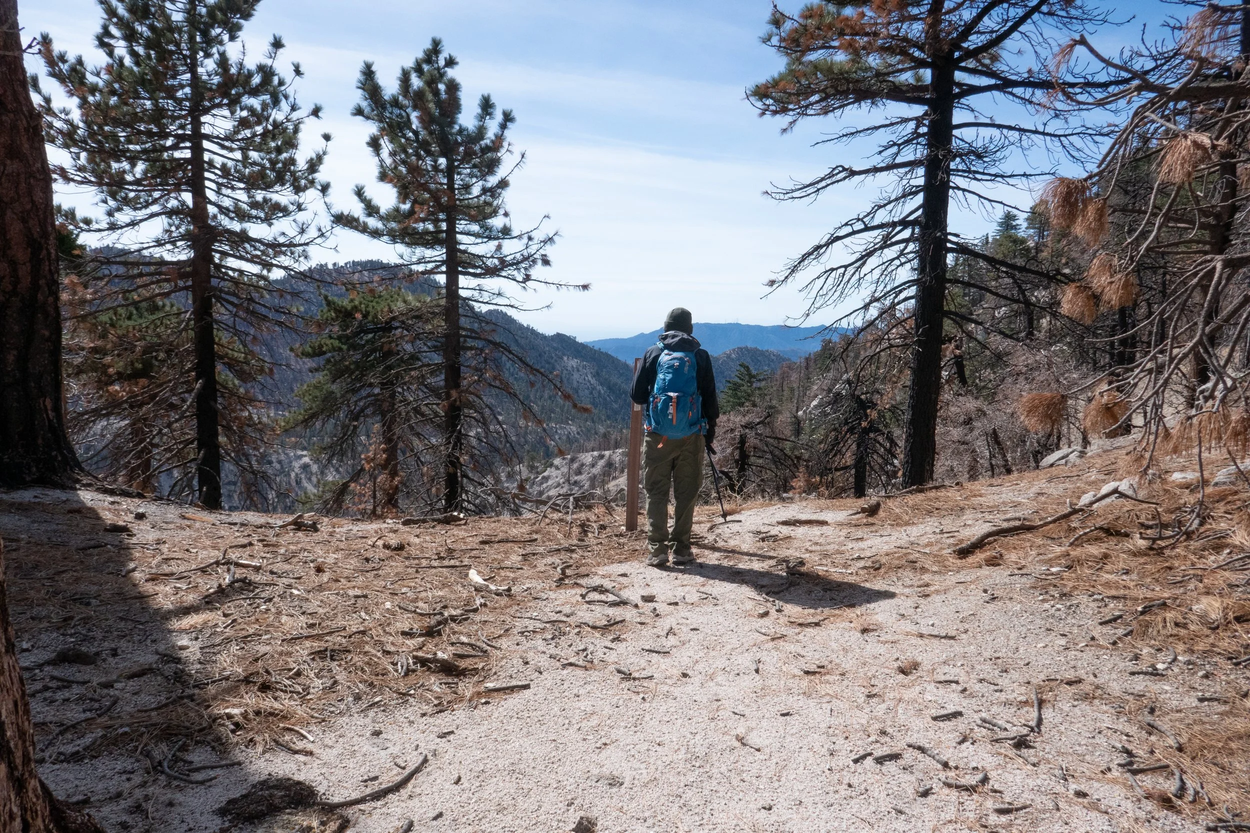
We took the trail from Buckhorn off the ACH climbing south through tall stands of Jeffrey Pine, Ponderosa Pine and Incense Cedars. This section took a hit from the Bobcat fire in 2020, and there are many charred trees, but the trail is still beautiful nonetheless. The vanilla smell of Jeffrey pines and dry sand along the trail was familiar and welcoming. I felt a sense of comfort. All worries and troubles from the past year were swept away on the fresh mountain air as we stepped onto the trail and began our climb. Once we reached the saddle on Waterman’s east ridge, we enjoyed the spectacular views down into Bear Canyon and out to Twin Peaks. Wildflowers were still blooming along the ridge. We took a short break before heading westward and up to the summit where we sat amongst the large rock formations and enjoyed our lunch. I reminisced how one year on New Year’s day we sipped champagne from the rocks and watched the stealth bomber fly over from the Pasadena Rose Parade. This mountain has always held special meaning to us and the San Gabriel High Country will always be one of my favorite sections of the Angeles.

Click “Read More” below to view more photos from this hike.

Read More

Coming home: Waterman Mountain, 8,037', 7 miles RT, (1,319 +/-), November 4, 2022

Coming home:  Waterman Mountain, 8,037', 7 miles RT, (1,319 +/-), November 4, 2022

Being back in the mountains of California was the most incredible feeling of coming home.  The evening we arrived we walked the hills of Griffith Park overlooking the city lights of Los Angeles.  I really can’t describe how happy and at peace I finally felt after being out of sorts on the east coast for the past couple of years.  The next morning we drove up the crest into the ANF.  I’d not forgotten anything about the highway with its twisting turns, steep drop offs and views of the mountain peaks.  I could still point them out.  I guess they are not so easily forgotten after spending so much time on top of them.  It was a beautiful morning and our plan was to return to Waterman Mountain, a mountain we’d climbed many times, snowshoed in the winter and even spent a New Year’s morning on the summit sipping champagne waiting to see the stealth bomber flyover after it opened the Pasadena Rose parade.  We parked the jeep and hit the trail in the cool air and warm sunshine.  Immediately I was gifted with the familiar vanilla scent of Jeffrey pine.  It almost brought me to tears, only reinforcing that I was truly home.  As we made our way up the trail, I noticed the damage that had been done by the Bobcat fire which happened just shortly after we left California in 2020.  The trees were charred, but surprisingly the trail was in good shape and still beautiful nonetheless.  I thought of all the firemen who put their lives on the line to save this beautiful land.  We took our time hiking up the trail through the great conifers and rock formations.  I wanted to savor every single moment of this trail.  Upon reaching the junction for Twin Peaks and the summit to the top of Waterman, we stopped and sat on the rocks as we’d done so many times before.  The quiet forest and sound of the mountain breeze whispering in the trees reminded me that this is where I belong.  I felt grounded, centered and at peace.  Like a huge weight had been lifted and carried away on the wind.  When we were ready, we climbed the rest of the way up to the summit where we sat, had a snack and gave an offering to the forest, thanking it for always being here and taking us in.  I had so much gratitude in my heart.  We were back!  Ready for more adventure!

Click “Read More” below for more photos.

Read More

Whitewater Preserve, March 1, 2020

Whitewater Preserve, March 1, 2020

After we left Big Morongo Canyon Preserve and started heading back to Los Angeles, we decided to make a pit stop at Whitewater Preserve. I’ve been by this area many times on our way to and from Joshua Tree, but never made a point to stop even though I’ve always been curious. Today we decided to check it out. I’m so glad we did! It’s incredibly beautiful and the flowing river is amazing. You wouldn’t think there’s be water like this flowing in a desert. Whitewater Preserve is also part of the Sand to Snow National Monument and it is another wildlife corridor between the San Bernardino and San Jacinto Mountains. Another birding hot spot, its wetlands attract more then 216 bird species. The preserve also has a population of bear, bighorn sheep and deer. As we hiked along the trail towards the river access, I heard plenty of frogs too. The wind was really kicking up by this time of day and the passing storm clouds coming from the direction of Mt. San Jacinto was causing some light rain showers. You’ll notice the rain spots on my camera lens in the photos. While I didn’t have time to do a proper hike today, Whitewater Preserve is definitely on my list to return. I highly recommend exploring this incredibly unique area.

Read More

Joshua Tree National Park, Panorama Loop from Black Rock Campground, 6.5 Miles RT, 1,158' +/-, February 29, 2020

Joshua Tree National Park, Panorama Loop from Black Rock Campground, 6.5 Miles RT, 1,158' +/-, February 29, 2020

Hiking the Panorama Loop from Black Rock Campground. This hike starts in the far northwest section of Joshua Tree National Park. You can park at the Black Rock Canyon Campground where there’s a visitors center and bathrooms. From there, look for campsite #30 and you’ll find the trailhead. You’ll see a water tank and a dirt road which you will follow southeast for a short distance until you are on a dirt trail. You’ll reach a sign for the Panorama Loop and Warren Peak via Black Rock Canyon Trail. Much of the trail is hiking through a sandy wash with a moderate incline. You’ll be winding through canyon walls here and as you continue, you’ll notice the lush greenery beginning to present itself. This area is abundant with pinyon pine, juniper and oak. You’ll also discover a spring. But keep your eyes peeled because it’s easy to miss. When we were here in February it was just a trickle. However, there is plenty of wildlife to be seen in this area such as insects, birds, rabbits, and ground squirrels. It’s a very unique section of the park. At about 1.7 miles in you’ll find the signage for the start of the loop to Panorama Peak. If you hike it clockwise, you’ll have a steeper climb up, but it will save your knees on the way down the other side. As you do the work to ascend, you’ll be rewarded with views of snow capped Mt. San Gorgonio. Continue upward on the steep switchbacks for incredible panoramic views of Mt. San Jacinto, Yucca Valley, Mt. San Gorgonio and the Coachella Valley. You can even catch a glimpse of the Salton Sea. When you’re ready to return, follow the ridge and descend down into a wash where you’ll continue to enjoy the lush terrain along with majestic Joshua Trees. Eventually, you’ll be back at the start of the loop and return the way you came. It was a beautiful hike. Much different then the typical terrain I’m used to seeing in the desert.

Read More

Cottonwood Pass, August 20, 2019, 6 Miles RT, 837' +/-, Max Elevation 11,000'

Cottonwood Pass, August 20, 2019, 6 Miles RT, 837' +/-, Max Elevation 11,000'

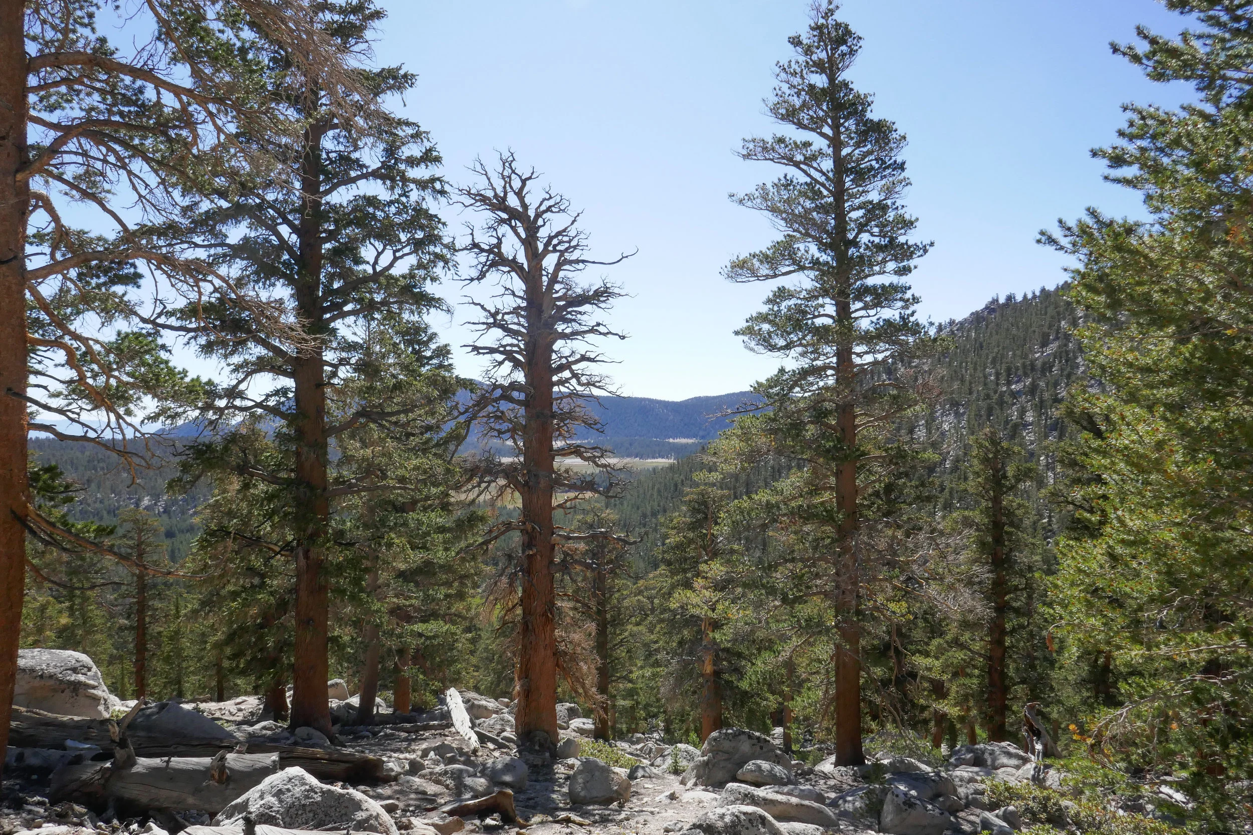
We didn’t really have a plan for our second day in the Eastern Sierra, but I did some quick research after we got back from Big Pine Lakes and decided upon the Cottonwood Pass Trail out of Horseshoe Meadow. Horseshoe Meadow is only about a 30 minute drive from Lone Pine where we were staying. Our plan was to hike up to the pass and then over to Chicken Spring Lake, but when we got started my husband was a lot more tired than usual. I think he may have been feeling the altitude (over 10,000’) and also a little lack of sleep the night before. The hike started out fairly flat winding in and out of tall pine trees until we got to the rocky switchbacks where we started to climb up and up. We passed through incredible alpine meadows covered with wildflowers and under the shade of towering foxtail and lodgepole pines. We were just short of the pass when my husband decided it was time to turn around. It’s really odd for him to be affected by altitude because he’s usually fine, but it just goes to show you altitude does not discriminate. It can happen to anyone on any given day without warning and when that happens, the best thing to do is descend. I would have loved to continue on, but we are a team and so I had no problems turning back and doing the hike again on another day when we could both enjoy it.

Read More

Big Pine Lakes, North Fork Trail, Eastern Sierra, 13.6 Miles RT, 2,385' +/-, 10,427' Max Elevation, August 19, 2019

Big Pine Lakes, North Fork Trail, Eastern Sierra, 13.6 Miles RT, 2,385' +/-, 10,427' Max Elevation, August 19, 2019

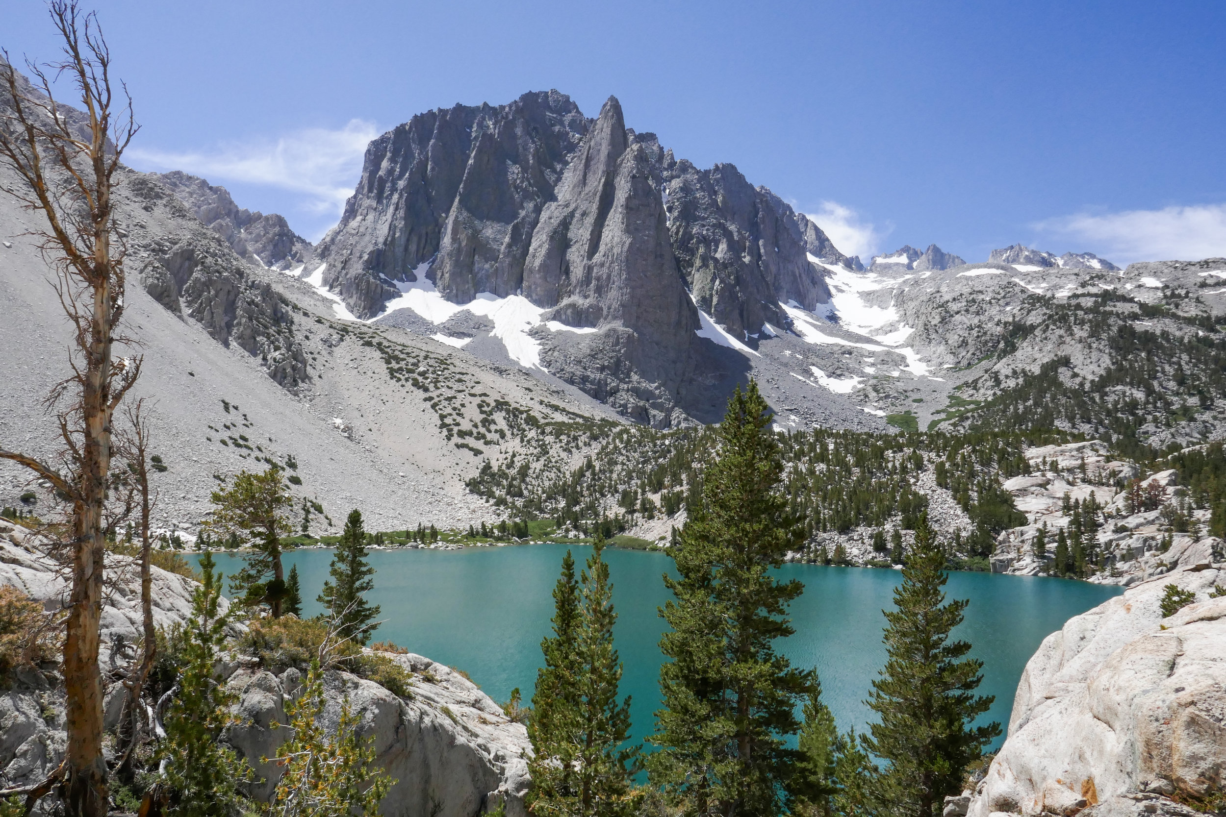
Our hike to Big Pine Lakes in the Eastern Sierra was one of the most beautiful hikes I’ve ever been on. There are seven lakes total and on this day, we hiked to the first three via the North Fork Trail. Since we weren’t backpacking, I had much less weight to carry then when we were in the Eastern Sierra last month backpacking the Mt. Whitney Trail. Most of the Big Pine Lakes hike follows along Big Pine Creek. We were next to the beautiful rushing waters most of the day. Early in the morning when we first got on the trail, we saw two doe and a fawn crossing the creek. There were plenty of wildflowers and butterflies to enjoy throughout the day as well. I took my time on this hike and spent a lot of time taking photos of it all. When we reached lake one we saw Temple Crag (popular with alpine rock climbers) towering over the incredible turquoise waters. The turquoise color comes from the glacial powder of Palisade Glacier. I also saw some trout swimming in the lake. This was a wonderful hike. We had to do some work climbing up in elevation to get to the lakes, but it was well worth the effort because the scenery was spectacular.

Read More

Jackson Lake, Boy Scout Trail, 7 Miles RT, 1,378' +/-, Max Elevation 7,462', Camping Table Mountain, June 1 and 2, 2019

Jackson Lake, Boy Scout Trail, 7 Miles RT, 1,378' +/-, Max Elevation 7,462', Camping Table Mountain, June 1 and 2, 2019

This weekend was our first camping trip of the season! It was time to pull all our gear out and get familiar with it again since we’ll be backpacking the Mt. Whitney trail this year. I love camping. It’s so nice after a day of hiking to be able to build a fire and sleep out under the stars. We headed out of the gloomy cloud covered city up to sunny Wrightwood. There were, however, some scattered storm clouds hanging around, but the rains held off and the clouds passed us by. Our hike today started at Jackson Lake. There were people here fishing and families picnicking. We got on the Jackson Lake trail to the Boy Scout Trail. There’s plenty of shade on this trail as you pass through a forest of beautiful black oaks and towering pine trees. I’d like to come back here in the fall when the leaves are changing. It’s a lovely trail and we didn’t see another person. The Boy Scout Trail eventually ends at a junction for two service roads. You can head southwest on the Pinyon Ridge Truck trail, or southeast on service road 3N26. This road winds around the mountain as it climbs upward with nice views of Mt. Baden-Powell which is still covered in snow at the top. The road eventually takes you to a junction for the PCT, so we headed north here to loop back to the Jackson Lake Trail. We passed about 6 thru hikers on this section heading towards Baden-Powell. Hope they all made it up safely with the snow. It was about 2:30 pm when we got back to the trailhead and headed to camp at Table Mountain. After we set up camp, we went into town and brought back some Grizzly Burgers from the Grizzly Cafe. That’s the nice thing about camping at Table Mountain. You’re about a 10 minute drive from food! Why cook when you can get a burger to go, right? As the sunset and the weather cooled down, we built a fire, toasted marshmallows and enjoyed the outdoors. We had a peaceful night and slept comfortably under the stars. The next morning welcomed us with a beautiful sunrise and birdsong. We had breakfast and then headed home. The weekend was way too short, but I’m so grateful for the times we have like this when we get to be away from the city, traffic, electronics, etc. and enjoy the beauty of the forest.

Read More

Saddleback Butte State Park, 4.8 Miles RT, 1,037' +/-, 3,651' Max Elevation, April 14, 2019

Saddleback Butte State Park, 4.8 Miles RT, 1,037' +/-, 3,651' Max Elevation, April 14, 2019

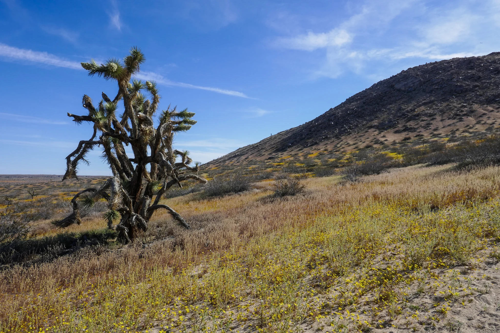
We hiked Little Butte and Saddleback Butte this weekend. I was here last year, but had not gone during the wildflower bloom. It was magical! We started our hike on the Dowen Nature Trail which connects to the Little Butte Trail and eventually the trail leading up to the top of Saddleback Butte at 3,651’. I immediately began to see carpets of wildflowers blanketing the park and the Fiddleneck flowers were covered in thousands of caterpillars. We took our time and admired all the beauty being offered to us here at the western edge of the Mojave Desert. I took note of some of the many wildflowers we observed. We saw: Coreopsis, Fiddleneck, Desert dandelion, Sun cups, Desert candles, Davy gilia, Fremont pincushions, Dune primrose, Wild Rhubarb and in addition, the Joshua Trees were in full bloom. Eventually, the sandy trail gave way to rocky terrain as it began its steep ascent up the top of Saddleback Butte. The wind was strong as we climbed and after a few easy rock scrambles, we were at the top enjoying the 360 degree views. To the south we could see the snow capped San Gabriel Mountains and further off in the distance we could make out Mt. San Gorgonio and Mt. San Jacinto. This was a really wonderful hike and being able to see the park in all it’s wildflower glory was a special treat!

Read More

Griffith Park: Mt. Hollywood, Captain's Roost, Mt. Chapel Trail, Mt. Lee, 9 Miles RT, 2,110' +/-, 1,708' Max Elevation, March 17, 2019

Griffith Park:  Mt. Hollywood, Captain's Roost, Mt. Chapel Trail, Mt. Lee, 9 Miles RT,  2,110' +/-, 1,708' Max Elevation, March 17, 2019

We spent another day exploring Griffith Park. Our plan was to hike the North Trail from Mineral Wells Picnic Area and from there take the Mt. Chapel Trail to watch the sunrise from Mt. Lee which is where the Hollywood Sign is located. This is a non-traditional route to the sign, and I had not been able to find much much information about the Mt. Chapel Trail. We got started around 5:30 am and saw a couple of coyotes scavenging the picnic area for leftover food. As we hiked up, the city below looked really pretty. The lights were twinkling and there was a soft, warm wind blowing which made it seem kind of surreal. Up ahead I noticed the orange glow of an eye reflecting in the light of my headlamp. I wasn’t sure what kind of animal it was until I got closer and realized it was a little bird. It seemed strange to see a bird just sitting in the dirt and there was another one not far up ahead. Later, I did some research and learned that these nocturnal birds are called Common Poorwills. We continued up the hill until we reached the base of Mt. Chapel. It was about 20 minutes before sunrise, and at this point the wide trail turned into a rocky, narrow footpath hugging the hillside. We didn’t get too far on this when we realized we’d have some rock scrambling to do. I wasn’t comfortable scrambling rocks in the dark with only the light of our headlamps, especially since I didn’t know much about this trail. To play it safe, we backtracked and opted to see if we could make it to Mt. Hollywood for sunrise instead. We could always check out the trail again later when there was more light. We had about 15 minutes to reach our Plan B destination, and we made it there just in time! There were already a number of people on the summit ready to enjoy the sun coming up over Los Angeles. It was lovely. We then headed down to Captain’s Roost where you can find the “hidden palm trees” that you see in so many photos of Griffith Park. It’s just a short distance from the Mt. Hollywood summit, and it’s a great place for a photo op with it’s beautiful garden overlooking the city. From there, we continued our journey and headed toward Taco Peak. Taco Peak is a just small bump, but the climbing was a bit slippery due to all the loose little pebbles. The views at the top were nice, and from what I understand, there used to be a tea house here. After a quick snack break, we headed back towards Mt. Chapel to check out the Mt. Chapel Trail again now that there was daylight. After surveying the scrambling situation and some encouragement from my husband (I’m not a fan of rock scrambling), we made our way across the rugged trail over to Mt. Lee. I admit the rugged trail was a lot of fun and the views from the ridge were probably some of the best I’ve seen yet in Griffith Park. By this time the sun was warming things up and there were a lot of Painted Lady butterflies fluttering around the wildflowers. Eventually, the Mt. Chapel Trail intersected with Mt. Lee Drive and we met up with the crowds making their way up to enjoy the views from the summit of Mt. Lee and the back of the Hollywood sign. It was actually really fun seeing the Hollywood sign up close. I’ve lived here for so long now and never made it a point to go see it. But we didn’t stay very long since there were lots of people on top jockeying for a good view and the perfect photo. Even so, I would definitely recommending seeing the sign at least once just as long as you know what to expect as far as the amount of people you’ll be sharing the views with. After leaving Mt. Lee, we scrambled our way back across the fun Mt. Chapel Trail and back the way we came on the North Trail and to Mineral Wells. We put in about 9 miles. I am really enjoying exploring this park!

Read More

Upper Las Virgenes Canyon Open Space Preserve, 4.8 Miles RT, 594' +/-, 1,404 Max Elevation, February 18, 2019

Upper Las Virgenes Canyon Open Space Preserve, 4.8 Miles RT, 594' +/-, 1,404 Max Elevation, February 18, 2019

There have been a number of rock slides in our local forests due to heavy rain and snow, so we decided to stick to lower ground and explore Upper Las Virgenes Open Space Preserve in Calabases. I’d see pictures of this place with its rolling hills, grassy meadows and majestic oak trees, but I never had the opportunity to visit and right now, it is so incredibly green! This area is a habitat for the San Fernando Valley Spineflower and the endangered Red-Legged Frog.

We started our hike at the Victory Trailhead. As soon as we left the parking area, I felt like I was in a movie set for “The Sound of Music” This place makes you feel so far away from LA, but it’s quite a different feel then the wilderness hikes we are so used to doing. We did an easy 5 miles on the Lasky Mesa Loop. It was a pleasant walk with just a little bit of up and down. We saw quite a few dogs on this trail too. I’m always happy to see people out hiking with their pups. It was a nice change of pace, and I was grateful to be able to see this location while it’s looking so vibrant. In the summer, the hills will lost their green radiance and turn to earthy brown.

Read More

Devil's Chair, 6.7 miles RT, 1, 260' +/-, 5,396' max. elevation, December 27, 2018

Devil's Chair,  6.7 miles RT, 1, 260' +/-, 5,396' max. elevation, December 27, 2018

I love the hike to Devil’s Chair. We did it in October of 2017 and it’s a beautiful part of the San Gabriels hidden away to the far north. The geological formations that have been formed throughout the years by the San Andreas and Punchbowl Faults are an incredible spectacle to witness firsthand. This area is also a transition zone between high desert and subalpine, and it’s interesting to see how the plants change as you travel the undulating trail. This time it seemed the trail was a bit more eroded in sections then the last time we hiked it, but it was still easily passable without being unsafe. As we approached the Devil’s Chair we descended the switchbacks and navigated the over narrow, rocky cliffs. Thankfully, there’s a metal fence put in place here that allows you to go all the way out to the edge. Otherwise you would not be able to hike here. The views from the Chair were spectacular. Once we’d taken it all in, we climbed back up and had a quick snack break before starting our return. The clouds were starting to roll in and it looked pretty chilly up in the higher elevations on Pleasant View Ridge and Mt. Lewis. The temperature dropped to about 43 degrees as we made our way back and the wind kicked up making it a chilly end to a beautiful winter day.

Read More

Mt Lowe, 3 miles RT, 5,604' Max Elevation, 548' +/-, September 30, 2018

Mt Lowe, 3 miles RT, 5,604' Max Elevation, 548' +/-, September 30, 2018

My husband and I did a sunset hike on Mt. Lowe this past Sunday. We drove up to Eaton Saddle, followed the Mt. Lowe Fire Road through the Mueller Tunnel to Markham Saddle and then picked up the trail to the Mt. Lowe summit. I really like this area a lot. There’s never very many people and you get some great views of the rugged San Gabriels. The hike to the summit is a short one, but it was perfect for a day when we didn’t have time to do a long hike. The views are pretty great too. As the sun began to sink behind the Santa Monica Mountains to the west, we started to make our way back down the mountain. We reached Markham Saddle just 10 minutes before the sunset then stopped to enjoy the show as the light faded from orange, to pink and finally inky black. It was a little spooky coming back through the Mueller Tunnel in the dark, but the city below us lit up in a romantic, sparkling glow of lights. It was a great way to wrap up the weekend!

Read More

Alabama Hills, Georges Fire, Horseshoe Meadow, Mobius Arch, Eastern Sierra, July 9, 2018

Alabama Hills, Georges Fire, Horseshoe Meadow, Mobius Arch, Eastern Sierra, July 9, 2018

Our original plan for our trip was to hike the Mount Whitney Trail to Lone Pine Lake, but I learned the night before a fire which was caused by lightening strike had closed Whitney Portal Road at Hogsback and there was no access to the Whitney Portal Trailhead.  Upon arrival, we stopped at the Eastern Sierra Interagency Visitors Center to talk to the rangers, pick up some additional maps and decide on our best "plan b" options which we gathered the night before.  I had several ideas in mind, of them being a nice, long day hike to Cottonwood Lakes which was then recommended to us by the rangers.  So Cottonwood Lakes it was!  We already had the maps for that, so I picked up a visitor's guide and a whole slew of other maps for future trips and we were on our way to do a little sight-seeing before the next day's trek.  Our first stop was the Alabama Hills where the rock outcrops frame incredible views of Mount Whitney.  From here we could see the Georges Fire burning, and the smoke was pluming towards the north so the air quality seemed to be okay at our location.  I took some photos and then we headed off to check out the trailhead for where we'd be hiking the next day.  From Whitney Portal Road before the closure, we turned onto Horseshoe Meadow Road which is an adventure unto itself.  The paved road switchbacks up the mountain 6,000 feet from Lone Pine's desert floor, all the way to an elevation of 10,000 feet with its terminus at Horseshoe Meadow.  We drove around to scope out the area, make note of where our trailhead would be and then stopped off at the day use area to have a picnic lunch before heading back to check into our hotel.  It was later in the afternoon by now and we could see the gray clouds forming and hear the soft sound of rolling thunder off in the distance.  The threat of storms are very common in summer.  If there's one thing I know about mountains at this high an elevation, they make their own weather so you have to be prepared for anything and know when to descend.  It was very peaceful up there as we listened to the soft booms that were farther off in the distance.  I pulled the maps out of the car to check out the terrain so we could get an idea of what to expect along our destination the next day.  Later that evening after stopping in Lone Pine for a bite to eat, we head back to the Alabama Hills for a quick little stroll to Mobius Arch, a natural arch that is formed in the rock formations.  A lot of people like to take photos through the arch because it frames Lone Pine Peak quite nicely.  I didn't make take the classic shot at the arch since there was another photographer there who had his equipment set up and I didn't want to disturb him.  Instead I walked just around the side of Mobius and found Lathe Arch and took my shot there.  As the sun was setting we could see the embers from the fire burning.  It was a lovely sunset, but we needed to get back to the hotel so we would be well rested for our hike to Cottonwood Lakes the next day.

Read More

Saddleback Butte State Park, 3,651', 3.75 miles RT, (1,020 +/-), November 26, 2017

Saddleback Butte State Park, 3,651', 3.75 miles RT, (1,020 +/-), November 26, 2017

This past Sunday we drove 90 minutes outside of LA to the Western Mojave desert to Saddleback Butte State Park.  Our destination was a short climb up the 3,651’ Saddleback Butte Peak.  This butte dates back to the Cretaceous period about 70 million years ago.  The hike was a short but sweet 3.7 miles round trip with an elevation +/- of 1,020’.  I think the hardest part of this hike was walking through the desert sand.  Once you start climbing up the butte, the trail fades in and out a bit.  There are also some rock scrambles, but they’re pretty easy making the hike a lot of fun.  In the spring, this area will be covered in wildflowers.  It was a nice relaxing day.  I’m looking forward to seeing this area again in the spring.
 

Read More

Big Horn Mine, 4 miles RT (997 +/-), October 8, 2017

Big Horn Mine, 4 miles RT (997 +/-), October 8, 2017

Big Horn Mine has been on my list of hikes to do, and Sunday was the perfect day to do it.  We arrived at the trailhead at Vincent’s Gap plenty early.  It was still dark and since this was a short 4 mile hike, I wanted to be able to enjoy the scenery and take some photos along the route.  We waited until about 6:30 when dawn began to turn black skies to blue and began our trek.  Some people parked on the opposite side of the parking lot fired up a grill and started cooking breakfast.  The delicious smell of bacon in the air made my stomach grumble, but we had a mine to explore.

This hike starts out on an old wagon road that winds around Mount Baden-Powell.  The last time I was here we had hiked up to the top of that mountain which stands at 9,406’.  Today we were on the lower slopes, and I took some lovely photos of the moon up over the ridge.  After about 200 yards in, we came to a split with two signs:  Mine Gulch left and Big Horn Mine right.  I later learned that taking the Mine Gulch trail would have taken us to Vincent’s Cabin.  I’d like to check that out someday.

I should note a short bit of history about the mine:  Big Horn Mine was discovered by Charles “Tom” Vincent in 1895.  He lived in the log cabin that you can still visit today.  The mine was profitable from 1903 to 1906.  Eventually, it was tapped out and abandoned.  

The trail to the mine is pretty easy as you wind along the mountain on the wagon road enjoying views from some of the tallest peaks in the range.  However, as you get further along, the trail begins to narrow and sections become steep and rocky with loose gravel.  Some areas were so narrow that there was only room to place one foot.  Rather then give myself time to think about the plunging descent to my side, I chose to focus on moving forward and getting to our destination.  In just a few moments the trail widened again, and soon the mine came into view just as the golden rays of morning sunshine were coming up over the San Gabriels.  

Just one more sketchy scramble to get through to get up to the structure and we had arrived!  No other hikers in sight yet, so we enjoyed exploring the outer structure and the views of the surrounding mountains.  We did not go inside the mine.  While you can crawl through some boards to get inside, it is not advised because the mine is deteriorating and subject to collapse.  

After we were done exploring, we headed back the way we came.  We veered off the main trail to do some quick exploring on a use trail that led us to what looked like the remains of another structure.  Not sure what that was, but we eventually made our way back to the main trail and back to trailhead.  As per usual, we stopped by the Grizzly Cafe for some delicious coffee and breakfast.  Great hike today with a lot of history!
 

Read More

Acorn Trail, PCT, Wright Mountain, 9.1 miles RT, 8,505', (2,227' +/-), September 3, 2017

Acorn Trail, PCT, Wright Mountain, 9.1 miles RT, 8,505', (2,227' +/-), September 3, 2017

This Sunday we left the unbearable heatwave looming over Los Angeles and headed to the higher altitude of the mountains in Wrightwood to hike the Acorn Trail and summit Wright Mountain. The Acorn Trail is a 2.1 mile trek with a 1,500’ elevation gain that leads to the junction of the PCT.  It starts off on private property at the end of Acorn Drive in Wrightwood, so you’ll need to park your car before the private property sign (there’s a turn out just before the sign that fits two cars) and hike about 3/4 miles up the steep Acorn Drive.  It’s a nice way to warm up those muscles and prep for the steady climb you’re about to take on.  Once you get to the proper trail, it climbs steeply through a shaded forest of oak and pine.  Some spots of the trail can be a bit precipitous, but no worries.  Take your time and keep on trekking.  At 2.1 miles you’ll reach a junction with the PCT.  Turn left (head east) and follow it, but keep you eyes peeled for the use trail leading up to the summit of Wright Mountain.  We missed this trail the first time because my original directions told me to hop on the Blue Ridge Truck Trail which parallels the PCT.  The truck trail does not lead to the summit, but it still has some outstanding views of Pine Mountain, Mount San Antonio and the Sheep Mountain Wilderness.  After we’d been walking for awhile with no indication that we’d be going up anytime soon, I pulled out the handy Tom Harrison map.  It showed that the truck trail would soon end, and at that point we could just hop back on the PCT and head back west to where we came from.  We were in no hurry, so we enjoyed the views and extra mileage.  On the way back, we found our destination.  Sure enough there was a use trail splitting off and leading to the summit of Wright Mountain.  This ‘trail’ (if you could call it that) is not maintained.  We had to bushwhack our way up through overgrown chaparral to get to the top which was actually a lot of fun.  This is definitely not a trail to do in shorts!  Just after we reached the top, the wind started kicking up and storm clouds started rolling in.  We took in our views and began our descent.  A light sprinkle began to fall and the forest became peaceful and still with only the sound and fragrance of fresh summer rain.  We could not have timed it any better...  Just as we got back to the car, the sky opened up and it poured!  There's nothing quite as refreshing as a good mountain rain!  It was a lovely day and as per our usual routine, we rewarded ourselves with a hearty lunch at the Grizzly Cafe in Wrightwood.
 

Read More

Angeles National Forest, Charlton Flats to Vetter Mountain 3.8 miles RT (525 Ft +/-) & Silver Moccasin Trail

Angeles National Forest, Charlton Flats to Vetter Mountain 3.8 miles RT (525 Ft +/-)  & Silver Moccasin Trail

Angeles National Forest is practically in my backyard.  I’ve visited a few times in the past, but it wasn’t until recently when I discovered the work of David Horner, a Santa Monica based photographer who specializes in wild butterfly photography (solardarkroom.com) that my interest was piqued.  His California Butterfly Project (over 10 years in the making) includes over 100 species that he photographed in the wild from sea level to 10,000 ft. from the border to Sonora Pass in the Sierra Nevada.  I took notice that many of his sightings were located right here in the Angeles National Forest.  About two years ago, I started a butterfly garden, Since then I’ve become somewhat of a butterfly enthusiast mostly observing them in my backyard and on my visits to local public gardens.  When I saw the number of different butterfly species we have here in California on David’s website, I was inspired to revisit Angeles NF not only in the hopes of viewing butterflies in their natural habitats, but also to take advantage of the multitude of hiking trails.  Years ago when I lived in Pennsylvania, I did quite a bit of hiking on solitary trails surrounded by nothing but the birds, the trees, the wildlife and peace and quiet.  But now that I’ve been living in a big city, I didn’t really think too much about what else was available here aside from the overly populated locations such as runyon canyon or hiking up to the Hollywood sign.  This past weekend I recruited my husband as my hiking partner (since you should never hike alone) and we ventured into Angeles NF.  The drive alone up the winding roads offers such spectacular views.  I’d planned ahead and decided our destination would be to hike from Charlton Flats to the top of Vetter Mountain.  As we climbed up the trail, I was able to see first hand some of the damage done by the 2009 Station Fire which burned more than 161,000 acres.  I also noticed lots of poodle dog bush which is a plant that causes skin irritation similar to poison oak if touched.  Much of this was located within the burn area perimeter and as I later learned, it’s usually found in nearly all habitats that have been burned.  Winding up the mountain, the trail was nothing less then spectacular with breathtaking views and wildflowers.  We detoured off the main path to do an out and back trek along the Silver Moccasin trail which traversed upward and down through oak-lined canyons and high ridges.  One day I’d like to take that trial a little further, as I didn’t want to get too side tracked since our goal was to reach the top of Vetter Mountain.  After getting back on the main trail, we continued our journey until we reached the top of the fire lookout at Vetter Mountain.  There we shared friendly conversation with forest rangers who were happy to answer our questions about the location.  These people stand guard daily over our beautiful forest with nothing but a small shelter.  The actual lookout tower was burned in the Station Fire.  I have to give them credit for being up there all day watching out for us with the wind and colder temperatures on the 5,903 ft. sumit.  We then climbed to the top of what remains of the old lookout and stood for a moment to enjoy the 360 degree view of the San Gabriel Mountains.  With mission accomplished, it was time to head back.  Round trip with our Silver Moccasin detour we did about a 7 mile, 2.5 hour hike.  My hope for the day was to possibly photograph at least one wild butterfly.  My wish was granted by a little common branded skipper who I saw fluttering along the trail as we got closer to where we started at Charlton Flats.  It was a great morning and I will definitely be visiting Angeles NF more frequently to take advantage to all that it has to to offer including butterfly sightings and more hiking adventures.

Read More