Hiking the Panorama Loop from Black Rock Campground. This hike starts in the far northwest section of Joshua Tree National Park. You can park at the Black Rock Canyon Campground where there’s a visitors center and bathrooms. From there, look for campsite #30 and you’ll find the trailhead. You’ll see a water tank and a dirt road which you will follow southeast for a short distance until you are on a dirt trail. You’ll reach a sign for the Panorama Loop and Warren Peak via Black Rock Canyon Trail. Much of the trail is hiking through a sandy wash with a moderate incline. You’ll be winding through canyon walls here and as you continue, you’ll notice the lush greenery beginning to present itself. This area is abundant with pinyon pine, juniper and oak. You’ll also discover a spring. But keep your eyes peeled because it’s easy to miss. When we were here in February it was just a trickle. However, there is plenty of wildlife to be seen in this area such as insects, birds, rabbits, and ground squirrels. It’s a very unique section of the park. At about 1.7 miles in you’ll find the signage for the start of the loop to Panorama Peak. If you hike it clockwise, you’ll have a steeper climb up, but it will save your knees on the way down the other side. As you do the work to ascend, you’ll be rewarded with views of snow capped Mt. San Gorgonio. Continue upward on the steep switchbacks for incredible panoramic views of Mt. San Jacinto, Yucca Valley, Mt. San Gorgonio and the Coachella Valley. You can even catch a glimpse of the Salton Sea. When you’re ready to return, follow the ridge and descend down into a wash where you’ll continue to enjoy the lush terrain along with majestic Joshua Trees. Eventually, you’ll be back at the start of the loop and return the way you came. It was a beautiful hike. Much different then the typical terrain I’m used to seeing in the desert.
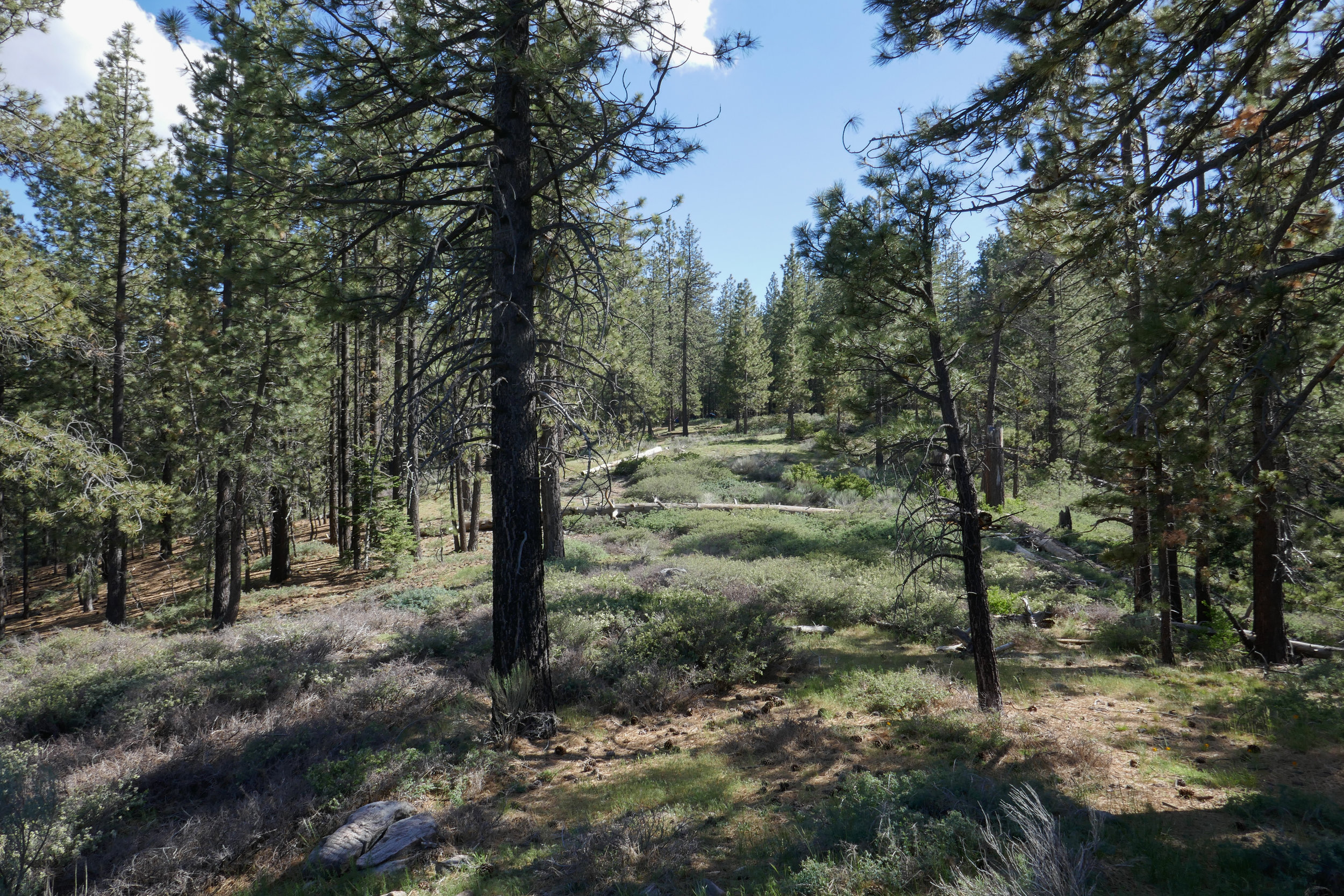
We had a fantastic long weekend backpacking and camping in Los Padres National Forest! Our first hike was an easy one to the top of Mt. Pinos and back. We wore our heavy packs to continue our training for Mt. Whitney. Afterwards, we headed to the McGill Campground. I was really excited to get to camping! I’d been at this campground a few times before, but never stayed. It was just lovely! The camp hosts are very hospitable and they keep the place in tip top shape. Almost all of the campground is shaded by towering pine trees. If you prefer, you can camp at one of the more exposed sites on the outer edge that offer sweeping views. We almost took one of those, but since it was windy we opted to stay a little farther in. We hung a hammock and enjoyed a lazy afternoon. In the evening we made dinner (just freeze dried meals using the Jetboil stove) and then took a romantic stroll along the Exploration Trail. The Exploration Trail is a paved nature trail leading to some benches where you can sit and enjoy the view. It was a very relaxing evening. Once the sunset, the moon rose and lit up the entire sky. It was magical. I really don’t think I’ve ever seen a full moon as beautiful as the one we saw from this forest. It was amazing and so bright, we didn’t even need our headlamps. When it was time to sleep, the only sounds we heard was the wind howling through the trees. Since it was a Sunday night, there was hardly any trace of human beings around. Just the way I like it! I woke up a few times from the wind during the night and each time, I saw the moon in a different spot as it circled our tent throughout the night. It was about 5:30 am when I woke up and stepped outside to catch a little bit of sunrise. It was so quiet and peaceful and the sky was full of different colors. I wanted to enjoy a little more sleep, so I got back in the tent and didn’t get up again until about 7:30. Once we were awake, we made a fire, had breakfast and relaxed some more before heading up to the Nordic Base and hiking to Mt. Pinos again. This time we went a little further and took the Vincent Tumamait trail down to the bottom of the switchbacks, At that point we decided it was time to head back. I really just wanted to do a good climb with my heavy backpack on to get in some more training for Mt. Whitney before heading home. It really was a wonderful weekend. I especially didn’t want to leave the camp. We will definitely be staying here again sometime in the future. It’s such a beautiful place.
After our snowshoeing excursion on Mount San Jacinto, we drove an hour to Twentynine Palms to spend the rest of the weekend at our favorite bed and breakfast, the Campbell House. We arrived early enough to relax for a bit before heading out for dinner and drinks at the Twentynine Palms Inn. It was a great way to end the day. I slept very well that night until I awoke around 5:45 am and decided to wake my husband up so we could head into the park by 6:48 am in time to watch the sun come up. As much as I would have liked to sleep in, I never miss a desert sunrise. We quickly put on some clothes, threw our backpacks and some extra water in the car and drove into the park. The colors were phenomenal as always! It was chilly, but I was bundled up so I barely noticed. It was quiet with not many people around since it was still very early. The only sounds we heard were the birds peacefully singing and I saw a huge hare hop by. His feet were quite large and he had long, black tipped ears. I took a some photos as the sun came up and then we spent some time simply enjoying the tranquil morning before heading back for breakfast. Later on, after checking out of the bed and breakfast, we decided to drive through the park. We had mixed feelings about it since all of the issues going on with the government shut down, but we wanted to see for ourselves. We discovered that there were rangers working both the West and North entrances (without pay). The park looked like it was being well taken care of by the volunteers. The ranger told us that the Visitor Center on Park Blvd. was open and being operated by Joshua Tree National Park Association. We stopped off at the visitor center and made a donation. It was the least we could do to help their efforts. If I lived near and worked in Joshua Tree National Park, I'm sure I'd be working for free too. Joshua Tree is a very sacred and special place. I was happy to see it being well cared for.
We had quite a bit of rain over the past few days and I really wanted to try snowshoeing. We had already made plans months ago to spend the weekend in Twentynine Palms, but instead of hiking in the desert like we normally would have, we decided to take the Palm Springs Aerial Tramway up to Mt. San Jacinto. We rented snowshoes from REI in Burbank and were lucky to get the last two pairs available for the upcoming weekend. Seems everyone had the same idea: Take advantage of the snow while you can. I got up at 4 am and we were on our way by 5 am. When we arrived in Palm Springs at 7 am, the parking lot was already getting filled up; families with sleds, coolers, snowshoes, etc., all gearing up for a winter play day. We got our tickets for the 8 am tram and were on our way up the mountain in no time. The tram is a unique activity to do in and of itself. I never get tired of being hoisted up a steep cliff inside a floating bubble travelling up a cable. The transition from desert floor to sub-alpine is amazing and in just 10 minutes we went from the desert floor at 2,643’ at Valley Station to 8,516’ at the top of Mountain Station. The air at the top of the tram was in the 30s. The snow was hard packed and crunchy with some ice. We headed over to the Desert View Loop to try out snowshoeing for the first time. It was actually quite easy. To me it felt a bit like an elliptical machine. The Desert View loop is a short trail with a gentle incline and five notches overlooking wonderful views. It was the perfect place to start. After we had gotten the hang of things, we headed over to Long Valley Station where we filled out a permit and continued on into the San Jacinto Wilderness with our destination being Round Valley. By this time, more people had arrived, some wearing microspikes and there were many groups of snowshoers and winter backpackers. I really enjoyed being able to “float” on top of the snow in the snowshoes. I also liked having a sturdy grip with the snowshoes’ crampon that dug its teeth into the hard packed snow for traction. I felt very secure both ascending and descending. There were a number of people on the trail today, but we were still able to enjoy some alone time. After arriving at Round Valley, we contemplated going up one more mile up to Wellman’s Divide. But instead, we changed our minds and decided to start heading back, knowing we had a cozy room waiting for us in Twentynine Palms. The weather was warming up now, and the snow was starting to get slushy. I think it was a little after 2 pm when we arrived back at Mountain Station. We had no problems getting on the next tram down and were headed out to spend the rest of the weekend relaxing and enjoying the desert. It was a wonderful day. I think I am hooked on snowshoeing and I cannot wait for the opportunity to do it again!
My favorite part of the hike to Josephine Peak are the spectacular views. It’s a steady 4 mile climb to the peak, and today we had a nice, clear day since it had just rained. As we travelled up the fire road from Clear Creek Station just off Angeles Crest Highway, we could smell the eucalyptus trees and the yerba santa. It was even more fragrant today since it had just rained. I’m not quite sure how the eucalyptus trees got here since they’re not native, but they sure do smell nice. As we continued hiking up the trail, I started to get some great photo ops. Strawberry Peak looked quite impressive and we could see a dusting of snow covering the mountaineer’s route. We also had a nice, clear view of DTLA. The views went out all the way to the ocean. To the north, the high country was covered in fresh snow; Waterman, Baden-Powell, Twin Peaks, etc. As we neared the summit of Josephine, we crossed over a bit of snow ourselves. When we arrived at the peak, the views were even more incredible. The last time we were here we were shrouded in clouds so we didn’t get the 360 degree views that we had today. I took advantage and snapped away with my camera. It was absolutely lovely. After spending some time at the summit and greeting a few fellow hikers who’d come to enjoy the day as well, we decided it was time to begin our descent. The clouds started to roll in as we hiked back down the mountain, but we didn’t see any rain. It was an absolutely perfect day.
Our first hike of 2019 was to Mount Hillyer. I love this hike. There’s so much going on. Lots of great rock formations and change of scenery along the way. It was 39 degrees at Chilao where we picked up the Silver Moccasin Trail with wind gusts up to 50 mph expected at the summit. We had a great hike up. The breezy day was refreshing and there’s not much exposure on this trail with all the boulders, so we were protected from the wind for most of the route. There was a downed tree on the switchbacks of the Silver Moccasin trail. I’m not sure if it was caused by the winds, but luckily it was easy to maneuver over. As we continued our journey upward, the winds became stronger. My core was warm with all my layers, but for some dumb reason I didn’t wear a bottom base layer under my hiking pants. I don’t know where my head was this morning. I knew there would be a wind chill, and I’m usually the one who is over prepared with too much gear. When we reached the gusty summit, I could feel the tops of my legs getting numb. We hauled butt pretty quickly down off the exposed mountain top. I haven’t felt that numb feeling set in since Pennsylvania when I would spend the entire day at the barn riding and taking care of my horses in temperatures below zero some days! Once out of the big gusts, my legs warmed up and we continued our descent. About 1:30 pm, we heard a loud roar in the sky. As we looked up we saw two B-2 Spirit Stealth Bombers flying overhead. They were probably headed back to base after the Rose Parade. Last year we got to see one of them from the top of Waterman Mountain. I didn’t think we’d get to see that this year, but we actually got to see two of them! It was a great way to begin the New Year!