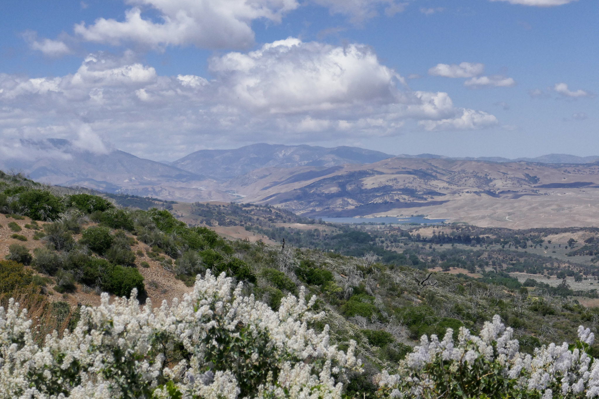
oak

Joshua Tree National Park, Panorama Loop from Black Rock Campground, 6.5 Miles RT, 1,158' +/-, February 29, 2020

Joshua Tree National Park, Panorama Loop from Black Rock Campground, 6.5 Miles RT, 1,158' +/-, February 29, 2020

Hiking the Panorama Loop from Black Rock Campground. This hike starts in the far northwest section of Joshua Tree National Park. You can park at the Black Rock Canyon Campground where there’s a visitors center and bathrooms. From there, look for campsite #30 and you’ll find the trailhead. You’ll see a water tank and a dirt road which you will follow southeast for a short distance until you are on a dirt trail. You’ll reach a sign for the Panorama Loop and Warren Peak via Black Rock Canyon Trail. Much of the trail is hiking through a sandy wash with a moderate incline. You’ll be winding through canyon walls here and as you continue, you’ll notice the lush greenery beginning to present itself. This area is abundant with pinyon pine, juniper and oak. You’ll also discover a spring. But keep your eyes peeled because it’s easy to miss. When we were here in February it was just a trickle. However, there is plenty of wildlife to be seen in this area such as insects, birds, rabbits, and ground squirrels. It’s a very unique section of the park. At about 1.7 miles in you’ll find the signage for the start of the loop to Panorama Peak. If you hike it clockwise, you’ll have a steeper climb up, but it will save your knees on the way down the other side. As you do the work to ascend, you’ll be rewarded with views of snow capped Mt. San Gorgonio. Continue upward on the steep switchbacks for incredible panoramic views of Mt. San Jacinto, Yucca Valley, Mt. San Gorgonio and the Coachella Valley. You can even catch a glimpse of the Salton Sea. When you’re ready to return, follow the ridge and descend down into a wash where you’ll continue to enjoy the lush terrain along with majestic Joshua Trees. Eventually, you’ll be back at the start of the loop and return the way you came. It was a beautiful hike. Much different then the typical terrain I’m used to seeing in the desert.

Read More

Santa Anita Canyon to Mt. Wilson, 14.5 miles RT, 4,426' elevation +/-, 5,712' max elevation, April 1, 2019

Santa Anita Canyon to Mt. Wilson, 14.5 miles RT, 4,426' elevation +/-, 5,712' max elevation, April 1, 2019

I decided to take a vacation day on Monday so I could go hiking. We headed to Chantry Flats, but we weren’t sure whether or not we wanted to do a longer, more strenuous hike to Mt. Wilson or a shorter loop. We figured we’d decided when we got to the junction at Sturtevant Camp. Santa Anita Canyon was exceptionally beautiful today. There was so much water flowing in the creek. We took the Lower Winter Creek Trail that climbs up along the side of a rocky cliff to the top of Sturtevant Falls. The water was rushing strong and it looked awesome! As we hiked along the trail, we saw so many cascading pools of water. When we reached the junction near Sturtevant we made the decision to do the longer route to Mt. Wilson. I figured why not. I’d taken the day off and had no other place to be. As we started up that first steep mile, I was almost starting to regret my decision. My body was tired, but I didn’t want to turn around. We’d done this route last year, and I remember I really enjoyed it. We slowed up our pace which made it a little more bearable. It was a fun climb! Lots of beautiful scenery along the way. But I was very happy to reach to top because all I kept thinking about was sprawling out at one of the tables at the Cosmic Cafe and eating a ham and cheese croissant my husband had picked up at the donut shop before our hike! Once at the top, we had a nice rest. I took my hiking boots off to give my feet a break too. After we were finished refueling and recharging, we began the 7 mile descent back down the mountain. We took the Mt. Wilson Trail where you can still see quite a bit of fire damage to the Mt. Wilson Toll Road. There had been an avalanche since the last time we hiked on this road, and there were huge fallen boulders strewn across it. They were easy enough to get around, and I wondered what it must have sounded like when they came crashing down. We then reached the junction for the Winter Creek Trail and continued the long, steep descent on the switchbacks until we reached the bottom of the canyon. There were a lot of downed trees to hop along the way and there was also some trail erosion. The trail was still in good shape, but it does need a little TLC from the wonderful volunteers who help keep these trails passable so we can enjoy them. My knees and feet were getting tired, but the Winter Creek Trail is just so pretty. The final part of the hike was the grueling slog up the concrete road leading back to the parking lot. It seems to go on forever and it is steep! I was sweaty and tired by the time we got back to the trailhead, but it was so worth it. It’s been a while since we did any long, hard days on the trail so it felt really good to get out there and enjoy it!

Read More

Liebre Mountain, 5783', 7.3 miles RT, 1,877 +/-, May 13, 2018

Liebre Mountain, 5783', 7.3 miles RT, 1,877 +/-, May 13, 2018

I was super excited to explore a new part of the Angeles National Forest this past Sunday! One of the first hiking books I’d ever purchased was “Trails of the Angeles” by the late John W. Robinson. This hike is hike #1 in his book. In addition, Casey Schreiner of ModernHiker.com, recently posted a trail report about this hike, making it sound even more appealing.

The trailhead is about an hour and 20 minute drive from our home and is in the northwestern section of the Angeles NF. It starts off on the PCT, and we did pass a number of thru hikers headed to the Sierras as we ascended the mountain southbound.

The first part of the trail took us up switchbacks that were surrounded by blooming ceanothus (wild lilac) as well as patches of yerba santa. As we made our way up, we had wonderful views of the Antelope Valley, the Ventura mountain ranges, the San Andres rift zone and the Tehachapis. It’s a very interesting contrast considering the mountain we were hiking on was so lush and green.

As we continued, we passed through an incredibly beautiful pine grove filled with purple lupines. Various wildflowers were numerous along the entire route. As we climbed upward, Liebre mountain turned into a sprawling oak savanna and the clouds began to roll over us as they made their way across the mountaintop. We reached a junction where the PCT headed east, but continued along the trail (which was now more of a fire road then a single track) to reach the highest point of Liebre Mountain. To find the high point which is marked with a wooden stake and a pile of large rocks, we had to leave the road and do a little searching. We stopped here to relax, have a snack and enjoy the scenery. We also did a some exploring around the top of the mountain before making our way back taking our time as we did. As we descended, the temperatures had warmed up a bit and there was more wildlife activity; lizards warming themselves in the sun and insects enjoying the wildflower blooms. I stopped for a while to get some photos of a Clearwing Hummingbird Moth nectaring on the yerba santa at about 4,300’. It was quite a sight! I’d never seen one of these before! This was a lovely hike and another great day to be in the mountains!

Read More

Cerro Negro Lookout, 5 miles RT, 1,024’ +/-, January 28, 2018

Cerro Negro Lookout, 5 miles RT, 1,024’ +/-, January 28, 2018

I’ve had this trail on my list for a while since the trailhead is right next to Descanso Gardens. It starts off on the appropriately named Descanso Trail which follows the fence that runs along the edge of the gardens. I parked my car just before sunrise and started heading up. The trail makes a pretty immediate ascent through some oaks and a series of switchbacks. Once you’re up high enough, you can actually look down into Descanso Gardens. There’s some nice views of the San Gabriels and the Verdugo mountains from the trail. The Santa Ana winds were pretty intense this morning and made walking interesting.  As I was hiking four coyotes crossed over the trail ahead of me and headed down the hill.  They seemed preoccupied with whatever they were tracking and not so much interested in what I was doing.  At an intersection called Five Points, I headed east on the Cerro Negro Trail and then finally up to the lookout to check out the Chrysler-Bell Victory air raid siren.  It was even more windy up at the summit.  I found the summit marker, took some pictures and then headed back down.  This is a nice short hike if you just want to stay close to the city.  Not much shade at all on this hike, so definitely not one to do when it’s hot outside.

Read More

Santa Anita Canyon, Chantry Flat, Gabrielino Trail, Sturtevant Falls, Sturtevant Camp, Mount Zion, Winter Creek Trail, 8 miles RT, 2,336 +/-, December 1, 2017

Santa Anita Canyon, Chantry Flat, Gabrielino Trail, Sturtevant Falls, Sturtevant Camp, Mount Zion, Winter Creek Trail, 8 miles RT, 2,336 +/-, December 1, 2017

Today was an epic day full of history!  We arrived at the locked gate at Chantry Flat Road about 10 minutes ‘til 6 just before the sheriff arrived to open it.  We then drove up the windy road to the parking area at Chantry Flats, displayed our Adventure Pass and off we went into the Big Santa Anita Canyon.  This place was beautiful!  I immediately forgot I was only 25 minutes from our house in the city; towering oaks, a village of rustic cabins along a creek and lush, green ivy cascading the canyon walls.  We trekked creekside along the Gabrielino Trail enjoying the scenery before we reached Fiddler’s Crossing where we followed a short spur trail to Sturtevant Falls.  We then backtracked to the Lower Gabrielino trail and traveled onward and upward towards Sturtevant Camp.  The Lower Gabrielino trail took us up above the falls which was pretty cool since I’d never actually been on top of a waterfall before.  But be warned, the trail here is mostly jagged rock cut into the canyon wall, and there was one section in particular where it got a little sketchy due to erosion from the rains.  Besides that section, the rest of the trip is on a lovely, well maintained path.  Next, we headed up towards Spruce Grove camp and picked up the Sturtevant Trail to the historic Sturtevant Camp, established in 1893.  When we arrived, Brad, the host, greeted us welcomingly.  We chatted with him for quite a while and he showed us around the buildings which date back to “The Great Hiking Era”.  He also gave us a little history about the place and showed us inside the Sturtevant Lodge which has a kitchen, a dining hall and a fireplace room with an old piano.  On the walls, you can see photos of Mr. Wilbur Sturtevent himself.  At the turn of the century there were five resorts built here.  Sturtevant Camp is the only one that remains, and it’s still functioning!  You can rent the cabins, but there is no wifi, cell phone service, computers or TV, and your things will have to be brought up by mules from Adam’s Pack Station.  How cool is that!  For more information, you can check out this link:  http://sturtevantcamp.com/  After leaving camp, we got back on the Sturtevant Trail to the Upper Zion trail which took us to the spur for Mount Zion.  In just a short climb we were at the summit looking back at Mount Wilson.  After enjoying the view, we headed down and continued on the Upper Zion trail.  This section didn’t have much shade and the switchbacks were steep.  I was glad we were going down and not up!  Eventually, the trail dropped us back into the cool, shady canyon passing through Hoegee’s camp and onto the Winter Creek Trail before reaching our car parked at Chantry Flats.  We ended our adventure with ice cream from Adam’s Pack Station General store.  I would have loved to have seen the mules, but they were busy working today and making a delivery to Sturtevant Camp.  This was a really great hike with a little bit of everything; beautiful scenery, a waterfall, unique history and even a peak.  We will definitely take this route again through Sturtevant Camp when we hike to Mount Wilson!

Read More

Acorn Trail, PCT, Wright Mountain, 9.1 miles RT, 8,505', (2,227' +/-), September 3, 2017

Acorn Trail, PCT, Wright Mountain, 9.1 miles RT, 8,505', (2,227' +/-), September 3, 2017

This Sunday we left the unbearable heatwave looming over Los Angeles and headed to the higher altitude of the mountains in Wrightwood to hike the Acorn Trail and summit Wright Mountain. The Acorn Trail is a 2.1 mile trek with a 1,500’ elevation gain that leads to the junction of the PCT.  It starts off on private property at the end of Acorn Drive in Wrightwood, so you’ll need to park your car before the private property sign (there’s a turn out just before the sign that fits two cars) and hike about 3/4 miles up the steep Acorn Drive.  It’s a nice way to warm up those muscles and prep for the steady climb you’re about to take on.  Once you get to the proper trail, it climbs steeply through a shaded forest of oak and pine.  Some spots of the trail can be a bit precipitous, but no worries.  Take your time and keep on trekking.  At 2.1 miles you’ll reach a junction with the PCT.  Turn left (head east) and follow it, but keep you eyes peeled for the use trail leading up to the summit of Wright Mountain.  We missed this trail the first time because my original directions told me to hop on the Blue Ridge Truck Trail which parallels the PCT.  The truck trail does not lead to the summit, but it still has some outstanding views of Pine Mountain, Mount San Antonio and the Sheep Mountain Wilderness.  After we’d been walking for awhile with no indication that we’d be going up anytime soon, I pulled out the handy Tom Harrison map.  It showed that the truck trail would soon end, and at that point we could just hop back on the PCT and head back west to where we came from.  We were in no hurry, so we enjoyed the views and extra mileage.  On the way back, we found our destination.  Sure enough there was a use trail splitting off and leading to the summit of Wright Mountain.  This ‘trail’ (if you could call it that) is not maintained.  We had to bushwhack our way up through overgrown chaparral to get to the top which was actually a lot of fun.  This is definitely not a trail to do in shorts!  Just after we reached the top, the wind started kicking up and storm clouds started rolling in.  We took in our views and began our descent.  A light sprinkle began to fall and the forest became peaceful and still with only the sound and fragrance of fresh summer rain.  We could not have timed it any better...  Just as we got back to the car, the sky opened up and it poured!  There's nothing quite as refreshing as a good mountain rain!  It was a lovely day and as per our usual routine, we rewarded ourselves with a hearty lunch at the Grizzly Cafe in Wrightwood.
 

Read More

Cooper Canyon Falls, July 30, 2017: Buckhorn Campground, Pleasant View Ridge Wilderness, Burkhart Trail to Cooper Canyon Falls, Little Rock Creek (776 ft. +/-) 3.7 miles RT

Cooper Canyon Falls, July 30, 2017:  Buckhorn Campground, Pleasant View Ridge Wilderness, Burkhart Trail to Cooper Canyon Falls, Little Rock Creek (776 ft. +/-) 3.7 miles RT

This is a very pretty, very green trail that starts at Buckhorn Campground and leads you into the Pleasant View Ridge Wilderness via Burkhart trail down to Cooper Canyon Falls. This is an upside down trail, so if you do it as an out and back you'll gain your elevation on the way back going all uphill. The falls were just a trickle, but it was a beautiful hike and fun to explore the creek at the bottom of the canyon. 

We started our hike around 07:25 AM from Buckhorn Campground on the Burkhart Trail leading into Pleasant View Ridge Wilderness, 26,752 acres of protected land.  You do not need a permit to enter this wilderness.  The moment you step onto the trail, you are engrossed in a forest of lush green.  Oak, Douglas Fir, Jeffrey Pine and Incense Cedar offer a canopy of shade along almost the entire journey.  As you walk, you can see and hear Little Rock Creek far below.  It’s very peaceful with only the sounds of flowing water and morning songbirds.  Aside from the campground which was very full, the trail itself was quiet and we had it mostly to ourselves the entire hike.  The trail makes a steady descent downward into the canyon.  It’s an easy grade and not too steep, although as you get closer to the falls, it can get a little rocky with some loose gravel.  It's nothing too difficult, just watch your step.  Along the way we crossed over two creek beds which were nice for photography.  We took our time to explore the area and did a little boulder hopping along the creek.  

It seemed we’d traveled a bit further then we should have to get to the falls, and we still hadn’t seen them.  I got out my map to take a look to see where we were.  As suspected, we had actually passed the area where they were supposed to be.  At this point we headed back the way we came, and I found the use trail which is a short, but steep scramble to get to the bottom of the canyon where the falls would normally be had it not been summer.  At this time of year, however, they were just a trickle of running water on mossy rock which is why they were so easily missed.

Although there wasn’t a rushing waterfall to see, we were not at all disappointed.  This hike was beautiful.  Satisfied that we’d reached our destination, we now continued our ascent all uphill now back to the trailhead at Buckhorn Campground.  We took our time to enjoy the scenery and peaceful splendor of the wilderness.  

Read More