Wrightwood

Big Pines, Blue Ridge, PCT Hike, Wrightwood, CA, 6 Miles RT, 1,302' +/-, 8,187' Max Elevation, August 11, 2019,

Big Pines, Blue Ridge, PCT Hike, Wrightwood, CA, 6 Miles RT, 1,302' +/-, 8,187' Max Elevation, August 11, 2019,

Today we made the drive to Wrightwood to hike the Blue Ridge Trail. We’ve been slacking the past couple of weeks since we got back from Mt. Whitney. The Blue Ridge Trail is a nice, mellow climb up to Blue Ridge in the welcoming shad of Oak and Pine. When we got to the ridge we decided to go a little bit further to enjoy the views. We hiked southeast along the PCT towards Guffy Campground and Wright Mountain for just a short while. It was a lovely day and much cooler than at the lower elevations. There are still plenty of wildflowers in bloom and the bees were buzzing all around them. Afterwards, we headed over to my favorite place to eat in Wrightwood, The Grizzly Cafe. It was a nice way to end the weekend.

Read More

Camping Table Mountain and Blue Ridge Trail, 4.9 Miles RT, 1,201' +/-, Max Elevation 7,919', June 20 and 30, 2019

Camping Table Mountain and Blue Ridge Trail, 4.9 Miles RT, 1,201' +/-, Max Elevation 7,919', June 20 and 30, 2019

We had a another relaxing camping trip to Table Mountain in Wrightwood this weekend. We set up camp in the afternoon, took a nap and then did a short evening hike up the Blue Ridge Trail through the majestic Black Oaks and up to the top of Blue Ridge. I love this trail. It was very peaceful on a Saturday night, since most of the day hikers were gone. Before heading back to camp, we stopped off in Wrightwood and picked up a pizza and a bottle of wine. We spent the rest of the evening enjoy food by the fire. When we turned in for the night, the forest was extremely quiet. It’s usually windy up on this mountain, but on this night it was very still. In the morning we woke up early and did a quick hike on the Table Mountain hiking trail. It’s about 2.5 miles and goes around the perimeter of the campground. It has great views of Mt. Baden-Powel and all the way out to Palmdale. It was another great weekend spent in the mountains!

Read More

Jackson Lake, Boy Scout Trail, 7 Miles RT, 1,378' +/-, Max Elevation 7,462', Camping Table Mountain, June 1 and 2, 2019

Jackson Lake, Boy Scout Trail, 7 Miles RT, 1,378' +/-, Max Elevation 7,462', Camping Table Mountain, June 1 and 2, 2019

This weekend was our first camping trip of the season! It was time to pull all our gear out and get familiar with it again since we’ll be backpacking the Mt. Whitney trail this year. I love camping. It’s so nice after a day of hiking to be able to build a fire and sleep out under the stars. We headed out of the gloomy cloud covered city up to sunny Wrightwood. There were, however, some scattered storm clouds hanging around, but the rains held off and the clouds passed us by. Our hike today started at Jackson Lake. There were people here fishing and families picnicking. We got on the Jackson Lake trail to the Boy Scout Trail. There’s plenty of shade on this trail as you pass through a forest of beautiful black oaks and towering pine trees. I’d like to come back here in the fall when the leaves are changing. It’s a lovely trail and we didn’t see another person. The Boy Scout Trail eventually ends at a junction for two service roads. You can head southwest on the Pinyon Ridge Truck trail, or southeast on service road 3N26. This road winds around the mountain as it climbs upward with nice views of Mt. Baden-Powell which is still covered in snow at the top. The road eventually takes you to a junction for the PCT, so we headed north here to loop back to the Jackson Lake Trail. We passed about 6 thru hikers on this section heading towards Baden-Powell. Hope they all made it up safely with the snow. It was about 2:30 pm when we got back to the trailhead and headed to camp at Table Mountain. After we set up camp, we went into town and brought back some Grizzly Burgers from the Grizzly Cafe. That’s the nice thing about camping at Table Mountain. You’re about a 10 minute drive from food! Why cook when you can get a burger to go, right? As the sunset and the weather cooled down, we built a fire, toasted marshmallows and enjoyed the outdoors. We had a peaceful night and slept comfortably under the stars. The next morning welcomed us with a beautiful sunrise and birdsong. We had breakfast and then headed home. The weekend was way too short, but I’m so grateful for the times we have like this when we get to be away from the city, traffic, electronics, etc. and enjoy the beauty of the forest.

Read More

Car Camping Table Mountain Campground, Wrightwood, CA September 15 & 16, 2018

Car Camping Table Mountain Campground, Wrightwood, CA September 15 & 16, 2018

This weekend was our first overnight camping adventure! We decided to start at an established campground with all the amenities (water, fire ring, picnic table, bathrooms) so we chose Table Mountain in Wrightwood. This is a beautiful campground that sits on top of the mountain at an elevation of 7,000’. There are great views from the camp, but it can get windy at night so we reserved a campsite ahead of time that had some protection from the wind. We had wanted to get to camp earlier in the day and do some hiking, but I underestimated the amount of time we’d be stuck in traffic on the way there. Usually, when we make the drive to Wrightwood, we leave very early in the morning before the freeways have time to get jammed. It was around 4 pm when we arrived which gave us just enough time to set up camp, build a fire and make dinner before the sun set. Once we were settled in, we sat by the fire relaxing and roasting marshmallows for making s’mores. It was a beautiful night with perfect weather. The forest was so peaceful with only the sound of the wind blowing through the trees. Our new tent and sleeping bags served us well. Around 2:30 am my husband and I both woke up and went outside to look up at the stars. It’s not often we get to see so many of them since we live in the city. In the morning (I think it was sometime after 6:30 am) I awoke to the sound of chickadees chirping outside our tent. We were so relaxed that we ended up just hanging around camp all morning in our sleeping clothes, cooking breakfast and drinking coffee. There was no rush to go anywhere or do anything besides sit in the warm morning sun enjoying the peace and quiet. I got a kick out of watching the birds take turns diving into my cooking pan to get the pancake crumbs leftover from breakfast.

Originally, when we got all our gear I really thought we would be using it mostly for backpacking overnights. But now that we’ve done car camping, I can absolutely see us doing this more often. It’s a great way to spend the weekend when you just want to get away, detox from the stress of everyday life and unplug from the electronics that we are unfortunately forced to be glued to all week long at our jobs. We’re already making plans for the next overnight adventure, and I can hardly wait!

Read More

Backpacking Test Run to Blue Ridge, Wrightwood, CA, 7 miles RT, 8,116' Max Elevation, 1,404' +/-, September 2, 2018

Backpacking Test Run to Blue Ridge, Wrightwood, CA, 7 miles RT, 8,116' Max Elevation, 1,404' +/-, September 2, 2018

I had my mind made up about wanting to transition from day hiking to backpacking. Once I get my mind set on something, I obsess over it until it happens. After spending a couple of weeks doing research, I felt confident enough to head over to REI and make the investment. We spent the following day setting up camp in the living room and practicing packing our backpacks. Sunday morning (also my birthday), we headed out with all our new gear to Wrightwood to hike the Blue Ridge Trail. The Blue Ridge trail was a perfect trail to get a feel for the new packs with the additional weight we’d be carrying on a backpacking trip. I picked this trail because it’s well maintained, it’s not too steep and there is no scree which makes it a great place for a worry free trial run. There’s also a bit of altitude (over 8,000’ at the ridge) and about 1,000’ of gain in two miles. Both of us carried over 20% of our bodyweight which slowed us down from our normal day hiking pace. But backpacking, to me, is a different mindset. It’s not about rushing to bag a peak or hiking to be at a certain place by a certain time. This is a quote from one of my hiking books that could not sum up how I feel about backpacking any better:

“Once you realize that the road is the goal and that you are always on the road, not to reach a goal, but to enjoy its beauty and its wisdom, life ceases to be a task and becomes natural and simple, in itself an ecstasy.” - Sri Nisargadatta Maharaj

I believe backpacking is going to take us on exciting new journeys into the wilderness and offer us amazing experiences that will make our lives even richer. In a few weeks, we’ll be setting up camp for the first time to enjoy our first overnight in the forest. I’m really excited about all of this and looking forward to many adventures to come!

Read More

Big Pines to Blue Ridge, 4 miles RT, 1,585 +/-, February 25, 2018

Big Pines to Blue Ridge, 4 miles RT, 1,585 +/-, February 25, 2018

Until I started hiking, I never thought I’d get to see snow here in Southern California.  After spending 27 years of my life in Pennsylvania, you’d think I’d be over it.  I guess I’m not.  This past weekend we drove up through Angeles Forest with the intent to enjoy some snow.  The plan was to do a short hike along the PCT from Islip Saddle to the beautiful Little Jimmy Campground.  My husband had been feeling under the weather all week, so it wasn’t a good idea to do anything strenuous.  When we got to Islip Saddle, however, the wind chill was so cold, we opted out.  We got back in the car and headed over to the Blue Ridge Trail.  This was one of the first trails we ever hiked in Wrightwood.  It’s a great go-to trail when you just want to hike along a mellow trail through a pretty section of forest that will lead you to a nice vista on top.  While I wasn’t expecting to be knee deep in snow, I was happy to at least get to see a little bit on some sections of the trail.  They want another storm this week, so fingers crossed, Southern California will get to see a little bit more winter! 
 

Read More

Big Horn Mine, 4 miles RT (997 +/-), October 8, 2017

Big Horn Mine, 4 miles RT (997 +/-), October 8, 2017

Big Horn Mine has been on my list of hikes to do, and Sunday was the perfect day to do it.  We arrived at the trailhead at Vincent’s Gap plenty early.  It was still dark and since this was a short 4 mile hike, I wanted to be able to enjoy the scenery and take some photos along the route.  We waited until about 6:30 when dawn began to turn black skies to blue and began our trek.  Some people parked on the opposite side of the parking lot fired up a grill and started cooking breakfast.  The delicious smell of bacon in the air made my stomach grumble, but we had a mine to explore.

This hike starts out on an old wagon road that winds around Mount Baden-Powell.  The last time I was here we had hiked up to the top of that mountain which stands at 9,406’.  Today we were on the lower slopes, and I took some lovely photos of the moon up over the ridge.  After about 200 yards in, we came to a split with two signs:  Mine Gulch left and Big Horn Mine right.  I later learned that taking the Mine Gulch trail would have taken us to Vincent’s Cabin.  I’d like to check that out someday.

I should note a short bit of history about the mine:  Big Horn Mine was discovered by Charles “Tom” Vincent in 1895.  He lived in the log cabin that you can still visit today.  The mine was profitable from 1903 to 1906.  Eventually, it was tapped out and abandoned.  

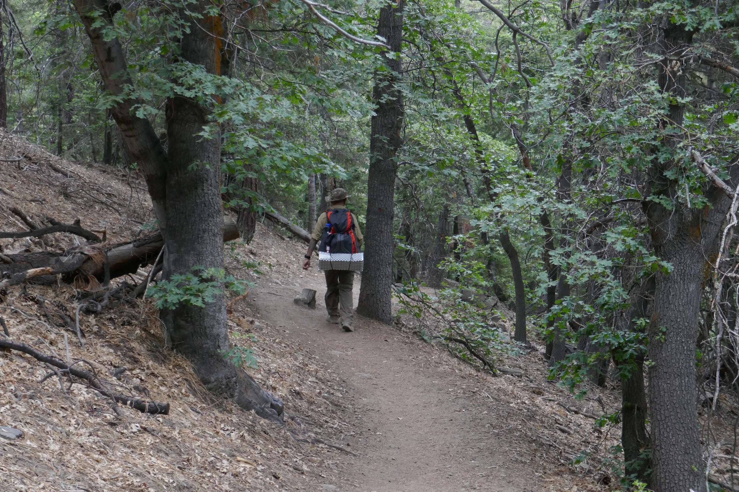
The trail to the mine is pretty easy as you wind along the mountain on the wagon road enjoying views from some of the tallest peaks in the range.  However, as you get further along, the trail begins to narrow and sections become steep and rocky with loose gravel.  Some areas were so narrow that there was only room to place one foot.  Rather then give myself time to think about the plunging descent to my side, I chose to focus on moving forward and getting to our destination.  In just a few moments the trail widened again, and soon the mine came into view just as the golden rays of morning sunshine were coming up over the San Gabriels.  

Just one more sketchy scramble to get through to get up to the structure and we had arrived!  No other hikers in sight yet, so we enjoyed exploring the outer structure and the views of the surrounding mountains.  We did not go inside the mine.  While you can crawl through some boards to get inside, it is not advised because the mine is deteriorating and subject to collapse.  

After we were done exploring, we headed back the way we came.  We veered off the main trail to do some quick exploring on a use trail that led us to what looked like the remains of another structure.  Not sure what that was, but we eventually made our way back to the main trail and back to trailhead.  As per usual, we stopped by the Grizzly Cafe for some delicious coffee and breakfast.  Great hike today with a lot of history!
 

Read More

Acorn Trail, PCT, Wright Mountain, 9.1 miles RT, 8,505', (2,227' +/-), September 3, 2017

Acorn Trail, PCT, Wright Mountain, 9.1 miles RT, 8,505', (2,227' +/-), September 3, 2017

This Sunday we left the unbearable heatwave looming over Los Angeles and headed to the higher altitude of the mountains in Wrightwood to hike the Acorn Trail and summit Wright Mountain. The Acorn Trail is a 2.1 mile trek with a 1,500’ elevation gain that leads to the junction of the PCT.  It starts off on private property at the end of Acorn Drive in Wrightwood, so you’ll need to park your car before the private property sign (there’s a turn out just before the sign that fits two cars) and hike about 3/4 miles up the steep Acorn Drive.  It’s a nice way to warm up those muscles and prep for the steady climb you’re about to take on.  Once you get to the proper trail, it climbs steeply through a shaded forest of oak and pine.  Some spots of the trail can be a bit precipitous, but no worries.  Take your time and keep on trekking.  At 2.1 miles you’ll reach a junction with the PCT.  Turn left (head east) and follow it, but keep you eyes peeled for the use trail leading up to the summit of Wright Mountain.  We missed this trail the first time because my original directions told me to hop on the Blue Ridge Truck Trail which parallels the PCT.  The truck trail does not lead to the summit, but it still has some outstanding views of Pine Mountain, Mount San Antonio and the Sheep Mountain Wilderness.  After we’d been walking for awhile with no indication that we’d be going up anytime soon, I pulled out the handy Tom Harrison map.  It showed that the truck trail would soon end, and at that point we could just hop back on the PCT and head back west to where we came from.  We were in no hurry, so we enjoyed the views and extra mileage.  On the way back, we found our destination.  Sure enough there was a use trail splitting off and leading to the summit of Wright Mountain.  This ‘trail’ (if you could call it that) is not maintained.  We had to bushwhack our way up through overgrown chaparral to get to the top which was actually a lot of fun.  This is definitely not a trail to do in shorts!  Just after we reached the top, the wind started kicking up and storm clouds started rolling in.  We took in our views and began our descent.  A light sprinkle began to fall and the forest became peaceful and still with only the sound and fragrance of fresh summer rain.  We could not have timed it any better...  Just as we got back to the car, the sky opened up and it poured!  There's nothing quite as refreshing as a good mountain rain!  It was a lovely day and as per our usual routine, we rewarded ourselves with a hearty lunch at the Grizzly Cafe in Wrightwood.
 

Read More