hiking adventures

Joshua Tree National Park, Panorama Loop from Black Rock Campground, 6.5 Miles RT, 1,158' +/-, February 29, 2020

Joshua Tree National Park, Panorama Loop from Black Rock Campground, 6.5 Miles RT, 1,158' +/-, February 29, 2020

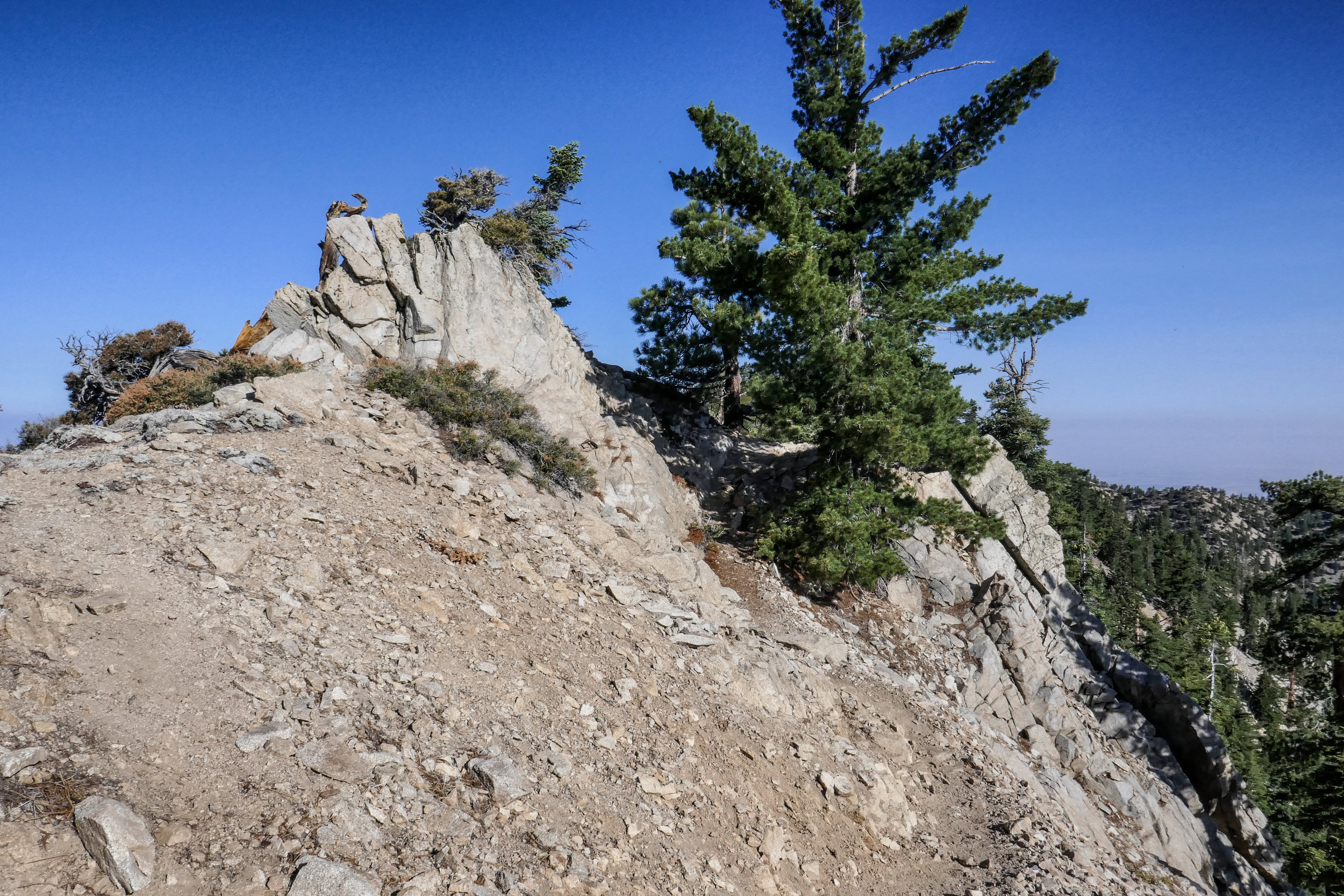
Hiking the Panorama Loop from Black Rock Campground. This hike starts in the far northwest section of Joshua Tree National Park. You can park at the Black Rock Canyon Campground where there’s a visitors center and bathrooms. From there, look for campsite #30 and you’ll find the trailhead. You’ll see a water tank and a dirt road which you will follow southeast for a short distance until you are on a dirt trail. You’ll reach a sign for the Panorama Loop and Warren Peak via Black Rock Canyon Trail. Much of the trail is hiking through a sandy wash with a moderate incline. You’ll be winding through canyon walls here and as you continue, you’ll notice the lush greenery beginning to present itself. This area is abundant with pinyon pine, juniper and oak. You’ll also discover a spring. But keep your eyes peeled because it’s easy to miss. When we were here in February it was just a trickle. However, there is plenty of wildlife to be seen in this area such as insects, birds, rabbits, and ground squirrels. It’s a very unique section of the park. At about 1.7 miles in you’ll find the signage for the start of the loop to Panorama Peak. If you hike it clockwise, you’ll have a steeper climb up, but it will save your knees on the way down the other side. As you do the work to ascend, you’ll be rewarded with views of snow capped Mt. San Gorgonio. Continue upward on the steep switchbacks for incredible panoramic views of Mt. San Jacinto, Yucca Valley, Mt. San Gorgonio and the Coachella Valley. You can even catch a glimpse of the Salton Sea. When you’re ready to return, follow the ridge and descend down into a wash where you’ll continue to enjoy the lush terrain along with majestic Joshua Trees. Eventually, you’ll be back at the start of the loop and return the way you came. It was a beautiful hike. Much different then the typical terrain I’m used to seeing in the desert.

Read More

Red Box to Valley Forge Trail Camp, Gabrielino Trail, 6 Miles RT, 4,868' Max Elevation, 1,276' +/-, September 23, 2018

Red Box to Valley Forge Trail Camp, Gabrielino Trail, 6 Miles RT, 4,868' Max Elevation, 1,276' +/-, September 23, 2018

Today we hiked the Gabrielino Trail East from Red Box to Valley Forge Trail Camp with the option to continue on to West Fork and Devore Trail Camps if we felt up to it. With the cool morning temperatures and the trail covered in falling leaves from the towering oaks that surrounded us, it was finally starting to feel like fall. The first part of the trail descended the steep stone steps from the Red Box picnic area then continued down some exposed switchbacks. It wasn’t long until we were in the cool shade of the oaks following the trail along the South Fork of the San Gabriel River. The stream was dry at this time of year, but that didn’t stop the gnats from bothering us. Luckily, we were prepared and always have our bug nets with us which prevented the pesky insects from flying into our eyes.

On our route we passed by some cabins and the ruins of an old, stone chimney. After about two miles, we reached the junction for the Valley Forge Trail Camp that was marked with a sign at the spur. We descended the spur to the camp to check it out and see if it was a place we’d like to stay as a future backpacking trip. The camp was lovely with plenty of shade, fire rings, picnic tables and primitive bathrooms. We set up at one of the picnic tables and decided to stay a while. I made friends with a Steller’s Jay who invited himself to our breakfast table. It was a very nice day and we were thoroughly enjoying the peace and quiet! This hike along this section of the Gabrielino Trail reminded me a bit of Santa Anita Canyon sans the crowds. We will definitely be coming back when the weather cools down a bit more to hike the longer routes to West Fork and Devore Trail Camps, and perhaps enjoy an overnight stay.

Read More

Car Camping Table Mountain Campground, Wrightwood, CA September 15 & 16, 2018

Car Camping Table Mountain Campground, Wrightwood, CA September 15 & 16, 2018

This weekend was our first overnight camping adventure! We decided to start at an established campground with all the amenities (water, fire ring, picnic table, bathrooms) so we chose Table Mountain in Wrightwood. This is a beautiful campground that sits on top of the mountain at an elevation of 7,000’. There are great views from the camp, but it can get windy at night so we reserved a campsite ahead of time that had some protection from the wind. We had wanted to get to camp earlier in the day and do some hiking, but I underestimated the amount of time we’d be stuck in traffic on the way there. Usually, when we make the drive to Wrightwood, we leave very early in the morning before the freeways have time to get jammed. It was around 4 pm when we arrived which gave us just enough time to set up camp, build a fire and make dinner before the sun set. Once we were settled in, we sat by the fire relaxing and roasting marshmallows for making s’mores. It was a beautiful night with perfect weather. The forest was so peaceful with only the sound of the wind blowing through the trees. Our new tent and sleeping bags served us well. Around 2:30 am my husband and I both woke up and went outside to look up at the stars. It’s not often we get to see so many of them since we live in the city. In the morning (I think it was sometime after 6:30 am) I awoke to the sound of chickadees chirping outside our tent. We were so relaxed that we ended up just hanging around camp all morning in our sleeping clothes, cooking breakfast and drinking coffee. There was no rush to go anywhere or do anything besides sit in the warm morning sun enjoying the peace and quiet. I got a kick out of watching the birds take turns diving into my cooking pan to get the pancake crumbs leftover from breakfast.

Originally, when we got all our gear I really thought we would be using it mostly for backpacking overnights. But now that we’ve done car camping, I can absolutely see us doing this more often. It’s a great way to spend the weekend when you just want to get away, detox from the stress of everyday life and unplug from the electronics that we are unfortunately forced to be glued to all week long at our jobs. We’re already making plans for the next overnight adventure, and I can hardly wait!

Read More

Mount Williamson 8,214', 5 miles RT, 1,552 +/-, July 29, 2018

Mount Williamson 8,214', 5 miles RT, 1,552 +/-, July 29, 2018

The best time for hiking during the hot summer months is EARLY! I like to be on the trail either before sunrise or shortly after so I can enjoy my time on the trail before the day heats up. This is also the time of year when I like to stick to the high country or look for higher elevation hikes which are usually a bit cooler than those at the lower altitudes. Mount Williamson was the perfect hike for today; a short 5 miles from the Islip Saddle trailhead with a little bit of an elevation gain and a fun climb. The early morning sunlight was brilliant as we headed up the trail which starts off on the PCT. It wasn’t long before views of Mount Islip opened up to the south on the opposite side of the Angeles Crest Highway. The hike to Mount Williamson is a fun one. We did this last year in September and I really enjoyed it. The climb is mostly steady until you get closer to the top where you leave the PCT and the trail to Mt. Williamson becomes quite steep and rugged. Once at the top we had wonderful 360 degree views. It was only us on the summit so we took our time, had some snacks and after orienting my map, I spread it out and secured it with some rocks so I could use it to identify some of the surrounding features of the area. Many of the surrounding peaks were visible including Mount Lewis, Mount Baden-Powell, Throop Peak, Mount Hawkins and Twin Peaks to name a few. To the north I could see all the way out to the Mojave Desert and to the southwest I had a nice view of Williamson Rock, which was once popular with rock climbers until the area was closed off to protect the mountain yellow-legged frog. It was barley 9 am and already I could feel the sun starting to heat up the day, so we headed back enjoying our time on the trail and the sweet, vanilla fragrance of the Jeffery pines along the way.

Read More

Dawson Saddle to Mount Hawkins 8,925' and Throop Peak 9,138', 6 miles RT (1,480' +/-) December 3, 2017

Dawson Saddle to Mount Hawkins 8,925' and Throop Peak 9,138', 6 miles RT (1,480' +/-) December 3, 2017

My alarm went off at 4 am, but both of us were tired and needed more sleep.  I got up, fed the cat, gave him some playtime and then went back to bed.  About 6 am I woke up and knew if we didn’t hike we’d spend the day regretting it.  We suited up, grabbed the packs and headed out.  By 10:30 we were at the trailhead for Dawson Saddle, 7,901’.  This was the latest we’d ever started a hike, but at the higher elevation the air was chilly and the winds were about 30 to 35 mph.  I was glad we were starting off in the mid-morning sun.  Dawson Saddle is an absolutely beautiful trail.  It was built by the Boy Scouts in 1982.  My favorite section of this trail is going up over the ridge where the views are incredible on either side.  It’s also nicely graded so even though you’re climbing, you don’t really notice it much.  Soon we arrived at the junction for the PCT where you can take a left to Mount Burnham and Mount Baden-Powell, or you can follow it to the right and summit Throop Peak and Mount Hawkins.  We’d already done Throop over the summer, so our plan was to skip Throop and just stay on the PCT heading over to Mount Hawkins.  As the trail skirted around Throop, you could notice some fire damage.  It was still a very pretty trail and the views continued throughout the trek.  Eventually, we reached the fork where the PCT heads down or you can veer left to reach the rocky summit of Mount Hawkins.  Once at the summit we had nice 360 views all around.  We took a break to enjoy the solitude and crisp mountain air before heading back.  On the return, we passed by the use trail that heads up to Throop .  We decided since we were already here, why not check it out.  The trail was steep and faded in and out in spots, but it was just a short distance to the summit.  Right before the peak, the trail became well defined again and the plaque dedicated to Amos G. Throop became visible.  I think it may have been around 1:30 by this time, so we didn’t hang around for too long before heading back down.  We got back on the Dawson Saddle trail and continued another 1.9 miles before reaching our car.  After bagging two peaks in one day, sushi and sake seemed like a good idea.  It was a perfect ending to a lovely day.  

Read More

Mount Baden-Powell & Vincent's Cabin, GPS: 7.08 miles RT, 9,406' (2,907' +/-), October 15, 2017

Mount Baden-Powell & Vincent's Cabin,  GPS:  7.08 miles RT, 9,406' (2,907' +/-), October 15, 2017

This was our second time hiking up Mount Baden-Powell from Vincent Gap.  It’s a challenging 7.08 mile roundtrip hike with an elevation +/- of 2,907’ according to my GPS.  I was really excited to try this one again.  The first time we did it in July it seemed a lot harder and longer.  I also wasn’t used to being up on high mountains with precipitous drop offs.  I remember the first time I looked over the side of this one I nearly had a heart attack.  Now that we’ve gained more experience, the hike to the summit was easier, went faster (41 switchbacks and yes… I was counting them as we hiked) and I’m now able to enjoy myself at 9,406’!  I felt very accomplished!  I was able to go right up to the Wally Waldron tree, the 1,000+ year old limber pine that clings to the side of the slope, without my stomach doing flip flops.  

Aside from the steep ascent and the hard work you need to do on this trail, the journey to the peak is quite enjoyable and scenic.  There are great views the entire way and it doesn’t have many rocky or sketchy sections.  

The summit of Mount Baden-Powell can also be approached from Islip Saddle and Dawson Saddle.  It’s a much longer hike, although not as steep as the more traditional ascent from Vincent Gap.  I think I’d like to try the longer approach sometime.  

On the way down we past a couple of thru-hikers who had already come 18 miles and were just reaching the 1 mile marker up to the summit of Baden-Powell.  Both of them were carrying 45 pound packs and were on their way to Little Jimmy Camp.  We stopped and chatted with them for a while.  It’s people like that who make you humble and also inspire you.  They said they’d only been hiking now for 3 years, so maybe someday we’ll be able to do the same.  

After we got back down the mountain, it was still pretty early so we decided to hike the Mine Gulch trail to check out Vincent’s Cabin.  The cabin once belonged to Charles “Tom” Vincent who also discovered the Big Horn Mine that I described in our hike from last Sunday.  He built the cabin himself and lived in it for many years.  Some of his pots and pans and things are still there.  It’s definitely worth the quick 1.36 mile side trip to view the cabin if you have enough steam left after Baden-Powell.
 

Read More

Icehouse Canyon, Cucamonga Wilderness, Icehouse Saddle, Kelly Camp, Ontario Peak GPS: 13.34 Miles RT, 8,696' (4,554' +/-), October 6, 2017

Icehouse Canyon, Cucamonga Wilderness, Icehouse Saddle, Kelly Camp, Ontario Peak GPS:  13.34 Miles RT, 8,696' (4,554' +/-), October 6, 2017

What a beautiful day to be in the mountains!  My husband and I took the day off to hike Icehouse Canyon though the Cucamonga Wilderness to Icehouse Saddle and this time our final destination would be Ontario Peak - 13.34 miles roundtrip.  We hit the trail at 5:30 am with only the light from our headlamps to guide us.  This was the first time we ever hiked for a significant amount of time in complete darkness.  I loved it!  The forest was so peaceful.  The only sounds we heard were the occasional chirp of a bird, the rustling of a forest creature and the rush of the flowing creek below us in the canyon.  

It was still dark when we reached Cucamonga Wilderness, but as soon as the sun came up we were treated to the vibrant colors of Fall.  We continued onward through the rocky canyon and then on to the switchbacks and finally Icehouse Saddle.  The trek to the saddle seemed easier for me this time.  Maybe I’m getting stronger. 

At the saddle the wind kicked up.  We took a quick 5 minute snack break and decided just to push forward onto the Ontario Peak trail to Kelly Camp.  We had a long day ahead of us, and I didn’t want to make too many stops to be sure we had enough time to complete our journey.  The trail to Kelly Camp was a nice stretch of trail winding through the fragrant pines.  We did, however, have to hop over a few downed trees on the way, but nothing too difficult.  When we arrived at Kelly Camp, we stopped to watch two foraging deer and took a short rest before continuing up to the ridge.  Kelly Camp is a backcountry campground named after John Kelly,  who established the camp in 1905 as a mining prospect.  It was then turned into a trail resort in 1922.  Today, all that remains are some foundations.  After leaving Kelly Camp and the shade of the pines, we entered a matchstick forest.  This area was burned during a fire in 1980 and left a forest of dead trees.  It didn’t seem long before we got to the ridge, where we had spectacular views in all directions.  These views stayed with us all the way to the peak.  On one side, our sprawling city and the other, the San Gabriel mountain ranges and all the major peaks.  

As we hiked along the ridge we had to be careful of false summits.  There were a few points where it looked like we were approaching the peak, but we were not.  We kept following along the ridge until finally the real Ontario Peak came into view.  We climbed up a series of switchbacks and topped out at 8,694’.  Success!  We took off our packs, snapped our summit selfies and soaked in the views before chowing down on some much earned grub.  With not a soul in sight, we had the whole mountain top to ourselves!  This sure beats sitting behind a desk!

Now it was time for us to begin our descent.  Having completed the mission, I could take my time and focus on taking some great pictures.  However, going down still presented us with the challenge of negotiating all the rocks we had climbed up to get here once we got back to the canyon.  After we past the wilderness boundary and reached canopy of shaded oak and bigleaf maple trees, I was in awe of all the beautiful colors!  We had missed all of this on the way up because we were walking in the pitch black dark.  It was absolutely gorgeous.  I snapped my photos and by 3 pm we were back at the trailhead.  It was an awesome journey! 
 

Read More