Pacific Crest Trail

Mt. Pacifico, Angeles National Forest, PCT out and back, 8 Miles RT, 1,519’ +/-, November 7, 2023

Mt. Pacifico, Angeles National Forest, PCT out and back, 8 Miles RT, 1,519’ +/-, November 7, 2023

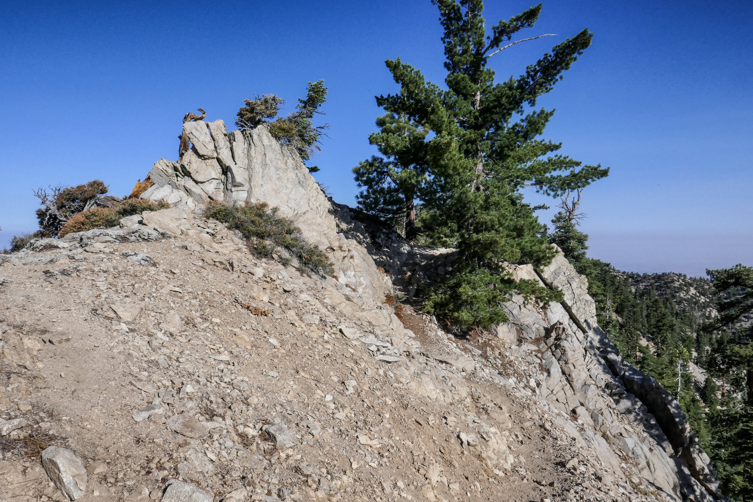
The beautiful Pacifico Mountain stands at 7,124’. It’s located in the central San Gabriels and the climb up on the PCT offers expansive views that sweep across the Antelope Valley and the Mojave Desert. This hike is about 6 miles one way. We’ve done it in its entirety in the past, but today our goal was to reach the PCT mile marker, break for lunch and then turn around and head back. With the shorter days, we wanted to make sure we were back down the mountain before darkness fell. We began the hike from Mill Creek Summit heading up the PCT. The aroma of chaparral was comforting and familiar and there was plenty of Manzanita on the trail. The charred trees burned in the Station Fire still held fast. As the trail hugged the north face of Mt. Pacifico, we passed large Spanish Bayonet. The trail is easy graded, but it is narrow and parts have now eroded since we were last here in 2019. We stopped to watch a group of ravens call and croak to one another as they danced and dived on the wind in tandem before landing on the precipitous ledges. I’ve always loved this hike because of those birds. The views to the PCT marker did not disappoint. The clouds decorated the blue sky only adding to the dramatic scenery of this incredible hike. After our break, we began making our way back. It was a nice way to end our time in the Angeles, until we return again next year.

Click “Read More” below for more photos from this hike.

Read More

Warm and Cozy on Table Mountain, October 7 & 8, 2018

Warm and Cozy on Table Mountain, October 7 & 8, 2018

We hiked along the PCT in Wrightwood from Inspiration Point and across Blue Ridge to kill time before checking in at our campsite at Table Mountain. This section of the PCT has great views of Mt. Baden-Powell and Mt. San Antonio (aka Mt. Baldy). It passes by Mountain High Ski Resort and continues on past the Blue Ridge Campground. Some of the oaks were starting to change color, and it finally felt like fall. We did just over two miles on the trail before it was time to head to camp and get set up so we could settle in and enjoy the evening.

The weather in Wrightwood was chilly! I knew we’d be in for a cold night, but I was looking forward to snuggling up inside the tent in our sleeping bags. After we made camp, we headed into town to pick up a pizza and bring it back to camp for dinner. No point in cooking when you have a pizza shop 10 minutes away! Wrightwood is such a cute little town. It’s a nice change compared to the chaos and sprawl of Los Angeles. All the shops were decorated for Halloween and I even spotted a pumpkin growing outside the Wrightwood Market. As we walked around town waiting for the pizza, I felt that warm and cozy feeling I used to get growing up in Pennsylvania when the seasons would change from summer to fall. This is exactly how it should be this time of year.

When we arrived back at camp, we got the fire going right away. The autumn days are getting shorter and it wouldn’t be long before sunset. We spent the rest of the evening enjoying each other’s company and the warmth of the crackling fire. As the daylight faded and darkness set in, the night sky filled with endless stars. We were almost ready to call it a night when we noticed a bright white light appear in the sky. We watched it as it continued to travel in a southwest direction until finally disappearing. Neither of us knew what it was, but guessed it might have been a comet or some sort of rocket. We didn’t find out until we got back to the city and had cell service that it was, in fact, the SpaceX Falcon 9 rocket launch. What a sight to see from on top of a mountain in the middle of a forest!

The next morning we were in no hurry to get up from our warm sleeping bags. We slept in until well after sunrise. When we did finally get up, we built a fire to keep warm in the chilly morning air, then made coffee and breakfast. There was no rush to be anyplace else, so we took our time and later did a walk around the campground and enjoyed the views from high up on the mountain before it was eventually time to check out and head back to civilization.

Read More

Mount Williamson 8,214', 5 miles RT, 1,552 +/-, July 29, 2018

Mount Williamson 8,214', 5 miles RT, 1,552 +/-, July 29, 2018

The best time for hiking during the hot summer months is EARLY! I like to be on the trail either before sunrise or shortly after so I can enjoy my time on the trail before the day heats up. This is also the time of year when I like to stick to the high country or look for higher elevation hikes which are usually a bit cooler than those at the lower altitudes. Mount Williamson was the perfect hike for today; a short 5 miles from the Islip Saddle trailhead with a little bit of an elevation gain and a fun climb. The early morning sunlight was brilliant as we headed up the trail which starts off on the PCT. It wasn’t long before views of Mount Islip opened up to the south on the opposite side of the Angeles Crest Highway. The hike to Mount Williamson is a fun one. We did this last year in September and I really enjoyed it. The climb is mostly steady until you get closer to the top where you leave the PCT and the trail to Mt. Williamson becomes quite steep and rugged. Once at the top we had wonderful 360 degree views. It was only us on the summit so we took our time, had some snacks and after orienting my map, I spread it out and secured it with some rocks so I could use it to identify some of the surrounding features of the area. Many of the surrounding peaks were visible including Mount Lewis, Mount Baden-Powell, Throop Peak, Mount Hawkins and Twin Peaks to name a few. To the north I could see all the way out to the Mojave Desert and to the southwest I had a nice view of Williamson Rock, which was once popular with rock climbers until the area was closed off to protect the mountain yellow-legged frog. It was barley 9 am and already I could feel the sun starting to heat up the day, so we headed back enjoying our time on the trail and the sweet, vanilla fragrance of the Jeffery pines along the way.

Read More

Mount Pacifico 7,134', 2,398' +/-, 14 miles on the PCT from Mill Creek, June 3, 2018

Mount Pacifico 7,134', 2,398' +/-, 14 miles on the PCT from Mill Creek, June 3, 2018

I’m always looking to escape weekend crowds and find new trails to explore. This Sunday our hike was to the top of Mount Pacifico in the northern part of Angeles National Forest. We planned to start the hike at Mill Creek and follow the PCT which runs through this area. It looked like the trek would be around 12 to 14 miles depending on whether or not we did an out and back on the PCT or did a loop. The day was going to be hot, but I figured since we were heading up to a higher elevation, it might not be so bad on the ascent. If it got too hot, we would descend and save it for another time. The trail was very beautiful. There were many wildflowers and so much ceanothus (California lilac) which made for a very pleasant fragrance along the way. There was lots of wildlife activity too; squirrels, chipmunks, songbirds, bees, insects and butterflies. As we climbed higher, we started to see beautiful, tall pine trees. Much of the area was burned in the 2009 Station Fire, and we could see the effects of that as we hiked this route. But the area looks as though it’s been recovering nicely. Eventually, we reached a junction where we left the PCT and headed southeast to a jeep road that took us up to the summit. There are outstanding views of the surrounding mountain ranges along the way making the road more interesting. After about a mile or so we reached the summit. Mount Pacifico Campground is also here. There are picnic tables, a fire ring and vault toilets. That’s quite a luxury to have up on a summit! There are also a lot of very interesting rock formations to explore. There wasn’t anyone here today, so we took a good long rest and relaxed and enjoyed the peace and quiet. Soon it was time to head back and get ready for the heat as we descended to a lower elevation. We opted to come back the way we came on the PCT for a more scenic and enjoyable route. Both of us had been keeping well hydrated throughout the trip and we had no problems with it being so warm. We were even gifted with an occasional breeze as we hiked back down the mountain. I found this trail to be very nicely graded so although it was long, it was very pleasant. A very enjoyable hike!

Read More

Cloudburst Summit to Cooper Canyon Falls via Pacific Crest Trail, 7.5 miles RT, 1,739’ +/-, March 25, 2018

Cloudburst Summit to Cooper Canyon Falls via Pacific Crest Trail, 7.5 miles RT, 1,739’ +/-, March 25, 2018

What a great weekend to chase waterfalls! We took advantage of the recent rains and snow melt and set out to hike to Cooper Canyon Falls. From Cloudburst Summit we picked up the PCT. This hike is an “upside down” hike so you gain all your elevation on the way back. The trail starts off by dropping you down into the canyon and takes you through the Pleasant View Ridge Wilderness. The views are quite lovely as you make your way around Winston Peak. Eventually, you’ll reach Cooper Canyon Trail Camp. We hiked past the camp and continued on the PCT to the junction with the Burkhart Trail (another really pretty trail and actually a shorter route to the falls.) From here you have to keep your eyes peeled and find one of the use trails that will take you down to the bottom of the falls. The trails are very steep, but there’s a rope tied to a tree to assist with the final few feet of rock scramble. The waterfall was absolutely beautiful today. When we were here last summer, it was barely a trickle. After we’d gotten our waterfall fix, we found a nice spot in the warm sunshine and had some lunch before heading back.

Read More

Three Points to Cloudburst Summit via PCT/Silver Moccasin Trail and Winston Peak 7,502' 12 miles RT, 2,014' +/- February 18, 2018

Three Points to Cloudburst Summit via PCT/Silver Moccasin Trail and Winston Peak 7,502' 12 miles RT, 2,014' +/-  February 18, 2018

This weekend our plan was to hike a section of the PCT/Silver Moccasin Trail starting from Three Points and continue to the higher elevation of Cloudburst Summit.  This section of trail sticks pretty close to the Angeles Crest Highway and crosses it several times, so you do hear a good deal of traffic noise when cars and motorcycles are traveling through.  The scenery, however, makes up for the fact that you’re so close to the highway.  The trail takes you along Waterman Mountain and into the Pleasant View Ridge Wilderness.  It’s a beautiful trail with no lack pine trees and tons of fallen pine cones along the path.  As we reached the higher altitude, we started to see some patches of snow along the trail  Finally arriving at Cloudburst Summit, we were so close to Winston Peak that we decided to climb up and check out the views.  Looking off in the distance we could see the snowy north face of Mount Baldy.  It was about 1:30 pm when we started to head back and the winds were kicking up.  We ended up doing about 12 miles out and back today according to my GPS stats.  On the way home we stopped off at Charlton Flats to grill up some food.  It was definitely feeling chilly by this time, but a warm bite to eat hit the spot. 

Read More

Pacific Crest Trail, 9.7 miles RT, Inspiration Point to Vincent Gap, 1,827' +/-, Christmas Day 2017

Pacific Crest Trail, 9.7 miles RT, Inspiration Point to Vincent Gap, 1,827' +/-, Christmas Day 2017

Our Christmas Day was spent hiking a section of the Pacific Crest Trail from Inspiration Point to Vincent Gap. The air was calm but crisp and scented with my favorite vanilla Jeffery Pines.  The trek along this stretch of the PCT is mostly evenly graded and under the shade of pine trees until you drop down into Vincent Gap where you’ll lose about 1,000’ of elevation in less then a mile.  If you do this trail, just remember to leave some extra gas in the tank for the climb back up later.  Beautiful pine needles cover much of the path along the way and just before Vincent Gap you’ll pass through a flat section where there’s a pine grove.  As the trail begins to descend the scenery then changes into a scene from Snow White’s forest and you’re suddenly in a fairytale forest of oak trees.  We hiked almost 10 miles round trip stopping at Jackson Flat campground to have lunch.  I can’t think of a better way to have spent our Christmas this year then on the trail in these beautiful mountains!

Read More

Testing out the Winter gear, 2 Miles RT on the Pacific Crest Trail from Grassy Hollow, December 17, 2017

Testing out the Winter gear, 2 Miles RT on the Pacific Crest Trail from Grassy Hollow, December 17, 2017

The plan for today was to hike about 9.7 miles from Inspiration Point to Vincent Gap along the PCT.  The temperature was 25 degrees according to the temp gauge on my car when we arrived, and the winds were blowing at about 30 mph.  This was going to be a good test to see how well we'd fare on the trail during the colder months and see what else we were going to need as far as layers, gear, etc.  When we got out of the car, there was one obvious thing that my husband realized he didn't have... gloves!  I knew he wasn't going to be able to do the hike with those winds whipping around the mountain on his bare hands.  But rather then abort the mission, we drove over to Grassy Hollow where it's a little less exposed.  I gave him my gloves since my fleece has sleeves that cover up most of your hands, and we got on the trail.  I really enjoyed hiking in the crisp mountain air.  My layering system seemed to work pretty good.  The only thing I need to add as far as I can tell right now is a good pair of base layer tights under my hiking pants and a balaclava to cover my face when the wind is kicking up.  After about a mile in, we decided to turn around and save the trail for another day when we were more prepared for the weather.  Besides, I'd been thinking about a nice cup of hot chocolate covered in sprinkles and whipped cream from the Grizzly Cafe.  On the way there, we saw Mountain High Ski Resort was blowing snow.  We stopped to check it out.  Even though this was a short day, we had a lot of fun getting our first taste of winter in our local mountains.

Read More

Mount Islip, 8,250' (1,690' +/-) 7 miles RT, August 13, 2017

Mount Islip, 8,250' (1,690' +/-) 7 miles RT, August 13, 2017

I’m really beginning to enjoy these higher elevation hikes, and the trek to Mt. Islip had just the right amount of work to do in order to enjoy the views once you reach the peak.  We started this hike from Islip Saddle on the Pacific Crest Trail (PCT)/Silver Moccasin Trail on the south side of Angeles Crest Highway 2.  It was about 6:30 am and the air was crisp with a cool breeze -- just perfect for hiking.  The trail starts off climbing up steep switchbacks and you’re immediately submerged in a beautiful landscape of white yarrow, golden rabbitbrush and a view of the great pines that will soon be providing you with shade for most of the hike.  At this hour, the sun was still coming up over the mountain as we trekked along, and I was able to get some beautiful photographs of its golden rays peeking through the trees.  As we approached the Little Jimmy Campground, the trail leveled out and we began to smell the fine aroma of campfire and coffee mixed with pine and forest making this hike even more pleasurable.  At the campground, we stopped for a snack and sat for a bit to take in the beauty of the forest before continuing on.  I should note here that there is a spur trail that leads to Little Jimmy Spring, so you actually have to walk through the campground and past the outhouses to find the Mt. Islip Trail that will lead to the peak.  Once on this trail, we began to climb again and we started to see some of the damage done by the 2002 Curve fire.  As we continued higher and higher with the trail hugging the slope, we came around a bend that suddenly opened up to even more spectacular views then the ones we had been enjoying the entire way up.  Finally, as we reached the summit, we saw what remains of an old, stone fire lookout.  On the peak, you will also find a register box where you can sign your name to make it official that you’ve climbed another mountain.  We spent some time up on the summit enjoying the 360 degree views and had our lunch before returning the way we came.  It was a very pleasurable hike today!

Read More

Cooper Canyon Falls, July 30, 2017: Buckhorn Campground, Pleasant View Ridge Wilderness, Burkhart Trail to Cooper Canyon Falls, Little Rock Creek (776 ft. +/-) 3.7 miles RT

Cooper Canyon Falls, July 30, 2017:  Buckhorn Campground, Pleasant View Ridge Wilderness, Burkhart Trail to Cooper Canyon Falls, Little Rock Creek (776 ft. +/-) 3.7 miles RT

This is a very pretty, very green trail that starts at Buckhorn Campground and leads you into the Pleasant View Ridge Wilderness via Burkhart trail down to Cooper Canyon Falls. This is an upside down trail, so if you do it as an out and back you'll gain your elevation on the way back going all uphill. The falls were just a trickle, but it was a beautiful hike and fun to explore the creek at the bottom of the canyon. 

We started our hike around 07:25 AM from Buckhorn Campground on the Burkhart Trail leading into Pleasant View Ridge Wilderness, 26,752 acres of protected land.  You do not need a permit to enter this wilderness.  The moment you step onto the trail, you are engrossed in a forest of lush green.  Oak, Douglas Fir, Jeffrey Pine and Incense Cedar offer a canopy of shade along almost the entire journey.  As you walk, you can see and hear Little Rock Creek far below.  It’s very peaceful with only the sounds of flowing water and morning songbirds.  Aside from the campground which was very full, the trail itself was quiet and we had it mostly to ourselves the entire hike.  The trail makes a steady descent downward into the canyon.  It’s an easy grade and not too steep, although as you get closer to the falls, it can get a little rocky with some loose gravel.  It's nothing too difficult, just watch your step.  Along the way we crossed over two creek beds which were nice for photography.  We took our time to explore the area and did a little boulder hopping along the creek.  

It seemed we’d traveled a bit further then we should have to get to the falls, and we still hadn’t seen them.  I got out my map to take a look to see where we were.  As suspected, we had actually passed the area where they were supposed to be.  At this point we headed back the way we came, and I found the use trail which is a short, but steep scramble to get to the bottom of the canyon where the falls would normally be had it not been summer.  At this time of year, however, they were just a trickle of running water on mossy rock which is why they were so easily missed.

Although there wasn’t a rushing waterfall to see, we were not at all disappointed.  This hike was beautiful.  Satisfied that we’d reached our destination, we now continued our ascent all uphill now back to the trailhead at Buckhorn Campground.  We took our time to enjoy the scenery and peaceful splendor of the wilderness.  

Read More