boulder

Exploring Mt. Akawie (aka Buckhorn Peak) 7,283' Max Elevation, 3.5 miles RT, 768 +/-, August 26, 2018

Exploring Mt. Akawie (aka Buckhorn Peak) 7,283' Max Elevation, 3.5 miles RT, 768 +/-, August 26, 2018

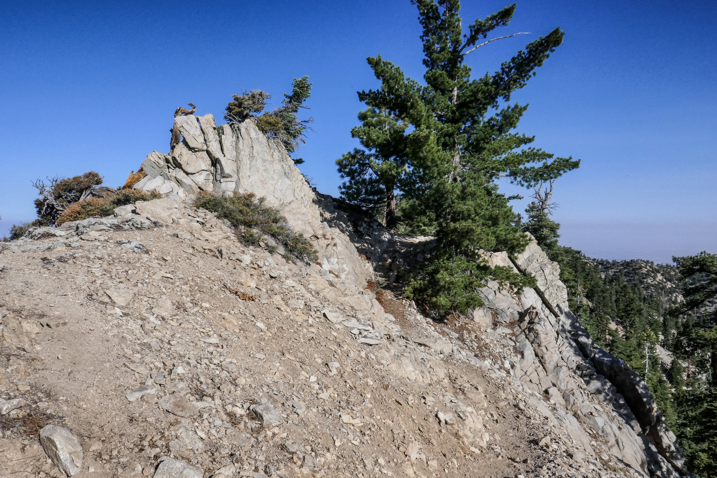
For my upcoming birthday I asked my husband for a Jetboil cooking system. It would be the first item in a long list of backpacking gear that we’re going to need to make the crossover from day hikers to backpackers. Since I’d been looking for an excuse to make the short hike up the little bump called Mt. Akawie (aka Buckhorn Peak if you’re using a Tom Harrison map), we headed up to the mountain to test the new cooking system and spend a quiet morning together.

We hit the trail just after 6 am. After a very short distance we took the path leading up to the peak. There appeared to be a number of fire roads around to explore, but we were ready to get cooking and I couldn’t wait for a hot cup of coffee. The Jetboil system did not disappoint! For breakfast I’d packed a couple of Eggo waffles (my favorite) and brought along a freeze dried breakfast scramble from Mountain House. Overall, it was pretty good. I definitely could live on this stuff for a couple of days in the backcountry. After eating, we got comfortable on one of the large, flat bounders looking towards Waterman Mountain and Twin Peaks and napped for a short while. After a peaceful rest and stomachs full of interesting freeze dried food, we packed up our gear and did some exploring around the mountain both on and off-trail. An unmaintained road/trail took us northeast around the bump and offered views looking towards Pleasant View Ridge. We also saw a lot of deer; mostly doe and one with a young fawn. The road/trail eventually disappeared and we made a scramble up the east side of the mountain before heading back the way we came. It was around 11 am when we got back to the car. We thanked Mount Akawie for the hospitality and headed home to enjoy what was left of our weekend.

Read More

Mount Williamson 8,214', 5 miles RT, 1,552 +/-, July 29, 2018

Mount Williamson 8,214', 5 miles RT, 1,552 +/-, July 29, 2018

The best time for hiking during the hot summer months is EARLY! I like to be on the trail either before sunrise or shortly after so I can enjoy my time on the trail before the day heats up. This is also the time of year when I like to stick to the high country or look for higher elevation hikes which are usually a bit cooler than those at the lower altitudes. Mount Williamson was the perfect hike for today; a short 5 miles from the Islip Saddle trailhead with a little bit of an elevation gain and a fun climb. The early morning sunlight was brilliant as we headed up the trail which starts off on the PCT. It wasn’t long before views of Mount Islip opened up to the south on the opposite side of the Angeles Crest Highway. The hike to Mount Williamson is a fun one. We did this last year in September and I really enjoyed it. The climb is mostly steady until you get closer to the top where you leave the PCT and the trail to Mt. Williamson becomes quite steep and rugged. Once at the top we had wonderful 360 degree views. It was only us on the summit so we took our time, had some snacks and after orienting my map, I spread it out and secured it with some rocks so I could use it to identify some of the surrounding features of the area. Many of the surrounding peaks were visible including Mount Lewis, Mount Baden-Powell, Throop Peak, Mount Hawkins and Twin Peaks to name a few. To the north I could see all the way out to the Mojave Desert and to the southwest I had a nice view of Williamson Rock, which was once popular with rock climbers until the area was closed off to protect the mountain yellow-legged frog. It was barley 9 am and already I could feel the sun starting to heat up the day, so we headed back enjoying our time on the trail and the sweet, vanilla fragrance of the Jeffery pines along the way.

Read More

Cottonwood Lakes, 14 miles RT, Max elevation 11,384', 1,660 +/-, Inyo National Forest, Eastern Sierra Trip, July 10, 2018

Cottonwood Lakes, 14 miles RT, Max elevation 11,384', 1,660 +/-, Inyo National Forest, Eastern Sierra Trip, July 10, 2018

I woke up at 4:30 am excited to get started on our new adventure. We had a hearty breakfast and soon were on our way up Horseshoe Meadow Road to the Cottonwood Lakes Trailhead at 10,000’. I took my compass bearings, geared up and we were on our way by about 7 am. The trail enters the Golden Trout Wilderness and starts off on a leisurely stroll through the big pine trees. As we went along we started to gently descend. We followed along side a beautiful creek and made a few water crossings. The mosquitos were out in full force, so I was sure to break out the bug spray before becoming their early morning breakfast. We passed by lush green meadows dotted with wildflowers, corn lily and incredible views of large granite cliffs. Soon we entered the John Muir Wilderness. There was another creek crossing and more lovely meadows to enjoy before we came to the switchbacks. As we began to ascend our pace was slower than usual due to the high altitude. I did not mind stopping to take a few breaks so I could enjoy the views from above and take my photos. As we approached the top of the switchbacks, we could see some peaks coming into view. We passed a junction for Muir Lake and started to see the playful marmots poking their heads out waiting to see if we were going to give them hand out. The trail gently meandered through the meadow with a flowing stream and had incredible views of Cirque Peak and Mount Langley. It wasn’t long before the Cottonwood Lakes came into view. They were stunningly beautiful. We took a moment and sat in the shade to take a break, have a snack and enjoy the scenery, peace and quiet. We made our way to lake #3 and followed along its shore to a short climb up some switchbacks. On the other side we reached lakes 4 and 5. We felt a light breeze and could see the summer storm clouds rolling in closer, but I didn’t hear any thunder. We thought it was a good time to start heading back. We had quite a ways to go before reaching the end of our journey. As we made our way down the switchbacks we enjoyed another marvelous view of lake #3 from above. We passed a man with his two sons who were fishing, but he said they hadn’t had any luck. As we made our way back to the trailhead, I could feel some light precipitation. The cool raindrops on my skin felt refreshing after a long day and the smell of summer rain mixed with the pine was intoxicating. We got back to the trailhead around 3:30 pm and clocked about 14 miles. It was my first time hiking for that long at such a high altitude and I was both tired and exhilarated at the same time. It was an incredible experience. The Eastern Sierra has so much to offer. I have fallen in love.

Read More

Cooper Canyon Falls, July 30, 2017: Buckhorn Campground, Pleasant View Ridge Wilderness, Burkhart Trail to Cooper Canyon Falls, Little Rock Creek (776 ft. +/-) 3.7 miles RT

Cooper Canyon Falls, July 30, 2017:  Buckhorn Campground, Pleasant View Ridge Wilderness, Burkhart Trail to Cooper Canyon Falls, Little Rock Creek (776 ft. +/-) 3.7 miles RT

This is a very pretty, very green trail that starts at Buckhorn Campground and leads you into the Pleasant View Ridge Wilderness via Burkhart trail down to Cooper Canyon Falls. This is an upside down trail, so if you do it as an out and back you'll gain your elevation on the way back going all uphill. The falls were just a trickle, but it was a beautiful hike and fun to explore the creek at the bottom of the canyon. 

We started our hike around 07:25 AM from Buckhorn Campground on the Burkhart Trail leading into Pleasant View Ridge Wilderness, 26,752 acres of protected land.  You do not need a permit to enter this wilderness.  The moment you step onto the trail, you are engrossed in a forest of lush green.  Oak, Douglas Fir, Jeffrey Pine and Incense Cedar offer a canopy of shade along almost the entire journey.  As you walk, you can see and hear Little Rock Creek far below.  It’s very peaceful with only the sounds of flowing water and morning songbirds.  Aside from the campground which was very full, the trail itself was quiet and we had it mostly to ourselves the entire hike.  The trail makes a steady descent downward into the canyon.  It’s an easy grade and not too steep, although as you get closer to the falls, it can get a little rocky with some loose gravel.  It's nothing too difficult, just watch your step.  Along the way we crossed over two creek beds which were nice for photography.  We took our time to explore the area and did a little boulder hopping along the creek.  

It seemed we’d traveled a bit further then we should have to get to the falls, and we still hadn’t seen them.  I got out my map to take a look to see where we were.  As suspected, we had actually passed the area where they were supposed to be.  At this point we headed back the way we came, and I found the use trail which is a short, but steep scramble to get to the bottom of the canyon where the falls would normally be had it not been summer.  At this time of year, however, they were just a trickle of running water on mossy rock which is why they were so easily missed.

Although there wasn’t a rushing waterfall to see, we were not at all disappointed.  This hike was beautiful.  Satisfied that we’d reached our destination, we now continued our ascent all uphill now back to the trailhead at Buckhorn Campground.  We took our time to enjoy the scenery and peaceful splendor of the wilderness.  

Read More