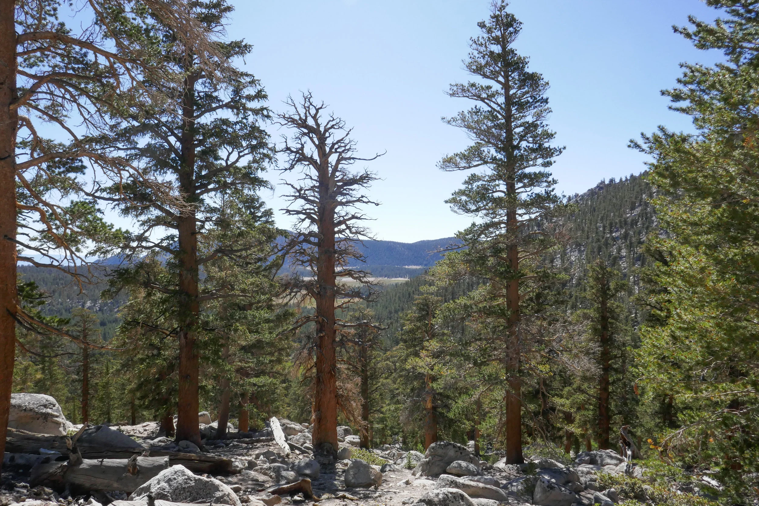
We didn’t really have a plan for our second day in the Eastern Sierra, but I did some quick research after we got back from Big Pine Lakes and decided upon the Cottonwood Pass Trail out of Horseshoe Meadow. Horseshoe Meadow is only about a 30 minute drive from Lone Pine where we were staying. Our plan was to hike up to the pass and then over to Chicken Spring Lake, but when we got started my husband was a lot more tired than usual. I think he may have been feeling the altitude (over 10,000’) and also a little lack of sleep the night before. The hike started out fairly flat winding in and out of tall pine trees until we got to the rocky switchbacks where we started to climb up and up. We passed through incredible alpine meadows covered with wildflowers and under the shade of towering foxtail and lodgepole pines. We were just short of the pass when my husband decided it was time to turn around. It’s really odd for him to be affected by altitude because he’s usually fine, but it just goes to show you altitude does not discriminate. It can happen to anyone on any given day without warning and when that happens, the best thing to do is descend. I would have loved to continue on, but we are a team and so I had no problems turning back and doing the hike again on another day when we could both enjoy it.
I woke up at 4:30 am excited to get started on our new adventure. We had a hearty breakfast and soon were on our way up Horseshoe Meadow Road to the Cottonwood Lakes Trailhead at 10,000’. I took my compass bearings, geared up and we were on our way by about 7 am. The trail enters the Golden Trout Wilderness and starts off on a leisurely stroll through the big pine trees. As we went along we started to gently descend. We followed along side a beautiful creek and made a few water crossings. The mosquitos were out in full force, so I was sure to break out the bug spray before becoming their early morning breakfast. We passed by lush green meadows dotted with wildflowers, corn lily and incredible views of large granite cliffs. Soon we entered the John Muir Wilderness. There was another creek crossing and more lovely meadows to enjoy before we came to the switchbacks. As we began to ascend our pace was slower than usual due to the high altitude. I did not mind stopping to take a few breaks so I could enjoy the views from above and take my photos. As we approached the top of the switchbacks, we could see some peaks coming into view. We passed a junction for Muir Lake and started to see the playful marmots poking their heads out waiting to see if we were going to give them hand out. The trail gently meandered through the meadow with a flowing stream and had incredible views of Cirque Peak and Mount Langley. It wasn’t long before the Cottonwood Lakes came into view. They were stunningly beautiful. We took a moment and sat in the shade to take a break, have a snack and enjoy the scenery, peace and quiet. We made our way to lake #3 and followed along its shore to a short climb up some switchbacks. On the other side we reached lakes 4 and 5. We felt a light breeze and could see the summer storm clouds rolling in closer, but I didn’t hear any thunder. We thought it was a good time to start heading back. We had quite a ways to go before reaching the end of our journey. As we made our way down the switchbacks we enjoyed another marvelous view of lake #3 from above. We passed a man with his two sons who were fishing, but he said they hadn’t had any luck. As we made our way back to the trailhead, I could feel some light precipitation. The cool raindrops on my skin felt refreshing after a long day and the smell of summer rain mixed with the pine was intoxicating. We got back to the trailhead around 3:30 pm and clocked about 14 miles. It was my first time hiking for that long at such a high altitude and I was both tired and exhilarated at the same time. It was an incredible experience. The Eastern Sierra has so much to offer. I have fallen in love.
Our original plan for our trip was to hike the Mount Whitney Trail to Lone Pine Lake, but I learned the night before a fire which was caused by lightening strike had closed Whitney Portal Road at Hogsback and there was no access to the Whitney Portal Trailhead. Upon arrival, we stopped at the Eastern Sierra Interagency Visitors Center to talk to the rangers, pick up some additional maps and decide on our best "plan b" options which we gathered the night before. I had several ideas in mind, of them being a nice, long day hike to Cottonwood Lakes which was then recommended to us by the rangers. So Cottonwood Lakes it was! We already had the maps for that, so I picked up a visitor's guide and a whole slew of other maps for future trips and we were on our way to do a little sight-seeing before the next day's trek. Our first stop was the Alabama Hills where the rock outcrops frame incredible views of Mount Whitney. From here we could see the Georges Fire burning, and the smoke was pluming towards the north so the air quality seemed to be okay at our location. I took some photos and then we headed off to check out the trailhead for where we'd be hiking the next day. From Whitney Portal Road before the closure, we turned onto Horseshoe Meadow Road which is an adventure unto itself. The paved road switchbacks up the mountain 6,000 feet from Lone Pine's desert floor, all the way to an elevation of 10,000 feet with its terminus at Horseshoe Meadow. We drove around to scope out the area, make note of where our trailhead would be and then stopped off at the day use area to have a picnic lunch before heading back to check into our hotel. It was later in the afternoon by now and we could see the gray clouds forming and hear the soft sound of rolling thunder off in the distance. The threat of storms are very common in summer. If there's one thing I know about mountains at this high an elevation, they make their own weather so you have to be prepared for anything and know when to descend. It was very peaceful up there as we listened to the soft booms that were farther off in the distance. I pulled the maps out of the car to check out the terrain so we could get an idea of what to expect along our destination the next day. Later that evening after stopping in Lone Pine for a bite to eat, we head back to the Alabama Hills for a quick little stroll to Mobius Arch, a natural arch that is formed in the rock formations. A lot of people like to take photos through the arch because it frames Lone Pine Peak quite nicely. I didn't make take the classic shot at the arch since there was another photographer there who had his equipment set up and I didn't want to disturb him. Instead I walked just around the side of Mobius and found Lathe Arch and took my shot there. As the sun was setting we could see the embers from the fire burning. It was a lovely sunset, but we needed to get back to the hotel so we would be well rested for our hike to Cottonwood Lakes the next day.