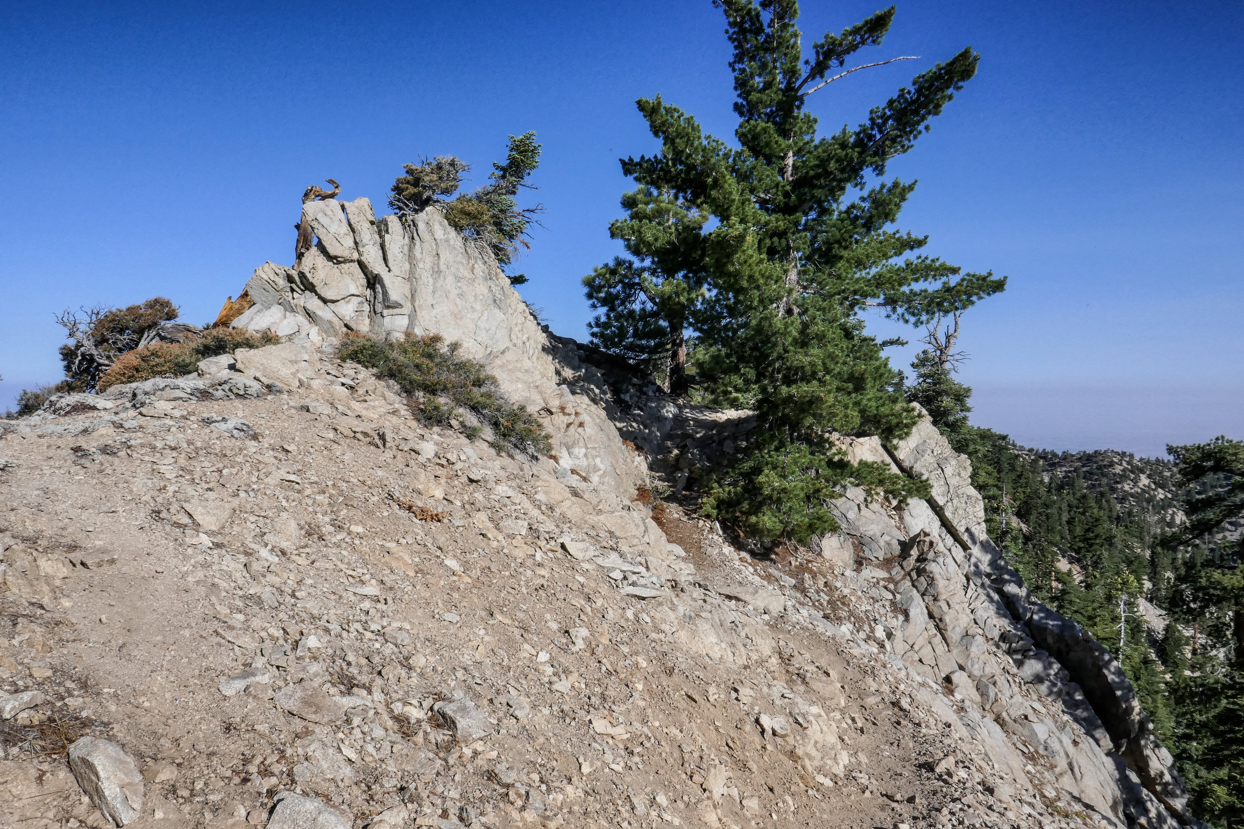
Angeles Crest Highway

Josephine Peak, 8 Miles RT, 1,898' +/-, 6,161' Max Elevation, December 24, 2019

Josephine Peak, 8 Miles RT, 1,898' +/-, 6,161' Max Elevation, December 24, 2019

Headed up Josephine Peak today. With storms predicted, I wanted to get in a quick hike before we’d be stuck at sea level for a couple of days. If we get the amount of snow they’re calling for, CalTrans will have their work cut out for them. This next storm is supposed to be bigger than the one we had on Thanksgiving. If that’s the case, the next time we’re up here we’ll be donning the snow gear (and believe me, I can’t wait!). It was a perfect day for this hike. The clouds were rolling past Strawberry Peak making for great photography. The sun was in and out for most of the afternoon. As we wrapped around to the north, it got much cooler and the wind picked up slightly. There were plenty of ravens to watch as they put on their aerial displays, diving and twisting in the sky. They are fascinating birds to watch, and I’ve become enamored with them through the years. We didn’t see one other person on this hike today. I guess everyone is out Christmas shopping. As we headed back, the sun began to lower on the horizon and the clouds started to roll in and wrap around the mountain. Glad we got one in before the weather hits tomorrow!

Read More

Snowshoeing Angeles National Forest, November 30, 2019

Snowshoeing Angeles National Forest, November 30, 2019

It had been raining the past few days, but we got out for a bit on Thanksgiving to do rain hike in Griffith Park. But what I’d really been waiting for was to get up into the forest. The snow levels came down to about 3,000’! We headed up Angeles Crest around 8:30 am and started seeing snow just past Clear Creek Station. We went as far the 6,000’ Day Use Area (just before Winston Peak and Cloudburst Summit) which is where they had the snow gates closed. The road was clear until that point with just little patches of snow/ice here and there, and although we carried chains we didn’t need to use them. We parked the car, geared up in our snowshoes and got to climbing up the hill. There was no trail so we broke our own. We snowshoed up to a high point near John Henge rocks. Our elevation top out was 6,600’. It was a steep, but short climb and enough to give us a good work out. The snow was super deep. We were both in awe of seeing the forest covered in snow at such low elevations. We took in all in and thoroughly enjoyed this gift of an amazingly beautiful early snowfall. I hope this is a precursor of what’s to come this winter!

Read More

Snowshoeing on Waterman Mountain, 3.8 Miles RT, 948' +/-, 7,713' Max Elevation, February 24, 2019

Snowshoeing on Waterman Mountain, 3.8 Miles RT, 948' +/-, 7,713' Max Elevation, February 24, 2019

I am really enjoying this snowshoeing thing! It was a beautiful day, so we decided to venture back into Angeles National Forest taking an alternative route around the recent rock slide on the ACH near Red Box and check out the conditions on Waterman Mountain. The ski lifts had recently been opened, so we knew there would be a good amount of snow. We past the lifts as skiers and snowboarders were just heading into the parking area and parked our car at the usual spot for the Mt. Waterman Trailhead. There was only one other car in the turnout when we arrived, and the air was chilly with an occasional gust of wind. We geared up (There’s a lot more to gear to deal with in winter.) and started up the Mt. Waterman Trail. At the junction with the Fire Road, we decided to head in that direction instead of our usual route. The snow conditions were mixed with sections of crusty ice on top of snow in the shade and a powdery mix in the sun. The snow was deep but packed and the fire road was a bit steep. We got a good workout as we enjoyed the views of snow capped Mt. Baden-Powell in the distance. We took our time and had the route mostly to ourselves. About two miles up we reached the junction with the ski runs. We stopped and watched some of the skiers and snowboarders do their thing. We could have continued on, but decided to take our time and head back. I thoroughly enjoyed every single second of another beautiful winter day!

Read More

Icy Pacifico Mountain and Snowy Waterman Mountain Hike, 8.6 Miles, 1,729' total +/-, Maximum Elevation 7,824', December 9, 2018

Icy Pacifico Mountain and Snowy Waterman Mountain Hike, 8.6 Miles, 1,729' total +/-, Maximum Elevation 7,824', December 9, 2018

Today we set out to hike from Mill Creek Summit on the Pacific Crest Trail and up to the Pacifico Mountain Campground. I knew this mountain was a north face, and I had a feeling we might encounter some icy patches on the trail, but we decided to give it a go. I knew there would be some snow up at the campground after the recent rain, and I wanted to take advantage of that since we never know what kind of winter we’ll have here in Southern California. We were about two miles into the hike and we started to come across patches of hard packed ice. We had microspikes to slip onto our boots for traction, but if we were to continue, coming down would be sketchy. Neither one of us wanted to risk spraining an ankle, so we decided to turn around and head back. Since it was still early in the day, we drove to Charlton Flats, had some lunch and then drove up to Waterman Mountain which I knew would be reliable for a nice snow hike. It was about 12:30 when we started on the trail and I expected to see many more people hiking, but it was actually very quiet. Most of the snow play folks stayed on the fire road or over at the Buckhorn day use area and there were very few people hiking up the Waterman Mountain trail. The few people we past were hiking with dogs in tow, or rather I should say they were in tow of their dogs. That’s the one thing I love about hiking… seeing all the happy dogs on the trail. As we got higher up, we seemed to be the only people on the trail. The sky was gray with overcast clouds and the mountain seemed still and peaceful. It was around 2:15 when we reached the Twin Peaks junction which is about 3/4 miles away from the Waterman Mountain summit. At this point we both decided it was time to head back to make sure we returned safely before the sun set and the temperatures dropped and turned the melting snow to ice. We both went home satisfied after spending another beautiful day in our Southern California mountains.

Read More

Warm and Cozy on Table Mountain, October 7 & 8, 2018

Warm and Cozy on Table Mountain, October 7 & 8, 2018

We hiked along the PCT in Wrightwood from Inspiration Point and across Blue Ridge to kill time before checking in at our campsite at Table Mountain. This section of the PCT has great views of Mt. Baden-Powell and Mt. San Antonio (aka Mt. Baldy). It passes by Mountain High Ski Resort and continues on past the Blue Ridge Campground. Some of the oaks were starting to change color, and it finally felt like fall. We did just over two miles on the trail before it was time to head to camp and get set up so we could settle in and enjoy the evening.

The weather in Wrightwood was chilly! I knew we’d be in for a cold night, but I was looking forward to snuggling up inside the tent in our sleeping bags. After we made camp, we headed into town to pick up a pizza and bring it back to camp for dinner. No point in cooking when you have a pizza shop 10 minutes away! Wrightwood is such a cute little town. It’s a nice change compared to the chaos and sprawl of Los Angeles. All the shops were decorated for Halloween and I even spotted a pumpkin growing outside the Wrightwood Market. As we walked around town waiting for the pizza, I felt that warm and cozy feeling I used to get growing up in Pennsylvania when the seasons would change from summer to fall. This is exactly how it should be this time of year.

When we arrived back at camp, we got the fire going right away. The autumn days are getting shorter and it wouldn’t be long before sunset. We spent the rest of the evening enjoying each other’s company and the warmth of the crackling fire. As the daylight faded and darkness set in, the night sky filled with endless stars. We were almost ready to call it a night when we noticed a bright white light appear in the sky. We watched it as it continued to travel in a southwest direction until finally disappearing. Neither of us knew what it was, but guessed it might have been a comet or some sort of rocket. We didn’t find out until we got back to the city and had cell service that it was, in fact, the SpaceX Falcon 9 rocket launch. What a sight to see from on top of a mountain in the middle of a forest!

The next morning we were in no hurry to get up from our warm sleeping bags. We slept in until well after sunrise. When we did finally get up, we built a fire to keep warm in the chilly morning air, then made coffee and breakfast. There was no rush to be anyplace else, so we took our time and later did a walk around the campground and enjoyed the views from high up on the mountain before it was eventually time to check out and head back to civilization.

Read More

Red Box to Valley Forge Trail Camp, Gabrielino Trail, 6 Miles RT, 4,868' Max Elevation, 1,276' +/-, September 23, 2018

Red Box to Valley Forge Trail Camp, Gabrielino Trail, 6 Miles RT, 4,868' Max Elevation, 1,276' +/-, September 23, 2018

Today we hiked the Gabrielino Trail East from Red Box to Valley Forge Trail Camp with the option to continue on to West Fork and Devore Trail Camps if we felt up to it. With the cool morning temperatures and the trail covered in falling leaves from the towering oaks that surrounded us, it was finally starting to feel like fall. The first part of the trail descended the steep stone steps from the Red Box picnic area then continued down some exposed switchbacks. It wasn’t long until we were in the cool shade of the oaks following the trail along the South Fork of the San Gabriel River. The stream was dry at this time of year, but that didn’t stop the gnats from bothering us. Luckily, we were prepared and always have our bug nets with us which prevented the pesky insects from flying into our eyes.

On our route we passed by some cabins and the ruins of an old, stone chimney. After about two miles, we reached the junction for the Valley Forge Trail Camp that was marked with a sign at the spur. We descended the spur to the camp to check it out and see if it was a place we’d like to stay as a future backpacking trip. The camp was lovely with plenty of shade, fire rings, picnic tables and primitive bathrooms. We set up at one of the picnic tables and decided to stay a while. I made friends with a Steller’s Jay who invited himself to our breakfast table. It was a very nice day and we were thoroughly enjoying the peace and quiet! This hike along this section of the Gabrielino Trail reminded me a bit of Santa Anita Canyon sans the crowds. We will definitely be coming back when the weather cools down a bit more to hike the longer routes to West Fork and Devore Trail Camps, and perhaps enjoy an overnight stay.

Read More

Mount Williamson 8,214', 5 miles RT, 1,552 +/-, July 29, 2018

Mount Williamson 8,214', 5 miles RT, 1,552 +/-, July 29, 2018

The best time for hiking during the hot summer months is EARLY! I like to be on the trail either before sunrise or shortly after so I can enjoy my time on the trail before the day heats up. This is also the time of year when I like to stick to the high country or look for higher elevation hikes which are usually a bit cooler than those at the lower altitudes. Mount Williamson was the perfect hike for today; a short 5 miles from the Islip Saddle trailhead with a little bit of an elevation gain and a fun climb. The early morning sunlight was brilliant as we headed up the trail which starts off on the PCT. It wasn’t long before views of Mount Islip opened up to the south on the opposite side of the Angeles Crest Highway. The hike to Mount Williamson is a fun one. We did this last year in September and I really enjoyed it. The climb is mostly steady until you get closer to the top where you leave the PCT and the trail to Mt. Williamson becomes quite steep and rugged. Once at the top we had wonderful 360 degree views. It was only us on the summit so we took our time, had some snacks and after orienting my map, I spread it out and secured it with some rocks so I could use it to identify some of the surrounding features of the area. Many of the surrounding peaks were visible including Mount Lewis, Mount Baden-Powell, Throop Peak, Mount Hawkins and Twin Peaks to name a few. To the north I could see all the way out to the Mojave Desert and to the southwest I had a nice view of Williamson Rock, which was once popular with rock climbers until the area was closed off to protect the mountain yellow-legged frog. It was barley 9 am and already I could feel the sun starting to heat up the day, so we headed back enjoying our time on the trail and the sweet, vanilla fragrance of the Jeffery pines along the way.

Read More