Mountain

Devils Canyon, 6 Miles RT, 1,348' +/-, Max Elevation 5,302', May 27, 2019

Devils Canyon, 6 Miles RT, 1,348' +/-, Max Elevation 5,302', May 27, 2019

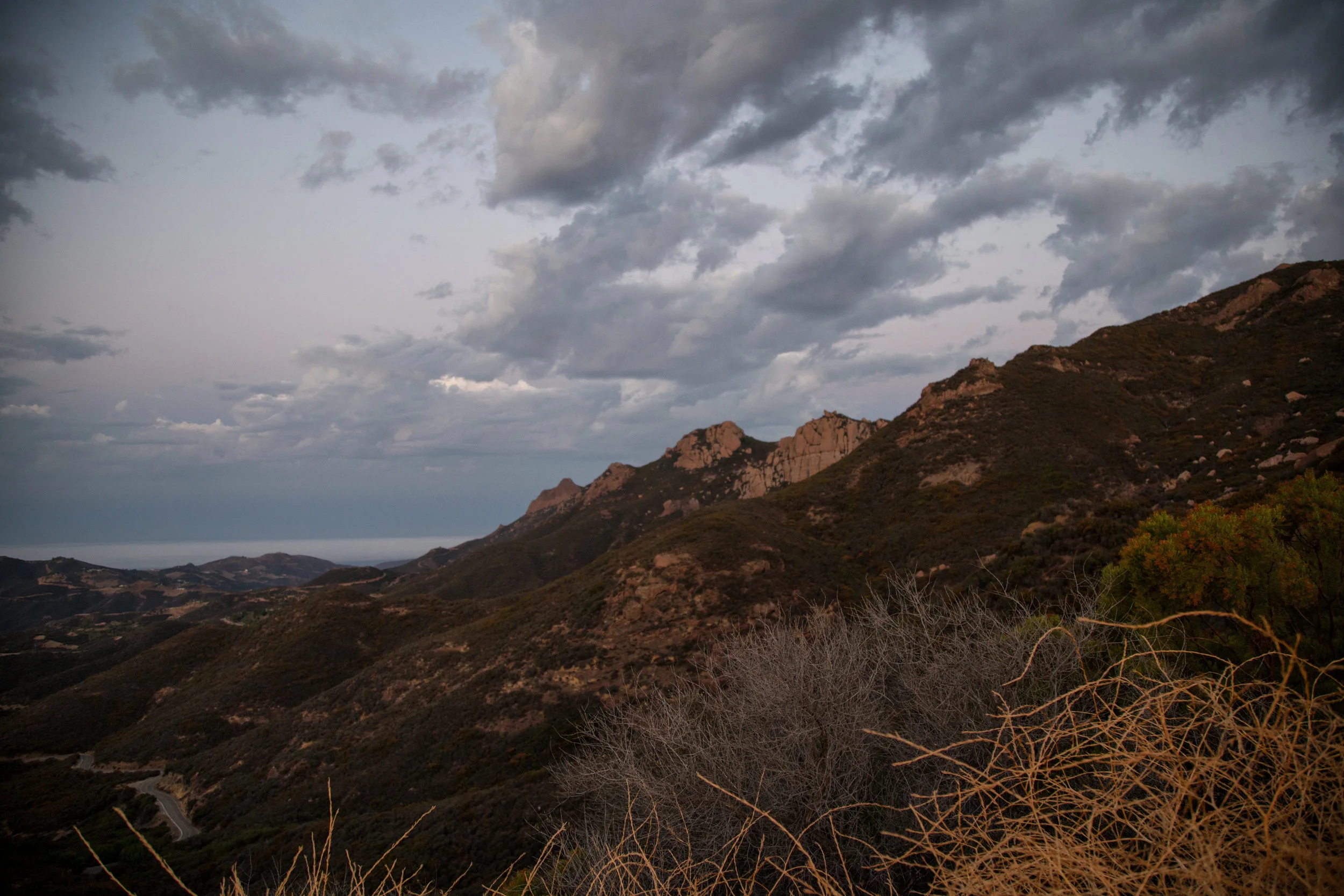
We got up late today and decided to take our time getting anywhere. We weren’t really decided upon any one hike, so I stuffed my backpack with maps, downloaded a bunch of different trails onto the Garmin and headed up the ACH. The rock slide still hasn’t been repaired, so we had to take the detour to get to the high country. We then decided today would be a good day to hike Devil’s Canyon. The weather was cool, and I remembered last year when we did this hike in April there was lots of water flowing. I knew with all the rain and snow this year, there would be plenty of water now too. The trail hadn’t changed much. The views down into the canyon overlooking the San Gabriel Wilderness were beautiful. The trail could definitely use some love though. It was pretty brushy in some areas, and there were some trees down across the trail. There was also more erosion. Still, it was nothing too difficult to get around. We followed the creek most of the way and eventually reached the backcountry campsite. We saw a family on their way out who had spent the night. They had their kids who were carrying backpacks bigger then they were and two dogs. I asked them how their night was, and they told me it rained all night. We made our way over to this really great rock I found last year right next to the stream. It’s nice and smooth and shaped like a recliner. We got comfortable and ate our lunch (ham and cheese croissants from the donut shop... yum!). The sound of the running water was so relaxing and the clouds were billowing across blue sky. We took a nice nap until eventually the sky turned to gray and the sun was covered by the clouds. We packed up our stuff and began the hike up out of the canyon. I took a lot of photos on the way back. There were lots of wildflowers, and at one of the creek crossings there was a ton of ladybugs (and also poison oak). The cloud cover made the hike up and out pleasant since it kept us cool on the exposed sections of the trail. It was a very peaceful, relaxing day.

Read More

Devil's Chair, 6.7 miles RT, 1, 260' +/-, 5,396' max. elevation, December 27, 2018

Devil's Chair,  6.7 miles RT, 1, 260' +/-, 5,396' max. elevation, December 27, 2018

I love the hike to Devil’s Chair. We did it in October of 2017 and it’s a beautiful part of the San Gabriels hidden away to the far north. The geological formations that have been formed throughout the years by the San Andreas and Punchbowl Faults are an incredible spectacle to witness firsthand. This area is also a transition zone between high desert and subalpine, and it’s interesting to see how the plants change as you travel the undulating trail. This time it seemed the trail was a bit more eroded in sections then the last time we hiked it, but it was still easily passable without being unsafe. As we approached the Devil’s Chair we descended the switchbacks and navigated the over narrow, rocky cliffs. Thankfully, there’s a metal fence put in place here that allows you to go all the way out to the edge. Otherwise you would not be able to hike here. The views from the Chair were spectacular. Once we’d taken it all in, we climbed back up and had a quick snack break before starting our return. The clouds were starting to roll in and it looked pretty chilly up in the higher elevations on Pleasant View Ridge and Mt. Lewis. The temperature dropped to about 43 degrees as we made our way back and the wind kicked up making it a chilly end to a beautiful winter day.

Read More

Icy Pacifico Mountain and Snowy Waterman Mountain Hike, 8.6 Miles, 1,729' total +/-, Maximum Elevation 7,824', December 9, 2018

Icy Pacifico Mountain and Snowy Waterman Mountain Hike, 8.6 Miles, 1,729' total +/-, Maximum Elevation 7,824', December 9, 2018

Today we set out to hike from Mill Creek Summit on the Pacific Crest Trail and up to the Pacifico Mountain Campground. I knew this mountain was a north face, and I had a feeling we might encounter some icy patches on the trail, but we decided to give it a go. I knew there would be some snow up at the campground after the recent rain, and I wanted to take advantage of that since we never know what kind of winter we’ll have here in Southern California. We were about two miles into the hike and we started to come across patches of hard packed ice. We had microspikes to slip onto our boots for traction, but if we were to continue, coming down would be sketchy. Neither one of us wanted to risk spraining an ankle, so we decided to turn around and head back. Since it was still early in the day, we drove to Charlton Flats, had some lunch and then drove up to Waterman Mountain which I knew would be reliable for a nice snow hike. It was about 12:30 when we started on the trail and I expected to see many more people hiking, but it was actually very quiet. Most of the snow play folks stayed on the fire road or over at the Buckhorn day use area and there were very few people hiking up the Waterman Mountain trail. The few people we past were hiking with dogs in tow, or rather I should say they were in tow of their dogs. That’s the one thing I love about hiking… seeing all the happy dogs on the trail. As we got higher up, we seemed to be the only people on the trail. The sky was gray with overcast clouds and the mountain seemed still and peaceful. It was around 2:15 when we reached the Twin Peaks junction which is about 3/4 miles away from the Waterman Mountain summit. At this point we both decided it was time to head back to make sure we returned safely before the sun set and the temperatures dropped and turned the melting snow to ice. We both went home satisfied after spending another beautiful day in our Southern California mountains.

Read More

Cucamonga Peak, 8,859', 12 miles RT, (4,252' +/-), November 23, 2017

Cucamonga Peak, 8,859', 12 miles RT, (4,252' +/-), November 23, 2017

Hit the trail early Thanksgiving morning to hike Cucamonga Peak.  We started up Icehouse Canyon at 5:30 am.  This was our third time up this trail to Icehouse Saddle which is a gateway to other trails including Cucamonga Peak.  It used to be a challenge, but it’s getting easier every time.  We entered the Cucamonga Wilderness just before the sun came up, and by 8 am we were at Icehouse Saddle.  We stopped for a snack, and it wasn’t long before other hikers arrived.  One of them was heading to the same destination as we were.  He was using the trail to train for other peaks.  After the break, we hopped on the next segment to Cucamonga Peak.  This is where the real hike began.  From here on out we were on much more rugged terrain with narrow sections, steep cliffs and rock scrambles.  It was one of those hikes where you really had to watch your footing.  Next came the switchbacks.  Some sections were all scree and talus.  It was a hard climb and my fear of heights being on a narrow ledge with loose rock and steep drops was starting to kick in.  I had to stop and take breaks to keep my zen.  I could see the peak, but it seemed a million miles away.  Up and up we went moving slowly, but making progress with each careful step.  We were less then half a mile away from the peak when we saw the young hiker we’d met at Icehouse Saddle coming down.  “Almost there.” he said.  “Take short steps and use your poles.”  After a few more switchbacks I spotted the marker for the spur trail leading up to the peak just ahead.  What a relief!  We made our final ascent up a steep but well buffed out section of trail.  Finally I saw the wooden sign, “Cucamonga Peak 8,859’”.  Whew!  That was rough!  The views from the peak were vast and sprawling overlooking the city and all the way out to the San Jacinto and Santa Ana mountain ranges.  We took a long break to rest our tired legs and celebrate Thanksgiving morning with yesterday’s leftover pizza!  On the way down my overactive mind calmed down.  Although I still had to be careful with my footing, I was in a much better headspace.  The hard part was over.  I was able to soak in the incredible views of the remote wilderness and enjoy the trek down this beautiful mountain.  The switchbacks seemed to go a lot faster on the way down, but we still had to negotiate our way through rugged trail back to Icehouse Saddle.  Once at the saddle, we still had about 3 miles to go to get back to the trailhead.  Luckily, the canyon is so pretty, it makes those last miles go quick.  We finished the hike (including our breaks and all my picture taking) in about 8 hours and 50 minutes.  We’ll be celebrating Thanksgiving day on Friday knowing we earned those extra slices of pumpkin pie!

Read More

Sandstone Peak 3,111' and the Mishe Mokwa Trail 8.3 miles RT, September 10, 2017

Sandstone Peak 3,111' and the Mishe Mokwa Trail 8.3 miles RT, September 10, 2017

Sandstone Peak is the highest point in the Santa Monica Mountains at 3,111’.  We got to the trailhead before 6 am and had planned to do the Mishe Mokwa 6.1 mile loop and then summit Sandstone Peak.  But since the sun was rising and it was just so pretty, we decided to hop on the 3 mile out and back trail leading up to the peak, summit and then come back down to enjoy the Mishe Mokwa loop, another 6 miles, respectively.  

Along the trail to the peak, the views were nothing less then stunning.  The warm winds were blowing off the ocean and the sea air was filled with the scent of coastal sage.  No one else was on the trail yet and we were able to enjoy a peaceful sunrise over a picturesque view of endless mountains.

As we continued onward and upward, we eventually came upon a set of steps with a sign pointing to Sandstone Peak.  Before the steps, we saw a series of steep use trails leading to the same destination.  We took a look at them and opted for the steps.  After the steps ended, we had an easy scramble to the top of the first mountain where there is a cell tower.  From here, we could see the actual peak off in the distance noted by a plaque dedicated to W. Herbert Allen.  Allen was a donor of land to Boy Scout camps and also Camp Circle X nearby.  From this point we were on our own to find use trails and make a challenging scramble to the peak.  I had to put my camera in my pack because I needed use of my hands to finish the climb so I didn’t get many photos during this part of the hike.  Once we made it up, we signed the register located under the plaque and started the very steep ascent down.  I have no shame in admitting that I did the butt slide most of the way down, as I picked the steepest, but most direct way to get back.  

Once down we could have hopped on the Backbone Trail and then picked up the Mishe Mokwa Trail, but we wanted to do it “by the book” and complete the whole thing start to finish.  We went back to where we came from and started it from the beginning adding extra mileage to our journey.

Being that it’s the end of summer, I knew the day would soon be heating up.  But since we’d gotten there so early, we still had some time to enjoy our hike without the blazing sun.  Much of this trek is exposed and you’ll need a lot of extra water to stay hydrated.  The trail was challenging, but there was a lot of different scenery to keep us busy.  At one point it dropped us down into a riparian grove which was a completely different environment then what we had experienced so far.  Had it not been summer, there would have been a flowing stream here.  In this grove near the appropriately titled Split Rock (which is exactly that), there’s also a solitary picnic table.  It was a welcoming place to take a break and fuel up with a sandwich before continuing on to complete the loop.  

In retrospect, I’m really glad we decided to summit first.  By the time we completed the loop, it was hot!  It was sometime after 11 am and on our way down to the parking lot, we saw a good number of sweaty hikers just making their way up.  I’m not sure how they could do it in the heat.  My best advice would be if you are going to attempt this trail in the summer, suck it up and do it EARLY!  You can always take a nap later, which is exactly what we did!  It’s totally worth it!

Read More

Angeles National Forest, Charlton Flats to Vetter Mountain 3.8 miles RT (525 Ft +/-) & Silver Moccasin Trail

Angeles National Forest, Charlton Flats to Vetter Mountain 3.8 miles RT (525 Ft +/-)  & Silver Moccasin Trail

Angeles National Forest is practically in my backyard.  I’ve visited a few times in the past, but it wasn’t until recently when I discovered the work of David Horner, a Santa Monica based photographer who specializes in wild butterfly photography (solardarkroom.com) that my interest was piqued.  His California Butterfly Project (over 10 years in the making) includes over 100 species that he photographed in the wild from sea level to 10,000 ft. from the border to Sonora Pass in the Sierra Nevada.  I took notice that many of his sightings were located right here in the Angeles National Forest.  About two years ago, I started a butterfly garden, Since then I’ve become somewhat of a butterfly enthusiast mostly observing them in my backyard and on my visits to local public gardens.  When I saw the number of different butterfly species we have here in California on David’s website, I was inspired to revisit Angeles NF not only in the hopes of viewing butterflies in their natural habitats, but also to take advantage of the multitude of hiking trails.  Years ago when I lived in Pennsylvania, I did quite a bit of hiking on solitary trails surrounded by nothing but the birds, the trees, the wildlife and peace and quiet.  But now that I’ve been living in a big city, I didn’t really think too much about what else was available here aside from the overly populated locations such as runyon canyon or hiking up to the Hollywood sign.  This past weekend I recruited my husband as my hiking partner (since you should never hike alone) and we ventured into Angeles NF.  The drive alone up the winding roads offers such spectacular views.  I’d planned ahead and decided our destination would be to hike from Charlton Flats to the top of Vetter Mountain.  As we climbed up the trail, I was able to see first hand some of the damage done by the 2009 Station Fire which burned more than 161,000 acres.  I also noticed lots of poodle dog bush which is a plant that causes skin irritation similar to poison oak if touched.  Much of this was located within the burn area perimeter and as I later learned, it’s usually found in nearly all habitats that have been burned.  Winding up the mountain, the trail was nothing less then spectacular with breathtaking views and wildflowers.  We detoured off the main path to do an out and back trek along the Silver Moccasin trail which traversed upward and down through oak-lined canyons and high ridges.  One day I’d like to take that trial a little further, as I didn’t want to get too side tracked since our goal was to reach the top of Vetter Mountain.  After getting back on the main trail, we continued our journey until we reached the top of the fire lookout at Vetter Mountain.  There we shared friendly conversation with forest rangers who were happy to answer our questions about the location.  These people stand guard daily over our beautiful forest with nothing but a small shelter.  The actual lookout tower was burned in the Station Fire.  I have to give them credit for being up there all day watching out for us with the wind and colder temperatures on the 5,903 ft. sumit.  We then climbed to the top of what remains of the old lookout and stood for a moment to enjoy the 360 degree view of the San Gabriel Mountains.  With mission accomplished, it was time to head back.  Round trip with our Silver Moccasin detour we did about a 7 mile, 2.5 hour hike.  My hope for the day was to possibly photograph at least one wild butterfly.  My wish was granted by a little common branded skipper who I saw fluttering along the trail as we got closer to where we started at Charlton Flats.  It was a great morning and I will definitely be visiting Angeles NF more frequently to take advantage to all that it has to to offer including butterfly sightings and more hiking adventures.

Read More