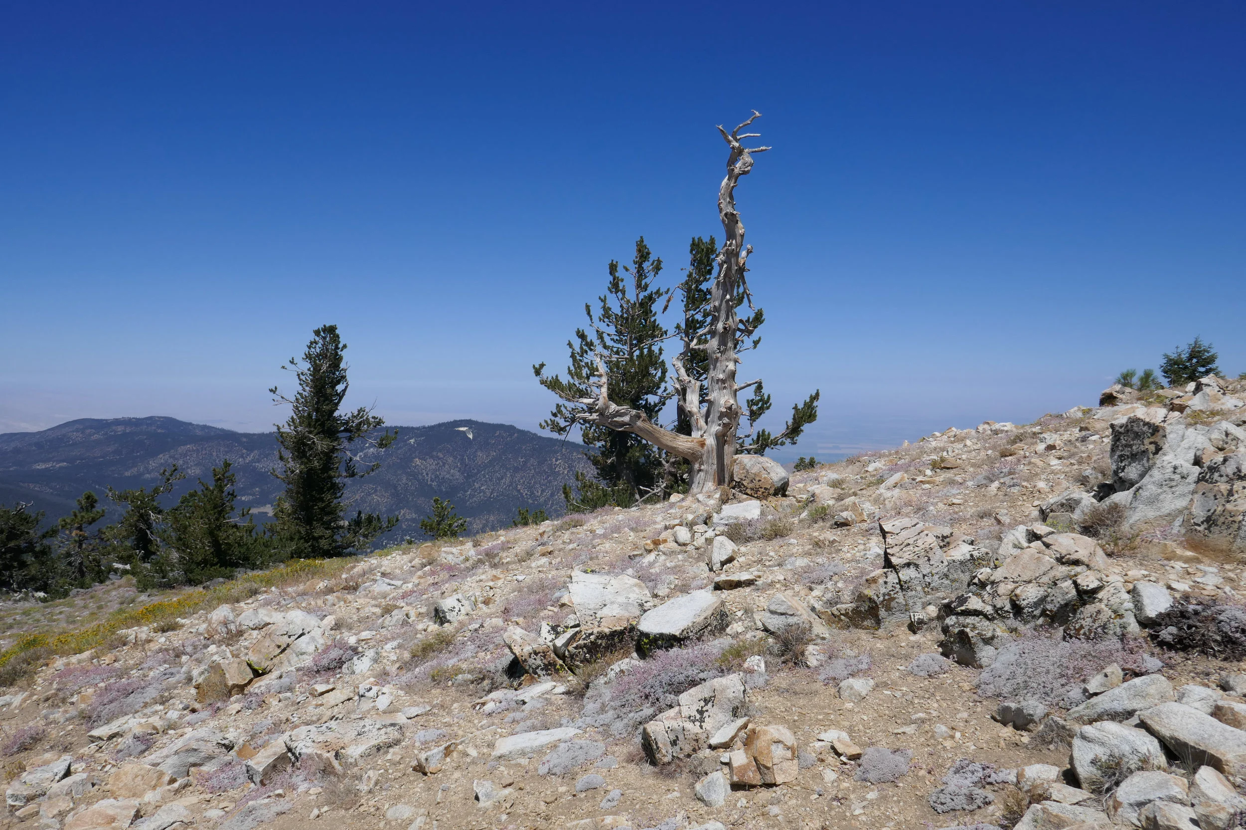
Decided to do something relaxing after our trip to the Eastern Sierra. It was a warm day. We hiked to Sheep Camp and back. Beautiful trails up here in the Los Padres National Forest!
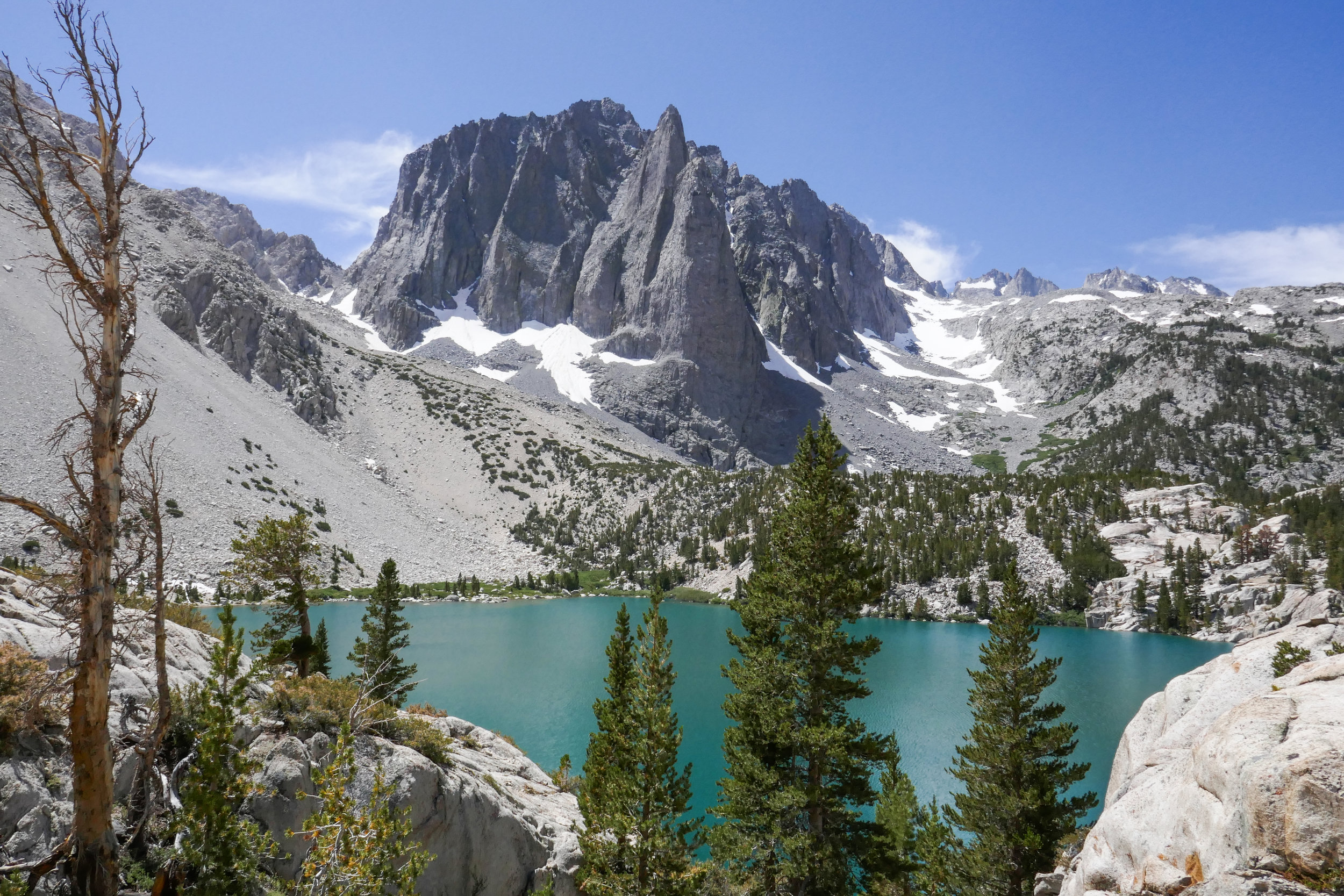
Our hike to Big Pine Lakes in the Eastern Sierra was one of the most beautiful hikes I’ve ever been on. There are seven lakes total and on this day, we hiked to the first three via the North Fork Trail. Since we weren’t backpacking, I had much less weight to carry then when we were in the Eastern Sierra last month backpacking the Mt. Whitney Trail. Most of the Big Pine Lakes hike follows along Big Pine Creek. We were next to the beautiful rushing waters most of the day. Early in the morning when we first got on the trail, we saw two doe and a fawn crossing the creek. There were plenty of wildflowers and butterflies to enjoy throughout the day as well. I took my time on this hike and spent a lot of time taking photos of it all. When we reached lake one we saw Temple Crag (popular with alpine rock climbers) towering over the incredible turquoise waters. The turquoise color comes from the glacial powder of Palisade Glacier. I also saw some trout swimming in the lake. This was a wonderful hike. We had to do some work climbing up in elevation to get to the lakes, but it was well worth the effort because the scenery was spectacular.
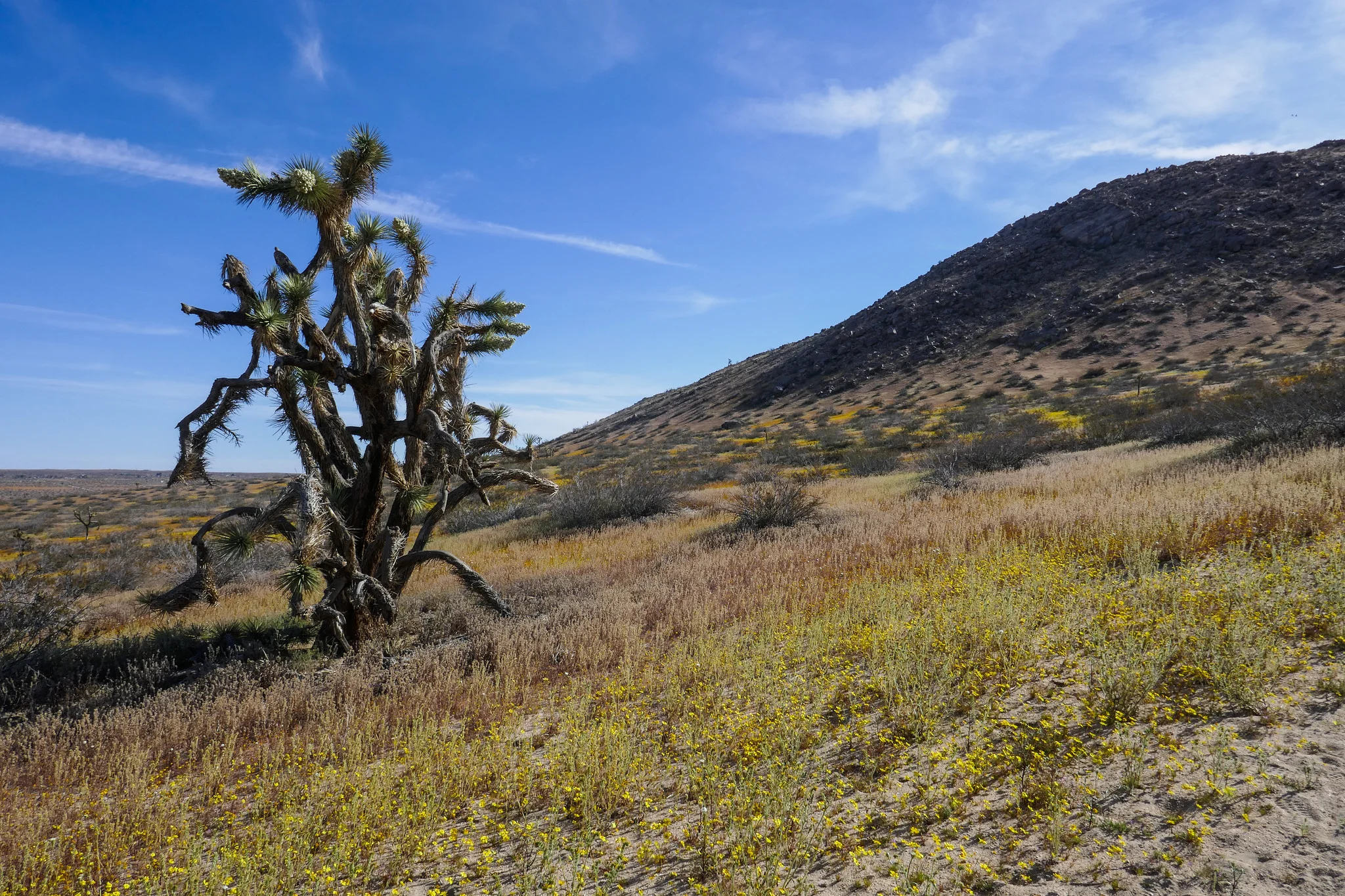
We hiked Little Butte and Saddleback Butte this weekend. I was here last year, but had not gone during the wildflower bloom. It was magical! We started our hike on the Dowen Nature Trail which connects to the Little Butte Trail and eventually the trail leading up to the top of Saddleback Butte at 3,651’. I immediately began to see carpets of wildflowers blanketing the park and the Fiddleneck flowers were covered in thousands of caterpillars. We took our time and admired all the beauty being offered to us here at the western edge of the Mojave Desert. I took note of some of the many wildflowers we observed. We saw: Coreopsis, Fiddleneck, Desert dandelion, Sun cups, Desert candles, Davy gilia, Fremont pincushions, Dune primrose, Wild Rhubarb and in addition, the Joshua Trees were in full bloom. Eventually, the sandy trail gave way to rocky terrain as it began its steep ascent up the top of Saddleback Butte. The wind was strong as we climbed and after a few easy rock scrambles, we were at the top enjoying the 360 degree views. To the south we could see the snow capped San Gabriel Mountains and further off in the distance we could make out Mt. San Gorgonio and Mt. San Jacinto. This was a really wonderful hike and being able to see the park in all it’s wildflower glory was a special treat!
Angeles National Forest is practically in my backyard. I’ve visited a few times in the past, but it wasn’t until recently when I discovered the work of David Horner, a Santa Monica based photographer who specializes in wild butterfly photography (solardarkroom.com) that my interest was piqued. His California Butterfly Project (over 10 years in the making) includes over 100 species that he photographed in the wild from sea level to 10,000 ft. from the border to Sonora Pass in the Sierra Nevada. I took notice that many of his sightings were located right here in the Angeles National Forest. About two years ago, I started a butterfly garden, Since then I’ve become somewhat of a butterfly enthusiast mostly observing them in my backyard and on my visits to local public gardens. When I saw the number of different butterfly species we have here in California on David’s website, I was inspired to revisit Angeles NF not only in the hopes of viewing butterflies in their natural habitats, but also to take advantage of the multitude of hiking trails. Years ago when I lived in Pennsylvania, I did quite a bit of hiking on solitary trails surrounded by nothing but the birds, the trees, the wildlife and peace and quiet. But now that I’ve been living in a big city, I didn’t really think too much about what else was available here aside from the overly populated locations such as runyon canyon or hiking up to the Hollywood sign. This past weekend I recruited my husband as my hiking partner (since you should never hike alone) and we ventured into Angeles NF. The drive alone up the winding roads offers such spectacular views. I’d planned ahead and decided our destination would be to hike from Charlton Flats to the top of Vetter Mountain. As we climbed up the trail, I was able to see first hand some of the damage done by the 2009 Station Fire which burned more than 161,000 acres. I also noticed lots of poodle dog bush which is a plant that causes skin irritation similar to poison oak if touched. Much of this was located within the burn area perimeter and as I later learned, it’s usually found in nearly all habitats that have been burned. Winding up the mountain, the trail was nothing less then spectacular with breathtaking views and wildflowers. We detoured off the main path to do an out and back trek along the Silver Moccasin trail which traversed upward and down through oak-lined canyons and high ridges. One day I’d like to take that trial a little further, as I didn’t want to get too side tracked since our goal was to reach the top of Vetter Mountain. After getting back on the main trail, we continued our journey until we reached the top of the fire lookout at Vetter Mountain. There we shared friendly conversation with forest rangers who were happy to answer our questions about the location. These people stand guard daily over our beautiful forest with nothing but a small shelter. The actual lookout tower was burned in the Station Fire. I have to give them credit for being up there all day watching out for us with the wind and colder temperatures on the 5,903 ft. sumit. We then climbed to the top of what remains of the old lookout and stood for a moment to enjoy the 360 degree view of the San Gabriel Mountains. With mission accomplished, it was time to head back. Round trip with our Silver Moccasin detour we did about a 7 mile, 2.5 hour hike. My hope for the day was to possibly photograph at least one wild butterfly. My wish was granted by a little common branded skipper who I saw fluttering along the trail as we got closer to where we started at Charlton Flats. It was a great morning and I will definitely be visiting Angeles NF more frequently to take advantage to all that it has to to offer including butterfly sightings and more hiking adventures.