butterfly

Pacifico Mountain from Mill Creek, 14 miles RT, 2,316' +/-, Max Elevation 7,124', May 12, 2019

Pacifico Mountain from Mill Creek, 14 miles RT, 2,316' +/-, Max Elevation 7,124', May 12, 2019

What a beautiful mountain. There are so many blooming wildflowers this time of year. We did this hike last year in June and the weather was very hot. This time the weather was still warm, but definitely not as bad. Again, just as last year, we saw very few people other then the PCT thru hikers passing by on their way to the Sierras. We put in quite a lot of mileage and the day was made even longer by my stopping to take photos every few minutes. The best hikes are always the ones where I take my time and don’t feel like I’m in a rush against the clock or in a big hurry to reach the summit. Now that we’ve been hiking for a few years and have hiked many of these mountains, I don’t feel such an urgency to summit and I’m taking more time to stop and really appreciate and enjoy the beauty of my surroundings. Even though Pacifico Mountain was hit hard in the 2009 Station Fire and there’s still a lot of visible damage along the route, it’s a very pretty hike. The area is incredibly beautiful with great vistas and it is full of flowers and wildlife. In fact, we can in very close proximity to a rattlesnake towards the end of the hike and only about a half a mile away from the trailhead. We didn’t see the snake, but we did hear the warning rattle. She must have been alongside the trail hidden where we couldn’t see her. It’s amazing how they can disguise themselves. As we climbed up the mountain, the trail changed from charred trees to beautiful Jeffery Pines. We had lunch at the campground on top of the summit. It would be so nice to camp here sometime. There were a good number of ravens circling and I saw several species of butterflies including painted ladies, swallowtails and duskywings. We spent good amount of time at the top before leaving. There was no one there but us. I scouted around the big boulders to see if I could find the official USGS marker, but I still couldn’t locate it. I’ll check again next time we’re here. It was a really nice day.

Read More

Mt. Pinos 8,831' & Sawmill Mountain 8,819', Los Padres National Forest, 8 miles RT, 1,437' +/-, July 15, 2018

Mt. Pinos 8,831' & Sawmill Mountain 8,819', Los Padres National Forest, 8 miles RT, 1,437' +/-, July 15, 2018

We headed into the local mountains on Sunday for a nice easy day of hiking in the Los Padres National Forest.  We did a short 8 mile hike to Mt. Pinos and Sawmill Mountain.  We did these peaks in May of this year and at that time we also added Grouse Mountain which completed the 3-2-1 challenge.  (Check out  mymountainchamber.com for info. on the challenge.) .  It's a lovely area to explore.  This time around the weather was much warmer then the last when it was cool and cloudy.  I got to see some butterflies and the highlight of my day, a horned lizard.  He blended in so well with his surroundings that I could barely see hime when looking through my camera lens.  After reaching Sawmill Mountain and taking in the views from there, we decided to head back before the day got too hot.  This was a nice hike to ease us back into it after an incredible 3 days spent in the Eastern Sierra.

Read More

Grizzly Flat Trailhead, 2N79, Hoyt Mountain, 4.32 miles RT, 3,904' Max Elevation, 912' +/-, July 1, 2018

Grizzly Flat Trailhead, 2N79, Hoyt Mountain, 4.32 miles RT, 3,904' Max Elevation, 912' +/-, July 1, 2018

Today we did a short hike in the front range from the Grizzly Flat Trailhead past the locked gate along 2N79.  2N79 splits off and you can continue northwest to Grizzly Flat or you can follow it north and then east as it makes a turn towards Hoyt Mountain.  The later was our destination.  We’ve hiked this trail many times before because it’s a hot spot for several different species of butterflies.  This was the first time we followed it all the way to Hoyt Mountain.  The trail continues to climb until it reaches a saddle after just a little over two miles.  Here there’s a split to continue on a rugged use trail up to the summit of Hoyt, or you can continue onto the very overgrown Telephone Trail which descends to Clear Creek.  We climbed up on the use trail about halfway to the false summit and decided it was too overgrown and steep to continue.  I was actually more interested in going back down to photograph all the Chalcedon Checkerspots that I saw at the base of the mountain.  I photographed Chalcedon Checkerspots near this area last year, but this year there were so many that they were practically landing on me as I took my photos!  It was about 9 am and the sun was really starting to warm things up.  We decided to descend before it got too hot and finish up the hike with a visit to DISH in LaCanda for some hot coffee, eggs, bacon and my favorite... pancakes!

Read More

Liebre Mountain, 5783', 7.3 miles RT, 1,877 +/-, May 13, 2018

Liebre Mountain, 5783', 7.3 miles RT, 1,877 +/-, May 13, 2018

I was super excited to explore a new part of the Angeles National Forest this past Sunday! One of the first hiking books I’d ever purchased was “Trails of the Angeles” by the late John W. Robinson. This hike is hike #1 in his book. In addition, Casey Schreiner of ModernHiker.com, recently posted a trail report about this hike, making it sound even more appealing.

The trailhead is about an hour and 20 minute drive from our home and is in the northwestern section of the Angeles NF. It starts off on the PCT, and we did pass a number of thru hikers headed to the Sierras as we ascended the mountain southbound.

The first part of the trail took us up switchbacks that were surrounded by blooming ceanothus (wild lilac) as well as patches of yerba santa. As we made our way up, we had wonderful views of the Antelope Valley, the Ventura mountain ranges, the San Andres rift zone and the Tehachapis. It’s a very interesting contrast considering the mountain we were hiking on was so lush and green.

As we continued, we passed through an incredibly beautiful pine grove filled with purple lupines. Various wildflowers were numerous along the entire route. As we climbed upward, Liebre mountain turned into a sprawling oak savanna and the clouds began to roll over us as they made their way across the mountaintop. We reached a junction where the PCT headed east, but continued along the trail (which was now more of a fire road then a single track) to reach the highest point of Liebre Mountain. To find the high point which is marked with a wooden stake and a pile of large rocks, we had to leave the road and do a little searching. We stopped here to relax, have a snack and enjoy the scenery. We also did a some exploring around the top of the mountain before making our way back taking our time as we did. As we descended, the temperatures had warmed up a bit and there was more wildlife activity; lizards warming themselves in the sun and insects enjoying the wildflower blooms. I stopped for a while to get some photos of a Clearwing Hummingbird Moth nectaring on the yerba santa at about 4,300’. It was quite a sight! I’d never seen one of these before! This was a lovely hike and another great day to be in the mountains!

Read More

Sunday's 2nd Hike: Wildlife & Wildflowers at Grizzly Flat, 2.4 miles RT, 643 +/-, April 15, 2018

Sunday's 2nd Hike:  Wildlife & Wildflowers at Grizzly Flat, 2.4 miles RT, 643 +/-, April 15, 2018

On the way back from Devil’s Canyon today, we stopped off at Grizzly Flat so I could take some butterfly photos with my DSLR.  I don’t hike with my DSLR anymore because it’s too cumbersome on strenuous hikes.  I also don’t want to ruin it when I need to climb up rocks or navigate through tall brush.  I brought it along today just for this hike since it’s an easy one up a nice, wide trail.  The sun was in and out so it was mostly cloudy, but the hike was very nice.  There were lots of wildflowers in bloom, hence the butterflies were around them.  I didn’t see a lot of activity today, but I did see a few as well as some other critters in the short time we were on the trail.  One of these days I’d like to hike up this trail a little further although it’s hard when you’re searching for butterflies because you end up spending a lot of time just in one spot waiting for that perfect shot! 

Read More

Trail Canyon Falls, 4.5 Miles RT, 981' +/-, April 8, 2018

Trail Canyon Falls, 4.5 Miles RT, 981' +/-, April 8, 2018

It was 6:30 am Sunday morning and we were on the trail headed to Trail Canyon Falls, a beautiful waterfall cascading 30 feet down into a rugged canyon.  What this hike lacks in distance, it makes up for in beautiful scenery.  The trail to the falls winds through the canyon and crosses the creek several times before heading up to the top of the waterfall where you’ll have spectacular views looking straight down.  If you’re feeling adventurous you can also descend a steep use trail where you can rock scramble your way down with the help of a rope tied to a tree to get to the base of the falls.  Today the water was flowing beautifully, the wildflowers were blooming and butterflies were on the wing.  Since we started so early, we shared the falls with only two other hikers.  It was a very peaceful morning.  As we headed back, I came upon a very hungry swallowtail who was so busy nectaring on Western Wallflower that he didn’t seem to mind me hovering over him with my camera to take some photos.  Also, if you keep your eyes peeled, there’s a picnic table nestled away in the shade off to the side of the trail that makes for a great place for a snack break or even a picnic.  We stopped there for a bite to eat before finishing up the hike.  It was an absolutely perfect day with temperatures at about 65 degrees at 10:30 am when we arrived back at the trailhead.
 

Read More

Burkhart Trail from Devil's Punchbowl, 12 miles RT, 3,038' +/-, April 1, 2018

Burkhart Trail from Devil's Punchbowl, 12 miles RT, 3,038' +/-, April 1, 2018

The Burkhart Trail from Devil’s Punchbowl has been on my bucket list ever since the first time we hiked to Devil’s Chair and the Punchbowl loop.  I wanted to get this one out of my system before the weather got too hot knowing that much of the trail is exposed.  This hike is kind of like two for the price of one.  It has a lot of diversity along the way taking you from the desert floor to the alpine zone.  The first part of this hike drops you down to Cruthers Creek which is lower then the elevation from which you started at the trailhead.  This section is a beautiful trek unto itself, but you have to remember to save some fuel in the tank since you’ll have to hike back up out of the canyon later on.  Next, you cross over Cruthers Creek and from here on out it’s a long, steep haul toward Burkhart Saddle.  Personally, I didn’t find the climb all that difficult.  BUT… what I didn’t expect were the lengthy sections of trail with loose rock on sometimes very narrow and mostly exposed slopes.  This trail has all kinds of terrain to hold your attention from beginning to end.  We encountered soft sand, loose scree, talus, and pine needle covered track.  I really enjoyed hiking through the different plant communities in this unique transition zone.  As we continued onward and upward, there was a nice, cool breeze coming up out of the canyon to keep us comfortable.  The higher we went, the more the temperature cooled and trail seemed to become more and more rocky with very few breaks in between.  At about 6 miles in, just one mile short of the saddle, we hit our turn around time.  We looked over at the saddle which seemed so close, yet so far!  Then we looked at the trail ahead of us...  More rock!  Ugh.  We contemplated making the final push anyway, but we both agreed it would be even more slow going on the way down and decided we should start heading back.  We also still had to make the climb up out of the canyon.  Carefully we negotiated our way down the slope.  My trekking poles came in handy here.  When we arrived back at the creek, I got distracted by all the little Lotus Hairstreak butterflies.  I spent some time chasing them around trying to get a good photo.  (Or maybe I was just procrastinating the climb back up.)  As I tried to focus my camera on the tiny green butterfly who was posing so patiently on a leaf, a hummingbird mistook my bright fuchsia tee shirt for a flower.  He swooped so close I could feel the flutter of his tiny wings.  He swiftly flew away when I looked over my shoulder at him and he realized he was mistaken.  As we began the final climb up out of the canyon a hazy cloud cover kept the sun at bay, and I enjoyed snapping photos of the ever changing scenery on the trek back to the trailhead.  Overall, I really enjoyed this hike and would do it again.  Perhaps next time we’ll start a little earlier now that we know what to expect with the rugged terrain.

Read More

Grizzly Flat, Angeles National Forest, August 12, 2017

Grizzly Flat, Angeles National Forest, August 12, 2017

I was curious about what would be flying at the closest “butterfly hot spot” to my home, so I took a quick trek up to Angeles National Forest and hopped on the trail.  It was HOT (which I knew it would be), but continued on.  The California Buckwheat is turning brown now and the landscape is looking as it should be for this time of year.  I saw some activity, but not nearly as much as the last time I’d been here.  I was happy when I came across a California Sister who fluttered around me then perched high up on a leaf to pose for some photos before flying away.  I continued my trek just a little higher up the hillside, then stopped in some shade to listen to the quiet before turning around.  On my way back down I spotted several Mormon Metalmarks nectaring on the Buckwheat.  These guys sure are characters. They seem to pivot around in all directions as if they’re making sure you get their best angle.  It was a short but sweet day for butterfly watching.
 

Read More

Solstice Canyon: Rising Sun Trail to Solstice Canyon Falls to Sostomo Trail to Deer Valley Loop to Solstice Canyon Trail, gain 1,100 ft. Approx. 7 miles RT, August 6, 2017

Solstice Canyon: Rising Sun Trail to Solstice Canyon Falls to Sostomo Trail to Deer Valley Loop to Solstice Canyon Trail, gain 1,100 ft. Approx. 7 miles RT, August 6, 2017

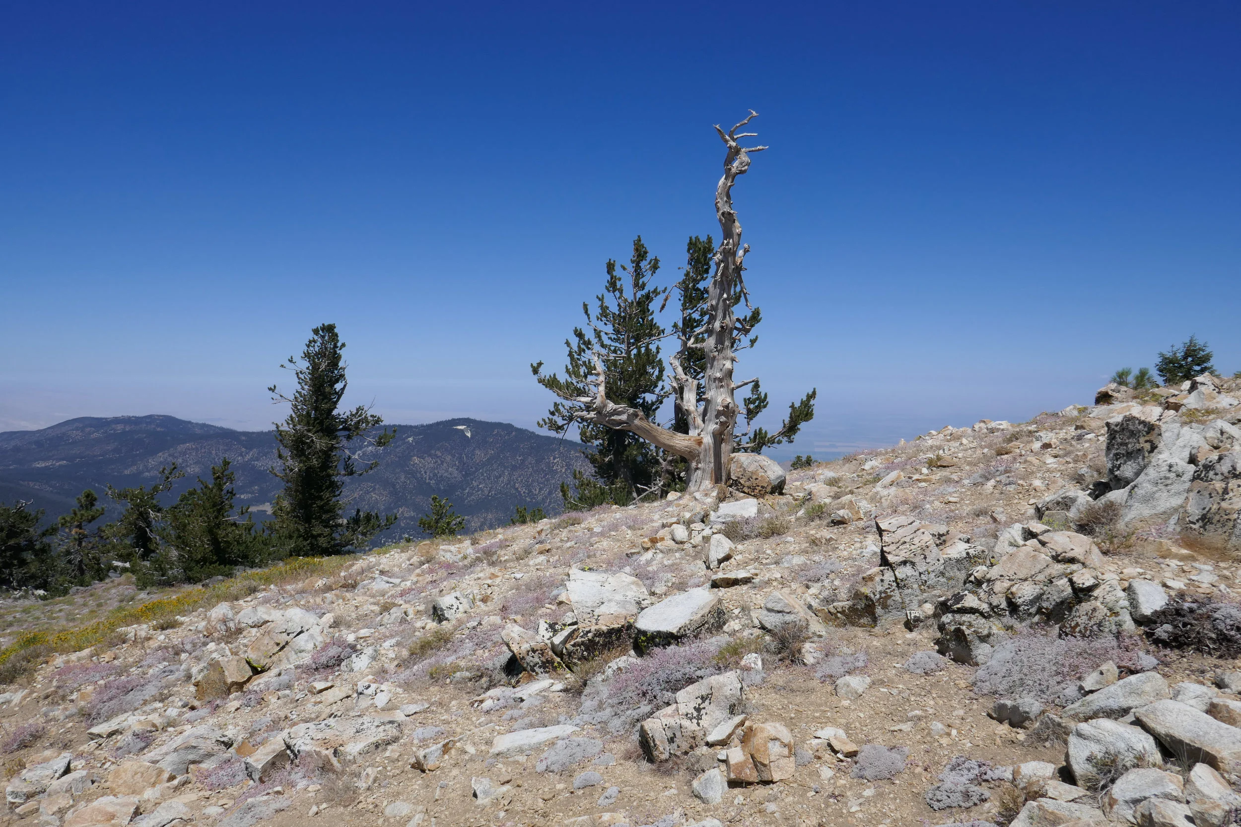
So far our summer hikes have been at the higher elevations where it’s usually cooler.  But this weekend we opted to head towards Malibu and explore Solstice Canyon.  I knew this was a popular spot with some of the trails being on exposed hills, so we got there early before the crowds and the heat.

We arrived just before 7 am and there was still plenty of parking.  Our options were to head straight to the falls via the Solstice Canyon Trail, an easy walk down a paved fire road, or to head up the stairs to the right and take the Rising Sun Trail which climbs upward on more rugged terrain.  We opted for the later.  Just a few feet in we were already getting some nice views of the pacific.  The morning light was gorgeous and it reflected a beautiful golden hue on the summer wildflowers along the trail.  It was still early in the morning, but the exposed hills had us working up a good sweat.  As we reached the crest, the first view of what remains of Tropical Terrace mansion became visible down in the canyon. This mansion was built in the 1950s, but it burned down in 1982 in a wildfire. As we began to descend down into the canyon towards the ruins, we could hear the waterfall and the vegetation became noticeably greener.  

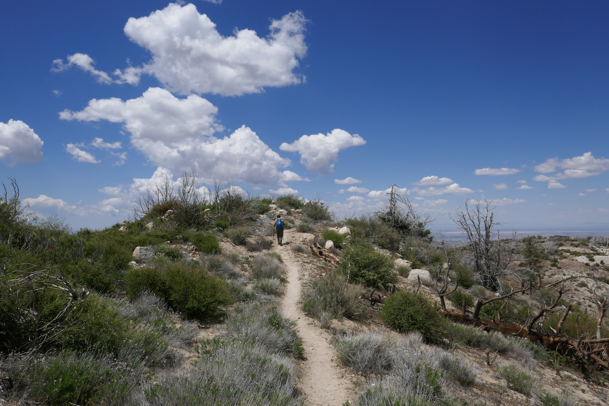
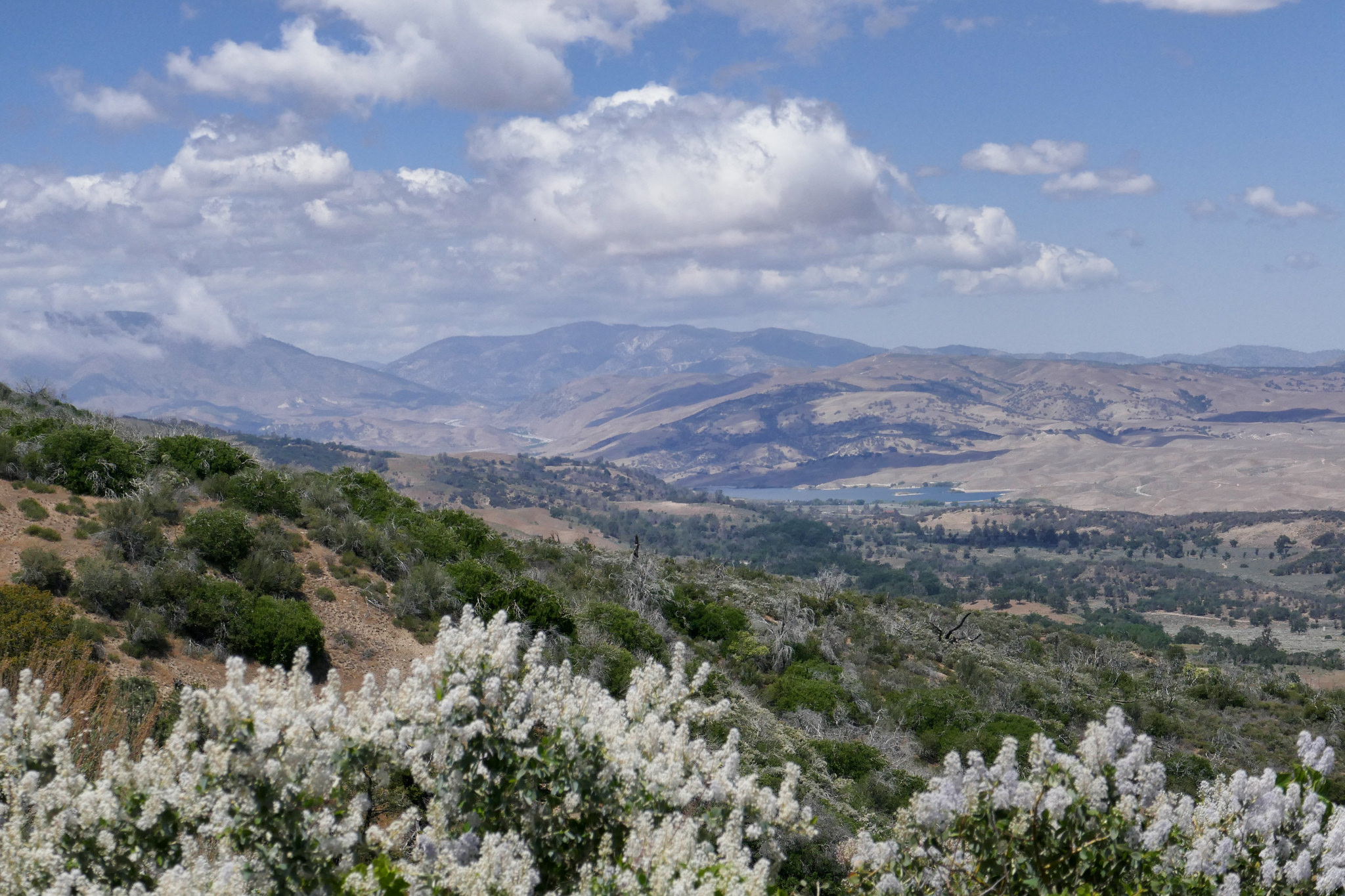
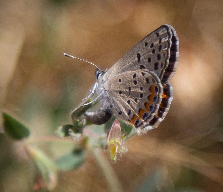
We spent some time exploring Tropical Terrace and the small but very pretty Solstice Canyon waterfall.  Afterwards, we walked south along the paved Solstice Canyon trail for a quick minute to pick up the Sostomo Trail.  The Sostomo Trail took us straight up on a less maintained more difficult trail to some very pretty views of the whole canyon and the pacific ocean.  We passed the ruins of a few more cabins along the way, dropped down in the the canyon and rock hopped over the creek a few times and eventually reached the junction of the Deer Valley Loop.  The Deer Valley Loop took us up even higher where we were able to get a birdseye view of Point Dume.  There were some parts of the loop that leveled off and opened up to meadows full of golden wildflowers and also beautiful Oaks.  This area was covered in white butterflies.  I believe they were Cabbage Whites, but they kept us company almost our entire time on these two trails.  I should note some of the other butterflies I saw here which were Swallowtails, Skippers and Marine Blues.  

After finishing the loop, we met back up with the Sostomo Trail and headed back the way we came.  It was about 10:30 am and now the crowds were starting to arrive.  We passed a few sweaty hikers who asked us if the climb was worth it.  It was actually pretty hot by this time, so a few of them decided to turn back.  

Once back down, we finished the hike on the Solstice Canyon Trail. (I actually don’t have any photos from this part of the hike because when I was downloading the images, some of the files got corrupted.  Not sure what happened there, but thankfully the rest of the photos were fine.)  

Overall, I really enjoyed this hike and the change of scenery.  I would definitely like to come back and do this one in the spring when everything is green, as I’m sure it would be full of different species of butterflies and the hills would be even prettier.
 

Read More

Angeles National Forest, Grizzly Flat, June 25, 2017

Angeles National Forest, Grizzly Flat, June 25, 2017

This weekend my husband and I were supposed to be in Joshua Tree, but with the soaring temperatures, we opted to remain local.  This morning we took a very short hike up Grizzly Flat Trailhead.  It was 92 degrees by 9 am, but we managed to get in a quick trek up the slope and I snapped just a few photos along the way.  There were swallowtails circling down and back up the summit, but they were too far away to get an image.  I did manage to catch a Bernardino Blue, as there were many on the California Buckwheat and also what I believe is a female Lupine Blue who appeared to be ovipositing.

Read More

A Butterfly Habitat in Angeles National Forest, Hiking Grizzly Flat, June 18, 2017

A Butterfly Habitat in Angeles National Forest, Hiking Grizzly Flat, June 18, 2017

This was an exciting weekend for me.  I experienced for the first time the natural butterfly habit that exists right here in Angeles National Forest.  It was incredible if not a little overwhelming.  Around 8 am we arrived at the trailhead and began our hike.  The weather was already heating up due to the current heatwave, and as we began our ascent up the slope we started to see all the activity.  Along the trail was an abundance of California Buckwheat which is both a host and nectar plant for many different species.  It was covered in different butterflies; Bernardino Blues, Hairstreaks and Chalcedon Checkerspot to name a few.  It was breathtaking seeing so many different butterflies all together in their natural habitat.  After I stopped “ohhh-ing and ahhh-ing” I did my best to get some images.  Photographing butterflies can be a real challenge unless they’re still warming up or they’re preoccupied sipping nectar.  I was so enamored “chasing butterflies” I hardly noticed how hot it was getting in the beating sun on the slope.  I could have stayed up there for hours observing and looking for different species.  It was the most amazing and educational day!  

Read More

Angeles National Forest, Charlton Flats to Vetter Mountain 3.8 miles RT (525 Ft +/-) & Silver Moccasin Trail

Angeles National Forest, Charlton Flats to Vetter Mountain 3.8 miles RT (525 Ft +/-)  & Silver Moccasin Trail

Angeles National Forest is practically in my backyard.  I’ve visited a few times in the past, but it wasn’t until recently when I discovered the work of David Horner, a Santa Monica based photographer who specializes in wild butterfly photography (solardarkroom.com) that my interest was piqued.  His California Butterfly Project (over 10 years in the making) includes over 100 species that he photographed in the wild from sea level to 10,000 ft. from the border to Sonora Pass in the Sierra Nevada.  I took notice that many of his sightings were located right here in the Angeles National Forest.  About two years ago, I started a butterfly garden, Since then I’ve become somewhat of a butterfly enthusiast mostly observing them in my backyard and on my visits to local public gardens.  When I saw the number of different butterfly species we have here in California on David’s website, I was inspired to revisit Angeles NF not only in the hopes of viewing butterflies in their natural habitats, but also to take advantage of the multitude of hiking trails.  Years ago when I lived in Pennsylvania, I did quite a bit of hiking on solitary trails surrounded by nothing but the birds, the trees, the wildlife and peace and quiet.  But now that I’ve been living in a big city, I didn’t really think too much about what else was available here aside from the overly populated locations such as runyon canyon or hiking up to the Hollywood sign.  This past weekend I recruited my husband as my hiking partner (since you should never hike alone) and we ventured into Angeles NF.  The drive alone up the winding roads offers such spectacular views.  I’d planned ahead and decided our destination would be to hike from Charlton Flats to the top of Vetter Mountain.  As we climbed up the trail, I was able to see first hand some of the damage done by the 2009 Station Fire which burned more than 161,000 acres.  I also noticed lots of poodle dog bush which is a plant that causes skin irritation similar to poison oak if touched.  Much of this was located within the burn area perimeter and as I later learned, it’s usually found in nearly all habitats that have been burned.  Winding up the mountain, the trail was nothing less then spectacular with breathtaking views and wildflowers.  We detoured off the main path to do an out and back trek along the Silver Moccasin trail which traversed upward and down through oak-lined canyons and high ridges.  One day I’d like to take that trial a little further, as I didn’t want to get too side tracked since our goal was to reach the top of Vetter Mountain.  After getting back on the main trail, we continued our journey until we reached the top of the fire lookout at Vetter Mountain.  There we shared friendly conversation with forest rangers who were happy to answer our questions about the location.  These people stand guard daily over our beautiful forest with nothing but a small shelter.  The actual lookout tower was burned in the Station Fire.  I have to give them credit for being up there all day watching out for us with the wind and colder temperatures on the 5,903 ft. sumit.  We then climbed to the top of what remains of the old lookout and stood for a moment to enjoy the 360 degree view of the San Gabriel Mountains.  With mission accomplished, it was time to head back.  Round trip with our Silver Moccasin detour we did about a 7 mile, 2.5 hour hike.  My hope for the day was to possibly photograph at least one wild butterfly.  My wish was granted by a little common branded skipper who I saw fluttering along the trail as we got closer to where we started at Charlton Flats.  It was a great morning and I will definitely be visiting Angeles NF more frequently to take advantage to all that it has to to offer including butterfly sightings and more hiking adventures.

Read More