scramble

Eaton Saddle, Mt. Lowe Road, Mt. Lowe Trail Camp, Tom Sloan, Mt. Lowe East, 6.4 Miles RT, 1,434' +/-, 5,421' Max Elevation, April 21, 2019

Eaton Saddle, Mt. Lowe Road, Mt. Lowe Trail Camp, Tom Sloan, Mt. Lowe East, 6.4 Miles RT, 1,434' +/-, 5,421' Max Elevation, April 21, 2019

The weather is still cool so I’m trying to make the best of the front range before it gets too hot. Today we drove up to Eaton Saddle with no specific plan in mind since there are plenty of routes you can take to make a great hike. We hiked up the Mt. Lowe Road through the Mueller Tunnel which experienced an avalanche over the winter, but some of the rocks were cleared so you can get around it safely. At Markham saddle, we decided to continue down the Mt. Lowe Road to Mt. Lowe Trail Camp and the ruins of Ye Alpine Tavern where we’d take a break and enjoy the ham and cheese croissants we’d picked up from the donut shop before starting our hike. I really love this area and enjoy walking the Mt. Lowe Fire Road. The views are great down into Bear Canyon and you can really see just how rugged the San Gabriels are. As we hiked the sun was trying very hard to break through the clouds, but we were soon engulfed in them as they wrapped around the mountain and our views disappeared in a heavy mist of white. When we reached the junction with the Tom Sloan Saddle trail, we branched off to explore it for about a quarter mile. It descended steeply and since we didn’t want to lose too much elevation, we decided to save that adventure for another day. I was really enjoying being surrounded by all the cloud cover. When we arrived at the Mt. Lowe Trail Camp, I noted that there was water flowing. This is the first time I’d seen it there. There were a few people enjoying the solitude of the camp, and we stopped for a while to appreciate the silence and eat lunch. I pulled out the map while we were eating to check out the Mt. Lowe East Trail. It would be a shorter, but steeper route back, so we decided to explore it. We got on the trail and began climbing up the switchbacks on Mt Lowe’s southern slope. There were some loose rocky, sections that were narrow and exposed so we had to be careful on those, but nothing too terrible. At one point, two mountain bikers almost collided into us as they were racing down the mountain on the switchbacks that didn’t give them much visibility to see what was around the corner. Thankfully, they saw us and we moved to the side so they could continue their way down the mountain. I worked up a pretty good sweat climbing up, but soon we reached the junction with the summit trail to Mt. Lowe. I considered continuing up since we were already here, but then we both decided since there would be no views today, that we’d just head back to Eaton Saddle and enjoy an early day.

Read More
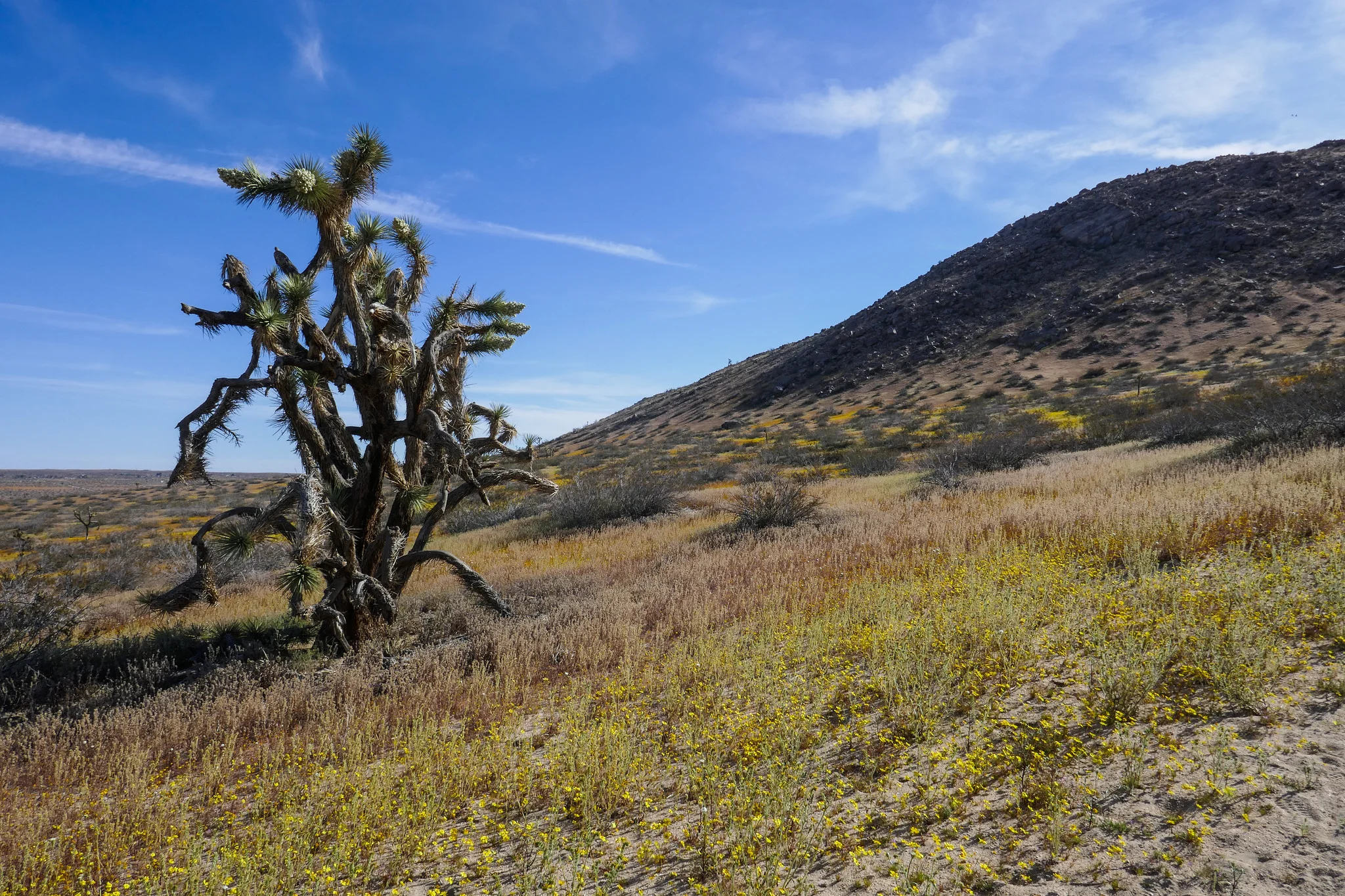
Saddleback Butte State Park, 4.8 Miles RT, 1,037' +/-, 3,651' Max Elevation, April 14, 2019

Saddleback Butte State Park, 4.8 Miles RT, 1,037' +/-, 3,651' Max Elevation, April 14, 2019

We hiked Little Butte and Saddleback Butte this weekend. I was here last year, but had not gone during the wildflower bloom. It was magical! We started our hike on the Dowen Nature Trail which connects to the Little Butte Trail and eventually the trail leading up to the top of Saddleback Butte at 3,651’. I immediately began to see carpets of wildflowers blanketing the park and the Fiddleneck flowers were covered in thousands of caterpillars. We took our time and admired all the beauty being offered to us here at the western edge of the Mojave Desert. I took note of some of the many wildflowers we observed. We saw: Coreopsis, Fiddleneck, Desert dandelion, Sun cups, Desert candles, Davy gilia, Fremont pincushions, Dune primrose, Wild Rhubarb and in addition, the Joshua Trees were in full bloom. Eventually, the sandy trail gave way to rocky terrain as it began its steep ascent up the top of Saddleback Butte. The wind was strong as we climbed and after a few easy rock scrambles, we were at the top enjoying the 360 degree views. To the south we could see the snow capped San Gabriel Mountains and further off in the distance we could make out Mt. San Gorgonio and Mt. San Jacinto. This was a really wonderful hike and being able to see the park in all it’s wildflower glory was a special treat!

Read More

Mt Lowe, 3 miles RT, 5,604' Max Elevation, 548' +/-, September 30, 2018

Mt Lowe, 3 miles RT, 5,604' Max Elevation, 548' +/-, September 30, 2018

My husband and I did a sunset hike on Mt. Lowe this past Sunday. We drove up to Eaton Saddle, followed the Mt. Lowe Fire Road through the Mueller Tunnel to Markham Saddle and then picked up the trail to the Mt. Lowe summit. I really like this area a lot. There’s never very many people and you get some great views of the rugged San Gabriels. The hike to the summit is a short one, but it was perfect for a day when we didn’t have time to do a long hike. The views are pretty great too. As the sun began to sink behind the Santa Monica Mountains to the west, we started to make our way back down the mountain. We reached Markham Saddle just 10 minutes before the sunset then stopped to enjoy the show as the light faded from orange, to pink and finally inky black. It was a little spooky coming back through the Mueller Tunnel in the dark, but the city below us lit up in a romantic, sparkling glow of lights. It was a great way to wrap up the weekend!

Read More

Kratka Ridge 7,515' and Peak 7160, 2.4 miles RT, 948 +/-, August 5, 2018

Kratka Ridge 7,515' and Peak 7160, 2.4 miles RT, 948 +/-, August 5, 2018

Kratka Ridge has been on my radar to hike for quite some time. We made a plan this weekend to go check it out and when mapping out the route, I added nearby Peak 7160 to the plan. The whole hike was only a little over two miles, but in that short distance we were offered amazing views, a fun, steep climb and plenty of solitude. We arrived at the trailhead at the Vista Picnic Area around 6:30 am. The route wasted no time ascending quickly and offering great views. As we continued there were sections where the ground was soft and the footing was loose making the going more challenging. It wasn’t long before we reached the ruins of an old, wooden ski lift that had been in operation from the 1950s up until 2001. Now its deteriorating structure sits abandoned with single seat ski lift chairs hanging from the cables. We spent some time exploring the structure and tried to imagine what it had been like when it was up and running. We sat inside the old ruins looking down the mountain towards the rickety lift chairs enjoying each other’s company and the quiet of the morning until it was time to continue up to the high point on Kratka ridge. Behind the ski lift I discovered what looked to be a use trail that would require some scrambling up rocks and tree roots to reach the top. I continued to explore the area looking for the best way up and just a little further past the wooden structure I found another use trail on the side of the slope that would also take us to the top. The trail was narrow and a bit loose, but I felt comfortable enough to negotiate it to reach the high point from this route. At the top of Kratka Ridge we were rewarded with some of the most excellent views of Bear Creek Canyon and the San Gabriel Wilderness I have ever seen. I could identify Mount Williamson, Waterman Mountain, Twin Peaks and many of the other surrounding mountains from the viewpoint. After we were done taking it all in, we found another faint trail which followed the wilderness boundary. I figured it would take us back to the scramble behind the lift and sure enough it did. We then began our descent down the mountain being extra careful on the slippery sections. As we descended I could see Peak 7160 right in front of us. There wasn’t much of an established way up, so we started heading towards its high point. The ascent was steep, but the footing was fine. Along the way I found a heart that someone had made out of pine cones. When we reached the summit, I found another one made out of stones. So cute! From Peak 7160 we had a great view looking back over at Kratka ridge and down into the canyon. It was a lovely day. Although it was short, this hike is definitely a favorite!

Read More

Mount Pacifico 7,134', 2,398' +/-, 14 miles on the PCT from Mill Creek, June 3, 2018

Mount Pacifico 7,134', 2,398' +/-, 14 miles on the PCT from Mill Creek, June 3, 2018

I’m always looking to escape weekend crowds and find new trails to explore. This Sunday our hike was to the top of Mount Pacifico in the northern part of Angeles National Forest. We planned to start the hike at Mill Creek and follow the PCT which runs through this area. It looked like the trek would be around 12 to 14 miles depending on whether or not we did an out and back on the PCT or did a loop. The day was going to be hot, but I figured since we were heading up to a higher elevation, it might not be so bad on the ascent. If it got too hot, we would descend and save it for another time. The trail was very beautiful. There were many wildflowers and so much ceanothus (California lilac) which made for a very pleasant fragrance along the way. There was lots of wildlife activity too; squirrels, chipmunks, songbirds, bees, insects and butterflies. As we climbed higher, we started to see beautiful, tall pine trees. Much of the area was burned in the 2009 Station Fire, and we could see the effects of that as we hiked this route. But the area looks as though it’s been recovering nicely. Eventually, we reached a junction where we left the PCT and headed southeast to a jeep road that took us up to the summit. There are outstanding views of the surrounding mountain ranges along the way making the road more interesting. After about a mile or so we reached the summit. Mount Pacifico Campground is also here. There are picnic tables, a fire ring and vault toilets. That’s quite a luxury to have up on a summit! There are also a lot of very interesting rock formations to explore. There wasn’t anyone here today, so we took a good long rest and relaxed and enjoyed the peace and quiet. Soon it was time to head back and get ready for the heat as we descended to a lower elevation. We opted to come back the way we came on the PCT for a more scenic and enjoyable route. Both of us had been keeping well hydrated throughout the trip and we had no problems with it being so warm. We were even gifted with an occasional breeze as we hiked back down the mountain. I found this trail to be very nicely graded so although it was long, it was very pleasant. A very enjoyable hike!

Read More

Sandstone Peak 3,111' and the Mishe Mokwa Trail 8.3 miles RT, September 10, 2017

Sandstone Peak 3,111' and the Mishe Mokwa Trail 8.3 miles RT, September 10, 2017

Sandstone Peak is the highest point in the Santa Monica Mountains at 3,111’.  We got to the trailhead before 6 am and had planned to do the Mishe Mokwa 6.1 mile loop and then summit Sandstone Peak.  But since the sun was rising and it was just so pretty, we decided to hop on the 3 mile out and back trail leading up to the peak, summit and then come back down to enjoy the Mishe Mokwa loop, another 6 miles, respectively.  

Along the trail to the peak, the views were nothing less then stunning.  The warm winds were blowing off the ocean and the sea air was filled with the scent of coastal sage.  No one else was on the trail yet and we were able to enjoy a peaceful sunrise over a picturesque view of endless mountains.

As we continued onward and upward, we eventually came upon a set of steps with a sign pointing to Sandstone Peak.  Before the steps, we saw a series of steep use trails leading to the same destination.  We took a look at them and opted for the steps.  After the steps ended, we had an easy scramble to the top of the first mountain where there is a cell tower.  From here, we could see the actual peak off in the distance noted by a plaque dedicated to W. Herbert Allen.  Allen was a donor of land to Boy Scout camps and also Camp Circle X nearby.  From this point we were on our own to find use trails and make a challenging scramble to the peak.  I had to put my camera in my pack because I needed use of my hands to finish the climb so I didn’t get many photos during this part of the hike.  Once we made it up, we signed the register located under the plaque and started the very steep ascent down.  I have no shame in admitting that I did the butt slide most of the way down, as I picked the steepest, but most direct way to get back.  

Once down we could have hopped on the Backbone Trail and then picked up the Mishe Mokwa Trail, but we wanted to do it “by the book” and complete the whole thing start to finish.  We went back to where we came from and started it from the beginning adding extra mileage to our journey.

Being that it’s the end of summer, I knew the day would soon be heating up.  But since we’d gotten there so early, we still had some time to enjoy our hike without the blazing sun.  Much of this trek is exposed and you’ll need a lot of extra water to stay hydrated.  The trail was challenging, but there was a lot of different scenery to keep us busy.  At one point it dropped us down into a riparian grove which was a completely different environment then what we had experienced so far.  Had it not been summer, there would have been a flowing stream here.  In this grove near the appropriately titled Split Rock (which is exactly that), there’s also a solitary picnic table.  It was a welcoming place to take a break and fuel up with a sandwich before continuing on to complete the loop.  

In retrospect, I’m really glad we decided to summit first.  By the time we completed the loop, it was hot!  It was sometime after 11 am and on our way down to the parking lot, we saw a good number of sweaty hikers just making their way up.  I’m not sure how they could do it in the heat.  My best advice would be if you are going to attempt this trail in the summer, suck it up and do it EARLY!  You can always take a nap later, which is exactly what we did!  It’s totally worth it!

Read More