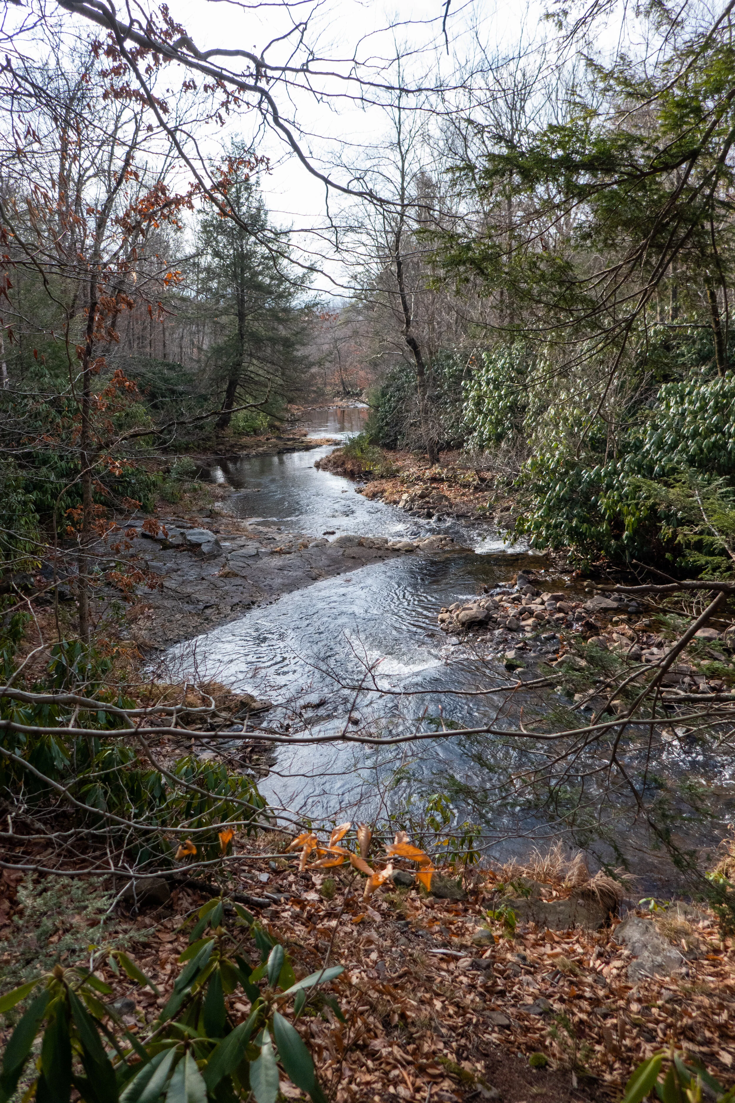
Beautiful creekside hiking at Bear Creek Preserve this weekend! This has been my favorite hike in NEPA thus far. We started from the trailhead at Rabbit Run Lane on the red trail and connected to the gray tail heading south along Shades Creek. This section of trail was just beautiful with many cascades flowing into deep, clear pools, waterfalls and undulating trail through rhododendron jungles, in and out of hemlock forest and mossy wetland. Before reconnecting to the red trail and heading back north, we crossed over Shades Creek on a really cool suspension bridge. The terrain for most of this hike was rocky and slippery with wet leaves, but I'm getting used to my feet taking a beating on these east coast trails and learning to slow down a bit and take my time. East coast hiking is very different from out west. There may not be much elevation to gain, but I’m starting to find some locations that feel a little more remote where we can track some decent mileage. We followed the red trail back to the trailhead and closed the loop at about 7 miles RT. Absolutely beautiful place to explore.
Big Pocono State park sits atop the summit of Camelback Mountain at about 2,100’. You can drive your car up to the top and enjoy a day of picnicking with views below of Eastern Pennsylvania, New Jersey and New York. There are hiking trails that start at the summit and traverse down the mountain and then back up. Today we hiked the North Trail to its lower loop and then circled back up the south face on the South Trail. The trail was surprisingly steep with about a 600’ change in elevation in under a mile. I haven’t needed to use my hiking poles since I left California, but I could have used them today. At the bottom, the trail flattens out and is paved with gravel. It passes through an old railroad grade and through a rock cut in the mountain. I saw a lot of rhododendron along the way so I’m sure this is a beautiful place to be in the spring when the flowers are blooming. The loop is just a short 4.6 miles, but there was enough of a challenge to get the heart pumping.
Today I ventured up to the Pocono Mountains to Hickory Run State Park. I was here years ago, but barely remember it. Hickory Run State Park sits on 15,990 acres in Carbon County and there are 41 miles of hiking trails. It’s also home to Boulder Field, a National Natural Landmark. I parked at the turn out off the 534, east of the turnpike overpass. I picked up a park map at the kiosk and examined the area. I was near Hawk Falls which is just a short .6 miles. I decided to make that my first stop. The trail starts off through thickets of tall rhododendrons and descends on an easy grade to Hawk Run. I’m learning that streams here are referred to as a “run”. I crossed over a footbridge and came to an intersection where you can climb up the steps leading to the Orchard Trail or carry on to Hawk Falls. I noticed that the trails are very well marked and have paint blazes on the trees to guide you. I made my way over to the 25 foot waterfall which was flowing nicely. I wondered if these waterfalls ever get down to a trickle as they do in Southern California where we didn’t get much rain. After snapping some photos, I made my way back to the car. From here I drove over to Sand Spring Lake to use the facilities (Flushable toilets and soap in the restrooms! Score!). There were some families with their kids swimming in the lake and the lake was loaded with bright green bullfrogs! I ran back to my car and pulled out the camera for some pictures. After being way more excited over frogs then a person should be, I pulled out the map again to decided on my next trail. I found a one mile trail called Shades of Death. This trail was noted as being the most difficult hiking in the park. I am not sure what is considered difficult here on the east coast, so of course I wanted to find out. The reality is that this trail was mostly full of rough terrain; tree roots, mud, rocks, but nothing overly terrifying to warrant the name Shades of Death. I later learned after reading the park brochure, that the trail was named by the colonists for its dark forests, swamps and rocky soil. So don’t let this name discourage you, I saw many families with small children hiking here. The muddy, rocky trail follows along Sand Spring run and takes you through more rhododendrons just like the Hawk Falls trail. There are notable rock formations and at one point there’s a narrow slot with steps cut into stone that you have to climb up. Along my way I saw many small waterfalls. I was not at a loss for lush greenery. There were a couple of dams and the remains of logging mills which I understand date back to the early 1800s. This hike does not gain much elevation, but it was a very nice hike through the shady forest along the stream. The trail ended in a grassy meadow leading up to the visitors center. I turned around here and returned the way I came. It was a lovely morning and a good introduction of what’s to come on the Pennsylvania trails.