hiking adventures

Delaware Water Gap, Van Campens Glen, January 8, 2022

Delaware Water Gap, Van Campens Glen, January 8, 2022

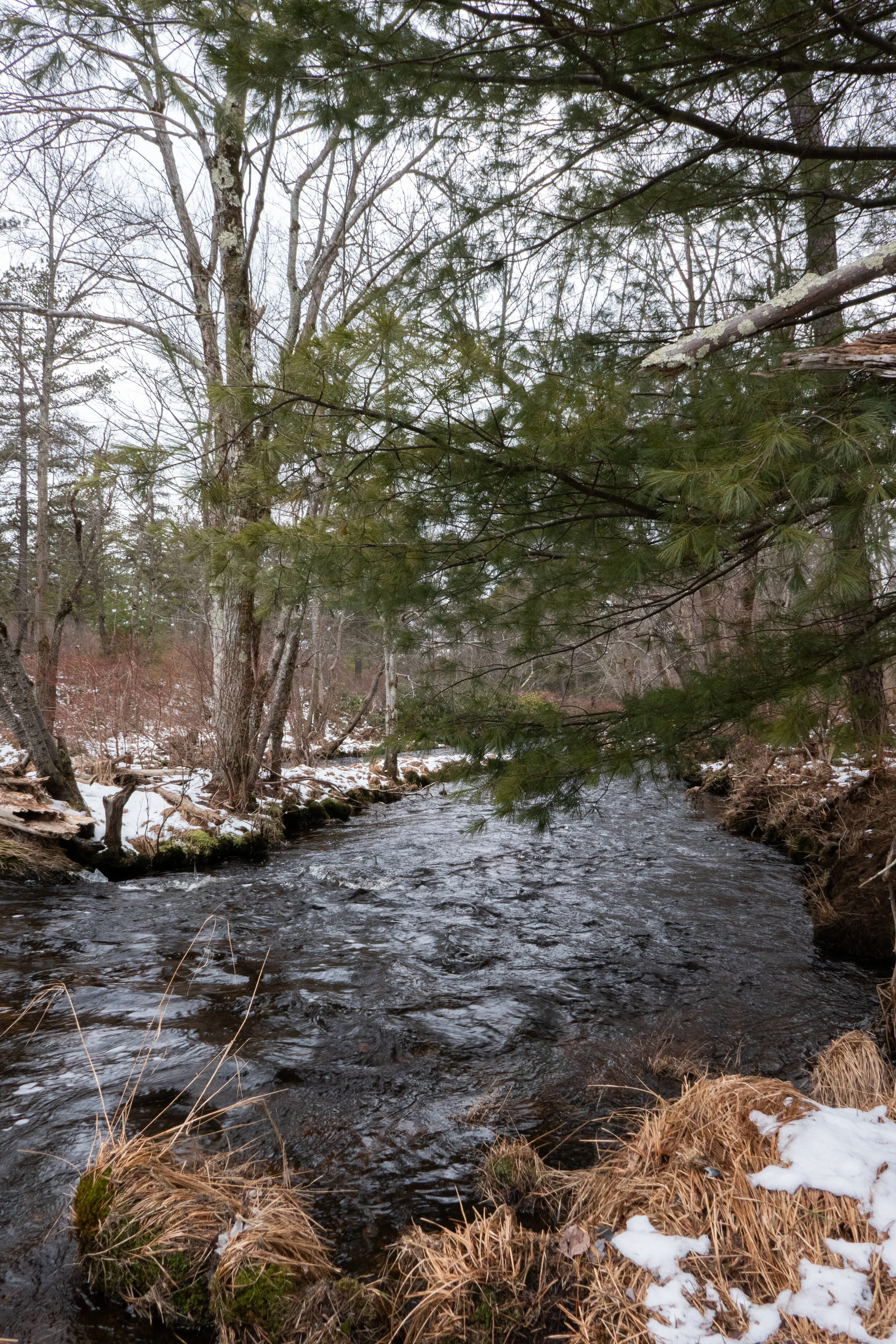
Beautiful day to hike Van Campens Glen on the New Jersey side of the Delaware Water Gap. Old Mine Road is now closed for the season, so we parked near Millbrook Village and walked in about a mile or so to the upper glen. Very pretty hike with waterfalls along the way. Falls were not frozen yet and the snow on the trail was still pretty soft since it hadn’t been packed down yet by other hikers. It was pretty cold out there today. Finally starting to feel more like winter.

Click “Read More” below for more photos from this hike.

Read More

Delaware Water Gap National Recreation Area: Sunfish Pond via Garvey Springs, Appalachian Trail, Douglas Trail, Rockcores Trail, 7 Miles RT, 1,345 +/-, April 24, 2021

Delaware Water Gap National Recreation Area:   Sunfish Pond via Garvey Springs, Appalachian Trail, Douglas Trail, Rockcores Trail, 7 Miles RT, 1,345 +/-, April 24, 2021

I’m really loving the Delaware Water Gap. There are so many trails here to link together to make the most out of your day. I admit it’s been hard for me to find the challenges I had hiking out west, but I’m finding that there are some places, such as the DWG, where you can get a little climbing in and also link up trails to add some decent mileage. Today we hiked to Sunfish Pond, a 44-acre glacial lake located on the Kittatinny Ridge. It lies within the Worthing State Forest on the New Jersey side of the DWG. We took the steepest, shortest route up to the lake via the Garvey Springs Trail which has a respectable gain of 1,058’ in 1.2 miles. There’s a more gradual ascent up the Douglas Trail from the same trailhead, which we planned to take on the return. Laurel Falls is also a nice feature to see that’s right at the start of the Douglas Trail if you go up that way. It was a somewhat chilly morning, but the sun was out and the ascent got us warmed up fast. The trail leads through a hardwood forest, and I saw some patches of bluets (wildflowers) along the path. As we hiked, two wild turkeys crossed the trail up ahead. The trail became more and more rocky as we got closer to the top of the ridge. We leveled off for a short distance and Sunfish Pond came into view. Next, we made our way onto the Appalachian trail which runs along the western and northern shores of the lake. The trail here was mostly rock hopping large rocks and boulders with a few breaks in between. There were some campsites on the way to sit on a log and enjoy views of the serene lake. There were also some alcoves to climb the rocks out onto the water to get a closer view. I very much enjoyed the scenery here and hiking along the shores. On the western side of the lake there’s a stone monument and a plaque marking Sunfish Pond as a registered natural landmark. We continued following the AT as it moved away from the lake on a wider path that was much less rocky. We reached a backpacker campsite where there were several campers. We then connected to the Douglas Trail and began to descend. When we reached the junction with the Rockcores Trail, we decided to take it northeast and then connect back to the Garvey Springs Trail. The Rockcores Trail passes Laurel Falls on the drainage from Sunfish Pond. There was a steep use trail that made a beeline along the drainage, but I wanted to hike further so we kept on following Rockcores until linking back up with Garvey Springs. It was now about 11:30 am and as we approached the trailhead, I could see that parking was already at maximum capacity. I looked over at Laurel Falls and there were some hikers trying to climb on top of the waterfall. One of them slipped and fell, but luckily was okay. It always makes me wonder what makes people do the things they do. As we made our way to the car, someone was already asking for our parking spot. We packed up our gear and headed out. I had a really nice time on this hike. It had a little bit of a challenge and the lake was a beautiful early morning destination.

Click on “Read More” below for more photos.

Read More

Wildlands Conservancy Maple Tract Preserve, 6 Miles RT, January 17, 2021

Wildlands Conservancy Maple Tract Preserve, 6 Miles RT, January 17, 2021

Pennsylvania has a good number of nature preserves to explore. Today we headed back up to the Pocono Mountains to the Maple Tract Preserve located near the 115 in Long Pond. The preserve is part of the Wildlands Conservancy Land Trust, and there are about 8 miles of hiking trails within its 680 acres. The area is made up of glacial wetlands, forest, mountain laurel and rhododendron which is so commonly found along the creekside trails of Pennsylvania. We started on the red trail heading southwest which took us past a frozen pond and along a carpet of soft pine needles. The day was mostly cloudy, which I’m learning is pretty typical of a Pennsylvania winter. As we continued we came up on another frozen pond. It seemed pretty solid so I got brave and ventured out onto it. It’s been years since I stood on a natural, frozen body of water. I remember ice skating on them as a kid many moons ago. We then continued along the trail through more forest of hemlock, spruce, larch, rhododendron and mountain laurel. I’m finally starting to be able to identify some of the trees and plants here on the east coast. It’s still very foreign to me since being out west all these years. As we hiked, we came upon some sections of trail that were on boardwalks to get across the wet marshes that were mostly frozen over. At about 2.5 miles we found Tunkhannock Creek. We walked down to the banks to get a better view and take some pictures. From here we followed the red trail west a bit further to enjoy more views of the creek before backtracking and heading north to explore the blue trail. I was really impressed with the scenery at this preserve. I loved the hilly ups and downs of the trail and the varying terrain. We hiked about 6 miles and didn’t see another person the entire day. This preserve is located close to the 80 and also the Pocono Raceway. I would imagine it might get a little noisy in the summer when the raceway is open. Nonetheless it is an incredibly beautiful area to explore.

Click Read More Below for More Photos

Read More

Lehigh Gorge State Park, Bald Mountain Loop, 9.8 Miles RT, December 29, 2020

Lehigh Gorge State Park, Bald Mountain Loop, 9.8 Miles RT, December 29, 2020

Today we spent the day exploring the Bald Mountain tract of Lehigh Gorge State Park near Rockport. Bald Mountain looked interesting to me because the access point isn’t located near any of the popular areas of the park. We found the turn off to the trailhead which wasn’t signed and if you blinked, you’d miss it. We parked the car and right away I heard the clack, clack, clack of the ravens above. I knew it was going to be a good hike. I have such a soft spot for these birds. They remind me of my hikes in California because they were always around when I was hiking in the higher elevations. We began the trek near Indian Run and crossed over the bridge which lead us into a beautiful forest of pitch pine and hemlock. The wide trail headed east with a steady incline up to the top of Penn Haven Mountain with the Lehigh River flanking us to the north, east and south. There was a junction here and signage for the Bald Mountain Loop. We followed the trail northeast in a clockwise direction being careful not to slip on the ice that was hidden under a thin layer of snow. It was about 30 degrees with about a 12 mph wind which made it seem much colder then it was. The loop dropped us down in elevation and eventually gave us a nice climb back up. It was a beautiful section of trail, although there was a lot of water we had to navigate around in addition to the ice. Once back at the top we found signage for the Vista Trail. The trail narrowed and lead us out to the rocky south facing cliff side of Bald Mountain. Here we had nice view down into the deep gorge and across to Scrub Mountain. We sat for a bit in the sun to warm up, but even in the sun it was still quite chilly. As we made our way back, the winds continued and we kept moving. The afternoon sunlight coming through the trees was absolutely gorgeous! I really enjoyed this hike. It was such a beautiful day despite the wind and I will definitely be back to explore more of this beautiful area.

Read More

Jacobsburg State Park, October 19, 2020

Jacobsburg State Park, October 19, 2020

The colors are really starting to show in Pennsylvania. Today I went to Jacobsburg State Park and walked from Henrys Woods over to the the National Historic District Site to check out the Henry Homestead/PA Longrifle Museum. I also took some time today to check out the birding area across Belfast Road near Henrys Forge. I didn’t have my birding camera with me, but I was able to get some decent photos of a tufted titmouse, black capped chickadee and a nuthatch. The day was cloudy and a little on the warm side for October. Now is the best time to enjoy the fall color before the leaves fall. It’s a beautiful time of year here on the east coast.

Read More

Hickory Run State Park, Fourth Run Trail, Stage Trail, Hickory Run Cemetery, Sand Spring Trail, Hickory Run Trail, 8.5 miles RT, October 9, 2020

Hickory Run State Park, Fourth Run Trail, Stage Trail, Hickory Run Cemetery, Sand Spring Trail, Hickory Run Trail, 8.5 miles RT, October 9, 2020

It was a perfect day to explore more of Hickory Run State Park. This is a beautiful park with so much history. We started the day off by hiking past the Manor House, the former dwelling of Samuel Gould. In the 1800s, the Goulds were the primary landholders of the region and owned many sawmills here. We past the Manor House and headed onto the Fourth Run Trail. This is the longest trail in the park, but today we diverted onto the Stage Trail which was once a stagecoach road that went from Bethlehem to Wilkes-Barre. The Stage trail took us to to the Saylorsville Dam where we followed the winding paved road across the ford and then back to the parking area. It was a lovely walk and I enjoyed meandering along enjoying the fall foliage. Once back at the trailhead I wanted to check out the old Hickory Run Cemetery. This small cemetery in the woods sits on top of a hill and most people aren't even aware that it's here. The cemetery is a place of rest for the unfortunate folks who lost their lives in a flood that devastated the community of Hickory Run on October 30, 1849. The story goes that the woods are haunted by Elizabeth Gould who lost her life on that tragic night when a dam gave way. "Lizzie" was just 11 years old. She was the daughter of Isaac and Susan Gould who were early settlers of the area. The family lived in a small cabin built along side the stream. When the dam broke the cabin was lifted up off its foundation, carried downstream and submerged in the rushing waters. When the water passed Susan was able to break a hole in the roof to get all of her children out except for one... Lizzie. When rescuers arrived, Susan claimed she heard Lizzie calling out, but no one else could hear the cries. Lizzie was later found deceased beneath a pile of rubble near the house. In the weeks ahead, Lizzie's brother Winefield would also pass away due to exposure from the night of the flood. Winefiled is also buried here next to Lizzie. The Legend goes that Lizzie is not at rest and park visitors have reported seeing her ghost roaming through the park or playing along Hickory Run. Others claim to still hear her cries. I paid my respects and headed back to the trailhead. It was such a lovely day and I wasn’t ready to leave just yet. I did one last trail which was a short loop on the Sand Springs Trail and returned back via the Hickory Run Trail. It was another great day to be outside enjoying nature and the fresh mountain air.

Read More

Jacobsburg State Park, Sobers Run, Red/Green Blazed Trail, July 19, 2020

Jacobsburg State Park, Sobers Run, Red/Green Blazed Trail, July 19, 2020

Today I went back to Jacobsburg State Park. I think this is going to be my “go to” place whenever I don’t want to do a long hike or drive too far. The temperatures were supposed to be in the mid 90s today, and I wanted to be back home in the a/c before that happened. I parked in the parking area just before the bridge over Bushkill Creek on Jacobsburg Road. Since the bridge was closed I made my way on foot to enter the west side of the park at the locked gate heading south across State Park Road. From there, I turned west and followed along Sobers Run on the Red/Green blazed trail. It was still fairly early and it was a pleasant walk in the shade along the creek. I had no real plan to do any mileage today, so I took my time and enjoyed the scenery. I could hear the song of a Wood Thrush and also the locusts chattering high up in the trees. I took the connector trail (yellow/green blazed) to make a loop. I crossed back over Jacobsburg Road and began to follow the trail South. According to the map, the trail should have crossed over Bushkill Creek and taken me back to the parking area. Unfortunately, I think the trail has become overgrown or washed away because I didn’t see anything that resembled a trail on the other side of the creek. I backtracked and walked a short ways on State Park Road to the car. Once back at the parking area, I took a short side trip down to the creek on the Jacobsburg Trail, but even from this direction, I didn’t see a trail on the other side of the creek. Maybe one day when it’s a little cooler I’ll do a bit more exploring off trail to see what I find.

Read More

Appalachian Trail, Fox Gap to Wolf Rocks, 4.8 Miles RT, July 12, 2020

Appalachian Trail, Fox Gap to Wolf Rocks, 4.8 Miles RT, July 12, 2020

Today I wanted to hike some of the Appalachian Trail. I figured it would be a nice way to experience more of the terrain and try out the rock scrambles because that seems to be a common thing here. After I got on the road, I realized that I’d forgotten my camera. Ugh. So all of my photos were taken with my mobile phone.

I started this hike at the Fox Gap trailhead and did the Wolf Rocks Loop. The hike starts out mostly flat, but the terrain is rocky in most parts so you have to watch your step or you’ll stub your toe like I did about a million times.

The trail meanders through beautiful groves of fern and it looks like something out of a fairytale at times. There isn’t much elevation to gain until you reach the boulders where you’ll scramble your way up to the ridge to the overlook. Once on the ridge you’ll boulder hop your way across. You can pick any of the outcroppings to climb up and check out the views. I could see a little above the tree line and make out some of the area’s high points, one of which is called Pimple Hill, a summit in Monroe County that stands at 2,197’. What a funny name. We sat for a bit on the boulders and enjoyed the cool morning breeze before heading back. It was a fun early morning hike and we saw only a few people on this trail. I would like to come back to this trailhead and next time hike it northbound from Fox Gap towards the Delaware Watergap.

Read More

Hickory Run State Park, Hawk Falls and Shades of Death Trail, Pocono Mountains, July 2, 2020

Hickory Run State Park, Hawk Falls and Shades of Death Trail, Pocono Mountains, July 2, 2020

Today I ventured up to the Pocono Mountains to Hickory Run State Park. I was here years ago, but barely remember it. Hickory Run State Park sits on 15,990 acres in Carbon County and there are 41 miles of hiking trails. It’s also home to Boulder Field, a National Natural Landmark. I parked at the turn out off the 534, east of the turnpike overpass. I picked up a park map at the kiosk and examined the area. I was near Hawk Falls which is just a short .6 miles. I decided to make that my first stop. The trail starts off through thickets of tall rhododendrons and descends on an easy grade to Hawk Run. I’m learning that streams here are referred to as a “run”. I crossed over a footbridge and came to an intersection where you can climb up the steps leading to the Orchard Trail or carry on to Hawk Falls. I noticed that the trails are very well marked and have paint blazes on the trees to guide you. I made my way over to the 25 foot waterfall which was flowing nicely. I wondered if these waterfalls ever get down to a trickle as they do in Southern California where we didn’t get much rain. After snapping some photos, I made my way back to the car. From here I drove over to Sand Spring Lake to use the facilities (Flushable toilets and soap in the restrooms! Score!). There were some families with their kids swimming in the lake and the lake was loaded with bright green bullfrogs! I ran back to my car and pulled out the camera for some pictures. After being way more excited over frogs then a person should be, I pulled out the map again to decided on my next trail. I found a one mile trail called Shades of Death. This trail was noted as being the most difficult hiking in the park. I am not sure what is considered difficult here on the east coast, so of course I wanted to find out. The reality is that this trail was mostly full of rough terrain; tree roots, mud, rocks, but nothing overly terrifying to warrant the name Shades of Death. I later learned after reading the park brochure, that the trail was named by the colonists for its dark forests, swamps and rocky soil. So don’t let this name discourage you, I saw many families with small children hiking here. The muddy, rocky trail follows along Sand Spring run and takes you through more rhododendrons just like the Hawk Falls trail. There are notable rock formations and at one point there’s a narrow slot with steps cut into stone that you have to climb up. Along my way I saw many small waterfalls. I was not at a loss for lush greenery. There were a couple of dams and the remains of logging mills which I understand date back to the early 1800s. This hike does not gain much elevation, but it was a very nice hike through the shady forest along the stream. The trail ended in a grassy meadow leading up to the visitors center. I turned around here and returned the way I came. It was a lovely morning and a good introduction of what’s to come on the Pennsylvania trails.

Read More

Monocacy Way Trail, Heritage Trail Section 26, Illick's Mill to Schoenersville Road, 2 Mile Nature Walk Out & Back, June 26, 2020

Monocacy Way Trail, Heritage Trail Section 26, Illick's Mill to Schoenersville Road, 2 Mile Nature Walk Out & Back, June 26, 2020

It had been a long couple of months locked away in a city apartment with the Covid pandemic looming over the world. On top of everything I was preparing for a move to eastern Pennsylvania. I was able to get in a few short, local hikes in Griffith Park before I left California, but no wilderness or desert hiking for months. Being away from the backcountry took a toll on my mental and physical well being. It broke my heart to cancel all my plans in Joshua Tree, Idyllwild and the Eastern Sierra, and I was not able to bid what I loved most about California, which were its high-elevation trails, wilderness and desert backcountry a proper farewell. But now I have arrived on the east coast and as the world is beginning to return to what people are referring to as “the new normal”, I am finally starting to feel more like myself again.

Tonight my husband and I began our journey to exploring nature on the east coast. Even though I grew up here, seeing Pennsylvania as an adult is seeing it with a new perspective. We started off with a short walk on a nature trail not far from our home called the Monocacy Way Trail. I used to walk this trail when I lived here over 20 years ago. It has now become part of Historic Bethlehem’s 10.9 mile long Heritage Trail which was designed to give Bethlehem city explorers a taste of Bethlehem history from its Moravian roots to its industrial heyday of the Bethlehem Steel.

We started at the trailhead at Illick’s Mill* across from Monocacy Park. The trail begins as a paved walkway but quickly turns into a proper dirt track. The first thing I noticed is how much greener everything is compared to Southern California. It’s quite a different color pallet. As I walked the trail became a symphony of birdsong; Gray Catbirds, Wood thrush, Carolina Wren and American Robins. There are many use trails along the path if you want to veer off the main trail and walk along Monocacy Creek. Wildflowers are plentiful here with Forget-me-nots, Honeysuckle, Day Lily, Milkweed and Aster. The trail winds along the creek and eventually crosses over the train tracks. I then passed by an open grassy meadow full of thistle and grazing bunnies. At about .8 miles I arrived at Schoenersville Road. If you cross Schoenersville Road, you will continue on past the Burnside Plantation. It was already dark by this time, so we headed back. As we did the fireflies started to light up the trail, just as I remembered from when I was a kid. This is a nice little nature walk bursting with wildlife such as deer, rabbits, box turtles, birds, etc. Great for a quick dose of nature any time of day.

*A little history about Illick’s Mill: The grist mill was built on the Monocacy Creek by John Peter and his son Joseph in 1856. At that time it operated as a flour and feed company. The Mill changed hands many times over the years opening and closing its doors. In 1935, the Bethlehem Water Authority took over the Mill and the Civilian Conservation Corps and the Works Progress Administration constructed Monocacy Park. Then in 1965 the Mill was restored and reopened as a music venue appealing to Lehigh Valley teenagers. It closed its doors again in 1973. Over the years, the Mill continued to change ownership. But what I remember most about Illick’s Mill were the years it hosted a haunted house attraction run by the Bethlehem Jaycees in the 80s and 90s. In the year 2005, the Mill was added to the National Register of Historic Places. As of today the Mill is home to the Appalachian Mountain Club’s Mid-Atlantic Conservation Office and is available for meetings and events through the City of Bethlehem.

Read More