trail

Mariton Wildlife Sanctuary, Murder Hornet Look-a-like and Little Wood Satyrs, May 29, 2022

Mariton Wildlife Sanctuary, Murder Hornet Look-a-like and Little Wood Satyrs, May 29, 2022

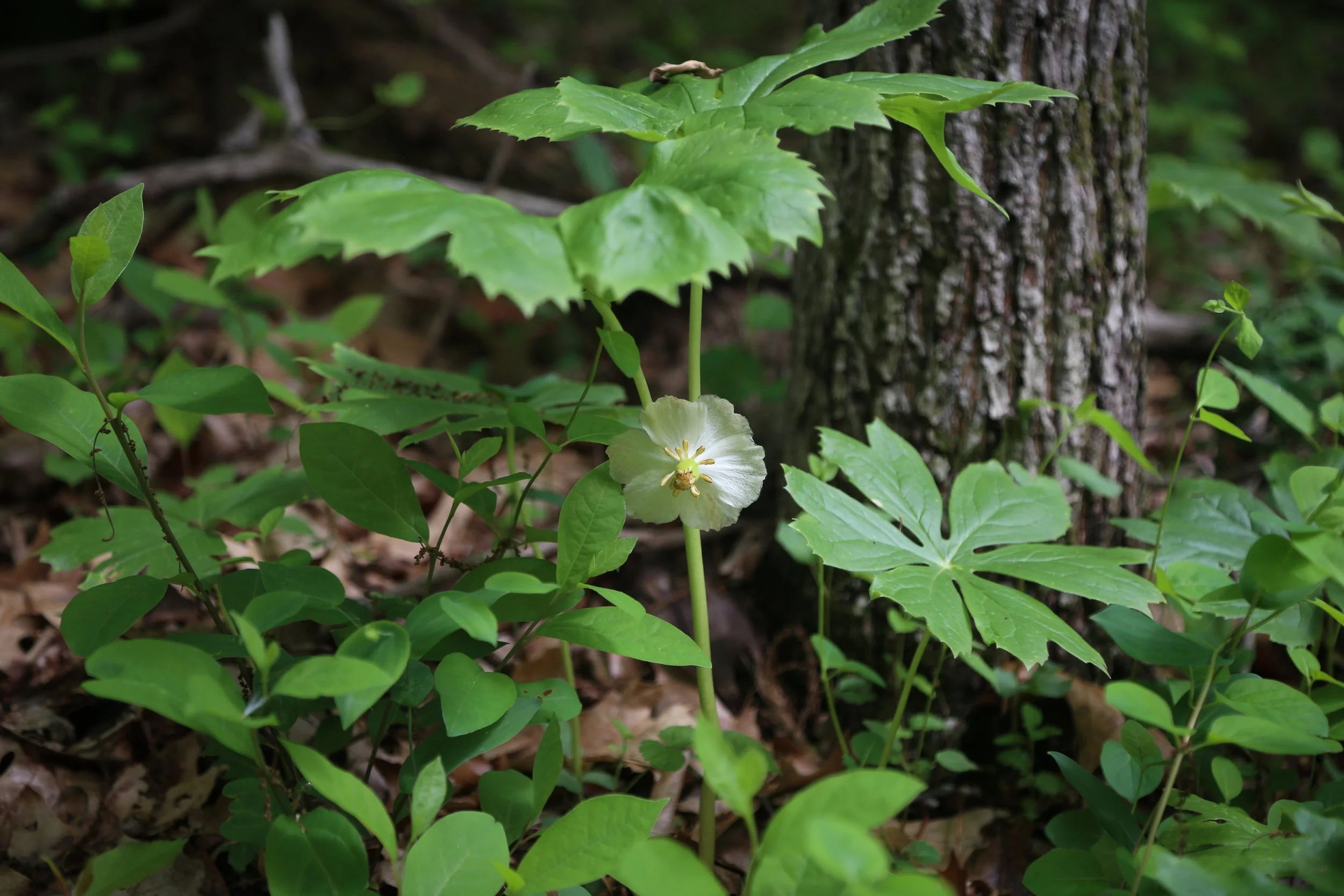
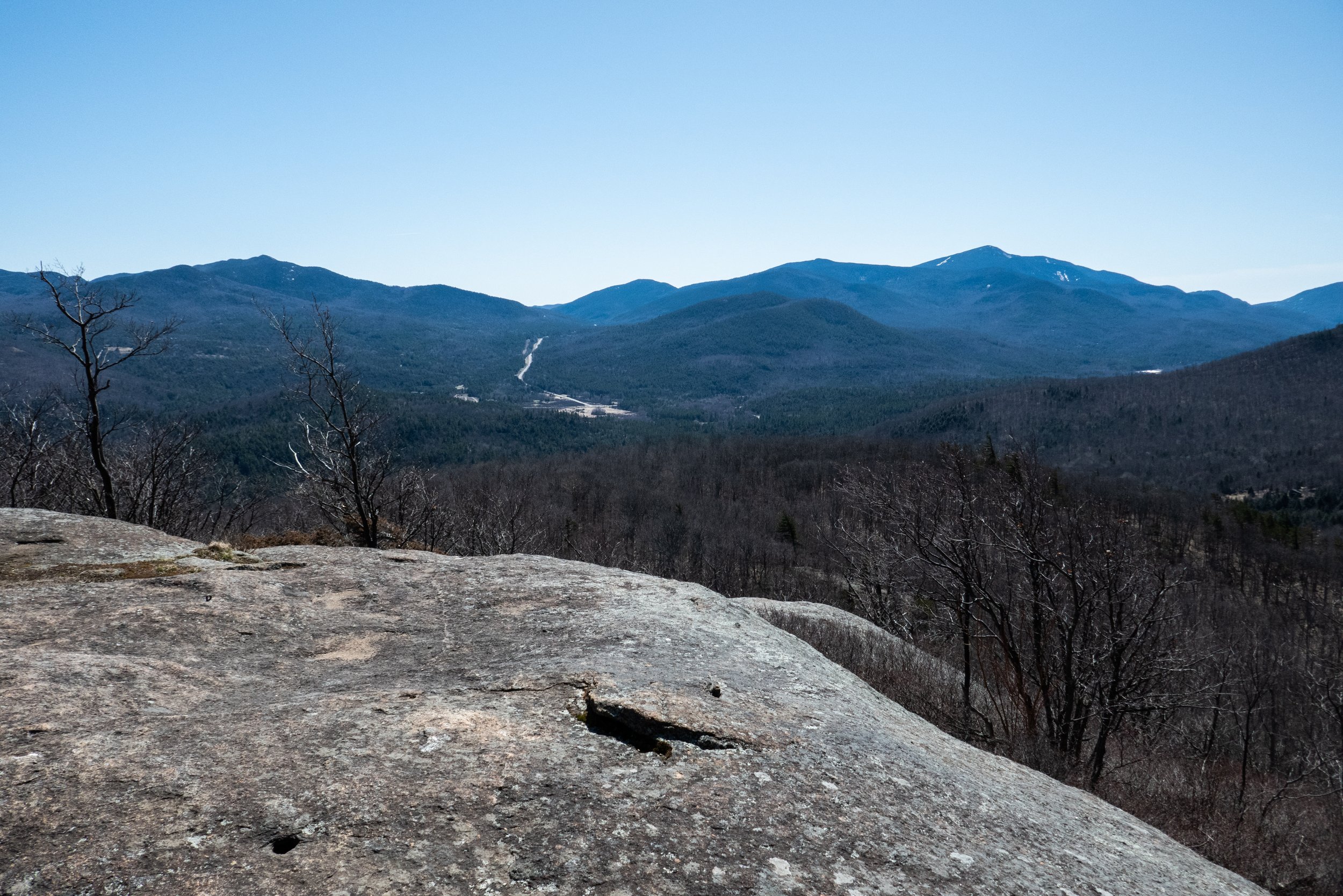
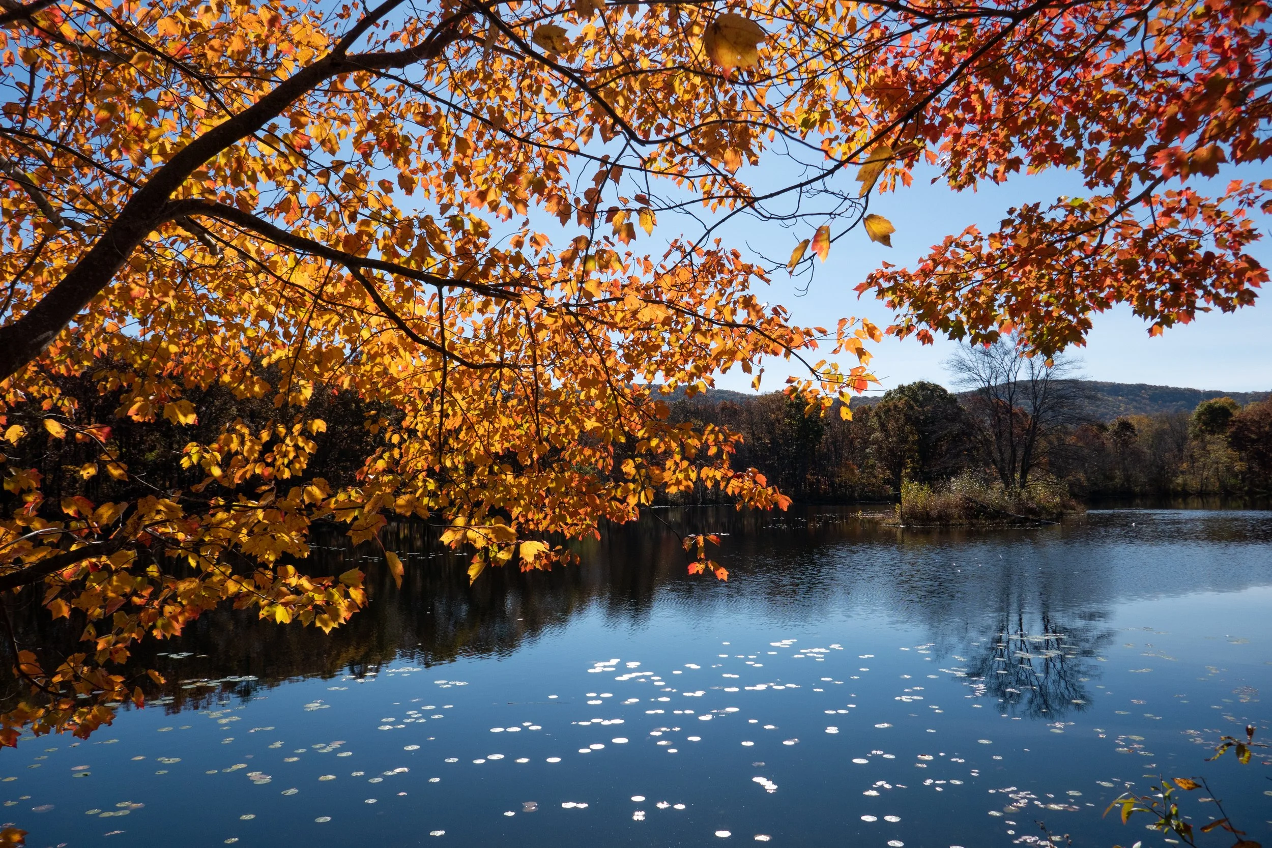
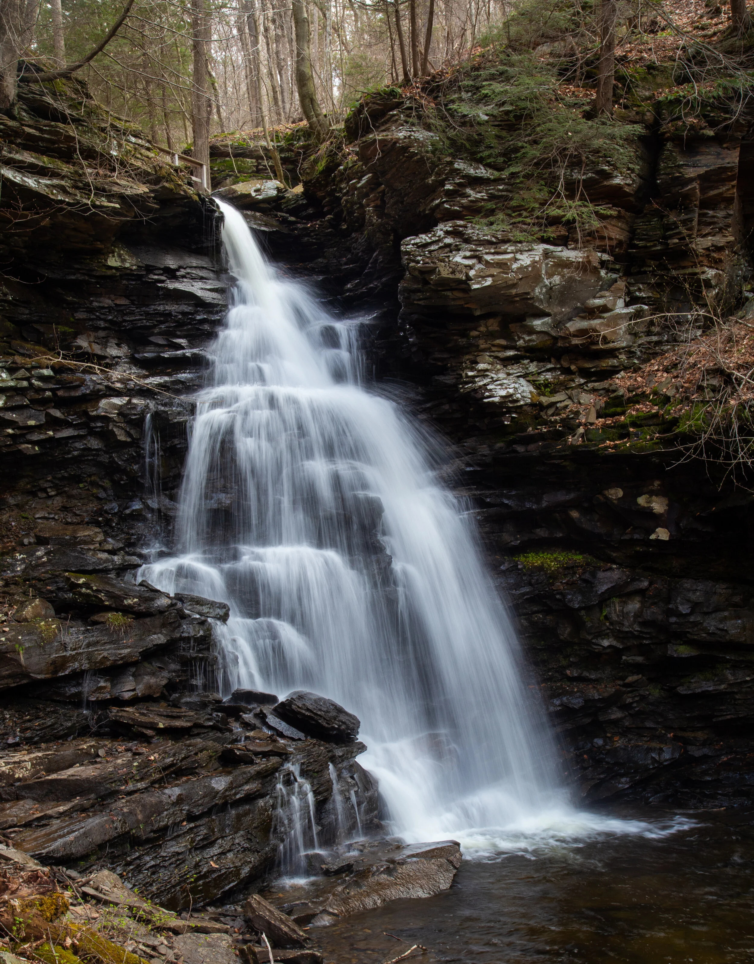
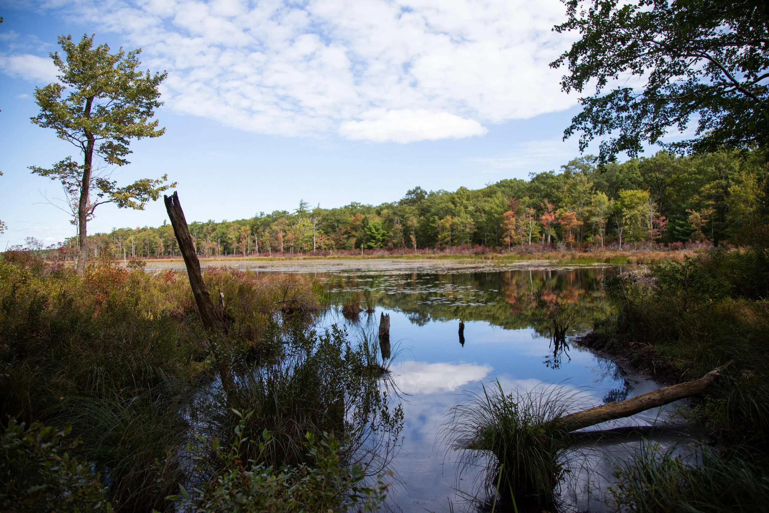
I spent another morning walking the wooded paths and grassy meadows at Mariton Wildlife Sanctuary. Today the white dame’s rocket seemed to be the dominant wildflower towering above the tall grasses at the start of the main trail. I noticed so many different kinds of mushrooms and am embarrassed to say I am not at all up to speed on identifying all the east coast fungi - there’s a lot! As I walked, I began to hear a loud buzzing sound coming from a large crack in the bark of a tree. It didn’t know what it was at the time, but it was some type of very LARGE hornet. When I first made an ID, I thought it was the invasive Asian Giant Hornet, aka “Murder Hornet”. But upon further research, I realized it was actually a European Hornet and not its menacing look-a-like which is a threat to the honey bee. I continued through the woods observing all the ferns and fungi. I crossed paths with a coyote who slipped stealthy into the woods on a deer path as I headed up the hill towards the meadow. In the meadow, I saw a fluttering tiny earthy brown wings. Some were Dusky Wing butterflies and the others were Little Wood Satyr. It was an easy ID to make because in the meadow I met another butterfly enthusiast and he told me what they were. The Little Wood Satyr flutters low to the ground in late May and Early June announcing the beginning of summer. The Wood Satyr has two prominent eye spots on its forewing and one (or two if it’s a female) on its hindwing. Sometimes there’s a smaller spot near the body. In the ventral view, there are two distinct lines across both wings and two eyespots on the forewing and two on the hindwing with several smaller spots. Are you confused? I know I am. But that’s what makes butterfly identification so fun (and frustrating)! After spending time in the meadow, I was going to start heading back via the Turnpike Trail, but decided head back into the woods and hike down (and then back up) the steep hillside on the North Fox Trail. The sun was starting to peak through the trees and the bugs were getting, well, buggier, so I perfumed myself in some all natural bug repellent attempting to make myself less irresistible to the gnats. I spent a good long while at the sanctuary this morning and had a lovely time taking in the fresh air, enjoying the accompany sounds of birds and the flutter of butterfly wings.

Click “Read More” below for more photos from the day.

Read More

Mariton Wildlife Sanctuary Mayapple & More Wildflowers, May 20, 2022

Mariton Wildlife Sanctuary Mayapple & More Wildflowers, May 20, 2022

I took an early morning walk around Mariton Wildlife Sanctuary this morning to see what wildflowers I could find. Right at the entrance to the Main Trail, showy dame’s rocket was bursting with with its soft, lavender and white flowers. As I walked along, I spotted jack-in-the-pulpit blooming inconspicuously long the woodsy trail. I noted wild geranium, fleabane, golden ragweed, dwarf dandelion, star of Bethlehem, ox eye daisy, and anise root. (All of this was ID’s through my iNaturalist app.) I’m still learning the east coast flora and I’m sure I will be learning for a long time. But the highlight of my walk today was the blooming Mayapple. I’ve seen these attractive umbrella like plants in many different locations in the area, and as I was hiking today, I caught a large patch of them in bloom. Mayapple is a native woodland plant that grows in colonies in deciduous forests, shady fields and along riverbanks. The plant is highly toxic except for fruit, but I personally am not that brave to try it. Another favorite of mine are the tulip trees. This time of year you can find the flowers that have dropped from the trees above along the forest floor. The flowers are a delicate shade of pale yellow outlined in bright orange. They’re usually high above in the trees and are easily missed until they fall from the trees.

Click “Read More” below for more photos from the day.

Read More

Adirondack Park, Marcy Dam via Van Hovenberg Trail, 5 miles RT, 500' +/-, April 18, 2022

Adirondack Park, Marcy Dam via Van Hovenberg Trail, 5 miles RT, 500' +/-, April 18, 2022

After our morning hike up Owl’s Head, we headed over to Adirondak Loj for a nice, mellow hike out to Marcy Dam via the Van Hovenberg Trail. We’ve done this section of trail several times before and being that it was shoulder season, we thought it was best to stay below 2,500’ to avoid soft melting snow and the ice still holding on at higher elevations. The hike to Marcy Dam is pleasant with much of it being easy, rolling trail. It was a perfectly beautiful day and upon arriving at the dam, we chatted with some hikers who’d just come down from Colden. They confirmed it was mostly still ice up there, which was not a surprise. We took our time and hung out at the dam soaking in more sunshine before heading back. We stopped at the Big Slide restaurant for lunch in Lake Placid before heading back to the hotel and checking out to drive back. We’d initially planned to stay another night, but a spring snow storm was predicted to roll in overnight and by this time, the weather service was pretty certain it would bring with it about 12 inches of snow. We checked out early and drove back home to be on the safe side and avoid unpredictable driving conditions the next morning. It was another wonderful trip to the ADK which has become my happy place since we are currently here on the east coast.

Click Read More below for more photos.

Read More

Adirondack Park, Owl's Head Trail, 1 Mile RT, 500' +/-, April 18, 2022

Adirondack Park, Owl's Head Trail, 1 Mile RT, 500' +/-, April 18, 2022

The Owl’s Head Trail is a short but steep 1 mile ascent requiring some moderate scrambling and is considered “Adirondack easy”. For a minimal amount of work, you’ll be rewarded with fantastic views of Giant, Hurricane, Lower Wolf Jaw, Porter, Cascade, Pitchoff and Jay.

The trail is on private land and is only open on weekdays. It’s located just off the 73 near Keene (you’ll actually see the summit as you descend from Lower Cascade Lake along the 73). Be mindful of parking (we parked along the 73 just to be safe) and walk down the dirt road to the sign for the unmarked trail. As you begin, the trail makes an immediate ascent. You’ll see views of Pitchoff, Cascade and Porter as you climb. The final pitch is a moderate scramble that snakes around the edge. At the top and you’ll be rewarded with fine views all around. From the main ledge we could make out Giant, Lower Wolf Jaw, Hurricane, Porter, Cascade, Pitchoff and Jay. We sprawled out on the large flat boulders and soaked in the sun before heading back down the way we came. Once back at the trailhead, we still had plenty of time in our day to head out and hike some other trails.

Click Read More below for more photos.

Read More

Adirondack Park, Cat & Thomas Mountain Preserve, Cat Mountain, 7 Miles RT, 1,342 +/-, April 17, 2022

Adirondack Park, Cat & Thomas Mountain Preserve, Cat Mountain, 7 Miles RT, 1,342 +/-, April 17, 2022

Beautiful day in the Adirondacks hiking to the top of Cat Mountain. We started the hike from the trailhead off Valley Woods Road, followed the blue trail and then onto the yellow trail to the summit which gave us spectacular views overlooking Lake George. There is nothing technical on this route and no rock scrambling as there typically is with much of the Adirondacks. Since it’s shoulder season, I was expecting more mud, but it was minimal. This was the perfect hike to do after a 4 hour drive which gave us enough time to head up to Lake Placid afterwards and enjoy a nice dinner before settling in early and heading out to do more hiking in the High Peaks region the next day.

Click Read More below for more photos.

Read More

Mt. Marcy via Van Hoevenberg Trail, Adirondack Mountains, High Peaks Region, 16 Miles RT, 3,734' +/-, 5,344' Max Elevation, September 20, 2021

Mt. Marcy via Van Hoevenberg Trail, Adirondack Mountains, High Peaks Region, 16 Miles RT, 3,734' +/-, 5,344' Max Elevation, September 20, 2021

“The love of wilderness is more than a hunger for what is always beyond reach; it is also an expression of loyalty to the earth ... the only home we shall ever know, the only paradise we ever need -- if only we had the eyes to see.” -- Edward Abbey (American writer and naturalist)

After over a year we were finally back in the mountains. Leaving California with its limitless peaks and vast wilderness and relocating to an area of Northeastern Pennsylvania which lacks high-elevation mountains was a very hard adjustment for me. We decided to drive to upstate New York and hike the High Peaks Region in the Adirondack Mountains. We would set up basecamp in Lake Placid, sleep one night and the next morning hike from Adirondack Loj on the Van Hoevenberg Trail to the top of Mt. Marcy, the highest peak in New York state. The journey would be an arduous climb of over 16 miles, most of which required bouldering, rock scrambling and climbing up large and oftentimes slippery slabs of rock. It had been over a year since I’d done any hiking with much elevation, but I craved the challenge and the rewards that come with reaching the summit after putting in a hard day’s work on the trail.

We arrived at Adirondack Loj at 5:30 am, about an hour before sunrise. We donned our headlamps and headed out on the Van Hoevenberg trail towards Marcy Dam. The trail was mostly easy going for the first two miles. We moved quickly to the first junction, and as we reached the dam the sun was starting to come up. We took a moment to enjoy the views of Mt. Colden, Avalanche Mountain and Wright Peak, but we couldn’t linger knowing we had a lot more miles to cover. We crossed the bridge over Marcy Brook and began to ascend on a moderate grade as we hiked along Phelps Brook. We passed the junction to Phelps Mountain and from here we began a steep climb up the trail which was covered in nothing but boulders. After the first steep pitch, the trail crossed Marcy Brook and briefly leveled off for a short distance as we passed the junction to Indian Falls. At about 5 miles in we began another steep ascent which seemed like endless scrambling and climbing. The terrain was slippery in sections and required a lot of mental concentration and careful foot placement. As we reached the top of the ridge, I began to see hints of blue sky. I knew we were getting closer. Now, the trail eased slightly except for the mud and the obstacle course of wooden planks we had to negotiate, and we began to get our first views of Mt. Marcy. We hiked through thick scrub and scrambled up more barefaced boulders before reaching the Alpine Zone. We were starting to get above the treeline, and I was beginning to feel anxious as the climbing got even harder and steeper. Higher and higher we ascended, scrambling the bare rock and slabs. We followed the cairns and the yellow paint blazes guiding the way straight up. And then, finally, we were there… standing on the summit of Mt. Marcy, the highest peak in New York State at 5,344 feet. It was an amazing feeling! One I haven’t felt since leaving the mountains of California. We took in the views and fueled up on snacks, but the moment could not last because we knew we had miles of strenuous descent before we could finally relax and celebrate. The climb back down the mountain was even more taxing. We were tired both physically and mentally, and the amount of concentration it took to descend the boulders and rocks was even more laborious then it was going up. It was about 6:30 pm when we finally reached the Loj. We were tired, sore and even a little delirious, but it was an incredible day and one which we will not soon forget.

Hiking Mt. Marcy was both a physical and mental challenge. It pushed us to our limits. There comes a point in hikes like these when you know you’re stretching yourself, but you just can’t turn back because you don’t want to waste all the effort you’ve already put in so you just keep pushing. The feeling of reaching a hard earned summit is a feeling that’s difficult to describe. It becomes an addiction. It’s a challenge not everyone will have the privilege of experiencing. It’s a journey that makes you stronger and brings you closer to those who are on that same journey. And although the moment of reaching the summit may be fleeting compared to the hours you put in to get there, it will always be worth it.

Click on “Read More Below for More Photos”

Read More

Mountain Laurel at Bear Creek Preserve, June 12, 2021

Mountain Laurel at Bear Creek Preserve, June 12, 2021

We went back to Bear Creek Preserve today. Last time we were here we were snowshoeing and it was 19 degrees. Looks quite a bit different in the spring. Everything in Pennsylvania is a lush green now and the mountains are filled with blooming Mountain Laurel. We hiked from the main parking area off Rabbit Run following the red trail. It took us down a muddy, rocky service road that was under construction. As we reached a clearing to a power line, I saw a black bear meandering around the open field. We were far enough away to make our presence known by making noise and putting the bear whistle to use. As we did, the bear slowly headed away from our direction and disappeared into the field. We crossed the clearing and headed back into the woods. We then connected to the gray trail where we used the suspension bridge to cross over shades creek. We followed the trail passing in and out of rhododendron tunnels along side the creek enjoying its many cascades. We found the use trail that took us to a very small waterfall just off the main trail and stopped to enjoy the scenery. As we left the creekside, the trail took us back into the hardwoods and a blooming sea of Mountain Laurel. The day was cloudy, but it was beautiful nonetheless and a great day for a hike. I enjoyed seeing Bear Creek Preserve during the spring.

Click on “Read More” below for more photos.

Read More

Ricketts Glen State Park, Falls Trail Loop, 9.6 Miles RT, 1,122' +/-, April 19, 2021

Ricketts Glen State Park, Falls Trail Loop, 9.6 Miles RT, 1,122' +/-, April 19, 2021

Ricketts Glen State park is home to the Glens Natural Area, a National Natural Landmark in Pennsylvania. The Falls Trail system that we hiked today consists of 21 incredible waterfalls that flow between steep, narrow valleys known as glens. The tallest waterfall on the circuit, Ganoga, is 94’ impressive feet. Ricketts Glen State Park is one of the most scenic hikes in Pennsylvania. It’s named after Colonel R. Bruce Ricketts who bought land in northeastern Pennsylvania for timbering. When fishermen exploring Kitchen Creek found that there were waterfalls flowing through the deep gorges, Colonel Ricketts spared the land. He hired six men to build the trail system in what is now known as the Glens Natural Area and the project was completed in just four years. Each of the 21 waterfalls has a name. Colonel Ricketts named them after American Indian tribes and also his friends and family.

We began our hike at the trailhead off the 118. From here we had a pleasant walk along Kitchen Creek on a flat path before reaching a junction for the lower and upper trails. The lower trail was marked as difficult, and the upper trail was marked as moderate. Of course we opted for the lower, more difficult path. Both trails meet back up again at waters meet before the beginning of the Falls Trail Loop. The lower trail hugged the creekside going up and down muddy, slippery terrain. It wasn’t particularly difficult, but we had to watch our footing. Soon, we started to see the waterfalls. There are three falls before you reach waters meet: Murray Reynolds, 16’, Sheldon Reynolds, 36’ and Harrison Wright, 27’. All three were absolutely beautiful. When we reached the junction at waters meet, we opted to hike up the Glen Lehigh side first. There are eight waterfalls on this side ranging from 15 to 60 feet. We made our way up the steep rocky gorge crossing over bridges that took us right up and over the top of the falls. It was a spectacular trail which varied between flat, rocky sections along the creek and steep climbs up rocky steps. We stopped at each fall to take photos and spent time enjoying the uniqueness of each waterfall. Once we completed the traverse up the Glen Leigh side, we got on the Highland Trail heading west. The Highland trail would take us to the Ganoga Glen side to see the next set of falls. The Highland Trail was mostly flat, quiet and very peaceful. It took us through a beautiful forest of pine and along the trail I noticed a wooden bench for sitting and taking in the serenity of the forest. About half way through this section of trail, we reached some giant rock formations and passed through two large boulders called the Midway Crevasse. Soon, I began to hear the sound of rushing water again which meant we were coming up on the next set of falls. We crossed over a bridge and were soon making our way down the gorge on the Ganoga Glen side. The rocky steps were muddy and slippery. We had to take extra care coming down the steep sections, as I think it’s harder coming down then it is going up because it’s easier to slip. We passed by three lovely falls before reaching Ganoga, the 94’ waterfall. It was absolutely stunning. As we continued down the Ganoga Glen side, we began to see more people coming out to enjoy the trail. At this point I sort of lost track of which waterfall we were passing and I was spending more time looking at the smaller details like the Trillium blooming alongside the trail, the green fern and bright moss growing above the gorge. There is so much to take in on this trail besides the just waterfalls. When we reached the junction for the upper and lower trails, we decided to take the upper trail for a change in scenery. The trail was an easy flat path that travelled high above Kitchen Creek. Along this trail I saw more blooming Trillium. By now it was early afternoon and the sun had started to come out. The weather up until this point had been cloudy and we even had a light sprinkle of rain. When we reached the final mile that would take us back to the trailhead, I noticed some blooming Trout Lily. It was a wonderful day and Ricketts Glen Natural Area is a really special place.

Click on “Read More” below for more photos.

Read More

Sunrise on Mt. Wismer and an afternoon at Stony Run in the Delaware State Forest, Vernal Equinox, March 20, 2021

Sunrise on Mt. Wismer and an afternoon at Stony Run in the Delaware State Forest, Vernal Equinox, March 20, 2021

Today was the vernal equinox, a time when day and night are in equal balance. To honor the official beginning of spring, we set out for a sunrise hike to the top of Mt. Wismer in Monroe County. We parked at the trailhead just off the 447 to take the blue blazed trail. This is actually the easy route. There’s a more challenging hike from the trailhead off Gravel Road. Today we were interested in doing photography and catching the light of the sunrise. It was a crisp, cold morning and as the sun began to rise up over the mountain, we made our way down a wide open path which led to the blue blazed trail. The trail heading up had patches of hard snow and ice. As we hiked along the trail became a single track and I noticed large moss covered boulders above us dripping with melting ice. Spring surely is here. The trail was rocky and wet with leaves as it gently ascended through large rhododendrons and hemlock trees. We followed along the escarpment of the mountain, and as it curved to the east we were almost blinded by the blazing sun coming up over the horizon. At the top we were rewarded with wide open views. From here we could see Gravel Pond, Camelback Mountain and even more impressive, the obvious gap of the Delaware Water Gap. The light was absolutely brilliant. We meandered around the overlook enjoying the open landscape before heading north on an unmarked trail. We hiked along the path through hardwoods, and then found ourselves in a beautiful grove of hemlock. The sunshine shimmered through the towering trees, and I heard the call of a tufted titmouse. Soon we were at the close of the loop and back at the trailhead. It was still very early and neither of us were ready to head home, so we opted to take another hike. We decided to venture into the Delaware State Forest to Stony Run. We parked the car at an unmarked trailhead off Snow Hill Road and headed onto a wide grassy trail. The trail began to descend southward and became more rocky. As we hiked I spotted two white-tailed deer off in the distance who quickly disappeared into the woods. Soon the trees began to thicken with evergreens and I could hear the sound of fast moving water. A wooden bridge came into view and we were now at Stony Run. From the bridge I watched the run as it tumbled and danced over moss-covered rocks. We explored the area for a bit then found a comfy spot to settle in, have a snack and enjoy the scenery. After our little break, we started to make our way to the trailhead. We took a short off-trail adventure over to a large rock outcropping with some nice views. Three large black vultures sored high above us in the sky. By now the day had warmed up to about 55 degrees, but it was time to make our way back and head home. It was a beautiful way to kick off the first day of spring.

Click on “Read More” below for more photos.

Read More

Nothstein Preserve, Exploring Cranberry Creek and Red Rock Quarry, March 14, 2021

Nothstein Preserve, Exploring Cranberry Creek and Red Rock Quarry, March 14, 2021

I’m finding some really great nature preserves here in the Keystone state. This past Saturday we ventured off to explore the Nothstein Preserve located in Paradise Township in Monroe County. The hike took us through a variety of different terrain, along the ravine of Cranberry Creek and up to a red rock quarry with views extending from east to west across the ridge to the surrounding preserves. We started at the trailhead off Cranberry Creek Road and headed north on a wide path in a counter clockwise direction. The forest was mostly hardwood dappled with tall hemlock trees. Immediately my ears were filled with the pleasant harmony of morning birdsong. We passed by marshes, bogs and small tributaries until we reached a primitive bridge crossing over the pristine waters of Cranberry Creek. We took a moment to branch off and explore its banks and the surrounding feeder creeks before continuing on a single track where we began to ascend gently upward. The trail reached an intersection where we turned northwest. I spotted some train tracks above us running parallel to our path. We made several primitive creek crossings over the crystal clear waters flowing down the mountain and over thick, bright green moss. Now the trail began to descend southwest. The forest became dense with hemlock, and I could hear the sound of rushing water flowing just beyond the trees. The path opened up to reveal another bridge crossing over the fast moving Cranberry Creek. Lined with rhododendron just beyond the bridge, the terrain became a snow covered single track leading us upward above the ravine. We made our way up the trail being careful on the icy patches of snow until reaching a vista of the beautiful cascading waters below. I made sure to get some photos from above, but I wanted to take a closer look. We then backtracked and made our way to a section of trail following along the edge creek where we could enjoy a closer perspective of the sights and sounds of the waterfalls and tumbling cascades. Eventually, we backtracked crossing over the bridge once again and up through the hard packed snow back to the top of the ravine. Soon, the trail began to move away from the creek and the forest became even more dense with tall stands of hemlock and oak. We crossed over more small tributaries being careful not to slip on the moss covered rocks. I’m not sure if it was the tall stands of pine or the way the sunlight was shining through, but this section of trail reminded me a little bit of my beloved Angeles National Forest. It was another lovely section of trail. The path widened again and took us under a canopy of pine. The trail became a bed of soft pine needles beneath our feet. As we travelled up the slope we were led to an old stone red rock quarry. Two large ravens suddenly emerged from the trees and soared across the blue sky above. Again, I felt at home as I was reminded of my life in California where there were always ravens to accompany me along my hikes in the higher elevations. As we traversed along the edge of the quarry, we were treated with sweeping views across the gorge and the ridge beyond. I was awe struck at how a place so beautiful can be so close to civilization. We spent some time exploring around the quarry before moving on, back into the hardwoods and finally looping back down to the woodland path on which we started. It was an absolutely amazing day and a beautiful preserve full of wild, natural beauty to explore and admire.

Click on “Read More” below for more photos.

Read More

Bear Creek Preserve Snowshoeing, 6 Miles RT, February 21, 2021

Bear Creek Preserve Snowshoeing, 6 Miles RT, February 21, 2021

February of 2021 brought the Lehigh Valley 38.8 inches of snow, the highest amount for the month to date. The days have been dark and gloomy, but today the sun made a glorious appearance. It was bound to be an amazing day, so we gathered our gear and headed out on the road into the Pocono Mountains. Our destination was Natural Lands Bear Creek Preserve. The early morning temperature was 19 degrees and the parking turnout at the trailhead off White Haven Road was still frozen. We suited up and hit the trail. We started out by following the purple trail south which took us through a hardwood forest scattered with mountain laurel and moss covered boulder formations. The beech trees still holding onto their autumn leaves glistened with a warm orange hue. We passed by a ravine with a waterfall now frozen into a striking 10 foot flow of ice. Sunlight danced on the frosty boughs of hemlock that still hung heavy with snow. As we meandered along the winding trail we began to descend closer to Shades Creek. We then connected to the gray trail as we reached the swinging bridge and crossed over the rapids. The winter landscape looked so amazing as we followed along the snow covered banks. We made our way in and out of rhododendron tunnels stopping every few feet to admire the fast flowing cascades. Sparkles of snow glistened in the sunlight as they fell from the trees like fairy dust. Before we knew it it was already getting to be late afternoon. As much as we wanted to stay, we knew we should start heading back. When we reconnected with the purple trail, we decided to make a quick side trip and follow it south. It crossed over Bear Creek on a primitive bridge and from here we went off trail to continue a little further along its edge. It was a beautiful section of trail, but we didn’t go too far since it was too late in the day to explore. We turned around making note to save that adventure for another time. We ascended steeply back up the hill, back into the hardwood forest and past the frozen waterfall. By this time, the sun had shifted lower on the horizon illuminating the landscape with its radiant afternoon light. When we arrived back at the trailhead, the frozen parking lot was a swimming pool of melted ice. We loaded up the car and headed home after another amazing winter’s day.

Click on “Read More” below for more photos.

Read More

Delaware State Forest, Egypt Meadow Lake, Snowshoeing, February 14, 2021

Delaware State Forest, Egypt Meadow Lake, Snowshoeing, February 14, 2021

Today we ventured out again to take advantage of the abundant snowfall in the Pocono Mountains. This time our destination was the Delaware State Forest. We parked at the trailhead for Egypt Meadow Lake off Route 390 just north of Promised Land State Park. From here we donned our snowshoes and headed out into a winter wonderland. The snow was even deeper than what we had experienced yesterday at Nescopeck State Park. But it was light and powdery and such a delight to walk on. We traveled east along a wide path through a hardwood forest. Soon enough Egypt Meadow Lake came into view. Egypt Meadow Lake was built by the Civilian Conservation Corps in 1935. It’s one of the few undeveloped lakes in Pennsylvania that can only be accessed by hiking. Today it was a sheet of solid ice covered in a veil of pure white snow. As we followed along the main path we came upon a side trail that looked like it would take us in for a closer look. We decided to explore. As we approached the icy shores we saw tracks made by humans leading out across the frozen lake. Ice thickness needs to be at least 4 inches to support the weight of a person up to 200 lbs. It appeared solid enough, so we made our way out onto the lake slowly and carefully. As we ventured further towards the center, expansive views opened up in all directions. It was such a thrill to be standing out there on top of the frozen water and enjoying the lake from this perspective. After taking it all in, we made our way back to the trail and continued following across the outlet of the dam. We then began to ascend on a single track into an exquisite forest of pine. The snowy path undulated gently along the shores of Egypt Meadow Lake and meandered in and out of giant hemlock trees. We passed by rhododendron, mountain laurels and rock formations that were almost hidden by the deep drifts of snow. It was an absolutely beautiful trail. At about 2 miles we came to the bridge that would cross over Egypt Meadow Lake and begin the second half of the loop around its western shores. This section of trail was equally as beautiful as the first half of the loop. We took our time as we snowshoed atop the magical white blanket covering the earth enjoying the beauty of the forest on this incredible winter day.

Click on “Read More” below for more photos.

Read More

Snowshoeing Jacobsburg State Park, 5 Mile Loop, Henry's Woods, Blue Blazed Trail, Homestead Trail, February 6, 2021

Snowshoeing Jacobsburg State Park, 5 Mile Loop, Henry's Woods, Blue Blazed Trail, Homestead Trail, February 6, 2021

Jacobsburg State Park got about 31” of snow in the latest Lehigh Valley snow storm earlier this week. Saturday we were up and out early to catch the morning sunrise and do a little snowshoeing. We parked at the main parking area and headed into Henrys Woods. The giant hemlock forest was quiet and still. The snow was already well traveled from the past few days which made it hard packed and icy. The early morning temperature was below freezing, but with the lack of wind the crisp winter air was refreshing and quite pleasant. From Henry’s Woods, we crossed the bridge over the creek towards the Boulton Historic site on the Blue Blazed Trail. We then continued onto the Homestead Trail through some open fields with views of the Pocono Mountains off in the distance. The snow here was deep in spots and less packed down making for a great leg workout. There were also some really great sections of trail that were a little less soft, and I was able to enjoy gliding on top of the snow. We took our time, enjoyed the sunshine and continued on the Homestead Trail until we arrived back at the Environmental Center making it about a 5 mile loop. It was such a beautiful morning, so we took another short walk back through Henry’s Woods to enjoy the change of light and the sunshine that was now sparkling on the creek and its frozen icicles. It was such a great day and I was happy to get out for a bit between storms since the weather service was calling for more snow on Sunday.

Click on “Read More” below for more photos.

Read More

A Winter Walk to Buttermilk Falls in Lehigh Gorge State Park, January 31, 2021

A Winter Walk to Buttermilk Falls in Lehigh Gorge State Park, January 31, 2021

My husband and I ventured out Sunday morning to check out the Rockport Area of Lehigh Gorge State Park. I’ve not seen much of the Lehigh Gorge besides the Bald Mountain Loop which we’d hiked last year and really enjoyed. We decided to check out a more popular area of the gorge and take a short walk on the D&L Trail to see Buttermilk Falls. I’m not much for hiking popular or crowded hikes, but I decided to step out of my comfort zone and give it a go. Getting to the falls is an easy walk on a flat gravel surface. From the parking area, the trail takes you upstream to the beautiful, 50 foot waterfall in less then half a mile. I’ve never had a hike to a waterfall be this easy! The forecast had been calling for snow, but not until later that afternoon. As we drove to the gorge, we were in and out of snow showers, but nothing too significant yet. When we arrived at the trailhead, it had started to snow very lightly. I was pleasantly surprised to see that there was only one other car parked in the lot at this very popular destination. I guess we were the only crazy people out braving the potential weather that was yet to come. We made our way down to the D&L Trail that would take us to the waterfall. The gorge was so still and peaceful. That kind of stillness you only get to experience in the middle of a forest just before a snowfall when no one else is around. I could hear the whispers of falling snowflakes as we walked silently along the trail. The fast moving waters of the Lehigh River below us carried large chunks of ice downstream. As we walked I was mesmerized by the towering walls of the gorge which were adorned with icicles. They looked like gigantic swords protecting its high cliff walls. We continued onward being very careful not to slip on the ice that was hidden by a dusting of snow. In no time we arrived at the waterfall. Its icy cold waters tumbled down a 50 foot rocky ledge into a crystal clear pool below. Surrounded by snow and ice, it looked incredibly beautiful, especially with the snow that was falling. By this time it was starting to snow more heavily so after taking it all in, we made our way back to the car and were soon on our way back home to enjoy a nice, hot cup of coffee. It was an easy day, but well worth it to see so much beauty in just a quick walk.

Click on “Read More” below for more photos.

Read More

Tuscarora State Park, Spirit Trail, 5 Mile Loop, January 30, 2021

Tuscarora State Park, Spirit Trail, 5 Mile Loop, January 30, 2021

Saturday morning we had a lovely walk around Tuscarora State Park. The temperatures were below freezing again, but there was no wind and the day was sunny. We hiked the Spirit Trail which we had done in the summer when it was filled with wildflowers. Today it was covered in a dusting of snow and patches of ice. The trail starts off following along the lake for about a mile ascending through an oak and hemlock forest. We could see views of frozen Tuscarora Lake below and also hear the water shifting under its thick coating of ice. It makes an eerie sound; kind of hard to describe. We then took the loop south heading back down towards Locust Creek where we hiked in and out of rhododendron tunnels. Parts of the creek were frozen solid and others had a coating of ice above with water flowing underneath. We passed by the Spirit Tree which is covered in a green coating of moss and mushrooms, even in the winter. We made our way to a newly added bridge and crossed over the creek to begin another ascent. At the top we came to a clearing with lovely views and an evergreen forest. Before continuing onto the second loop (the trail is actually a figure eight if you look at it on a map), we explored a side trail which ascended the mountain again. I believe would have taken us to the Crow Trail. We’ll have to explore that one on another day. The trail then dropped us back down for more creekside hiking. We crossed another bridge over the creek that had been broken by a fallen tree. When we arrived back at the trailhead, we took a walk down to the lake. By this time there were ice fisherman and ice skaters taking advantage of this beautiful winter’s day. It was a nice contrast to when we had visited over the summer.

Click on “Read More” below for more photos.

Read More

Winter Hiking Around Bear Creek Preserve, 6 Miles RT from White Haven Rd., January 10, 2021

Winter Hiking Around Bear Creek Preserve, 6 Miles RT from White Haven Rd., January 10, 2021

We had a perfect day of winter hiking around Bear Creek Preserve. This time we accessed the trail from White Haven Road on the west side of the preserve. It was a chilly morning (somewhere in the low 20s), but we warmed up as soon as we got moving. The lighting today was lovely. My husband had just gotten a GoPro camera, and he wanted to test it out. I couldn’t think of a better place to be on this fine winter morning. We started the hike following the purple trail which met up with the red trail and then the gray trail. This would take us right to swinging bridge and the beautiful waterfalls and cascades of Shades Creek. Before we arrived at the swinging bridge, we hiked along a path at the top of a beautiful frozen 10 foot waterfall I stopped here for a moment to enjoy the scenery before continuing along the trail. We spent most of the day experimenting with cameras and video, but we ended up hiking about 6 miles before returning home. Some day when we aren’t on a camera test mission, I’d like to hike the whole purple trail loop. It was such an amazing day. Both of us got a lot of great pictures and video.

Click on Read More Below for More Photos from this Hike.

Read More

Hopewell Furnace, French Creek State Park, Horseshoe Trail, Ridge Trail, Boone Trail, 8 Miles RT, September 27, 2020

Hopewell Furnace, French Creek State Park, Horseshoe Trail, Ridge Trail, Boone Trail, 8 Miles RT, September 27, 2020

Today I got up much later then I’d wanted to. It just feels so comfortable here on the east coast as the seasons are starting to change. Nevertheless, I knew if I didn’t get up and out I’d regret wasting the day. I decided to go back to French Creek State Park and explore more of the trails. This time I parked at the Hopewell Furnace National Historic Site so I could walk through the old iron plantation and take in a bit of history before heading off on the Horseshoe Trail. The Horseshoe Trail is a 130 mile trail that runs from Valley Forge to the Appalachian Trail in Harrisburg, PA. Part of this trail passes through French Creek State Park with stops along Hopewell Lake and Scotts Run Lake. I followed the trail west until I reached a junction for the Boone Trail which would take me to the Ridge Trail and the Hopewell Fire Tower on top of William’s Hill. Not far from the junction I came upon some empty cabins. The cabins were not locked, so I went inside to take a look. Each cabin had some old metal bed frames, but nothing else. It was fun exploring around and even a little eerie. To add to my woodsy macabre adventure, I could heard gunshots off in the distance. However I knew those shots were coming from a nearby firing range and there was no need for alarm. After checking out the cabins, I continued on to the fire tower. I hiked up the Ridge Trail to the top of William’s Hill. There was a parking area here, but to my disappointment, I was unable to see the tower because it was blocked by all the trees. I found what looked like a use trail and followed it for a short while, but it was severely overgrown. I’ll have to come back in the winter when the trees drop their leaves and hopefully, I’ll be able to get a better view. The fire tower was built in 1935 by the Civilian Conservation Corps/French Creek Recreation project. Oh well. Better luck next time. I headed back down the Boone Trail which seemed a little more rocky then the way I’d come up and looped back to the Horseshoe Trail passing by Scotts Run Lake then back to Hopewell Furnace. It was lovely, overcast day and an enjoyable hike coupled with some sight-seeing.

Read More

Bruce Lake Natural Area, Delaware State Forest, Promised Land State Park, Rock Oak Trail, Telephone Trail, Bruce Lake Trail, Rock Oak Ridge Trail Loop, 10.2 Miles RT, September 20, 2020

Bruce Lake Natural Area, Delaware State Forest, Promised Land State Park, Rock Oak Trail, Telephone Trail, Bruce Lake Trail, Rock Oak Ridge Trail Loop, 10.2 Miles RT,  September 20, 2020

This morning I headed up to the Pocono Mountains to Promised Land State Park in the Delaware State Forest. Promised Land is a huge area with about 50 miles of trails in a very well organized trail system. As per usual, I wanted to hike on a less populated trail, so I looked for the most remote looking area I could see on the map. I found a trail I could access off the 390 from a turnout on North Shore Road where I could link up to the Bruce Lake Trail outside of Promised Land and it would take me to Bruce Lake. According to the park map, the route was mostly a hiking only trail (no bikes) which was a plus, and it was away from the beaches and campgrounds near Promised Land Lake which meant it should be pretty isolated. From the parking turn out I got on the Rock Oak Trail heading east. The path started out wide and grassy through the shaded forest. The ground was a bit rocky as per usual Pennsylvania terrain, but I could still enjoy the scenery and not have to keep looking down to watch my footing. At the first junction I continued eastward as the trail turned into the Telephone Trail. From here it got interesting. I was rock hopping boulders for the majority of this section and bushwhacking through huge towers of rhododendrons. I felt like I was in a jungle, but I definitely was not bored. It was actually fun. As much as I complained about the rocks being a pain in my butt, I did enjoy the test in agility. As I neared the end of the Telephone Trail, I found the junction for the Bruce Lake Trail. This would take me northbound to the natural glacial lake where I could sit and enjoy the scenery before looping around the lake to make my way back. The Bruce Lake Trail started out pretty well maintained, but eventually I was back to bushwhacking my way through. Thankfully, the rocks weren’t that bad. Eventually, I reached another junction to make the loop around the lake. I headed east in a counterclockwise direction. Now the trail was wider and way less overgrown. I could see the lake to my left as I hiked along this beautiful section of trail. As I approached the north side of the lake, the trail came to an opening at the shore. It was absolutely beautiful. All that rock hopping and navigating through brush made it worth it for these views without a soul in sight. I took a nice long break here, had a sandwich and enjoyed the quite. When it was time to return, I made use of the West Bruce Lake Trail heading southbound. This trail was REALLY overgrown and on top of that it was right at the shore of the wetlands so it was super muddy. Luckily, it was still easy to make out the trial and the blue blaze markers/guides were always easy to find. I finished off the day by continuing the loop on the Rock Oak Ridge trail and then eventually the Rock Oak Trial back to the trailhead. It was a fun day. The peace and quiet and views of the lake were definitely worth the effort. I would love to come back again and see more of this area, especially in the next month because the leaves will be changing colors and it will be spectacular.

Read More