This was our first Pennsylvania camping trip. It had been a long time, and I think the last time we used our overnight gear may have been when we backpacked the Mt. Whitney trail in the Eastern Sierra. I was excited to experience an overnight in the woods. Our previous overnights were high up in the mountains of California, a completely different experience. But I enjoy the woods and the quiet of the forest. I find being surrounded by lush green forest and birdsong very relaxing. The Wood Thrush and Ovenbirds are back for the season. They are my favorite sounds to hear while hiking through the dense woods.
We planned a night at the campground in Worlds End State Park. The camping here is much more modern than what I’m used to. There are modern bathrooms and even showers. I feel like I could get used to this. We chose one of the “walk-in” campsites. The walk isn’t far from the car but set back enough not to be right on the edge of the road that loops through the campground. We had a picnic table, fire ring, and there was even a tent pad with mulch.
When we arrived in the morning around 11:30 am, we stopped at the visitors’ center. We picked up a map and chatted with a very helpful woman at the center who showed us exactly where our tent site was and recommended some hikes. I’d already done my homework and knew I wanted to start with the Canyon Vista Trail which was the hike she recommended.
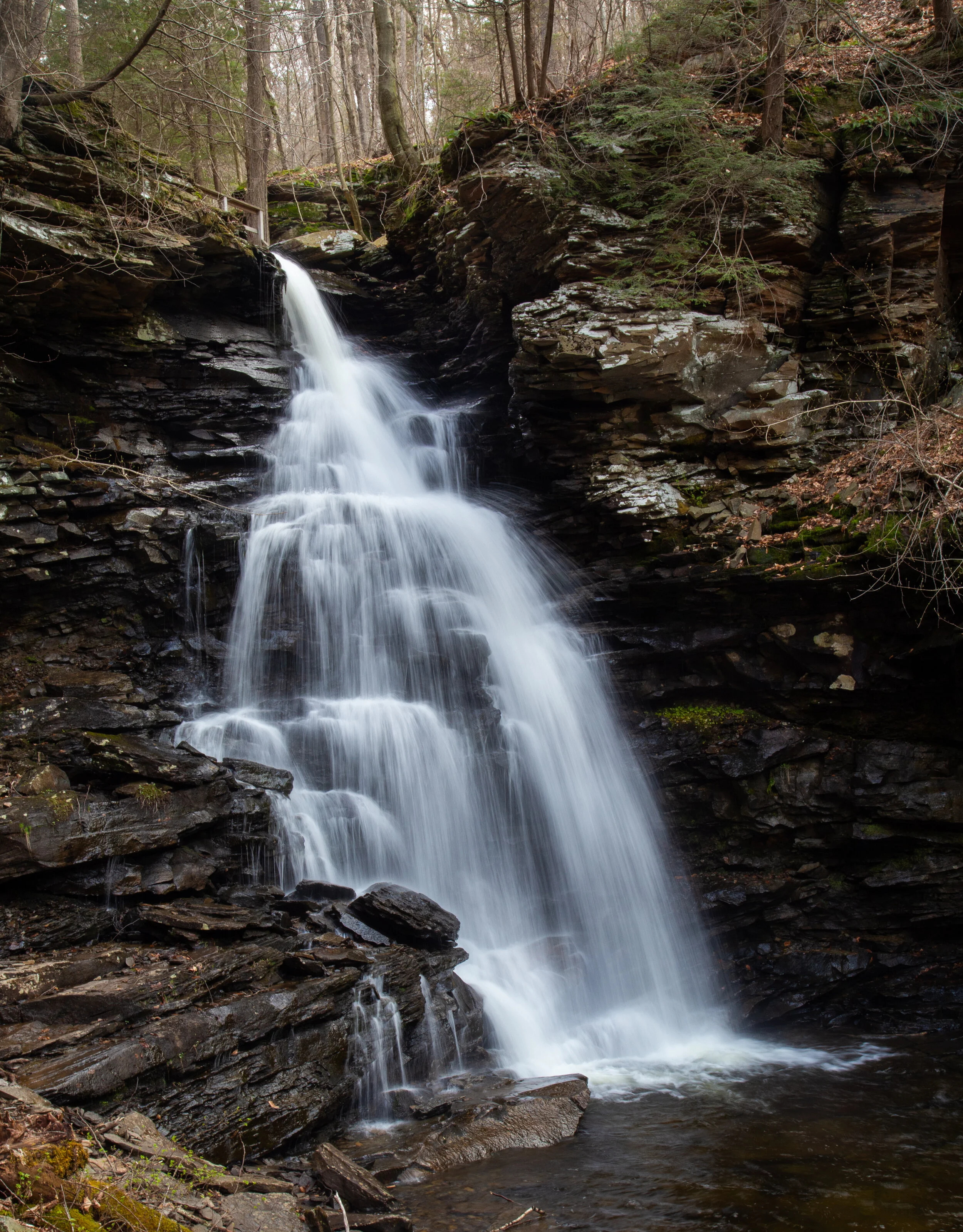
We left the center and parked at the campground heading towards Loyalsock Creek to begin the loop in a northeast direction. The first part of the loop took us around Loyalsock Creek just off the side of Route 154 across from the campground. There were fishermen here and the creek looked very pretty. The trail eventually crossed over the 154 and began to ascend switchbacks into a forest of hardwood and fern. Light rain fell off and on, but the temperature was warm. The forest looks like green technicolor in the rain. The trail met up with the Cold Run extension trail loop and we took a short side adventure to explore the impressive boulder formations that made me feel as though I was in Jurassic Park. I wondered how many millions or possibly billions of years old this geology was. We could have hiked the Cold Run loop and added another mile and a half, but with the weather being unpredictable, we opted to stay on the Canyon Vista trail and explore Cold Run another day. The forest had a heavy mist of fog lying low all around us. It was beautiful. When we made it to the top of the trail, there was a viewpoint overlooking Loyalsock Canyon. This is the most expansive forested area I have seen since being in Pennsylvania. Most of the views I have experienced in this state have been blocked by trees or they overlook farms or freeways. It’s been difficult adjusting to the lack of wild spaces like I was used to coming from out West, but Loyalsock was an exception. And while the mountains are not high peaks, the name of this range “Endless Mountains” was fitting. The vista is accessible by car and you can drive up from Mineral Springs Road if you don’t want to hike it. It is also ADA-accessible. After enjoying some time at the vista, we made our way back to camp, got a fire going and enjoyed the rest of the evening.
Click “Read More” below for more photos.
Read More