hiking trail

Ricketts Glen State Park, Falls Trail Loop, 9.6 Miles RT, 1,122' +/-, April 19, 2021

Ricketts Glen State Park, Falls Trail Loop, 9.6 Miles RT, 1,122' +/-, April 19, 2021

Ricketts Glen State park is home to the Glens Natural Area, a National Natural Landmark in Pennsylvania. The Falls Trail system that we hiked today consists of 21 incredible waterfalls that flow between steep, narrow valleys known as glens. The tallest waterfall on the circuit, Ganoga, is 94’ impressive feet. Ricketts Glen State Park is one of the most scenic hikes in Pennsylvania. It’s named after Colonel R. Bruce Ricketts who bought land in northeastern Pennsylvania for timbering. When fishermen exploring Kitchen Creek found that there were waterfalls flowing through the deep gorges, Colonel Ricketts spared the land. He hired six men to build the trail system in what is now known as the Glens Natural Area and the project was completed in just four years. Each of the 21 waterfalls has a name. Colonel Ricketts named them after American Indian tribes and also his friends and family.

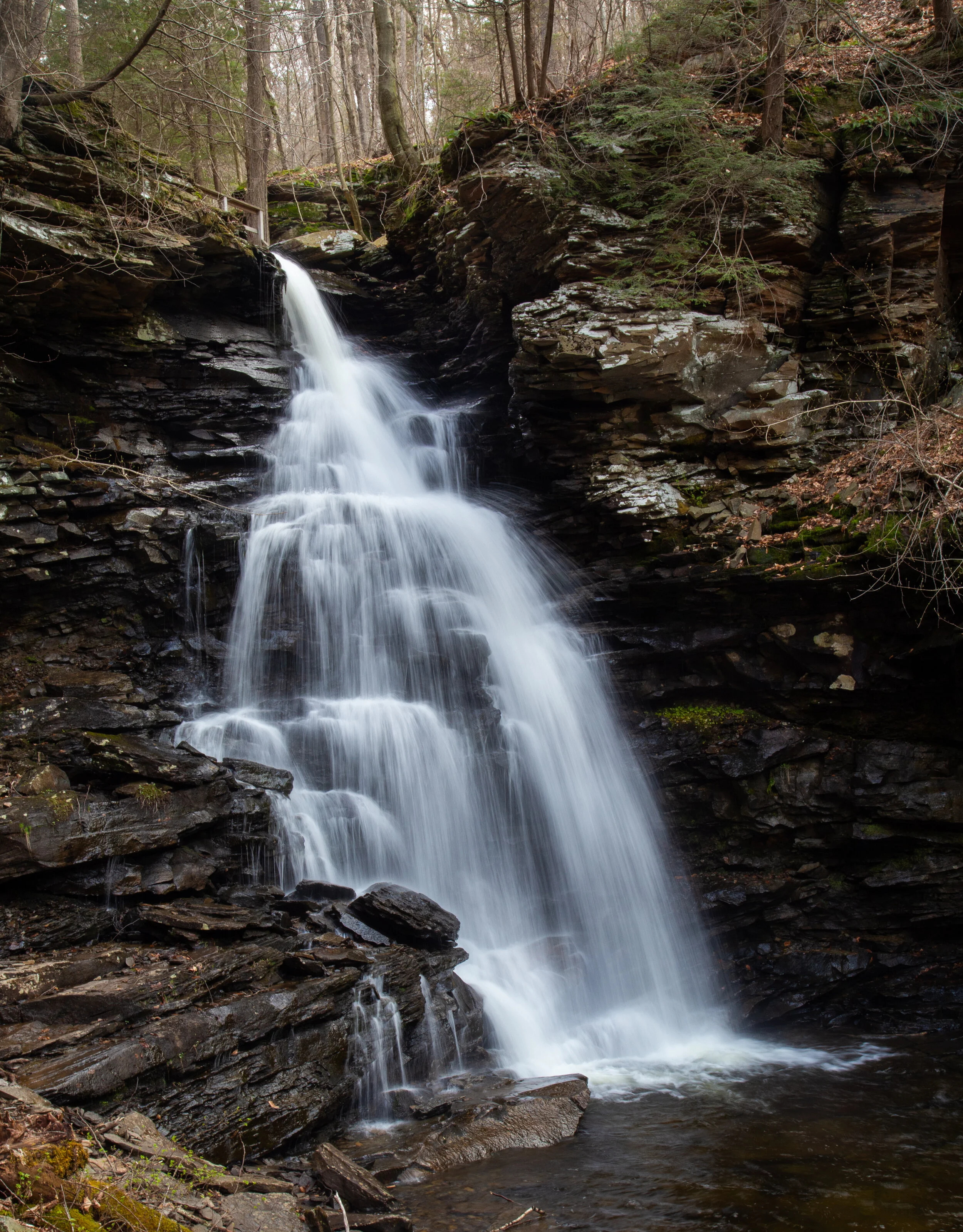
We began our hike at the trailhead off the 118. From here we had a pleasant walk along Kitchen Creek on a flat path before reaching a junction for the lower and upper trails. The lower trail was marked as difficult, and the upper trail was marked as moderate. Of course we opted for the lower, more difficult path. Both trails meet back up again at waters meet before the beginning of the Falls Trail Loop. The lower trail hugged the creekside going up and down muddy, slippery terrain. It wasn’t particularly difficult, but we had to watch our footing. Soon, we started to see the waterfalls. There are three falls before you reach waters meet: Murray Reynolds, 16’, Sheldon Reynolds, 36’ and Harrison Wright, 27’. All three were absolutely beautiful. When we reached the junction at waters meet, we opted to hike up the Glen Lehigh side first. There are eight waterfalls on this side ranging from 15 to 60 feet. We made our way up the steep rocky gorge crossing over bridges that took us right up and over the top of the falls. It was a spectacular trail which varied between flat, rocky sections along the creek and steep climbs up rocky steps. We stopped at each fall to take photos and spent time enjoying the uniqueness of each waterfall. Once we completed the traverse up the Glen Leigh side, we got on the Highland Trail heading west. The Highland trail would take us to the Ganoga Glen side to see the next set of falls. The Highland Trail was mostly flat, quiet and very peaceful. It took us through a beautiful forest of pine and along the trail I noticed a wooden bench for sitting and taking in the serenity of the forest. About half way through this section of trail, we reached some giant rock formations and passed through two large boulders called the Midway Crevasse. Soon, I began to hear the sound of rushing water again which meant we were coming up on the next set of falls. We crossed over a bridge and were soon making our way down the gorge on the Ganoga Glen side. The rocky steps were muddy and slippery. We had to take extra care coming down the steep sections, as I think it’s harder coming down then it is going up because it’s easier to slip. We passed by three lovely falls before reaching Ganoga, the 94’ waterfall. It was absolutely stunning. As we continued down the Ganoga Glen side, we began to see more people coming out to enjoy the trail. At this point I sort of lost track of which waterfall we were passing and I was spending more time looking at the smaller details like the Trillium blooming alongside the trail, the green fern and bright moss growing above the gorge. There is so much to take in on this trail besides the just waterfalls. When we reached the junction for the upper and lower trails, we decided to take the upper trail for a change in scenery. The trail was an easy flat path that travelled high above Kitchen Creek. Along this trail I saw more blooming Trillium. By now it was early afternoon and the sun had started to come out. The weather up until this point had been cloudy and we even had a light sprinkle of rain. When we reached the final mile that would take us back to the trailhead, I noticed some blooming Trout Lily. It was a wonderful day and Ricketts Glen Natural Area is a really special place.

Click on “Read More” below for more photos.

Read More
Exploring Paradise Price Preserve and Targa Falls on the Brodhead Creek, March 21, 2021

Exploring Paradise Price Preserve and Targa Falls on the Brodhead Creek, March 21, 2021

It was a glorious Sunday morning. The air was crisp and the sun was gleaming in hues of orange and gold as we set out on the loop trail to hike to Targa Falls from the western side of Paradise Price Preserve. The trail started out in a forest of hardwoods scattered with eastern white pine. As we walked along the wide, rocky path heading east into the bright morning sunlight, the song of an eastern bluebird filled the air. We passed by vernal pools, wetlands and observed various types of fungi attached to fallen logs. Soon we came upon a picnic table along the side of the trail. We sat for a moment to enjoy the quiet of the peaceful forest. When we were ready, we continued along the path which was now starting a descent towards the Brodhead Creek. We passed by large boulders and crossed over tributaries that were flowing down from the ridge. We then turned onto the spur trail that took us directly to the large horseshoe shaped Targa Falls. This is the only natural waterfall on the Brodhead Creek. It’s not a tall waterfall, but its waters roar and move swiftly. We climbed down to the falls where I sat on some large boulder slabs to take in the scenery as the creek crashed and roared downstream. A cool mist from the falls brushed against my face. It felt so refreshing in the warm sunshine. I dipped my hand in to feel the cold, sparkling water. It was a lovely place to sit for a while, enjoy a snack and take in the beauty of nature before continuing. Once back on the loop, the trail took us above the Brodhead offering us lovely views of the rapids along the way before turning west and taking us back in the direction of the trailhead. It was a gorgeous day and the more time I spend hiking the trails here in northeastern Pennsylvania, the more the landscape is starting to grow on me. I’m finding so many gems right here in the Pocono Mountains, and I can’t wait to continue exploring all that this area and beyond has to offer.

Click on “Read More” below for more photos.

Read More

Lackawanna State Park, South Branch Trail, Tunkhannock Creek, Bassett Trail, Lake Shore Trail, Abington Trail, Lee Hill Trail, 6 Miles RT, January 9, 2021

Lackawanna State Park, South Branch Trail, Tunkhannock Creek, Bassett Trail, Lake Shore Trail, Abington Trail, Lee Hill Trail, 6 Miles RT, January 9, 2021

Today we explored some of the trails in Lackawanna State Park. Lacka-wanna is Native American for “the meeting of two streams”. We parked at the trailhead just off Cole Road on the north side of Tunkhannock Creek, crossed the bridge and headed east onto the South Branch Trail. The trail first took us through an open field covered in snow. It looked so magical with the icy snowflakes blowing off the trees like glitter against the blue sky. It was a sunny day, and the snow covered ground sparkled in the morning sunlight as we followed the path. The temperatures were in the mid 20s, but no wind and the sun felt warming as we hiked. The trail then moved closer to the creek entering a beautiful forest of hemlock trees. It followed along the edge of the creek on a narrow track before ascending upward to a wider path. We continued along this track about 2 miles to Messimer Preserve where we found a sign stating, “Sorry We’re Closed”. At this point we turned around and headed back in the opposite direction. On our way we found a spur trail that descended to the creek where we spent time exploring the area and enjoying the small cascades. After our side adventure, we continued back to Cole Road where we crossed and headed west on the Bassett Trail. The trails here were a mix of mud and ice, but the scenery was beautiful nonetheless. We took the Abington Trail to the Lake Shore Trail to get some views of Lackawanna Lake which looked like it was mostly frozen over. We reached a junction for the Lee Hill Trail, took a sharp turn north and began to ascend into more beautiful forest. This trail is also used for mountain biking and I can see why. The trails here were undulating and very enjoyable to hike. Eventually, we met up again with the Bassett Path and closed out the loop. Lackawanna State Park is a beautiful area with many more trails to explore and also a number of preserves in the same vicinity. I’ll surely be back again to see more of this place.

(Click Read More Below to See More Photos)

Read More

New Year's Day Hike, Austin T. Blakeslee Natural Area, January 1, 2021

New Year's Day Hike, Austin T. Blakeslee Natural Area, January 1, 2021

We started out the year with a hike to Tobyhanna Falls in the Austin T. Blakeslee Natural Area. Pennsylvania has so many waterfalls, I haven’t even scratched the surface of what there is to discover. The weather reports were calling for freezing rain later in the day, so we got up and out early so as not to risk it.

The Austin T. Blakeslee Natural Area was once home to Harrison Amusement Park which entertained the community along the Tobyhanna Creek. What was then known as Toby Park had a carousel, skating rink, swimming pool, dining hall, penny arcade, sporting fields and a creekside beach. It was destroyed in a flood in 1955.

Today the area is open to hikers with a small network of trails that take the hiker along Tobyhanna Creek to the scenic Tobyhanna Falls.

We started at the trailhead off the 115 heading west along the Creek Trail. The first section of the hike takes you through a beautiful stand of tall spruce trees. A short half a mile walk then leads to the waterfall. The falls aren’t very tall, but they are mighty. It’s quite a spectacle to see. The fast moving water was tinted with an amber color which is caused by the tannic acid produced by hemlock and spruce along the banks of the creek. It was a beautiful site to start off the new year. After taking it all in, we continued west. At about .9 miles Tunkhannock Creek flows into Tobyhanna. We looped around north heading away from the creek on the Highland Trail and into a beautiful coniferous forest.

It was a wonderful morning and this is a beautiful area to explore in just a few short miles. We got back in plenty of time to beat the weather.

(Click Read More Below to See More Photos)

Read More

Mariton Wildlife Sanctuary, July 25, 2020

Mariton Wildlife Sanctuary, July 25, 2020

I recently learned about Mariton Wildlife Sanctuary which is located not far from where I live. I’ve been doing short hikes and nature walks early in the mornings and sticking close to home because it’s been too hot and humid this summer to do any long mileage or strenuous hiking. This was my first time visiting the sanctuary which is part of Natural Lands, a non-profit organization preserving open space in Pennsylvania and southern New Jersey. Mariton is absolutely lovely. It sits on top of Bougher Hill and overlooks the Delaware River. There is a small trail system that took me through the woods and along the slopes of Bougher Hill to the River Lookout which on a clear day may have provided views of the Delaware Canal below. The woods were thick with morning mist and being the first on the trails so early in the morning I was breaking through spider silk from the previous evening. The forest was so still and quiet. The kind of quiet that almost hurts your ears. Who knew such a place existed so close to home! I kept my walk short today and didn’t bother to record any mileage. I simply enjoyed the scenery and took these wonderful photos. I will most definitely be back to do more exploring.

Read More