Today we went back to explore more of the Delaware Water Gap National Recreation Area. This time we planned to hike some trails that started at the Pocono Environmental Education Center Campus. The PEEC is a non-profit organization that offers environmental learning experiences in a national park. It looked like a really cool place. We started the day on the Tumbling Waters Trail which begins just across the road from the Main Education Building. We crossed a bridge and along the trail was a fun looking bird blind complete with exhibits inside. I should note that the really cool thing about this place is that the trails here are interpretive. Points of interest are marked with numbers and you can purchase a guided map outside the PEEC building, or download them onto your phone. An interesting exhibit at the beginning of the hike is a Trash Graveyard. It’s meant to demonstrate the amount of time it takes for common materials to decompose such as water bottles, plastic bags and cigarettes. It’s a fun way to educate people on the effects of littering. The trail then took us through a pine plantation and along the shores of Pickerel Pond where there was evidence of beavers. We walked over a boardwalk above more wetlands and then into a forest of conifers and mixed hardwoods. Eventually, the trail became a lovely single track just above a ravine with hemlocks towering above. A helpful set of steps are cut into switchbacks leading down the ravine to the waterfall. The purpose of the steps is to keep hikers on the trail. Cutting switchbacks can lead to erosion. It’s so important to respect the rules of our beautiful parks and wilderness areas. Unfortunately, I did see many use trails branching off near the waterfall, which gives evidence that some hikers do not respect these principles. As we made our descent down to the falls, there were many rhododendrons and large hemlock trees. We spent some time here exploring the area, taking pictures, and enjoying the “tumbling waters”. Next, we hiked back up and the trail skirted cliffside with expansive views of the Delaware River Valley. We then passed a stone fireplace which was once part of a cabin. It made me think about how difficult it must have been to haul all those stones up the steep slope to build it. We then hiked through more forests of mixed oaks, cedar and pine. Along the trail I saw wildflowers of periwinkle and rue anemone beginning to peak out from under the leaf debris. Soon we arrived back at the parking area where we then made our way onto the Ridgeline and Scenic Gorge Trails. These trails offered so much variety! We hiked through forests of tamarack, oak, hickory, hemlock and pine. We climbed up and down large sedimentary rocks where there was a handy rope installed to assist with the descent. We passed through wetlands and vernal pools while spring peepers sang their spring chorus. We crossed bridges over the cascading waters of Spackman’s creek and enjoyed the scenic gorge that was decorated with bright green moss and fern. There were also various types of shelf-like mushrooms to observe. As we reached the trailhead once again, I couldn’t believe how quickly time went by on these trails. I really enjoyed my time here and am so appreciative that there are gems like this to learn about and enjoy the magic of nature.
Today we headed out early to explore the Delaware Water Gap National Recreation Area. Our first stop was Dingmans Falls. This is a popular area with a beautiful boardwalk system that provides safe and easy access leading to two beautiful waterfalls. I was aware that this is a popular destination and can become quite busy, so we arrived just after sunrise. The road to the parking area at the Dingmans Visitor Center was closed (they close it during winter), so we parked in the lot just off the 209 and began a short mile walk down Dingmans Falls Road to the trailhead. The road itself was very scenic as it followed Dingmans Creek past tall pines. As we strolled along I saw a lot of downed trees which I later learned were caused by a violent storm in 2018. Soon we reached the Dingmans Falls Visitor Center where the smooth boardwalk trail begins. It crossed over Dingmans Creek and within just a short distance we were treated to a view of our first waterfall of the day, the 80 foot Silver Thread Falls. Silver Thread is tall, narrow and drops over the rocky cliffs in almost a perfectly straight line; hence the name “silver thread”. As we continued on the boardwalk we passed through large stands of rhododendron surrounding us on either side. It gave the trail a jungle-like feeling. In less than a mile we arrived at the majestic 130 foot Dingmans Falls. This waterfall is noted as being the second tallest in Pennsylvania; the tallest is Raymondskill Falls just a few miles up the road. The fast flowing waters tumbled down a gorge carved into exposed bedrock from the Devonian period 365-405 million years ago. We spent some time taking photos and enjoying the views before making our way up a steep wooden staircase to the top of the falls. The views from above were just as spectacular as below as the water spilled down the 130 foot vertical drop. After taking in the scenery and making sure to grab lots of photos, we decided it was time to start heading back so we could enjoy another trail while it was still early. We walked back to the parking area, hopped in the car and headed north on the 209 to the Hackers trailhead on Raymondskill Road where we planned to hike to Hackers Falls and the Cliff Trail. The Hackers trail began on a gravel path leading uphill. As it leveled off we were taken on a pleasant walk through an inviting hemlock forest. We then reached the junction for the waterfall and descended steeply. As we continued to follow the trail, I could hear Raymondskill Creek off in the distance. Soon we were hiking above and parallel to the creek. Within about a mile we reached Hackers Falls. This waterfall was steep but short and shaped like a feather fan. We spent some time taking photos, studying the rocks and enjoying the small but mighty waterfall before making a gentle ascent back up the Hackers trail through more hemlocks and mixed hardwoods. Next, we reached a junction for the Buchanan trail which ran north along a power line. We passed by an abandoned building and a dilapidated trailer home just before reaching a pond. When we arrived at the junction for the Cliff Trail, it was closed due to nesting Peregrine Falcons. We backtracked onto the Hackers Trail to access the Cliff Trail from the opposite direction. This section was open so we followed the trail to the first vista. From here I could see the Delaware River and across to New Jersey. We continued along the Cliff Trail as it travelled along the Raymondskill Ridge offering sweeping views along the way. Several vultures soared at eye-level as we hiked. It was a beautiful sunny day and by the time we reached the parking area, it was already full with people coming out to enjoy this perfect spring day.
I’m finding some really great nature preserves here in the Keystone state. This past Saturday we ventured off to explore the Nothstein Preserve located in Paradise Township in Monroe County. The hike took us through a variety of different terrain, along the ravine of Cranberry Creek and up to a red rock quarry with views extending from east to west across the ridge to the surrounding preserves. We started at the trailhead off Cranberry Creek Road and headed north on a wide path in a counter clockwise direction. The forest was mostly hardwood dappled with tall hemlock trees. Immediately my ears were filled with the pleasant harmony of morning birdsong. We passed by marshes, bogs and small tributaries until we reached a primitive bridge crossing over the pristine waters of Cranberry Creek. We took a moment to branch off and explore its banks and the surrounding feeder creeks before continuing on a single track where we began to ascend gently upward. The trail reached an intersection where we turned northwest. I spotted some train tracks above us running parallel to our path. We made several primitive creek crossings over the crystal clear waters flowing down the mountain and over thick, bright green moss. Now the trail began to descend southwest. The forest became dense with hemlock, and I could hear the sound of rushing water flowing just beyond the trees. The path opened up to reveal another bridge crossing over the fast moving Cranberry Creek. Lined with rhododendron just beyond the bridge, the terrain became a snow covered single track leading us upward above the ravine. We made our way up the trail being careful on the icy patches of snow until reaching a vista of the beautiful cascading waters below. I made sure to get some photos from above, but I wanted to take a closer look. We then backtracked and made our way to a section of trail following along the edge creek where we could enjoy a closer perspective of the sights and sounds of the waterfalls and tumbling cascades. Eventually, we backtracked crossing over the bridge once again and up through the hard packed snow back to the top of the ravine. Soon, the trail began to move away from the creek and the forest became even more dense with tall stands of hemlock and oak. We crossed over more small tributaries being careful not to slip on the moss covered rocks. I’m not sure if it was the tall stands of pine or the way the sunlight was shining through, but this section of trail reminded me a little bit of my beloved Angeles National Forest. It was another lovely section of trail. The path widened again and took us under a canopy of pine. The trail became a bed of soft pine needles beneath our feet. As we travelled up the slope we were led to an old stone red rock quarry. Two large ravens suddenly emerged from the trees and soared across the blue sky above. Again, I felt at home as I was reminded of my life in California where there were always ravens to accompany me along my hikes in the higher elevations. As we traversed along the edge of the quarry, we were treated with sweeping views across the gorge and the ridge beyond. I was awe struck at how a place so beautiful can be so close to civilization. We spent some time exploring around the quarry before moving on, back into the hardwoods and finally looping back down to the woodland path on which we started. It was an absolutely amazing day and a beautiful preserve full of wild, natural beauty to explore and admire.
We tried to beat the rain on Sunday and take a short hike around Mariton Wildlife Sanctuary. I haven’t been here since fall and today the forest was covered in snow. With the weather having been warmer this past week and the snow starting to melt, I wasn’t expecting to need snowshoes. But the snow was still deep and we ended up putting them on. As we made our way along the trail, we were accompanied by the soft sound of rain falling on the trees and the snow covered forest floor. Despite the gray skies, it was a lovely day; very peaceful and relaxing to be in this serene place on a rainy winter morning.
It was a bitter cold morning, but despite the weather we headed out for a short hike along Sobers Run in Jacobsburg State Park. It was somewhere in the 20s and the winds were blowing steadily which made it feel even colder. We Parked in the turn out just off Jacobsburg Road, crossed the bridge and headed south on the service road that would take us to the creek. We then turned north onto a one track trail which follows along Sobers Run. The trees here are mostly hardwoods and the forest looked completely different from when we had hiked this section of trail over the summer. At about 1.5 miles we reached Keller Road where we crossed a footbridge and circled back south on a long stretch of paved trail until it intersected with the dirt track that would take us closer to the creek. Along the way we discovered some large tree carvings which appeared to be either tikis or jack o’lanterns. I’m not really sure what they were supposed to be. It was a sunny morning and although it was quite chilly, it felt good to get out in the fresh winter air.
I recently discovered the Graver Arboretum, a hidden gem located in Bushkill Township, Pennsylvania while my husband and I were out for a drive. He noticed a sign, and we decided to stop. The arboretum is used as an outdoor classroom by the biology and other science departments of Muhlenberg College. There are a few trails here and it’s a quiet place to walk and relax. This was our second visit to the arboretum. The first time I didn’t have my camera with me. This time I brought it along. It was a cloudy, overcast day. There were a number of Canada Geese on the pond and the leaves were falling as we walked along the quiet path. It’s a nice place to come to visit when I just want to relax in nature without a long day of hiking.
I woke up to the sound of pouring rain coming from Tropical Storm Isaias today. I love listening to the sound of rolling thunder and the feeling of being safe in my bed. There was no rush to go anywhere, so I enjoyed listening to the rain and nodding in and out of sleep. About mid-morning the rain let up, and I left the house and took a walk down by the creek. The mist coming off the water was beautifully eerie. I didn’t see anyone braving the stormy weather save for a few fishermen. The sun was peeking in and out between the gray clouds as I walked the nature trail and crossed over the rail tracks to the meadow. I travelled up and down the hillside admiring the wildflowers, the trees and the stormy sky. The goldenrod is beginning to bloom and I saw some butterflies and clearwing hummingbird moths. The storm was still brewing and so I thought it best to head out before the next round of downpour rolled through. It’s nice to have such a wonderful place to visit that’s so close to home.
I recently learned about Mariton Wildlife Sanctuary which is located not far from where I live. I’ve been doing short hikes and nature walks early in the mornings and sticking close to home because it’s been too hot and humid this summer to do any long mileage or strenuous hiking. This was my first time visiting the sanctuary which is part of Natural Lands, a non-profit organization preserving open space in Pennsylvania and southern New Jersey. Mariton is absolutely lovely. It sits on top of Bougher Hill and overlooks the Delaware River. There is a small trail system that took me through the woods and along the slopes of Bougher Hill to the River Lookout which on a clear day may have provided views of the Delaware Canal below. The woods were thick with morning mist and being the first on the trails so early in the morning I was breaking through spider silk from the previous evening. The forest was so still and quiet. The kind of quiet that almost hurts your ears. Who knew such a place existed so close to home! I kept my walk short today and didn’t bother to record any mileage. I simply enjoyed the scenery and took these wonderful photos. I will most definitely be back to do more exploring.
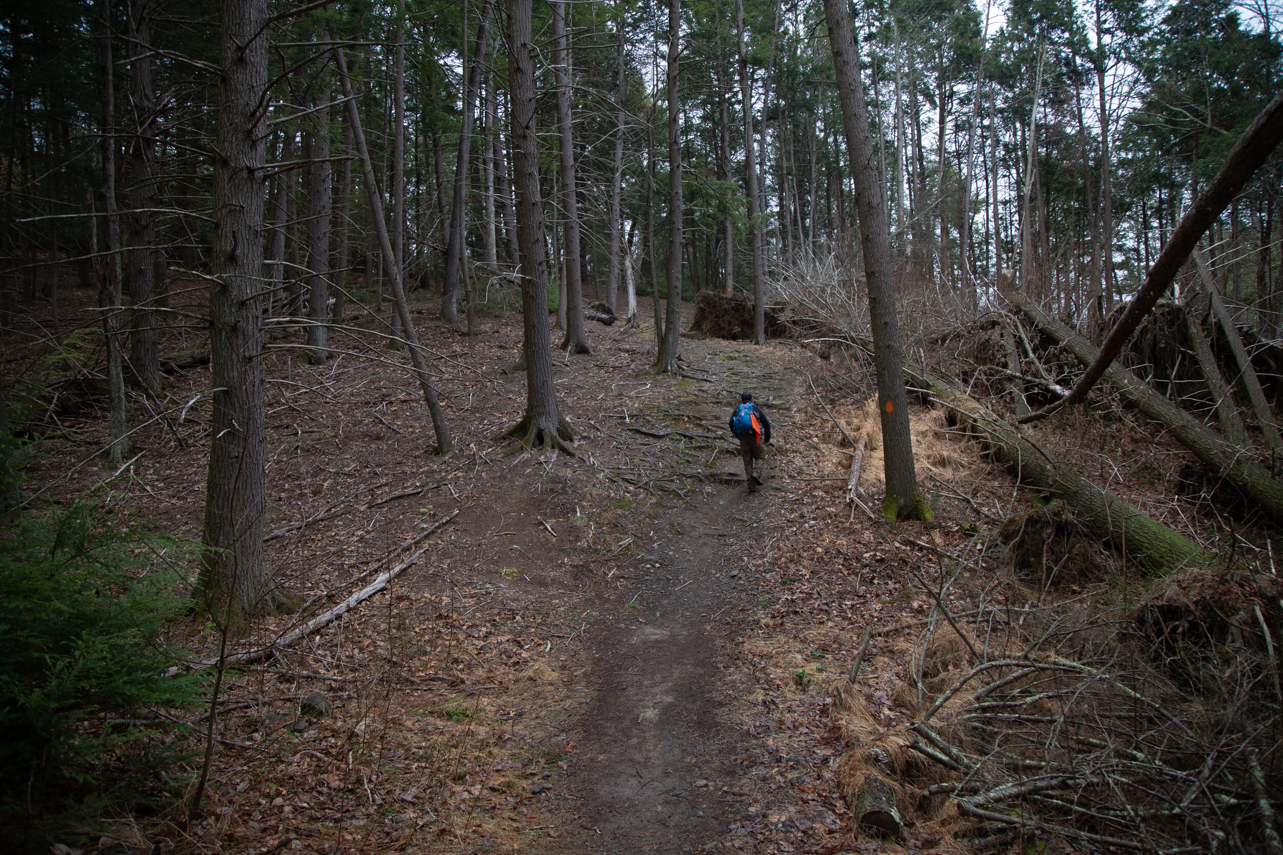
Today I wanted to hike some of the Appalachian Trail. I figured it would be a nice way to experience more of the terrain and try out the rock scrambles because that seems to be a common thing here. After I got on the road, I realized that I’d forgotten my camera. Ugh. So all of my photos were taken with my mobile phone.
I started this hike at the Fox Gap trailhead and did the Wolf Rocks Loop. The hike starts out mostly flat, but the terrain is rocky in most parts so you have to watch your step or you’ll stub your toe like I did about a million times.
The trail meanders through beautiful groves of fern and it looks like something out of a fairytale at times. There isn’t much elevation to gain until you reach the boulders where you’ll scramble your way up to the ridge to the overlook. Once on the ridge you’ll boulder hop your way across. You can pick any of the outcroppings to climb up and check out the views. I could see a little above the tree line and make out some of the area’s high points, one of which is called Pimple Hill, a summit in Monroe County that stands at 2,197’. What a funny name. We sat for a bit on the boulders and enjoyed the cool morning breeze before heading back. It was a fun early morning hike and we saw only a few people on this trail. I would like to come back to this trailhead and next time hike it northbound from Fox Gap towards the Delaware Watergap.