waterfalls

Bear Creek Preserve, 7.9 Miles RT, 856' +/-, March 31, 2024

Bear Creek Preserve, 7.9 Miles RT, 856' +/-, March 31, 2024

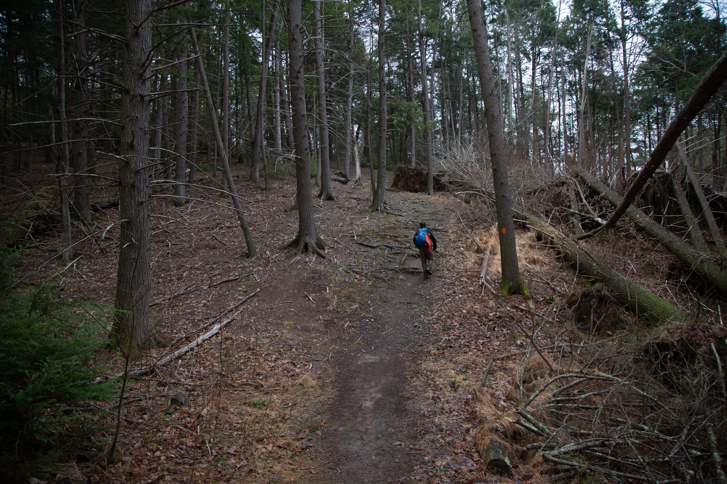
The day started cold and damp. The kind of dampness that chills to the bone. It had rained the night before and sections of the trail were mud which is mostly to be expected this time of year. But we continued our hike, hoping to see the sun eventually. We hiked through hardwood forest until we descended to the creek. We crossed the bridge and hiked through rhododendron tunnels, hemlock, and white pine. The bridge to return that crosses over Shades Creek further south of where we started was washed away. But I remembered there was another bridge further up the trail and luckily that one was intact. Once on the other side, we hiked to my favorite rocks on the creek's edge and sat down. We got lucky and the sun broke through the clouds. We spent a while there lounging around and soaking it in before heading back in a loop to complete the day.

Click “Read More” below for more photos from this hike.

Read More

Ricketts Glen State Park, Falls Trail Loop, 9.6 Miles RT, 1,122' +/-, April 19, 2021

Ricketts Glen State Park, Falls Trail Loop, 9.6 Miles RT, 1,122' +/-, April 19, 2021

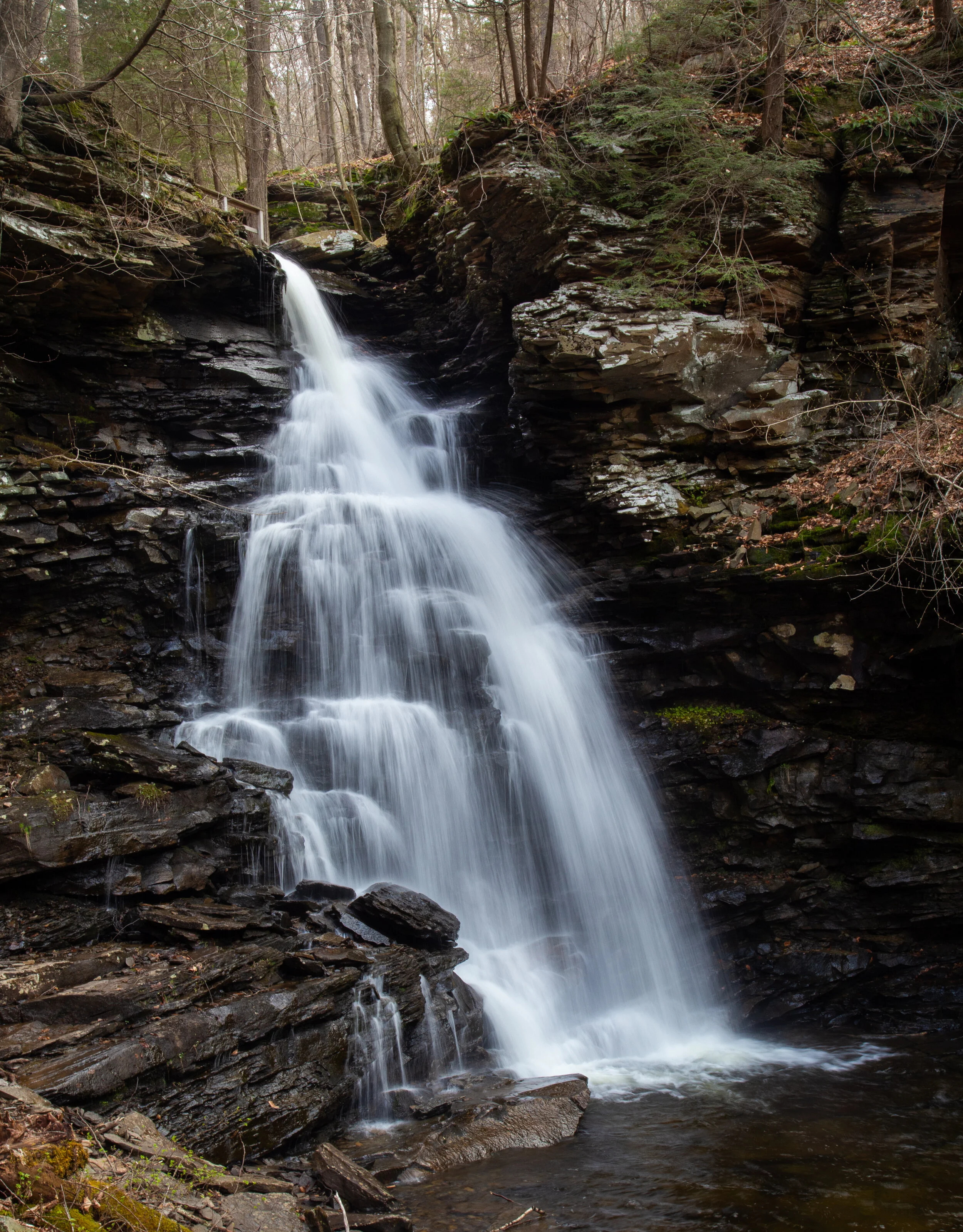
Ricketts Glen State park is home to the Glens Natural Area, a National Natural Landmark in Pennsylvania. The Falls Trail system that we hiked today consists of 21 incredible waterfalls that flow between steep, narrow valleys known as glens. The tallest waterfall on the circuit, Ganoga, is 94’ impressive feet. Ricketts Glen State Park is one of the most scenic hikes in Pennsylvania. It’s named after Colonel R. Bruce Ricketts who bought land in northeastern Pennsylvania for timbering. When fishermen exploring Kitchen Creek found that there were waterfalls flowing through the deep gorges, Colonel Ricketts spared the land. He hired six men to build the trail system in what is now known as the Glens Natural Area and the project was completed in just four years. Each of the 21 waterfalls has a name. Colonel Ricketts named them after American Indian tribes and also his friends and family.

We began our hike at the trailhead off the 118. From here we had a pleasant walk along Kitchen Creek on a flat path before reaching a junction for the lower and upper trails. The lower trail was marked as difficult, and the upper trail was marked as moderate. Of course we opted for the lower, more difficult path. Both trails meet back up again at waters meet before the beginning of the Falls Trail Loop. The lower trail hugged the creekside going up and down muddy, slippery terrain. It wasn’t particularly difficult, but we had to watch our footing. Soon, we started to see the waterfalls. There are three falls before you reach waters meet: Murray Reynolds, 16’, Sheldon Reynolds, 36’ and Harrison Wright, 27’. All three were absolutely beautiful. When we reached the junction at waters meet, we opted to hike up the Glen Lehigh side first. There are eight waterfalls on this side ranging from 15 to 60 feet. We made our way up the steep rocky gorge crossing over bridges that took us right up and over the top of the falls. It was a spectacular trail which varied between flat, rocky sections along the creek and steep climbs up rocky steps. We stopped at each fall to take photos and spent time enjoying the uniqueness of each waterfall. Once we completed the traverse up the Glen Leigh side, we got on the Highland Trail heading west. The Highland trail would take us to the Ganoga Glen side to see the next set of falls. The Highland Trail was mostly flat, quiet and very peaceful. It took us through a beautiful forest of pine and along the trail I noticed a wooden bench for sitting and taking in the serenity of the forest. About half way through this section of trail, we reached some giant rock formations and passed through two large boulders called the Midway Crevasse. Soon, I began to hear the sound of rushing water again which meant we were coming up on the next set of falls. We crossed over a bridge and were soon making our way down the gorge on the Ganoga Glen side. The rocky steps were muddy and slippery. We had to take extra care coming down the steep sections, as I think it’s harder coming down then it is going up because it’s easier to slip. We passed by three lovely falls before reaching Ganoga, the 94’ waterfall. It was absolutely stunning. As we continued down the Ganoga Glen side, we began to see more people coming out to enjoy the trail. At this point I sort of lost track of which waterfall we were passing and I was spending more time looking at the smaller details like the Trillium blooming alongside the trail, the green fern and bright moss growing above the gorge. There is so much to take in on this trail besides the just waterfalls. When we reached the junction for the upper and lower trails, we decided to take the upper trail for a change in scenery. The trail was an easy flat path that travelled high above Kitchen Creek. Along this trail I saw more blooming Trillium. By now it was early afternoon and the sun had started to come out. The weather up until this point had been cloudy and we even had a light sprinkle of rain. When we reached the final mile that would take us back to the trailhead, I noticed some blooming Trout Lily. It was a wonderful day and Ricketts Glen Natural Area is a really special place.

Click on “Read More” below for more photos.

Read More

Delaware Water Gap National Recreation Area, Tumbling Waters, Ridgeline, Scenic Gorge, April 10, 2021

Delaware Water Gap National Recreation Area, Tumbling Waters, Ridgeline, Scenic Gorge, April 10, 2021

Today we went back to explore more of the Delaware Water Gap National Recreation Area. This time we planned to hike some trails that started at the Pocono Environmental Education Center Campus. The PEEC is a non-profit organization that offers environmental learning experiences in a national park. It looked like a really cool place. We started the day on the Tumbling Waters Trail which begins just across the road from the Main Education Building. We crossed a bridge and along the trail was a fun looking bird blind complete with exhibits inside. I should note that the really cool thing about this place is that the trails here are interpretive. Points of interest are marked with numbers and you can purchase a guided map outside the PEEC building, or download them onto your phone. An interesting exhibit at the beginning of the hike is a Trash Graveyard. It’s meant to demonstrate the amount of time it takes for common materials to decompose such as water bottles, plastic bags and cigarettes. It’s a fun way to educate people on the effects of littering. The trail then took us through a pine plantation and along the shores of Pickerel Pond where there was evidence of beavers. We walked over a boardwalk above more wetlands and then into a forest of conifers and mixed hardwoods. Eventually, the trail became a lovely single track just above a ravine with hemlocks towering above. A helpful set of steps are cut into switchbacks leading down the ravine to the waterfall. The purpose of the steps is to keep hikers on the trail. Cutting switchbacks can lead to erosion. It’s so important to respect the rules of our beautiful parks and wilderness areas. Unfortunately, I did see many use trails branching off near the waterfall, which gives evidence that some hikers do not respect these principles. As we made our descent down to the falls, there were many rhododendrons and large hemlock trees. We spent some time here exploring the area, taking pictures, and enjoying the “tumbling waters”. Next, we hiked back up and the trail skirted cliffside with expansive views of the Delaware River Valley. We then passed a stone fireplace which was once part of a cabin. It made me think about how difficult it must have been to haul all those stones up the steep slope to build it. We then hiked through more forests of mixed oaks, cedar and pine. Along the trail I saw wildflowers of periwinkle and rue anemone beginning to peak out from under the leaf debris. Soon we arrived back at the parking area where we then made our way onto the Ridgeline and Scenic Gorge Trails. These trails offered so much variety! We hiked through forests of tamarack, oak, hickory, hemlock and pine. We climbed up and down large sedimentary rocks where there was a handy rope installed to assist with the descent. We passed through wetlands and vernal pools while spring peepers sang their spring chorus. We crossed bridges over the cascading waters of Spackman’s creek and enjoyed the scenic gorge that was decorated with bright green moss and fern. There were also various types of shelf-like mushrooms to observe. As we reached the trailhead once again, I couldn’t believe how quickly time went by on these trails. I really enjoyed my time here and am so appreciative that there are gems like this to learn about and enjoy the magic of nature.

Click on “Read More” below for more photos.

Read More
Delaware Water Gap National Recreation Area, Dingmans Falls, Hackers Falls, Cliff Trail, March 4, 2021

Delaware Water Gap National Recreation Area, Dingmans Falls, Hackers Falls, Cliff Trail, March 4, 2021

Today we headed out early to explore the Delaware Water Gap National Recreation Area. Our first stop was Dingmans Falls. This is a popular area with a beautiful boardwalk system that provides safe and easy access leading to two beautiful waterfalls. I was aware that this is a popular destination and can become quite busy, so we arrived just after sunrise. The road to the parking area at the Dingmans Visitor Center was closed (they close it during winter), so we parked in the lot just off the 209 and began a short mile walk down Dingmans Falls Road to the trailhead. The road itself was very scenic as it followed Dingmans Creek past tall pines. As we strolled along I saw a lot of downed trees which I later learned were caused by a violent storm in 2018. Soon we reached the Dingmans Falls Visitor Center where the smooth boardwalk trail begins. It crossed over Dingmans Creek and within just a short distance we were treated to a view of our first waterfall of the day, the 80 foot Silver Thread Falls. Silver Thread is tall, narrow and drops over the rocky cliffs in almost a perfectly straight line; hence the name “silver thread”. As we continued on the boardwalk we passed through large stands of rhododendron surrounding us on either side. It gave the trail a jungle-like feeling. In less than a mile we arrived at the majestic 130 foot Dingmans Falls. This waterfall is noted as being the second tallest in Pennsylvania; the tallest is Raymondskill Falls just a few miles up the road. The fast flowing waters tumbled down a gorge carved into exposed bedrock from the Devonian period 365-405 million years ago. We spent some time taking photos and enjoying the views before making our way up a steep wooden staircase to the top of the falls. The views from above were just as spectacular as below as the water spilled down the 130 foot vertical drop. After taking in the scenery and making sure to grab lots of photos, we decided it was time to start heading back so we could enjoy another trail while it was still early. We walked back to the parking area, hopped in the car and headed north on the 209 to the Hackers trailhead on Raymondskill Road where we planned to hike to Hackers Falls and the Cliff Trail. The Hackers trail began on a gravel path leading uphill. As it leveled off we were taken on a pleasant walk through an inviting hemlock forest. We then reached the junction for the waterfall and descended steeply. As we continued to follow the trail, I could hear Raymondskill Creek off in the distance. Soon we were hiking above and parallel to the creek. Within about a mile we reached Hackers Falls. This waterfall was steep but short and shaped like a feather fan. We spent some time taking photos, studying the rocks and enjoying the small but mighty waterfall before making a gentle ascent back up the Hackers trail through more hemlocks and mixed hardwoods. Next, we reached a junction for the Buchanan trail which ran north along a power line. We passed by an abandoned building and a dilapidated trailer home just before reaching a pond. When we arrived at the junction for the Cliff Trail, it was closed due to nesting Peregrine Falcons. We backtracked onto the Hackers Trail to access the Cliff Trail from the opposite direction. This section was open so we followed the trail to the first vista. From here I could see the Delaware River and across to New Jersey. We continued along the Cliff Trail as it travelled along the Raymondskill Ridge offering sweeping views along the way. Several vultures soared at eye-level as we hiked. It was a beautiful sunny day and by the time we reached the parking area, it was already full with people coming out to enjoy this perfect spring day.

Click on “Read More” below for more photos.

Read More
Exploring Paradise Price Preserve and Targa Falls on the Brodhead Creek, March 21, 2021

Exploring Paradise Price Preserve and Targa Falls on the Brodhead Creek, March 21, 2021

It was a glorious Sunday morning. The air was crisp and the sun was gleaming in hues of orange and gold as we set out on the loop trail to hike to Targa Falls from the western side of Paradise Price Preserve. The trail started out in a forest of hardwoods scattered with eastern white pine. As we walked along the wide, rocky path heading east into the bright morning sunlight, the song of an eastern bluebird filled the air. We passed by vernal pools, wetlands and observed various types of fungi attached to fallen logs. Soon we came upon a picnic table along the side of the trail. We sat for a moment to enjoy the quiet of the peaceful forest. When we were ready, we continued along the path which was now starting a descent towards the Brodhead Creek. We passed by large boulders and crossed over tributaries that were flowing down from the ridge. We then turned onto the spur trail that took us directly to the large horseshoe shaped Targa Falls. This is the only natural waterfall on the Brodhead Creek. It’s not a tall waterfall, but its waters roar and move swiftly. We climbed down to the falls where I sat on some large boulder slabs to take in the scenery as the creek crashed and roared downstream. A cool mist from the falls brushed against my face. It felt so refreshing in the warm sunshine. I dipped my hand in to feel the cold, sparkling water. It was a lovely place to sit for a while, enjoy a snack and take in the beauty of nature before continuing. Once back on the loop, the trail took us above the Brodhead offering us lovely views of the rapids along the way before turning west and taking us back in the direction of the trailhead. It was a gorgeous day and the more time I spend hiking the trails here in northeastern Pennsylvania, the more the landscape is starting to grow on me. I’m finding so many gems right here in the Pocono Mountains, and I can’t wait to continue exploring all that this area and beyond has to offer.

Click on “Read More” below for more photos.

Read More

Sunrise on Mt. Wismer and an afternoon at Stony Run in the Delaware State Forest, Vernal Equinox, March 20, 2021

Sunrise on Mt. Wismer and an afternoon at Stony Run in the Delaware State Forest, Vernal Equinox, March 20, 2021

Today was the vernal equinox, a time when day and night are in equal balance. To honor the official beginning of spring, we set out for a sunrise hike to the top of Mt. Wismer in Monroe County. We parked at the trailhead just off the 447 to take the blue blazed trail. This is actually the easy route. There’s a more challenging hike from the trailhead off Gravel Road. Today we were interested in doing photography and catching the light of the sunrise. It was a crisp, cold morning and as the sun began to rise up over the mountain, we made our way down a wide open path which led to the blue blazed trail. The trail heading up had patches of hard snow and ice. As we hiked along the trail became a single track and I noticed large moss covered boulders above us dripping with melting ice. Spring surely is here. The trail was rocky and wet with leaves as it gently ascended through large rhododendrons and hemlock trees. We followed along the escarpment of the mountain, and as it curved to the east we were almost blinded by the blazing sun coming up over the horizon. At the top we were rewarded with wide open views. From here we could see Gravel Pond, Camelback Mountain and even more impressive, the obvious gap of the Delaware Water Gap. The light was absolutely brilliant. We meandered around the overlook enjoying the open landscape before heading north on an unmarked trail. We hiked along the path through hardwoods, and then found ourselves in a beautiful grove of hemlock. The sunshine shimmered through the towering trees, and I heard the call of a tufted titmouse. Soon we were at the close of the loop and back at the trailhead. It was still very early and neither of us were ready to head home, so we opted to take another hike. We decided to venture into the Delaware State Forest to Stony Run. We parked the car at an unmarked trailhead off Snow Hill Road and headed onto a wide grassy trail. The trail began to descend southward and became more rocky. As we hiked I spotted two white-tailed deer off in the distance who quickly disappeared into the woods. Soon the trees began to thicken with evergreens and I could hear the sound of fast moving water. A wooden bridge came into view and we were now at Stony Run. From the bridge I watched the run as it tumbled and danced over moss-covered rocks. We explored the area for a bit then found a comfy spot to settle in, have a snack and enjoy the scenery. After our little break, we started to make our way to the trailhead. We took a short off-trail adventure over to a large rock outcropping with some nice views. Three large black vultures sored high above us in the sky. By now the day had warmed up to about 55 degrees, but it was time to make our way back and head home. It was a beautiful way to kick off the first day of spring.

Click on “Read More” below for more photos.

Read More

A Winter Walk to Buttermilk Falls in Lehigh Gorge State Park, January 31, 2021

A Winter Walk to Buttermilk Falls in Lehigh Gorge State Park, January 31, 2021

My husband and I ventured out Sunday morning to check out the Rockport Area of Lehigh Gorge State Park. I’ve not seen much of the Lehigh Gorge besides the Bald Mountain Loop which we’d hiked last year and really enjoyed. We decided to check out a more popular area of the gorge and take a short walk on the D&L Trail to see Buttermilk Falls. I’m not much for hiking popular or crowded hikes, but I decided to step out of my comfort zone and give it a go. Getting to the falls is an easy walk on a flat gravel surface. From the parking area, the trail takes you upstream to the beautiful, 50 foot waterfall in less then half a mile. I’ve never had a hike to a waterfall be this easy! The forecast had been calling for snow, but not until later that afternoon. As we drove to the gorge, we were in and out of snow showers, but nothing too significant yet. When we arrived at the trailhead, it had started to snow very lightly. I was pleasantly surprised to see that there was only one other car parked in the lot at this very popular destination. I guess we were the only crazy people out braving the potential weather that was yet to come. We made our way down to the D&L Trail that would take us to the waterfall. The gorge was so still and peaceful. That kind of stillness you only get to experience in the middle of a forest just before a snowfall when no one else is around. I could hear the whispers of falling snowflakes as we walked silently along the trail. The fast moving waters of the Lehigh River below us carried large chunks of ice downstream. As we walked I was mesmerized by the towering walls of the gorge which were adorned with icicles. They looked like gigantic swords protecting its high cliff walls. We continued onward being very careful not to slip on the ice that was hidden by a dusting of snow. In no time we arrived at the waterfall. Its icy cold waters tumbled down a 50 foot rocky ledge into a crystal clear pool below. Surrounded by snow and ice, it looked incredibly beautiful, especially with the snow that was falling. By this time it was starting to snow more heavily so after taking it all in, we made our way back to the car and were soon on our way back home to enjoy a nice, hot cup of coffee. It was an easy day, but well worth it to see so much beauty in just a quick walk.

Click on “Read More” below for more photos.

Read More