NEPA

Hickory Run State Park, October 9, 2023, Gould, Switchback, Hickory Run, Fireline Skyline Loop, 5.4 Miles RT, 899' +/-

Hickory Run State Park, October 9, 2023, Gould, Switchback, Hickory Run, Fireline Skyline Loop, 5.4 Miles RT, 899' +/-

Today we hiked in Hickory Run State Park. It had been a while since we’d been here, and I knew the fall foliage would be starting to change into autumn color.

Hickory Run was once territory of the Lenape, Susquehannock and the Iroquois Nation. When the colonists arrived, they named the area Shades of Death due to the rocky unfarmable soil and swamps.

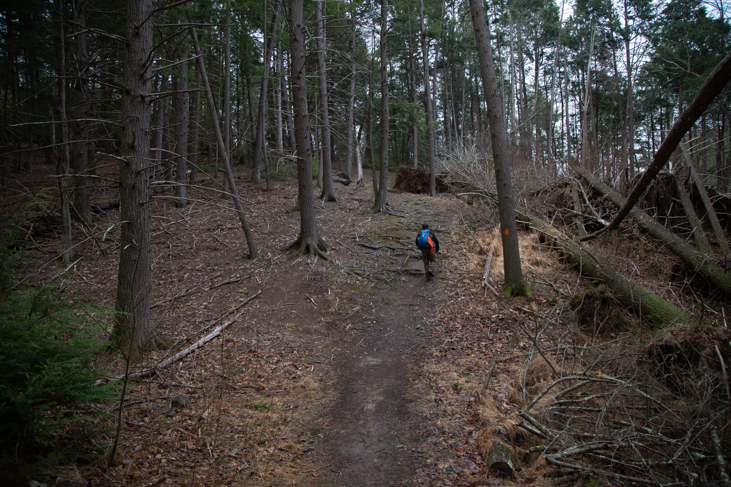
We started on the Gould Trail which took us through the woods and down to Hickory Run via the Switchback Trail. Hickory Run was beautiful and the leaves were starting to change to golden color. We headed north on the Fireline Trail which took us up the hillside overlooking the Lehigh River and the distant State Gameland 149. I particularly enjoyed the Pitch Pines along the trail. We passed an overlook with a clear view of Lehigh Gorge. Heading east on Fireline, we turned south to take the Skyline Trail back to Gould to make a lollipop loop. But before reaching the trailhead, we found a comfortable log just off the trail to stop, make coffee and have light breakfast on our campstove. I miss camping. We haven’t been since we left California. Most of the campgrounds in our area are very developed and mostly made for large campers. I’m not a fan of this type of camping, so I haven’t had much luck finding more remote space.

It was a lovely day. As we reached the trailhead the sun began to hide behind the clouds and we headed back home.

Click “Read More” below for more photos from this hike.

Read More

Jacobsburg State Park, Explorer Trail, Sobers Run, April 10, 2021

Jacobsburg State Park, Explorer Trail, Sobers Run, April 10, 2021

Beautiful early morning walk at Jacobsburg State Park. I parked in the lot off Belfast road, crossed the bridge over Bushkill creek and headed onto Sobers Run to the Explorer Trail. This is one of my favorite sections of the park, as there’s a large conifer plantation here and walking through it in the early morning hours was magical. The trail then travels mostly through hardwood forest until it eventually drops down to the creek. I sat here for a while enjoying the sound of the rushing water and the hemlocks swaying in the wind. I love starting out my mornings with a nature meditation and grounding practice. And even though some days it’s hard to wake up before the sun, I never regret it.

Read More

Lake Towhee walk, April 3, 2022

Lake Towhee walk, April 3, 2022

Quick walk at Lake Towhee this evening. This is a 50-acre lake in Bucks Count Pennsylvania. I was here one time last summer for a short visit. Next time I’ll be sure to bring my binoculars because it seems to be a great place for birdwatching. I saw lots of waterfowl and plenty of red-winged black birds. There are some very short trails in the surrounding woods and we walked the short paths searching for spring wildflowers. First to be spotted was Blood root (Sanguinaria canadensis). Native to Pennsylvania, its name refers to the red-orange sap that comes from its broken stem and root. Native Americans used this plant as a dye and an insect repellent. (I really should try the latter, as the east coast is full of bugs.) Blood root is a spring ephemeral and grows in woodlands throughout the Northeast. It blooms in April and its flowers open in full sun and close at night. I've been seeing a lot of these on the trails.

Next up I saw Rue Anemone, (Thalictrum thalictroides). Another native to Northeastern Pennsylvania. The flowers are found in spring woodlands and I observed some with white petals while others were a light pink to lavender color. These little flowers bloom for a short time from April to May.

The yellow flowers posted here are Lesser celandine or pilewort and not native to Pennsylvania. They come from the buttercup family Ranunculaceae and are native to Europe and Western Asia. I believe they are marked as an invasive species to the area.

This is a nice place to stop for a quick walk or a quiet meditation by the water.

Click “Read More” below for more photos.

Read More

Graver Arboretum Walk, Spring Flowers Emerge, March 26, 2022

Graver Arboretum Walk, Spring Flowers Emerge, March 26, 2022

Photos from a relaxing early evening walk at Graver Arboretum, in Bushkill Township, Pennsylvania. I’ve been here a coupe of times and need to make it a point to visit more often. The arboretum is used as an outdoor classroom by the biology and other science departments of Muhlenberg College. Today I saw the first signs of spring in the form of the emerging Eastern Skunk Cabbage (Symplocarpus foetidus). It’s one of the earliest spring flowers in Northeastern Pennsylvania. These plants are unique in that they can generate heat to melt through snow making them one of the first wildflowers to be seen emerging in the spring. The plant produces a pungent odor if the leaves are crushed. Some compare it to rotting flesh. (I didn't crush the leaves to try it, because I didn't want to hurt the plant.) The odor, while maybe not so pleasant to a human, is attractive to pollinators. Another subject of artistic interest was the early evening light cast on the “knees” coming up from the roots of the Bald Cypress (Taxodium distichum) near the pond. I spent about about an hour here walking, observing and enjoying my time discovering some trees I had not seen before such as the Lacebark Pine (Pinus bungeana). But as the sun sank lower in the sky, a large dark clouds threatened with stormy winds. I knew the sky was about to open up with rain, but luckily, I was dressed for weather because it started to hail. I loved the sound of the trees swaying in the wind, and the sound of the bark on the limbs rubbing against each other. It made the time even magical to be here at this hour with no one else around listening to the trees talk. The storm didn’t last long before the sun came back out. As I was driving home a gorgeous rainbow appeared in the sky. It was a nice way to wrap up a wonderful evening.

Click “Read More” below for more photos from this day.

Read More

Hickory Run State Park, Boulder Field Trail in the Snow, January 30, 2022

Hickory Run State Park,  Boulder Field Trail in the Snow, January 30, 2022

Today we set out much later in the day then expected. Weather was in the teens, but the sky was blue and the snow was fresh . We drove to Hickory Run State Park and decided to check out the trail to Boulder Field. This is about a 7 mile out and back if you start at the trailhead off the 476. The trail was broken for about the first quarter mile, but after that it appeared no one had been on it since the recent snowfall. We continued to make our way winding through a beautiful single track in and out of hemlock, hardwoods and rhododendron. I wish I’d had my snowshoes with me. I underestimated how deep the snow would be. Even so it was still doable with just a little more effort as we broke trail. As the sun started to lower itself in the sky, it cast beautiful hues of orange and long deep shadows on the glistening snow. We thought it would be best to turn around at this point due to the temperatures dropping and because we knew it would soon be getting dark. We made our way back and decided to come back again to complete the trail another day when we have more time and could get an earlier start.

Read More

Dick and Nancy Eales Preserve at Moosic Mountain, September 6, 2021

Dick and Nancy Eales Preserve at Moosic Mountain, September 6, 2021

Today we hiked the Dick and Nancy Eales Preserve on Moosic Mountain. It looked quite a bit different then when we were here in the winter when it was covered in snow. We started the hike on the Blueberry Trail passing through stunted pitch pines, oak and blueberry. We then followed the Stonehenge Trail through a large garden of boulders where we connected to the After Five Trail following along large rock slabs. From here we dropped down to check out the O’Connor reservoir and then took Gene’s Trail to the Bruised Ego Trail closing the loop at a little over 8 miles. It was a nice day. The clouds kept the sun from making it too hot and the humidity wasn’t quite as bad as it’s been most of the summer. It was a nice hike with some variety in the terrain and scenery.

Click Read More Below for More Photos.

Read More

Tuscarora State Park, Lake View & Crow Trail Out & Back, August 1, 2021

Tuscarora State Park, Lake View & Crow Trail Out & Back, August 1, 2021

We had a nice hike around Tuscarora State Park. We started from the Day Use area on the Lake View Trail heading east and clockwise around Tuscarora Lake. The trail looped along the edge of the north side of the lake until crossing over the dam and heading back into the woods. The views along the trail of the lake were quite nice. We then passed through open meadows and followed the Crow Trail to its terminus at the parking area. I had thought we might be able to make a loop around the lake, but I wasn’t quite sure of the route. I had a feeling we’d have to take the road, but decided to wait until I had better intel and come back another day. We made our way back the way we came and enjoyed the scenery from the opposite direction. I enjoyed the hike today and this is a lovely area with very few people. The terrain isn’t quite as rocky as further north so the walking wasn’t as tough on your feet. I really enjoy this area and will be back again to complete the loop.

Click Read More Below for More Photos.

Read More

A spring hike at Nothstein Preserve and Van Buskirk Farm Preserve, May 31, 2021

A spring hike at Nothstein Preserve and Van Buskirk Farm Preserve, May 31, 2021

Today we revisited both the Nothstein Preserve and the Van Buskirk Preserve, both of which we had hiked in March before the deciduous trees had gotten their leaves and the earth awakened from its winter slumber. We started the day at the Nothstein Preserve. As we began the hike on the now grassy path, it seemed like a completely different world. The brown tones were replaced with hues of green, and the trail once covered in snow was lined with fern and wildflowers. As I was walking and keeping my eye out for wildflowers, I came upon a Red Eft which is the juvenile stage of the Eastern Newt. We saw many of these along the trail today, as they are not hard to find due to their bright orange color. The Red Eft is poisonous to anything that eats it; therefore I assume this is the reason for it not having to camouflage itself. We followed the trail upward to the red rock quarry we had seen last time. Now the oaks and birch trees were filled with bright green leaves. The beautiful pitch pines stood tall showing off their prickly cones, but the views of the ridge beyond were now masked by the leaf covered trees. After exploring the quarry we made our way through a grove of pine where I spotted a Lady’s Slipper Orchid. The genus name of this orchid is “Cypripedium.” It comes from the Greek word Cypris which in Greek mythology is a reference to the Goddess Aphrodite. Pedilon means sandal, and the orchid’s labellum resembles a slipper; hence, the name “Lady’s Slipper”. It was a unique find and a very curious looking flower. Next, the trail took us over a bridge and over Cranberry Creek. I remembered this section from winter because everything here was covered in snow at that time. We followed the trail along the creek. It looked so beautiful with its many cascades flowing over the moss covered rocks, and its False Hellebore strewn banks. When we arrived back at the trailhead, it was still pretty early in the day. We decided to stop by the Van Buskirk Preserve which is just a few miles away. Here again, everything looked completely different covered in lush, green foliage. I remembered back in March, we had passed by a vernal pool full of singing wood frogs. This time, the pool was filled with tadpoles. I guess those frogs we heard in early spring were busy! As we hiked past the ruins of the old Van Buskirk Farm, I could smell the sweet fragrance of flowers from the Black Locust trees. By now the day was warming up and the sun was shining high in the sky. I made a plan to revisit some of the other preserves we had seen over the winter to experience them in a new season.

Click on “Read More” below for more photos.

Read More

Delaware Water Gap National Recreation Area, Tumbling Waters, Ridgeline, Scenic Gorge, April 10, 2021

Delaware Water Gap National Recreation Area, Tumbling Waters, Ridgeline, Scenic Gorge, April 10, 2021

Today we went back to explore more of the Delaware Water Gap National Recreation Area. This time we planned to hike some trails that started at the Pocono Environmental Education Center Campus. The PEEC is a non-profit organization that offers environmental learning experiences in a national park. It looked like a really cool place. We started the day on the Tumbling Waters Trail which begins just across the road from the Main Education Building. We crossed a bridge and along the trail was a fun looking bird blind complete with exhibits inside. I should note that the really cool thing about this place is that the trails here are interpretive. Points of interest are marked with numbers and you can purchase a guided map outside the PEEC building, or download them onto your phone. An interesting exhibit at the beginning of the hike is a Trash Graveyard. It’s meant to demonstrate the amount of time it takes for common materials to decompose such as water bottles, plastic bags and cigarettes. It’s a fun way to educate people on the effects of littering. The trail then took us through a pine plantation and along the shores of Pickerel Pond where there was evidence of beavers. We walked over a boardwalk above more wetlands and then into a forest of conifers and mixed hardwoods. Eventually, the trail became a lovely single track just above a ravine with hemlocks towering above. A helpful set of steps are cut into switchbacks leading down the ravine to the waterfall. The purpose of the steps is to keep hikers on the trail. Cutting switchbacks can lead to erosion. It’s so important to respect the rules of our beautiful parks and wilderness areas. Unfortunately, I did see many use trails branching off near the waterfall, which gives evidence that some hikers do not respect these principles. As we made our descent down to the falls, there were many rhododendrons and large hemlock trees. We spent some time here exploring the area, taking pictures, and enjoying the “tumbling waters”. Next, we hiked back up and the trail skirted cliffside with expansive views of the Delaware River Valley. We then passed a stone fireplace which was once part of a cabin. It made me think about how difficult it must have been to haul all those stones up the steep slope to build it. We then hiked through more forests of mixed oaks, cedar and pine. Along the trail I saw wildflowers of periwinkle and rue anemone beginning to peak out from under the leaf debris. Soon we arrived back at the parking area where we then made our way onto the Ridgeline and Scenic Gorge Trails. These trails offered so much variety! We hiked through forests of tamarack, oak, hickory, hemlock and pine. We climbed up and down large sedimentary rocks where there was a handy rope installed to assist with the descent. We passed through wetlands and vernal pools while spring peepers sang their spring chorus. We crossed bridges over the cascading waters of Spackman’s creek and enjoyed the scenic gorge that was decorated with bright green moss and fern. There were also various types of shelf-like mushrooms to observe. As we reached the trailhead once again, I couldn’t believe how quickly time went by on these trails. I really enjoyed my time here and am so appreciative that there are gems like this to learn about and enjoy the magic of nature.

Click on “Read More” below for more photos.

Read More

Hiking Chestnut Mountain Nature Preserve, April 3, 2021

Hiking Chestnut Mountain Nature Preserve, April 3, 2021

Today we explored the Chestnut Mountain Nature Preserve in Barrett Township. This area was going to be developed and town homes built on the land, but plans failed and the new owner timbered the forest. Buck Hill Conservation Foundation acquired the land and opened the preserve to the public in 2012. This was an interesting hike exploring a forest in recovery. We hiked along rugged logging roads and challenging terrain rutted with deep holes hidden beneath leaves and between large rocks where trees that once stood were pulled up from their roots. Much of the trail is undefined, but there are helpful blue and red markers to guide you along the way. We began the hike from a small parking area just off the 191. The morning was chilly; only 27 degrees. There was a layer of thin ice on top of the frozen leaves that covered the logging road which begins the hike. Right away I noticed the sparseness of the forest. Along the trail we spotted a beech tree that had bear claw marks in its bark. The logging road dipped slightly downhill and after about a mile made its way up a magical, mossy green carpet to an overlook. The area here was flat, wide and scattered with trees, stumps and boulders. From this vantage point I could see Mt. Wismer and High Knob. We explored the area despite the wind which made it feel even colder than it was for a spring morning. We then continued along the trail and made a descent onto a path much less defined. We followed the helpful blue markers until we reached a junction for the red trail. Here, we checked our map and decided to follow it since it would add some extra mileage to our day. We passed by even more boulders of various shapes and sizes. I saw a fallen log covered in velvety bluish-gray mushrooms. I haven’t studied up on mushroom identification yet, so I guess I’ll need to do that now since Pennsylvania sure has a lot of them. Soon, the trail began to traverse uphill where we crossed over a small stream flowing down from the mountain. The vegetation here was thick and overgrown. We bushwhacked our way through and the terrain became even more challenging with rocks and deep ruts hidden by leaf debris. We crossed over large, fallen trees being careful of each step. I noticed piles of chipped wood scattered around tree roots. As I looked up, I could see large, deep holes pecked into the tree’s trunk; the work of persistent woodpeckers. I also took note of some sapling hemlock trees peeking out from under the leaves; a promise that one day this would again be a healthy forest. Eventually, the trail made its way back to another logging road which was much easier to walk on. The day was warming up and with the workout we were getting, I was starting to work up a sweat. I took a moment to set down my pack and remove a layer, and as I glanced at the trail up ahead I saw a huge black bear! The big bear was sauntering across the trail and appeared to be foraging for food. We watched for a moment before my husband blew the safety whistle to make the bear aware of our presence. The bear then took off into the woods. We waited a moment to give the bear some leeway before continuing up the trail. It was a very exciting moment and my first time seeing a bear in Pennsylvania. The trail continued to make its way uphill and finally back to the trailhead. It was a wonderful day and an interesting trail full of fun challenges, surprises and promise.

Click on “Read More” below for more photos.

Read More

Day Hike at the Van Buskirk Farm Preserve, March 27, 2021

Day Hike at the Van Buskirk Farm Preserve, March 27, 2021

Today our hike took place at the Van Buskirk Farm Preserve in the Pocono Mountains. We parked at the trailhead on the east side of Cranberry Creek and headed out onto the trail. Immediately, we were transported into an ethereal world of towering hemlocks, a roaring creek and huge boulders carpeted in thick green moss. It was beautiful here. And only a few steps away from the road. I wondered how many people drive by this place every day and don’t even notice the inconspicuous trail and the beauty that lies just beyond. We took time to explore the area and capture the morning sunlight that shone through the pines and sparkled on the clear waters of the creek. We crossed over a primitive wooden bridge to the other side where we found large trees taller than a building toppled over from a powerful windstorm. I can’t even imagine the force it must have taken to uproot them. Next we continued along the trail which paralleled the creek crossing over patches of mud, rocks and small streams flowing down from the mountain. The trail then turned west and made an ascent towards more downed trees that we had to to navigate around. As the trail leveled out we were treated to a path of soft pine needles that always feel so good on your feet after traversing rocky terrain. We passed through the middle of an old stone wall, left from days gone by. As we hiked along the wind whispered through the trees and gently moved cumulus clouds across the sky like soft puffs of white cotton. We made our way through more patches of mud and wet leaves before the trail became a pleasant mossy path passing through rows of young white pine. Soon we found ourselves at an open meadow and before us stood the ruins of an early 20th century farm. We observed some old farm equipment and the remnants of a stone structure. Below the ruins was an open field which I imagined may once have been an orchard abundant with fruit trees. After exploring the farm, we continued on our way. Next, the trail led us to an open area at the foot of a rock quarry surrounded by vernal pools. A chorus of wood frogs filled our ears. These pools must have been loaded with them. We made our way up to the top of the quarry where twisted pitch pines grew out from its rocky ledges. We took in the view and enjoyed the mountain breeze before heading back down to the trail. Soon we were back at the beginning of the loop that would take us back the way we came along the creek. By this time it was early afternoon and with the beautiful weather, we decided to sit aside the creek and enjoy a snack before heading back home.

Click on “Read More” below for more photos.

Read More

Mariton Wildlife Sanctuary, Snowshoeing in the Rain, February 28, 2021

Mariton Wildlife Sanctuary, Snowshoeing in the Rain, February 28, 2021

We tried to beat the rain on Sunday and take a short hike around Mariton Wildlife Sanctuary. I haven’t been here since fall and today the forest was covered in snow. With the weather having been warmer this past week and the snow starting to melt, I wasn’t expecting to need snowshoes. But the snow was still deep and we ended up putting them on. As we made our way along the trail, we were accompanied by the soft sound of rain falling on the trees and the snow covered forest floor. Despite the gray skies, it was a lovely day; very peaceful and relaxing to be in this serene place on a rainy winter morning.

Click on “Read More” below for more photos.

Read More

Snowshoeing Nescopeck State Park, 5 Miles, Nescopeck Trail, Creekside Loop, Woodland Way Trail, February 13, 2021

Snowshoeing Nescopeck State Park, 5 Miles, Nescopeck Trail, Creekside Loop, Woodland Way Trail, February 13, 2021

It’s hard to believe we’re moving closer and closer to spring with all of this snow around. The days are getting longer, but the temps are the coldest they’ve been so far this winter and we’re still receiving snowfall. We took advantage of the latest accumulation and headed up to Nescopeck State Park for a day of snowshoeing. Nescopeck is a beautiful area that we’ve returned to quite a few times since we’ve been on the east coast. We started our day enjoying the views around frozen Lake Frances which was now blanketed in a layer of snow. We turned south onto the Nescopeck Trail on a single track through a hardwood forest in the direction of Mount Yeager. The trail then widened and we made sure to stay out of the cross country ski tracks that were already laid. The snow was powder fluff and over a foot deep; perfect for snowshoes. We continued south until we reached the Creekside Trail. This trail is my favorite in the park. It looked exceptionally beautiful today. Its pristine waters were now mixed with patches of ice and a light dusting of snow. We stopped to admire its beauty and listen to the sound of the quiet forest as delicate snowflakes fell from surrounding Hemlocks. We continued following the creek westward until reaching a crossing where the bridge has been out since summer. We didn’t see a way of getting around it without having to make a water crossing, so we backtracked the way we’d come until reaching the junction for the Nescopeck Trail. From here we continued northeast and onto the Woodland Way Trail which circles around a pond. In the summer you can enjoy watching the turtles sunning themselves here on the rocks. We closed out our day at 5 miles. I’m really enjoying taking advantage of spending time outdoors during these beautiful winter days. I can feel the earth stirring beneath my feet, and life is beginning to awaken. I know soon enough the cold winter days and gray skies will give way to the warmth of the sun. The bare, leafless trees will burst forth in hues of green and the soil will make way for the first of blooms of spring flowers.

Click on “Read More” below for more photos.

Read More

Tuscarora State Park, Spirit Trail, 5 Mile Loop, January 30, 2021

Tuscarora State Park, Spirit Trail, 5 Mile Loop, January 30, 2021

Saturday morning we had a lovely walk around Tuscarora State Park. The temperatures were below freezing again, but there was no wind and the day was sunny. We hiked the Spirit Trail which we had done in the summer when it was filled with wildflowers. Today it was covered in a dusting of snow and patches of ice. The trail starts off following along the lake for about a mile ascending through an oak and hemlock forest. We could see views of frozen Tuscarora Lake below and also hear the water shifting under its thick coating of ice. It makes an eerie sound; kind of hard to describe. We then took the loop south heading back down towards Locust Creek where we hiked in and out of rhododendron tunnels. Parts of the creek were frozen solid and others had a coating of ice above with water flowing underneath. We passed by the Spirit Tree which is covered in a green coating of moss and mushrooms, even in the winter. We made our way to a newly added bridge and crossed over the creek to begin another ascent. At the top we came to a clearing with lovely views and an evergreen forest. Before continuing onto the second loop (the trail is actually a figure eight if you look at it on a map), we explored a side trail which ascended the mountain again. I believe would have taken us to the Crow Trail. We’ll have to explore that one on another day. The trail then dropped us back down for more creekside hiking. We crossed another bridge over the creek that had been broken by a fallen tree. When we arrived back at the trailhead, we took a walk down to the lake. By this time there were ice fisherman and ice skaters taking advantage of this beautiful winter’s day. It was a nice contrast to when we had visited over the summer.

Click on “Read More” below for more photos.

Read More

New Year's Day Hike, Austin T. Blakeslee Natural Area, January 1, 2021

New Year's Day Hike, Austin T. Blakeslee Natural Area, January 1, 2021

We started out the year with a hike to Tobyhanna Falls in the Austin T. Blakeslee Natural Area. Pennsylvania has so many waterfalls, I haven’t even scratched the surface of what there is to discover. The weather reports were calling for freezing rain later in the day, so we got up and out early so as not to risk it.

The Austin T. Blakeslee Natural Area was once home to Harrison Amusement Park which entertained the community along the Tobyhanna Creek. What was then known as Toby Park had a carousel, skating rink, swimming pool, dining hall, penny arcade, sporting fields and a creekside beach. It was destroyed in a flood in 1955.

Today the area is open to hikers with a small network of trails that take the hiker along Tobyhanna Creek to the scenic Tobyhanna Falls.

We started at the trailhead off the 115 heading west along the Creek Trail. The first section of the hike takes you through a beautiful stand of tall spruce trees. A short half a mile walk then leads to the waterfall. The falls aren’t very tall, but they are mighty. It’s quite a spectacle to see. The fast moving water was tinted with an amber color which is caused by the tannic acid produced by hemlock and spruce along the banks of the creek. It was a beautiful site to start off the new year. After taking it all in, we continued west. At about .9 miles Tunkhannock Creek flows into Tobyhanna. We looped around north heading away from the creek on the Highland Trail and into a beautiful coniferous forest.

It was a wonderful morning and this is a beautiful area to explore in just a few short miles. We got back in plenty of time to beat the weather.

(Click Read More Below to See More Photos)

Read More

Lehigh Gorge State Park, Bald Mountain Loop, 9.8 Miles RT, December 29, 2020

Lehigh Gorge State Park, Bald Mountain Loop, 9.8 Miles RT, December 29, 2020

Today we spent the day exploring the Bald Mountain tract of Lehigh Gorge State Park near Rockport. Bald Mountain looked interesting to me because the access point isn’t located near any of the popular areas of the park. We found the turn off to the trailhead which wasn’t signed and if you blinked, you’d miss it. We parked the car and right away I heard the clack, clack, clack of the ravens above. I knew it was going to be a good hike. I have such a soft spot for these birds. They remind me of my hikes in California because they were always around when I was hiking in the higher elevations. We began the trek near Indian Run and crossed over the bridge which lead us into a beautiful forest of pitch pine and hemlock. The wide trail headed east with a steady incline up to the top of Penn Haven Mountain with the Lehigh River flanking us to the north, east and south. There was a junction here and signage for the Bald Mountain Loop. We followed the trail northeast in a clockwise direction being careful not to slip on the ice that was hidden under a thin layer of snow. It was about 30 degrees with about a 12 mph wind which made it seem much colder then it was. The loop dropped us down in elevation and eventually gave us a nice climb back up. It was a beautiful section of trail, although there was a lot of water we had to navigate around in addition to the ice. Once back at the top we found signage for the Vista Trail. The trail narrowed and lead us out to the rocky south facing cliff side of Bald Mountain. Here we had nice view down into the deep gorge and across to Scrub Mountain. We sat for a bit in the sun to warm up, but even in the sun it was still quite chilly. As we made our way back, the winds continued and we kept moving. The afternoon sunlight coming through the trees was absolutely gorgeous! I really enjoyed this hike. It was such a beautiful day despite the wind and I will definitely be back to explore more of this beautiful area.

Read More

Delaware State Forest, Egypt Meadow Lake, Bruce Lake, Promised Land, 6 Miles RT, December 27, 2020

Delaware State Forest, Egypt Meadow Lake, Bruce Lake, Promised Land, 6 Miles RT, December 27, 2020

Beautiful day in the Delaware State Forest. We started the day by stopping off in Promised Land to check out the Little Falls trail along East Branch Wallenpaupack Creek. It was 18 degrees in the morning, and as I walked I could feel the ice underneath the frozen leaves cracking beneath my boots. The creek was moving fast and there were icicles clinging to the trees. I took a few photos and headed out to the trailhead for Egypt Meadow Lake off the 390. We started the trail heading east in a clockwise direction, but soon came upon an area where the water from the lake had breeched the trail making it impassable. There’s been so much rain over the past few days that it’s caused the snow to wash away and the rivers and creeks to swell. We backtracked and took the trail in the opposite direction. It was a beautiful walk through the forest with rock outcroppings lending spectacular views of frozen Egypt Meadow Lake. The trail undulated gently up and down over the typical rocky Pennsylvania terrain until we reached the junction for Bruce Lake. From here we continued eastward on a wide road with a lot of icy sections that were easy enough to navigate around. We arrived at Bruce Lake which was also frozen over. I tested the water with my boot and it felt solid. I could see footprints of a person and their dog who had ventured out onto the icy lake. We took a short break here to enjoy the scenery, but with the below freezing temperatures we didn’t stay too long before we needed to get moving again. On the way back we took the Panther Swamp trail to reconnect with the Egypt Meadow Trail and returned to the trailhead. The parking lot at the trailhead was still a sheet of ice. It didn’t go above freezing the whole day, but there were no winds which made it a perfect day for winter hiking.

Read More