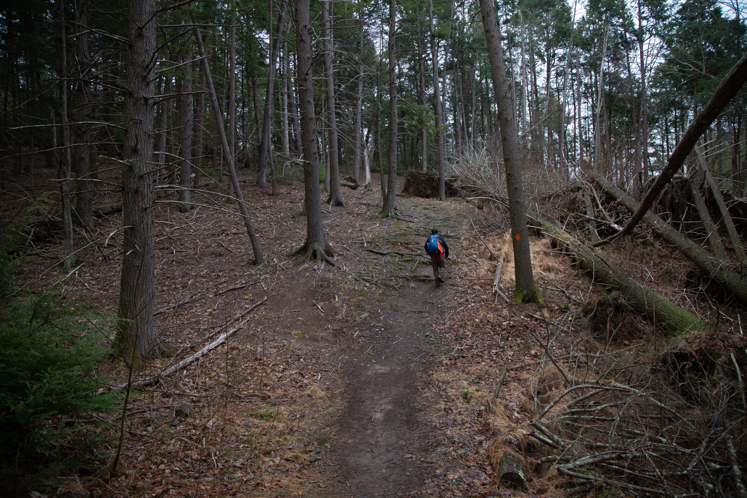
Today we hiked the Dick and Nancy Eales Preserve on Moosic Mountain. It looked quite a bit different then when we were here in the winter when it was covered in snow. We started the hike on the Blueberry Trail passing through stunted pitch pines, oak and blueberry. We then followed the Stonehenge Trail through a large garden of boulders where we connected to the After Five Trail following along large rock slabs. From here we dropped down to check out the O’Connor reservoir and then took Gene’s Trail to the Bruised Ego Trail closing the loop at a little over 8 miles. It was a nice day. The clouds kept the sun from making it too hot and the humidity wasn’t quite as bad as it’s been most of the summer. It was a nice hike with some variety in the terrain and scenery.
Today we went back to explore more of the Delaware Water Gap National Recreation Area. This time we planned to hike some trails that started at the Pocono Environmental Education Center Campus. The PEEC is a non-profit organization that offers environmental learning experiences in a national park. It looked like a really cool place. We started the day on the Tumbling Waters Trail which begins just across the road from the Main Education Building. We crossed a bridge and along the trail was a fun looking bird blind complete with exhibits inside. I should note that the really cool thing about this place is that the trails here are interpretive. Points of interest are marked with numbers and you can purchase a guided map outside the PEEC building, or download them onto your phone. An interesting exhibit at the beginning of the hike is a Trash Graveyard. It’s meant to demonstrate the amount of time it takes for common materials to decompose such as water bottles, plastic bags and cigarettes. It’s a fun way to educate people on the effects of littering. The trail then took us through a pine plantation and along the shores of Pickerel Pond where there was evidence of beavers. We walked over a boardwalk above more wetlands and then into a forest of conifers and mixed hardwoods. Eventually, the trail became a lovely single track just above a ravine with hemlocks towering above. A helpful set of steps are cut into switchbacks leading down the ravine to the waterfall. The purpose of the steps is to keep hikers on the trail. Cutting switchbacks can lead to erosion. It’s so important to respect the rules of our beautiful parks and wilderness areas. Unfortunately, I did see many use trails branching off near the waterfall, which gives evidence that some hikers do not respect these principles. As we made our descent down to the falls, there were many rhododendrons and large hemlock trees. We spent some time here exploring the area, taking pictures, and enjoying the “tumbling waters”. Next, we hiked back up and the trail skirted cliffside with expansive views of the Delaware River Valley. We then passed a stone fireplace which was once part of a cabin. It made me think about how difficult it must have been to haul all those stones up the steep slope to build it. We then hiked through more forests of mixed oaks, cedar and pine. Along the trail I saw wildflowers of periwinkle and rue anemone beginning to peak out from under the leaf debris. Soon we arrived back at the parking area where we then made our way onto the Ridgeline and Scenic Gorge Trails. These trails offered so much variety! We hiked through forests of tamarack, oak, hickory, hemlock and pine. We climbed up and down large sedimentary rocks where there was a handy rope installed to assist with the descent. We passed through wetlands and vernal pools while spring peepers sang their spring chorus. We crossed bridges over the cascading waters of Spackman’s creek and enjoyed the scenic gorge that was decorated with bright green moss and fern. There were also various types of shelf-like mushrooms to observe. As we reached the trailhead once again, I couldn’t believe how quickly time went by on these trails. I really enjoyed my time here and am so appreciative that there are gems like this to learn about and enjoy the magic of nature.
Today we explored the Chestnut Mountain Nature Preserve in Barrett Township. This area was going to be developed and town homes built on the land, but plans failed and the new owner timbered the forest. Buck Hill Conservation Foundation acquired the land and opened the preserve to the public in 2012. This was an interesting hike exploring a forest in recovery. We hiked along rugged logging roads and challenging terrain rutted with deep holes hidden beneath leaves and between large rocks where trees that once stood were pulled up from their roots. Much of the trail is undefined, but there are helpful blue and red markers to guide you along the way. We began the hike from a small parking area just off the 191. The morning was chilly; only 27 degrees. There was a layer of thin ice on top of the frozen leaves that covered the logging road which begins the hike. Right away I noticed the sparseness of the forest. Along the trail we spotted a beech tree that had bear claw marks in its bark. The logging road dipped slightly downhill and after about a mile made its way up a magical, mossy green carpet to an overlook. The area here was flat, wide and scattered with trees, stumps and boulders. From this vantage point I could see Mt. Wismer and High Knob. We explored the area despite the wind which made it feel even colder than it was for a spring morning. We then continued along the trail and made a descent onto a path much less defined. We followed the helpful blue markers until we reached a junction for the red trail. Here, we checked our map and decided to follow it since it would add some extra mileage to our day. We passed by even more boulders of various shapes and sizes. I saw a fallen log covered in velvety bluish-gray mushrooms. I haven’t studied up on mushroom identification yet, so I guess I’ll need to do that now since Pennsylvania sure has a lot of them. Soon, the trail began to traverse uphill where we crossed over a small stream flowing down from the mountain. The vegetation here was thick and overgrown. We bushwhacked our way through and the terrain became even more challenging with rocks and deep ruts hidden by leaf debris. We crossed over large, fallen trees being careful of each step. I noticed piles of chipped wood scattered around tree roots. As I looked up, I could see large, deep holes pecked into the tree’s trunk; the work of persistent woodpeckers. I also took note of some sapling hemlock trees peeking out from under the leaves; a promise that one day this would again be a healthy forest. Eventually, the trail made its way back to another logging road which was much easier to walk on. The day was warming up and with the workout we were getting, I was starting to work up a sweat. I took a moment to set down my pack and remove a layer, and as I glanced at the trail up ahead I saw a huge black bear! The big bear was sauntering across the trail and appeared to be foraging for food. We watched for a moment before my husband blew the safety whistle to make the bear aware of our presence. The bear then took off into the woods. We waited a moment to give the bear some leeway before continuing up the trail. It was a very exciting moment and my first time seeing a bear in Pennsylvania. The trail continued to make its way uphill and finally back to the trailhead. It was a wonderful day and an interesting trail full of fun challenges, surprises and promise.
The first stop on our Sunday adventure was Targa Falls, a natural waterfall found on the Broadhead Creek. The waterfall is easily accessible from a parking area just off the 447, or you can hike to it from the Paradise Price Preserve. I wanted to see and photograph it in the very early morning sunshine, so we chose the easy drive up access for today. Someday I plan to return to hike in from the west side of the preserve. We parked the car and as I stepped out I could hear the loud rushing waters. Just a few steps more and there it was, this incredible flowing creek roaring past me over large, rocky boulders. The early morning sunlight danced on the white foaming rapids, and the tall hemlocks swayed in the breeze on the banks. It was a beautiful sight just a stone’s throw away from the road. At that moment I honestly felt a little guilty having such a natural wonder within such easy reach. Being used to the rugged mountains of Southern California, I’m not used to having this kind of quick and easy access to something so beautiful as a roaring waterfall. I got my hiking legs out west where you have to earn your views by trekking miles into the wilderness and climbing to precarious mountain tops to view such spectacular places; no cell service, no wifi and only your two legs to rely on to get you there and back. Pennsylvanian’s are so very lucky in this respect.
After enjoying the waterfalls, we hopped back in the car and headed to the trailhead for the Red Rock Loop and Mt. Sophia. The Red Rock Trail is part of the Mount Airy Trail Network and sits on lands protected by a conservation easement held by Paradise Township. At the trailhead there’s a helpful map laying out the topography of the hike, and the trail begins just beyond the kiosk. It starts out on a gravel path leading up stone steps. Right away I noticed the beautiful oak trees and not far into the trail we arrived at a vernal pool. I imagined it would soon be filled with salamanders, wood frogs and other critters. The trails here seemed to be very well kept (save for some downed trees), and they were so pleasant to walk on. So much so that I forgot how rocky the Pennsylvania terrain usually is. We soon arrived at a well-marked junction for the Red Rock Loop and decided to continue northwest directly towards the junction for the top of Mt. Sophia. Along the trail there were large stands of mountain laurel which I am so excited to see bloom in late spring and early summer. This will be my first spring on the east coast in over 20 years. Soon the trail became covered with patches of icy snow and we reached the junction for Mt. Sophia. The trail took us up gently graded switchbacks and as we continued upward, there were helpful wooden steps peeking out from underneath the snow. As we approached the summit, an impressive forest of large pine and hemlock came into view. The sunlight radiated through the majestic trees. I spent some time exploring the summit and the views. From here I could make out the ski runs on Camelback Mountain to the south and more views to the north. We followed the trail a little further as it looped us around in a circle with a convenient “Exit” sign pointing back to the direction in which we came. We took our time hiking down enjoying the views through the beautiful pines and the sunshine. We then arrived at a junction for Red Rock Spur #1. It led us to the site of an old car from the 50s that was flipped upside down and settled into a ditch. It made me wonder what its story was and how it even got up there. There were some old logs that looked like they’d make a perfect place to sit down and enjoy the fresh mountain air, so we sat down and took a break. It was a windy day and I was enjoying listening to that groaning, creaky sound the trees make when they sway against each other in the wind. After our break, we continued along the trail and the winds started kicking up even more. We reached a junction for Red Rock Spur #2 (another outer loop) and began a gentle ascent. We passed by some interesting rock formations before noticing a vintage car graveyard nestled below us, deep in the woods. Had this been summer, we would have never even seen it since the trees would have concealed it with their leaves. We decided to move in closer to explore. There were three rusty cars who had clearly been here for a long time; their final resting place nestled into the forest. We took some photos and then got back on route, enjoying more views to the south as we hiked. The trail made its way down some lovely switchbacks until finally we were back at the junction for the Red Rock Trail on which we had started. This was a wonderful day hike. I really enjoyed my time here and again, it felt like wilderness even though we were so close to civilization. I’d like to come back again and explore more of the spurs and see it when the mountain laurel is in full bloom.
Today our adventures took us to Hickory Run State Park. The last time we were here it was fall when the leaves were showing off their vibrant autumn colors. I was excited to see how it was going to look in winter covered in snow. We got an early start so we could avoid the crowds. This area has become quite popular over the years, and can be very overcrowded on weekends. The parking area for Hawk Falls off route 534 was empty when we arrived. We parked the car, geared up in our microspikes and made our way onto the icy trail. Light snow showers began just as we started the hike. The trail was packed down into a hard sheet of ice. But the path was wide and not very steep, so it was safe to travel with just light traction. A foot bridge crossed over Hawk Run, and we continued past steep rock walls lined in hemlock and rhododendron. We followed a short use trail to a rock outcropping that gave us a nice view of the top of the falls tumbling down the side of the rocky ledge. It looked so beautiful as soft white snowflakes fell from the sky. In just a short .6 miles we arrived at the bottom where the 25 foot Hawk Falls plunged into a clear pool of cascades. We spent some time here enjoying the magnificence of this natural waterfall. Near the falls, we noticed some ice formations along the high cliff walls and decided to explore them. The moss covered ledges and large icicles dripped with melting water. We then got back on the trail and followed along Mud Run until we reached the junction for the Orchard Trail. We turned east and made an ascent up a hill and onto a ridge with nice views that continued through a hardwood forest. Eventually, the trail dropped us down again on some switchbacks into a windy thicket of rhododendron. It led us to a large rock outcrop just above Mud Run where spectacular cascades tumbled over large rocks and boulders. There were many use trails branching off to offer closer views of the beautiful water flow. The trail then turned northeast and we started to ascend moving away from the creek. Now higher above Mud Run the trail was a mix of patchy snow and muddy pools of water flowing down the mountain. Our waterproof boots came in handy here. Eventually, the trail looped west and back into the hardwoods where it was mostly snow. We closed the lollipop loop and made our way back over the ridge and down to the Hawk Falls trail to return the way we came. By this time many people were starting to arrive. We saw several large groups slipping and sliding on the ice attempting to make their way to the falls on the icy trail. When we arrived back at the parking area, there were at least 20+ cars with more lining up to get a spot. I was grateful to have been able to enjoy a quiet morning in solitude along this beautiful trail.
February of 2021 brought the Lehigh Valley 38.8 inches of snow, the highest amount for the month to date. The days have been dark and gloomy, but today the sun made a glorious appearance. It was bound to be an amazing day, so we gathered our gear and headed out on the road into the Pocono Mountains. Our destination was Natural Lands Bear Creek Preserve. The early morning temperature was 19 degrees and the parking turnout at the trailhead off White Haven Road was still frozen. We suited up and hit the trail. We started out by following the purple trail south which took us through a hardwood forest scattered with mountain laurel and moss covered boulder formations. The beech trees still holding onto their autumn leaves glistened with a warm orange hue. We passed by a ravine with a waterfall now frozen into a striking 10 foot flow of ice. Sunlight danced on the frosty boughs of hemlock that still hung heavy with snow. As we meandered along the winding trail we began to descend closer to Shades Creek. We then connected to the gray trail as we reached the swinging bridge and crossed over the rapids. The winter landscape looked so amazing as we followed along the snow covered banks. We made our way in and out of rhododendron tunnels stopping every few feet to admire the fast flowing cascades. Sparkles of snow glistened in the sunlight as they fell from the trees like fairy dust. Before we knew it it was already getting to be late afternoon. As much as we wanted to stay, we knew we should start heading back. When we reconnected with the purple trail, we decided to make a quick side trip and follow it south. It crossed over Bear Creek on a primitive bridge and from here we went off trail to continue a little further along its edge. It was a beautiful section of trail, but we didn’t go too far since it was too late in the day to explore. We turned around making note to save that adventure for another time. We ascended steeply back up the hill, back into the hardwood forest and past the frozen waterfall. By this time, the sun had shifted lower on the horizon illuminating the landscape with its radiant afternoon light. When we arrived back at the trailhead, the frozen parking lot was a swimming pool of melted ice. We loaded up the car and headed home after another amazing winter’s day.
It was a bitter cold morning, but despite the weather we headed out for a short hike along Sobers Run in Jacobsburg State Park. It was somewhere in the 20s and the winds were blowing steadily which made it feel even colder. We Parked in the turn out just off Jacobsburg Road, crossed the bridge and headed south on the service road that would take us to the creek. We then turned north onto a one track trail which follows along Sobers Run. The trees here are mostly hardwoods and the forest looked completely different from when we had hiked this section of trail over the summer. At about 1.5 miles we reached Keller Road where we crossed a footbridge and circled back south on a long stretch of paved trail until it intersected with the dirt track that would take us closer to the creek. Along the way we discovered some large tree carvings which appeared to be either tikis or jack o’lanterns. I’m not really sure what they were supposed to be. It was a sunny morning and although it was quite chilly, it felt good to get out in the fresh winter air.
We had a perfect day of winter hiking around Bear Creek Preserve. This time we accessed the trail from White Haven Road on the west side of the preserve. It was a chilly morning (somewhere in the low 20s), but we warmed up as soon as we got moving. The lighting today was lovely. My husband had just gotten a GoPro camera, and he wanted to test it out. I couldn’t think of a better place to be on this fine winter morning. We started the hike following the purple trail which met up with the red trail and then the gray trail. This would take us right to swinging bridge and the beautiful waterfalls and cascades of Shades Creek. Before we arrived at the swinging bridge, we hiked along a path at the top of a beautiful frozen 10 foot waterfall I stopped here for a moment to enjoy the scenery before continuing along the trail. We spent most of the day experimenting with cameras and video, but we ended up hiking about 6 miles before returning home. Some day when we aren’t on a camera test mission, I’d like to hike the whole purple trail loop. It was such an amazing day. Both of us got a lot of great pictures and video.
Click on Read More Below for More Photos from this Hike.
Today we explored some of the trails in Lackawanna State Park. Lacka-wanna is Native American for “the meeting of two streams”. We parked at the trailhead just off Cole Road on the north side of Tunkhannock Creek, crossed the bridge and headed east onto the South Branch Trail. The trail first took us through an open field covered in snow. It looked so magical with the icy snowflakes blowing off the trees like glitter against the blue sky. It was a sunny day, and the snow covered ground sparkled in the morning sunlight as we followed the path. The temperatures were in the mid 20s, but no wind and the sun felt warming as we hiked. The trail then moved closer to the creek entering a beautiful forest of hemlock trees. It followed along the edge of the creek on a narrow track before ascending upward to a wider path. We continued along this track about 2 miles to Messimer Preserve where we found a sign stating, “Sorry We’re Closed”. At this point we turned around and headed back in the opposite direction. On our way we found a spur trail that descended to the creek where we spent time exploring the area and enjoying the small cascades. After our side adventure, we continued back to Cole Road where we crossed and headed west on the Bassett Trail. The trails here were a mix of mud and ice, but the scenery was beautiful nonetheless. We took the Abington Trail to the Lake Shore Trail to get some views of Lackawanna Lake which looked like it was mostly frozen over. We reached a junction for the Lee Hill Trail, took a sharp turn north and began to ascend into more beautiful forest. This trail is also used for mountain biking and I can see why. The trails here were undulating and very enjoyable to hike. Eventually, we met up again with the Bassett Path and closed out the loop. Lackawanna State Park is a beautiful area with many more trails to explore and also a number of preserves in the same vicinity. I’ll surely be back again to see more of this place.
Today we spent the day exploring the Bald Mountain tract of Lehigh Gorge State Park near Rockport. Bald Mountain looked interesting to me because the access point isn’t located near any of the popular areas of the park. We found the turn off to the trailhead which wasn’t signed and if you blinked, you’d miss it. We parked the car and right away I heard the clack, clack, clack of the ravens above. I knew it was going to be a good hike. I have such a soft spot for these birds. They remind me of my hikes in California because they were always around when I was hiking in the higher elevations. We began the trek near Indian Run and crossed over the bridge which lead us into a beautiful forest of pitch pine and hemlock. The wide trail headed east with a steady incline up to the top of Penn Haven Mountain with the Lehigh River flanking us to the north, east and south. There was a junction here and signage for the Bald Mountain Loop. We followed the trail northeast in a clockwise direction being careful not to slip on the ice that was hidden under a thin layer of snow. It was about 30 degrees with about a 12 mph wind which made it seem much colder then it was. The loop dropped us down in elevation and eventually gave us a nice climb back up. It was a beautiful section of trail, although there was a lot of water we had to navigate around in addition to the ice. Once back at the top we found signage for the Vista Trail. The trail narrowed and lead us out to the rocky south facing cliff side of Bald Mountain. Here we had nice view down into the deep gorge and across to Scrub Mountain. We sat for a bit in the sun to warm up, but even in the sun it was still quite chilly. As we made our way back, the winds continued and we kept moving. The afternoon sunlight coming through the trees was absolutely gorgeous! I really enjoyed this hike. It was such a beautiful day despite the wind and I will definitely be back to explore more of this beautiful area.
It was Saturday morning, two days after the snow storm and it was time to test out snowshoeing in Pennsylvania. Not really knowing how well the roads would be plowed further north, I decided it was best to stay somewhat local. I checked the DCNR State Parks Winter Reports page for the conditions and snow levels at Jacobsburg State Park. The reports showed 11 inches of snow which was enough for snowshoeing. It was 7 degrees when I woke up. I wasn’t quite sure how that was going to feel. I’m used to Southern California weather. In SoCal this time of year the temperature might (and that is a big MIGHT) drop into the 30s, and then I’d drive to higher elevations for snow and colder weather. In Pennsylvania winter is right outside my door. I suited up in my winter hiking gear and headed out. When I arrived at Jacobsburg, I was surprised to see there were very few cars in the well plowed lot. I thought for sure since this park is so close to town that there would be families with children sledding and many more people enjoying the winter wonderland. There was hardly anyone, and I was not going to complain. I suited up and headed out along the blue trail to get the blood flowing. The snow was more of a hard pack because during the storm, it was mixed with sleet. I followed the blue trail which loops around the edge of the park. I passed a group of cross-country skiers which I’m learning is a popular sport here. I can see why with the wide trails and easy going terrain. I reached the junction for the trail that would loop me around to the bridge that crosses over Bushkill Creek and headed into Henry’s Woods. The creek was starting to freeze over with icicles clinging to the rock walls along the creek. The giant hemlocks towered above. It was just beautiful. I finished the loop with about 3 miles RT. It was a nice warm up hike and introduction of what to expect after experiencing my first Pennsylvania snow storm in 20 years.
Today I wanted to hike some of the Appalachian Trail. I figured it would be a nice way to experience more of the terrain and try out the rock scrambles because that seems to be a common thing here. After I got on the road, I realized that I’d forgotten my camera. Ugh. So all of my photos were taken with my mobile phone.
I started this hike at the Fox Gap trailhead and did the Wolf Rocks Loop. The hike starts out mostly flat, but the terrain is rocky in most parts so you have to watch your step or you’ll stub your toe like I did about a million times.
The trail meanders through beautiful groves of fern and it looks like something out of a fairytale at times. There isn’t much elevation to gain until you reach the boulders where you’ll scramble your way up to the ridge to the overlook. Once on the ridge you’ll boulder hop your way across. You can pick any of the outcroppings to climb up and check out the views. I could see a little above the tree line and make out some of the area’s high points, one of which is called Pimple Hill, a summit in Monroe County that stands at 2,197’. What a funny name. We sat for a bit on the boulders and enjoyed the cool morning breeze before heading back. It was a fun early morning hike and we saw only a few people on this trail. I would like to come back to this trailhead and next time hike it northbound from Fox Gap towards the Delaware Watergap.
Today I headed back up to Jacobsburg State Park. It’s nearby and such a wonderful place to take in some nature. I parked in the main parking lot and took the Hazard Trail. I remember hiking this with my dog when I was a kid in the snow and ice. In the summer months, it’s really not much of a hazard. The trail is a single dirt track and it’s well maintained. There’s even a set of steps to take you up one of the steeper sections. The trail climbs easily above Bushkill Creek and there are nice views looking down to the water. At about a half mile I came upon a beautiful meadow filled with Yarrow and Common Milkweed. There were many birds here enjoying the first rays of sunshine. I could hear Eastern Towhee, Brown Thrasher and Gray Catbirds. I turned south and followed the path through the meadow which is part of the Homestead Trail. This trail skirts around the edge of the park on the southeast side. It was partly cloudy today making the walk around the open grassy areas very pleasant. The dewy grass and cool breeze felt so refreshing. In my journey I noted some wildflowers; Coneflower, Common Milkweed, Yarrow, Common St. John’s Wort, Red Clover, Crown Vetch, Wild Bergamont and a few others that I wasn’t able to identify. I closed the loop around the park by heading towards the Jacobsburg Environmental Education Center and exiting the trail there. I took a quick side trip across Belfast Road to visit the Henry’s Forge historic buildings before heading home. I’m really enjoying these relaxing morning hikes and taking the time to explore and learn the flora and fauna of the east coast.