nature

Catskills, Hunter Mountain Via Spruceton Trail, 4 Miles RT, Max Elevation 3,362', May 30, 2026

Catskills, Hunter Mountain Via Spruceton Trail, 4 Miles RT, Max Elevation 3,362', May 30, 2026

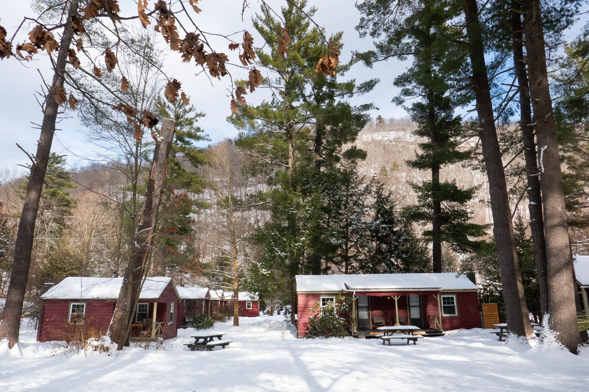
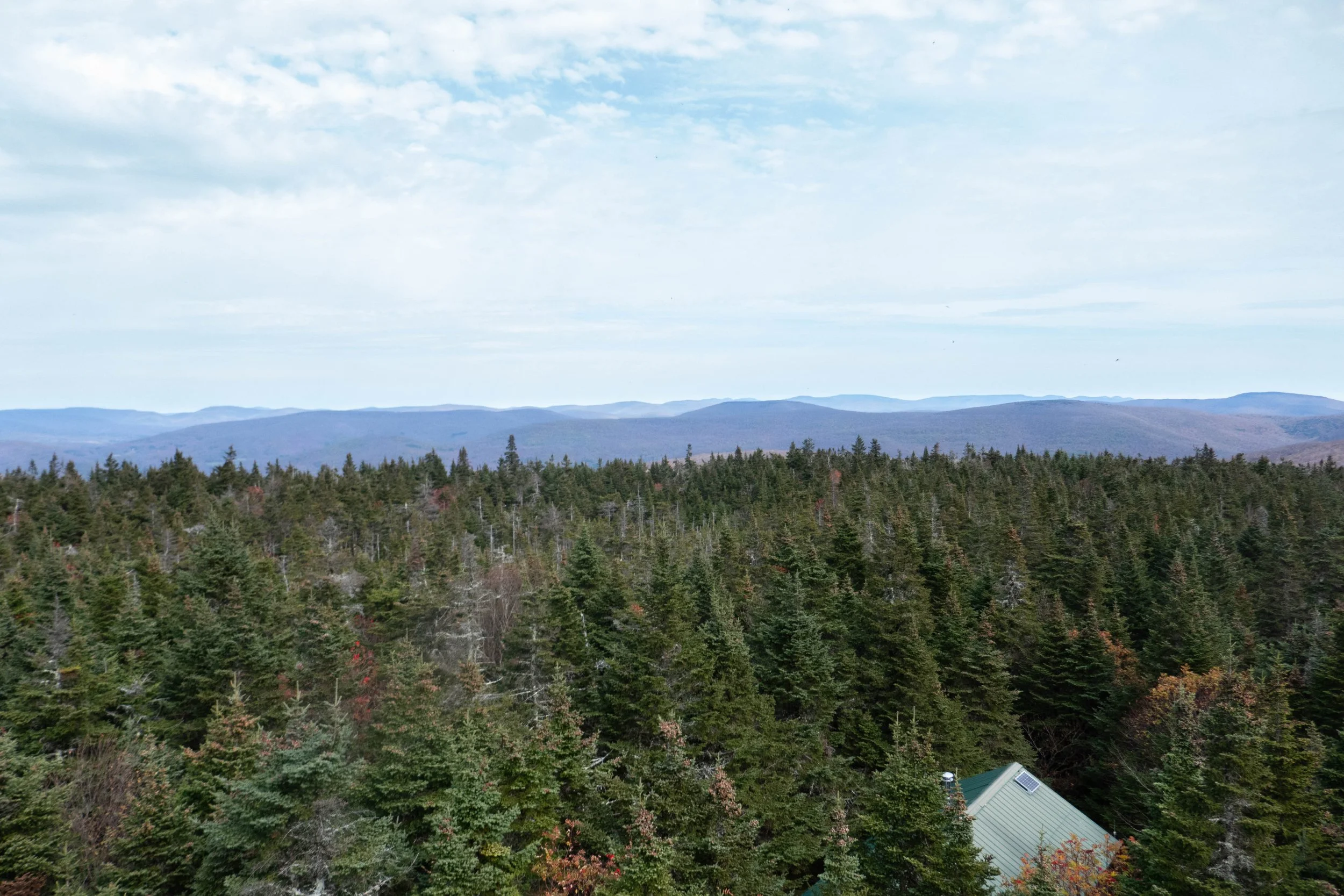
We left Friday afternoon to spend the weekend in the Catskills. This was my first time staying at the Spruceton Inn in the hamlet of West Kill. The Inn is near Hunter Mountain off Spruceton Road and there’s not much nearby except for the West Kill Brewery which was just perfect. May 30th was our official wedding anniversary of 12 years, and it was lovely being in the Catskills on our special day.

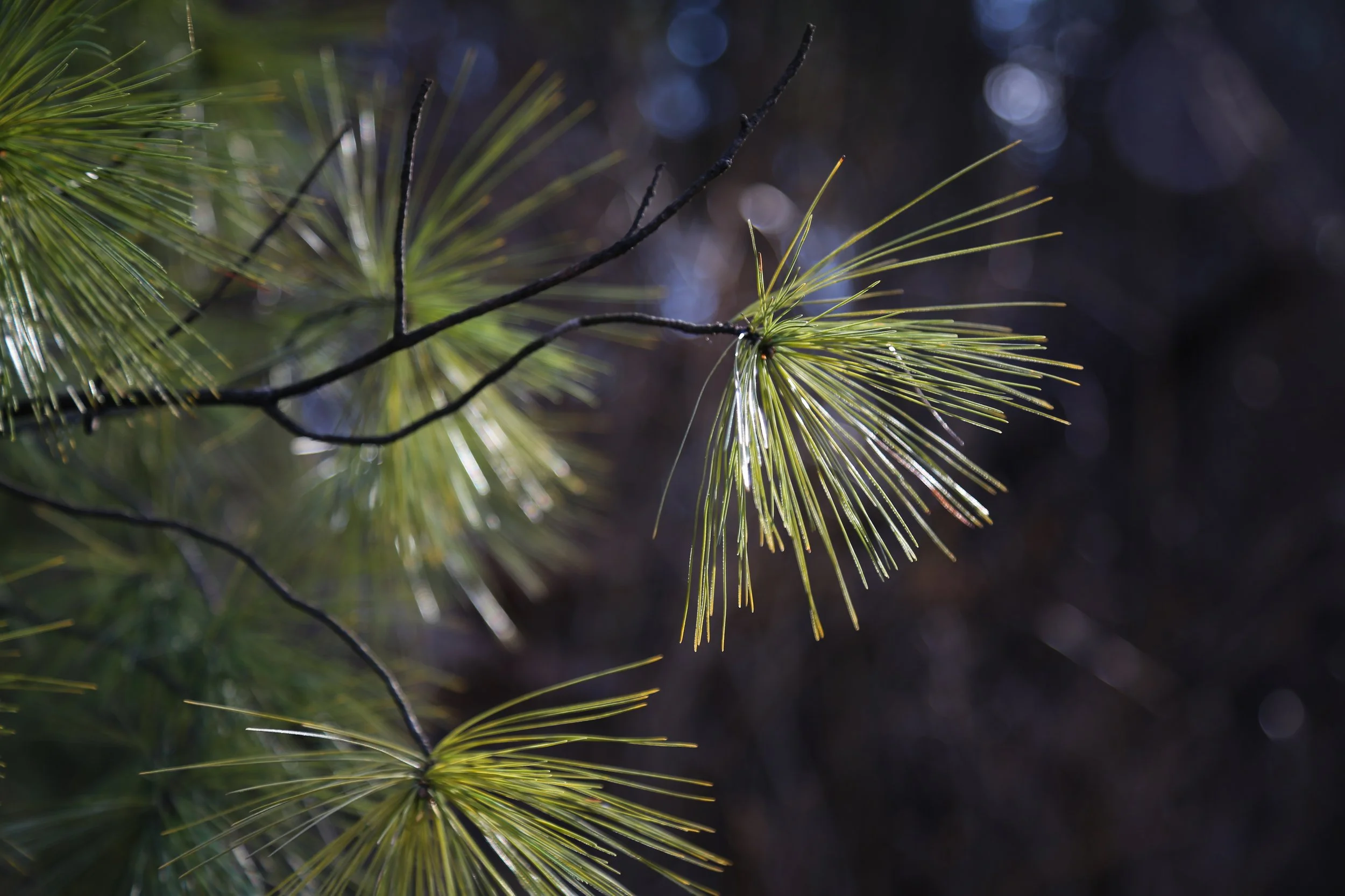
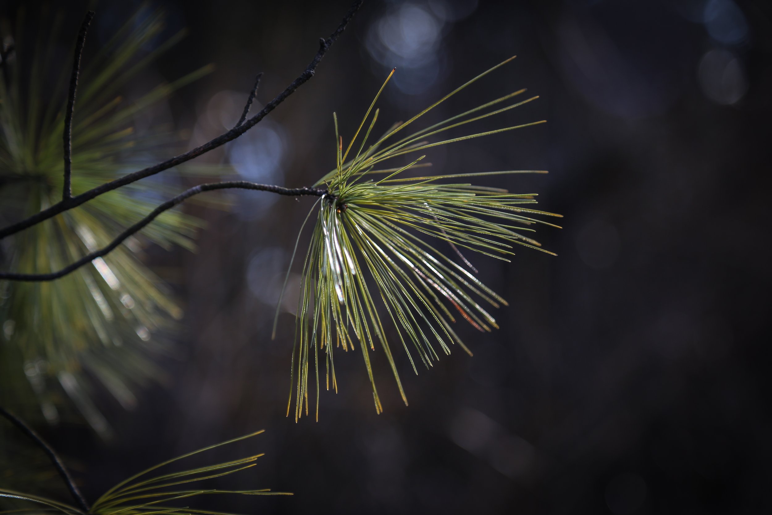
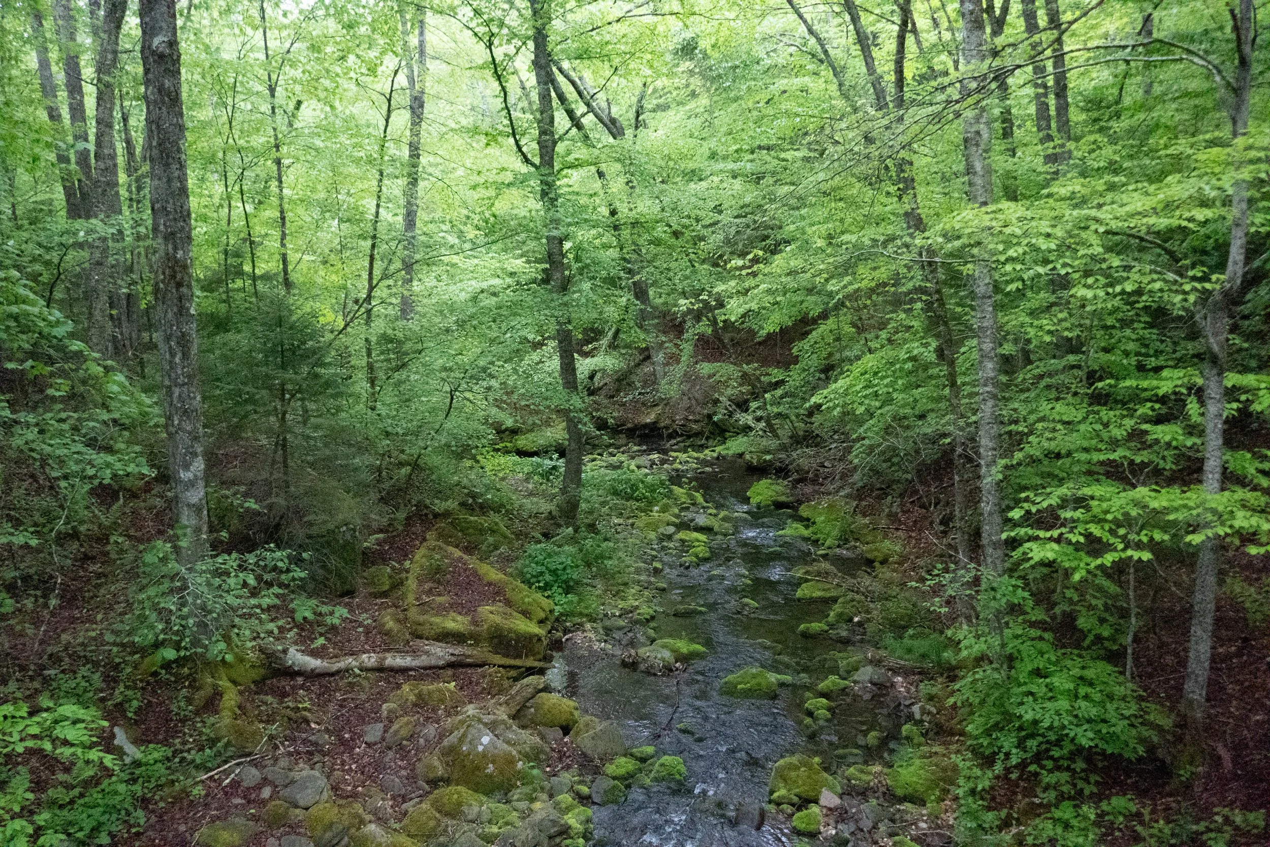
After checking into the room, we walked the grounds and sat by the West Kill Creek. It was only the two of us so we sat for a while just listening to the flow of the water and the wind. It was cloudy and overcast and a little bit chilly. We hadn’t eaten anything yet so we walked up Spruceton Road to the West Kill Brewery where we had IPAs on tap and bite to eat. We walked back to the Inn and sat by the creek where we saw two beavers swim down stream on the West Kill. I also saw my first Belted Kingfisher. Later, as the sun was beginning to set, we explored the big barn. There’s a library full of books you can borrow for as long as you wish, so I chose one and started to read. The barn had three relaxing rope swings to sit in, so I sat on one of the swings and read until the light began to fade and the sun started to set. Barn swallows flew in and out of the barn, and I watched the beautiful hues of light change from golden orange to a deep shade of blue fading over the mountain. Night arrived. The red-winged black birds got quiet, but the sound of spring peppers in the nearby pond continued throughout the evening. I was feeling sleepy and relaxed, but as a bright full moon rose up over the mountain, I felt a surge of energy. We built a fire right next to the creek and sat quietly enjoying the sound of the water, the crackle and warmth of the fire and the bright glow of the full moon. That evening we slept with the curtains open in our room and let the moonlight spill out across the bed; a silhouette of pine trees outlining the top of the mountain. The next morning we woke at sunrise. It was cloudy, cold and windy. It started to rain just before 6 am. We got in the car and headed up Spruceton Road to the trailhead for Hunter Mountain. It was 42 degrees at the base of the mountain, and as we climbed closer to the junction for the John Robb Lean-to, it started to rain harder. The wind was getting stronger and the temperature was dropping. We decided to turn around and head back to the Inn instead of pushing on towards the summit. Once back at the Inn, we cleaned up then drove into Tannersville for breakfast at Maggie’s Crooked Cafe. She remembered us from the last time we were there in April. We had hot coffee, ate homemade breakfast and then stopped at Camp Catskill to check out the outdoor gear. Before heading back to the Inn, we made one last stop at Fred’s donuts. Back at the Inn, we took a good nap. The sun was starting to come out by afternoon and you could barely tell just how cold, wet and windy it had been earlier. Mountains make their own weather, so I was not surprised. It turned out to be a gorgeous day. We walked to West Kill Brewery, had a few IPAs and some food before heading back to the Spruceton Inn to enjoy the rest of the evening. The next morning we were up early again. We we built a fire and sat in the sunshine watching and listening to all the birds. It was a lovely way to wrap up the weekend before heading back to the city.

Click “Read More” below for more photos.

Read More

Montauk, New York, Montauk Point, Hither Hills State Park, Shadmoor State Park, May 16 & 17, 2026

Montauk, New York, Montauk Point, Hither Hills State Park, Shadmoor State Park, May 16 & 17, 2026

This was my first time visiting Montauk, the furthest point on the South Fork at the eastern end of Long Island.  I’d done my research and knew I wanted to hike the Walking Dunes Trail at Hither Hills State Park.  From there we’d continue to drive east on the peninsula to hike the bluffs and see the hoodoos in Shadmoor State Park.  I figured we’d save the lighthouse at Montauk Point for last since that would be a more populated area, and I always look for places with fewer people.

We drove through the Hamptons along Route 27.   It was just as I’d imagined, with big homes and designer shops.  As we got closer to the small fishing village of Montauk, the space on either side of the highway opened up to expansive state park land.  I immediately felt a rush of excitement seeing the open, wild space.

We made a quick change of plans and decided to go to Montauk Point first then backtrack to the other parks. Montauk Point was crowded, but we parked the car, got out, and started walking toward the beach and the lighthouse.  It was a Saturday afternoon, and it was busy with people. I snapped a few photos of the historic lighthouse then got back in the car to head to Hither Hills.  

We turned off Route 27 onto Napeague Harbor Road and parked the car at the end.  There’s a sign here directing you to the Walking Dunes Trail.  The dunes are called walking dunes because they shift about three and a half feet each year due to the strong winds out of the northwest which push the dunes southwest.  The northwest winds are funneled in between Springs (to the west) and Gardiner’s Island (to the north) causing a strong funneling effect that moves the dunes over the forest.  I observed pitch pine and oak trees that appeared stunted and short, but the trees have been buried almost completely by the dunes.  Eventually, these trees will be covered completely.  It was impressive.

After our hike through the dunes, which was just a short loop, the trail brought us out to Iodine Beach at Napeague Harbor.  The beach has reddish colored sand unlike I’d ever seen. Immediately we saw lots of shorebirds wading and feeding along the shore.  There were only a couple of surfers on the beach, and I knew this was exactly where I wanted to spend my time.

As we walked along the red sand, I noticed something up ahead on the beach that looked like a large shell.  As we approached, we realized it was a horseshoe crab. I thought it was dead, but suddenly the legs moved. It had been flipped over by the waves when it washed ashore with the tide.  We flipped it over and it began to walk away.  I was fascinated.  I’d never seen one o these amazing creatures before.  Further ahead we found three more, all of which had also been flipped over and stranded on their backs, so we saved them too.  I later went on to research how important horseshoe crabs are to the shorebirds and also how humans are harvesting them for use in pharmaceuticals (which was rather disturbing so you can google that if you’re interested.)

We continued to walk along the beach and I photographed piping plovers, black-bellied plovers, willets, and sanderlings.  Gulls played on the thermals in the sky and an osprey flew overhead.  I photographed the shells and the rocks and the glistening waves of Napeague Harbor.  It was getting to be late afternoon, so we turned around and started to head back to the car.  Along the way, we noticed that the horseshoe crabs, all but one, had returned to the sea.  That one, unfortunately, didn’t make it.

We drove back to the village of Montauk, checked into our hotel, and had lunch; steamed clams and mussels at one of the local restaurants.  There was a music festival in town, so it was a little too hectic for me, but it is a tourist town afterall, so I knew what I was getting myself into. Thankfully, our hotel was quiet, with a fire pit outside, and the innkeeper was super sweet.  The hotel had a bottle of champagne waiting for us in the room since we are celebrating our 12-year anniversary this month, and the reason we decided to make it an overnight stay in Montauk.

We sat by the fire pit drinking champagne in the late afternoon sun.  Later that night we walked along the beach listening to the crashing waves and looking out into the darkness across the vast Atlantic.  There were small groups of people warming themselves by bonfires in the chilly ocean air.  Both of us slept very well that night, and I dreamed of horseshoe crabs and sea creatures.

The next morning we woke up super early with the sun around 5:30 am. We actually missed sunrise, but it was still early enough to get out and enjoy nature before people started waking up.  We headed to Shadmoor State Park and walked a wooded trail that took us straight to the top of the bluffs where we had impressive views of the hoodoos, rock formations carved by powerful ocean waves.  The sea glistened in the morning sunlight as we looked out over the bluffs at flock of black scoters bobbing up and down on the waves.  They looked perfectly at ease out there, moving in rhythm with the swell of the waves.

Shadmoor State Park is a hotspot for birding.  I spotted and photographed my first yellow warbler. There were plenty of eastern towhees, catbirds, and I heard more prairie warblers although, again, I wasn’t able to see one.  

After our walk we headed back to town and had breakfast at Bird on the Roof, the restaurant run by Daunt’s Albatross, the motel where we were staying.  We sat outside sipping coffee, eating blueberry pancakes and enjoying the morning sunlight and the salty ocean air.  It was still very early, so after breakfast we walked across the street to the beach.  We made our way toward the hoodoos, only this time we were below them and could view them from a different perspective.  This view was even more impressive.  We saw bank swallows flying in and out of burrows they had dug directly into the cliffs, and the area was fenced off so the swallows would not be disturbed.  We sat for a minute and I took off my hiking boots and let the cold Atlantic wash over my feet.  I hadn’t done that since I was a kid.  We both walked back barefoot in the sand, connecting with the earth and the waves and the wind.  My hair was brushed with sea salt, and it felt like a completely different kind of freedom and expansiveness than what I feel in a mountain wilderness environment.  I carried that feeling with me after I got back to the city.  It was an amazing trip.

Click “Read More” below for more photos.

Read More

Minnewaska State Park Preserve, Mossy Glen, Lake Awosting, 5.9 Miles RT, 574' +/-, January 11, 2026

Minnewaska State Park Preserve, Mossy Glen, Lake Awosting, 5.9 Miles RT, 574' +/-, January 11, 2026

IIt has been a month since we’ve been able to go out for a hike, and I have been craving that balance between nature and city. This past weekend was our first hike of 2026, and getting out into the woods was much overdue. I had been wanting to check out Minnewaska State Park Preserve for some time, and today we made the hour and forty-minute drive out of the city to explore it.

Minnewaska State Park Preserve is located on the Shawangunk Ridge in Ulster County, New York. The Shawangunk Mountains, aka The Gunks, extend from the northernmost point of the border with New Jersey to the Catskills. It’s a continuation of the easternmost section of the Appalachian Mountains. In New Jersey, this ridge is known as Kittatinny Mountain, which we have hiked many times in the Delaware Water Gap.

With the freeze-thaw conditions over the past week or so, I knew the terrain would be a mixed bag of mud, snow and hard-pack ice requiring traction. We brought our microspikes and snowshoes, which I keep in the back of my car throughout the winter just in case there’s enough snow for snowshoeing. I’d studied the winter recreation map, as some trails are closed to hikers during the winter, and chose the Mossy Glen Trail to Lower Awosting Carriage Road to the lake and back.

We entered the main parking area just off Route 44, where there is a kiosk, and a helpful ranger handed us a map and advised us on trail conditions that would require microspikes throughout. There was a $10 fee, which goes back to fund the park, which I did not mind paying. To be honest, I’m so used to hiking in remote areas with no facilities or information that sometimes I really appreciate a nice, paved parking area with bathroom facilities and a visitor center!

The morning was chilly, but there was no wind, and the sun was glistening on the ice-covered carriage road, which begins the hike. Then we entered the glen, which runs along the Peterskill stream. The trail undulated through beautiful hemlock, pitch pine, hardwoods, and rhododendron tunnels. There were wooden bridges to cross over the stream and wooden planks to navigate along the trail. Along Peterskill stream, we walked across large flat rocks layered in about six inches of hard-pack ice. The day could not have been more beautiful.

The Mossy Glen Trail terminates at the junction for the Blueberry Run footpath. You can continue south on the Blueberry Run Trail up to Castle Point Ledge, or north, crossing back over Peterskill to the Lower Awosting Carriage Road. We chose to cross back over the stream, continue southwest to Lake Awosting, and then head back along the carriage road to return to the trailhead. Lake Awosting is one of The Gunks’ five naturally occurring “sky lakes.” It was looking pretty well frozen today.

After checking out the lake, we made our way back, crunching along the carriage road in our microspikes. From here we caught a glimpse of the Catskills just north in the distance. We passed a few people out for a walk with their dogs, some wearing traction and some slipping and sliding without. It was about 12:30 pm, and we decided to grab lunch and a couple of brews up the road at Rough Cut Brewing. By the time we were ready to get back on the road, the sun was covered by clouds, the winds were picking up, and there were a few snow showers passing through. We got back to the city just in time to enjoy the rest of the evening, warm, cozy, and satisfied with our much-needed time spent in nature.

Click “Read More” below for more photos.

Read More

First Winter Hike in the Catskills & a Cozy Cabin, December 13 & 14, 2025

First Winter Hike in the Catskills & a Cozy Cabin, December 13 & 14, 2025

Another trip to the Catskills! I was counting the days until we could get back up. I’ve really fallen in love with these mountains. Every time we go, they become more and more familiar. This time we stayed in Phoenicia in a rustic cabin. The cabin had a warm, glowing fire, and the main lodge was decorated for the holidays, which really set the mood perfectly. The town of Phoenicia is centrally located in the Catskills, so it was a great base with plenty of options for different hiking trails.

There was already snow on the ground from a few days earlier, so I wasn’t sure how my low-clearance car was going to manage. I went with no expectations and decided that if worse came to worst and we didn’t get out on the trail, we’d still have a nice place to stay and relax.

Our original plan was to hike to Balsam Lake Fire Tower. This trip was more of a recon trip to reacquaint ourselves with our winter gear and get a feel for hiking upstate. We’re experienced with snow hiking on the West Coast, but the East Coast is a completely different beast. The cold and wind come at much lower elevations, and as with any mountain, temperatures and weather conditions can change in an instant.

As we drove along Route 28 and up and over Belleayre Mountain, the temperature dropped, the winds picked up, and the snow started coming down fast. We decided to turn around, just in case conditions got worse. If we had an AWD vehicle, that might have been a different story, but I didn’t want to spend the weekend waiting for a tow truck to pull us out of a snow drift.

It was already late in the day, so we decided to head over to the trailhead for Hunter Mountain on Spruceton Road and see what the driving was like over there. I was more worried about the car than the hiking, because once we’re on the trail, we’re good to go.

The afternoon was very quiet and still, and the only sound I heard was the flow of Hunter Brook. The trail was doable in either spikes or snowshoes; however, if we’d had time to go farther up the mountain, we definitely would have switched to snowshoes.

We were able to get in a few miles before the short winter day started to fade and the sun began to set behind the mountain. We headed back to the cabin, checked in, and then went out for a bite to eat before settling in for a warm, cozy evening.

The night was so quiet and peaceful. We woke up Sunday morning to a few more inches of snow. It was nice to look out the window and see towering pine trees instead of towering skyscrapers for a change. We had a light breakfast and took our time in the morning, hoping the DEC might have the trailhead plowed out so we could get in another hike on Hunter before heading back to the city. Spruceton Road was plowed just fine, but unfortunately the parking area at the trailhead wasn’t, and my car just can’t handle snow like that. We headed back to the cabin to enjoy the rest of the day in the beauty of the Catskills, with a cozy fire and each other’s company, before making our way back to the city.

Click “Read More” below for more photos.

Read More

Catskills, Mt. Tremper Fire Tower via Jessup Road, Willow Trail & Warner Creek Trail, 7.1 Miles RT, 1,837' +/-, Max Elevation 2,740', October 19, 2025

Catskills, Mt. Tremper Fire Tower via Jessup Road, Willow Trail & Warner Creek Trail,  7.1 Miles RT, 1,837' +/-, Max Elevation 2,740', October 19, 2025

We wanted to make the best out of our weekend, so we woke up and headed out to hike Mount Tremper from the Willow Parking Area located off Jessup Road. This approach is longer but less steep than hiking it from Old Rt. 28/Mt. Tremper-Phoenicia Rd.

We parked in the small lot in a residential area that had room for about six cars. The trail immediately begins a steep ascent on an old jeep road through mostly hardwoods. We hiked through the beautiful Hoyt Hollow, where huge boulders line the walls of the hollow. Here, the trail narrows as it passes through more conifers. It’s my favorite section of this hike. Some parts of the trail were slightly eroded but still very manageable. It also loses some elevation before ascending again as it meets the junction with the Warner Creek Trail.

The Warner Creek Trail is a section of the Long Path that continues past the summit of Mount Tremper to Silver Hollow Notch. It’s an undulating stretch, and the winds really picked up here. With the autumn leaves falling, we had some views to the north and south. Eventually, we reached the 47-foot fire tower at the summit. We climbed as high as we could up to the locked cab and enjoyed views of the Burroughs Range, Stony Clove, Deep Notch, and the Devil’s Path Range. We had a snack and checked out the Baldwin lean-to before heading back the way we came.

The weather was starting to turn, and it looked like rain was moving in, so we hiked back down at a decent pace. I was so focused and deep in my groove, enjoying the wind and racing the ominous weather that seemed to be approaching. As we descended, the wind died down, and we stayed well ahead of the rain. It was a great hike. I’ve really fallen in love with the Catskills!

Click “Read More” below for more photos from this hike.

Read More

Catskills, Balsam Lake Mountain Fire Tower via Dry Brook Ridge, 6 Miles RT, 1,197' +/-, Max Elevation, 3,723', October 18, 2025

Catskills, Balsam Lake Mountain Fire Tower via Dry Brook Ridge, 6 Miles RT, 1,197' +/-, Max Elevation, 3,723', October 18, 2025

Today’s hike took us to the top of Balsam Lake Mountain.

The very first fire tower ever placed on a mountaintop in New York State was installed here in 1887. The 47 foot tower that stands today was erected in 1919, closed in 1988, and later reopened in 2000.

We began our hike at the trailhead off Mill Brook Road, where there’s a parking lot with a kiosk and clear signage pointing the way. Crossing the road, we followed the blue markers on the Dry Brook Ridge Trail. The trail was moderately graded by Catskill standards and wide, with rocks that were easy to navigate. Large moss-covered boulders and ferns lined the path and we passed a small mountain spring along the way.

Eventually, we reached a junction with the red marked Balsam Lake Mountain Trail leading to the summit. The grade became steeper here, but still very manageable. The trail soon transitioned into an aromatic forest of balsam fir and spruce before opening into a clearing with the Observer’s Cabin and the Balsam Lake Mountain Fire Tower. Picnic tables are scattered around the area, and a group of young hikers was gathered there playing music and having a great time, adding to the joyful, welcoming energy of the mountain.

We climbed to the top of the tower and took in the views stretching over the tops of the balsam fir trees. Ladybugs were flying around the the tower and the clearing adding to the happy atmosphere. We hung out for a while, had a snack, and then began our descent.

It was a wonderful day… nothing too strenuous and just the right amount of effort to make you feel like you earned your dinner. I absolutely loved this hike.

Click “Read More” below for more photos.

Read More

Delaware Water Gap National Recreation Area, Orchard Trail, Hamilton Ridge Trail, Pioneer Trail Loop, 7.6 Miles RT, August 10, 2025

Delaware Water Gap National Recreation Area, Orchard Trail, Hamilton Ridge Trail, Pioneer Trail Loop, 7.6 Miles RT, August 10, 2025

This weekend was another one without high humidity, so I had to take advantage and get out on the trail. We went back to the Delaware Water Gap with plans to hike from Millbrook Village, starting out on the Orchard Trail, up to Hamilton Ridge, then descending on the Pioneer Trail with a side trip to the river. From there, we could either hike out to the waterfall at VanCampen’s Glen and back, or just loop around on Hamilton Ridge, depending on how hot it got.

The morning started out great! It was cool and refreshing with sunlight flickering in and out through the forest canopy. We hiked up the Orchard Trail past my favorite stand of cedar trees and ascended along a mossy green path to Hamilton Ridge. From there, the trail widened into a carriage road lined with hardwoods like shagbark hickory and oak, as well as conifers such as Eastern White Pine and Eastern Hemlock.

At the junction for the Pioneer Trail, we turned onto its narrow path, which passed through groves of white pine and eventually ran alongside a ravine that was almost completely dry. As we lost elevation, the trail became overgrown full of ferns and another leafy green plant I see all the time but still don’t know the name of. You could hardly tell there was a trail at all, but it was still easy enough to follow. I kept checking myself for ticks every few minutes, hoping I wouldn’t pick up any hitchhikers.

The last time we were here was in the fall, so I had never seen this trail in late summer. I was surprised it wasn’t better maintained because it’s such a beautiful route. We carried on, with glimpses of the river visible through the deciduous trees to our right. I couldn’t focus on the view for long because I was too busy bushwhacking through tall brush.

When we reached the side trail down to the river, it looked like it had been cleared more recently than the section we’d just traveled. There were kayak campers in the spots where we usually sit, so we found another path to the water not far from the campsite. We watched a few kayakers and some motorboats go by, had a snack, and then headed back.

By then, the day was starting to heat up, and I didn’t want to be hiking in the midday heat. We opted to loop back on Hamilton Ridge rather than take the extra mileage to VanCampen’s Glen, since from there the only way back to Millbrook is along the road. It was too hot for concrete walking and too busy with summer weekend traffic.

When we reached the Hamilton Ridge junction, the trail was overgrown again. We considered going back via the Glen, but decided to stick with our plan. We powered through the tall brush and climbed back up in elevation.

It was still a great hike, but the heat and the bushwhacking wore me out. As we reached the last stretch, the trail leveled off and I cooled down. The forest felt peaceful with the hum of cicadas and the earthy scent of late summer. The sun broke through the canopy, lighting the moss and ferns in deep shades of green. I could feel the afternoon air becoming heavier. But even with the overgrown trails and a layer of sweat and trail dust on my body, I was grateful to be out here. Days like this remind me that even when the trails aren’t perfect, it’s always worth lacing up my boots and seeing where they take me.

Click “Read More” below for more photos from this hike.

Read More

Pinelands National Reserve, Franklin Parker Preserve, 5.74 Miles RT, 79' +/-, March 1, 2025

Pinelands National Reserve, Franklin Parker Preserve, 5.74 Miles RT, 79' +/-, March 1, 2025

Today, we visited a very special place, the Pinelands National Reserve in New Jersey. The Pine Barrens have been on my bucklist to hike and today was the day. Weather conditions were sunny in the low 60s and perfect for hiking.

The Pinelands, also known as the Pine Barrens, is the largest surviving forest on the eastern seaboard between Maine’s North Woods and the Florida Everglades. The biodiversity here is remarkable! It is truly a unique and special place.

The ecosystem consists of acidic, low-nutrient water and soil, which support a wide variety of plant and wildlife species that have adapted to these conditions. The Pinelands provide critical habitat for over 50 rare, threatened, or endangered species. Here, you can find bald eagles, northern pine snakes, pine barrens tree frogs, and rare plants such as the pine barrens gentian and bog asphodel, to name just a few. Spanning over 800,000 acres, the Pinelands forest has only about half of its land permanently preserved.

Today, our hike took place at the Franklin Parker Preserve, the New Jersey Conservation Foundation’s largest property, covering 16 square miles in the heart of the Pine Barrens. We followed the Sam Lambert Trail, formerly known simply as the Red Trail, which is marked by red blazes. The loop trail led us through beautiful pitch pine forests and cedar swamps, with sandy roads winding through the woods, past shallow lakes and tributaries of the West Branch of the Wading River.

Once home to an active cranberry and blueberry farm, the land was purchased by the New Jersey Conservation Foundation in 2003 and is now a protected nature preserve. Efforts are underway to restore the land to functioning wetlands, providing essential habitat for a diverse variety of plants and animals.

There was little to no elevation on this hike, and the terrain was easy walking, allowing us to enjoy the scenery and take in all its beauty.

Discovering this incredible gem in such a densely populated state was a delightful surprise. I look forward to exploring more of this unique and beautiful area.

Click “Read More” below for more photos from this hike.

Read More

Loyalsock State Forest, Fern Ridge Trail and Equestrian Trail, September 23, 2024

Loyalsock State Forest, Fern Ridge Trail and Equestrian Trail, September 23, 2024

We spent another weekend camping at World’s End State Park. This time for our hike we wanted an easy route just to stretch our legs. I wanted to spend more time at the campsite enjoying a campfire and toasting marshmallows. We drove to the Fern Ridge Trailhead and decided to explore. It was wet and boggy with too many slippery rocks. We opted to explore the Equestrian Trail instead which offered an easy walk without having to gaze down at our footing every step. We got back to camp just as the sun began to fall below the horizon. We set up the tent, built a fire and settled in to enjoy the quiet evening. It was a new moon and the forest was as black as I’d ever seen it. Millions of stars sparkled overhead. When we got tired we cozied up in our tent in our sleeping bags and drifted off to sleep. Sometime during the night a Barred Owl visited the trees just above our tent. I loved listening to the calls in the darkness with hardly another soul around.

For more photos click “Read More” below.”

Read More

Swiftwater Forest Preserve, August 11, 2024

Swiftwater Forest Preserve, August 11, 2024

This summer has been unbearable with the heat and humidity. I’m afraid with global climate change, this may be our new normal. But today it was a little cooler and we took advantage of the favorable weather and got out for a hike at Swiftwater Forest Preserve in Paradise Township. I love this short hike for its coniferous forest and soft, pine needle-covered trails. It’s a mellow hike and today there were so many mushrooms to look at. We had heavy rains this week, but the trails were mostly dry and not too buggy. We took our time exploring and enjoying the fresh morning air.

Click “Read More” below for more photos.

Read More

Worlds End State Park Camping & Hiking in Loyalsock State Forest, July 7 & 8, 2024

Worlds End State Park Camping & Hiking in Loyalsock State Forest, July 7 & 8, 2024

We spent the weekend camping at Worlds End State Park. It’s the height of summer and the weather was quite warm. We did a few short hikes on a section of the Loyalsock Trail, but the purpose of our trip was mostly to enjoy the campsite and relax without feeling obligated to reach a specific destination or hike lengthy miles. We did a loop starting at Coal Mine Road, where we headed into the forest on the a dirt trail and finished with a trek back on Coal Mine Road where we checked out the more primitive campsites. In the early evening, we drove to High Knob overlook which offered sweeping views of the Loyalsock State Forest before settling in back at the campsite. It was the perfect amount of hiking, site seeing and relaxing for a warm summer weekend.

Click “Read More” below for more photos.

Read More

Camping at Worlds End State Park, Loyalsock State Forest, June 9 and 10, 2024

Camping at Worlds End State Park, Loyalsock State Forest, June 9 and 10, 2024

We spent a relaxing weekend camping at World’s End State Park. We did a few miles of hiking but didn’t commit ourselves to completing any particular trails. It was simply a weekend of relaxing by the fire, making s’mores, and enjoying nature and each other’s company.

Click “Read More” below for more photos from this trip.

Read More

Worlds End State Park, Loyalsock State Forest, Canyon Vista Trail, 5 Miles RT, 780' +/-, May 18, 2024

Worlds End State Park, Loyalsock State Forest, Canyon Vista Trail, 5 Miles RT, 780' +/-, May 18, 2024

This was our first Pennsylvania camping trip. It had been a long time, and I think the last time we used our overnight gear may have been when we backpacked the Mt. Whitney trail in the Eastern Sierra. I was excited to experience an overnight in the woods. Our previous overnights were high up in the mountains of California, a completely different experience. But I enjoy the woods and the quiet of the forest. I find being surrounded by lush green forest and birdsong very relaxing. The Wood Thrush and Ovenbirds are back for the season. They are my favorite sounds to hear while hiking through the dense woods.

We planned a night at the campground in Worlds End State Park. The camping here is much more modern than what I’m used to. There are modern bathrooms and even showers. I feel like I could get used to this. We chose one of the “walk-in” campsites. The walk isn’t far from the car but set back enough not to be right on the edge of the road that loops through the campground. We had a picnic table, fire ring, and there was even a tent pad with mulch.

When we arrived in the morning around 11:30 am, we stopped at the visitors’ center. We picked up a map and chatted with a very helpful woman at the center who showed us exactly where our tent site was and recommended some hikes. I’d already done my homework and knew I wanted to start with the Canyon Vista Trail which was the hike she recommended.

We left the center and parked at the campground heading towards Loyalsock Creek to begin the loop in a northeast direction. The first part of the loop took us around Loyalsock Creek just off the side of Route 154 across from the campground. There were fishermen here and the creek looked very pretty. The trail eventually crossed over the 154 and began to ascend switchbacks into a forest of hardwood and fern. Light rain fell off and on, but the temperature was warm. The forest looks like green technicolor in the rain. The trail met up with the Cold Run extension trail loop and we took a short side adventure to explore the impressive boulder formations that made me feel as though I was in Jurassic Park. I wondered how many millions or possibly billions of years old this geology was. We could have hiked the Cold Run loop and added another mile and a half, but with the weather being unpredictable, we opted to stay on the Canyon Vista trail and explore Cold Run another day. The forest had a heavy mist of fog lying low all around us. It was beautiful. When we made it to the top of the trail, there was a viewpoint overlooking Loyalsock Canyon. This is the most expansive forested area I have seen since being in Pennsylvania. Most of the views I have experienced in this state have been blocked by trees or they overlook farms or freeways. It’s been difficult adjusting to the lack of wild spaces like I was used to coming from out West, but Loyalsock was an exception. And while the mountains are not high peaks, the name of this range “Endless Mountains” was fitting. The vista is accessible by car and you can drive up from Mineral Springs Road if you don’t want to hike it. It is also ADA-accessible. After enjoying some time at the vista, we made our way back to camp, got a fire going and enjoyed the rest of the evening.

Click “Read More” below for more photos.

Read More

Delaware Water Gap, Orchard Trail, Hamilton Ridge, Pioneer Trail, Van Campens Glen, 8 Miles RT, 1,003 +/-, April 14, 2024

Delaware Water Gap, Orchard Trail, Hamilton Ridge, Pioneer Trail, Van Campens Glen, 8 Miles RT, 1,003 +/-, April 14, 2024

Another day hike in the Delaware Water Gap, New Jersey side. We hiked from Millbrook Village on the Orchard Trail which connects to Hamilton Ridge. From Hamilton Ridge we took the Pioneer Trail, then took a spur trail down to the river and back then onward to Old Mine Road where we crossed and hiked through Van Campens Glen. We walked the last few miles back on the road. Old Mine Road is going to be closed for most of the summer due to construction. It should be a nice time to visit the Glen as many people will not want to hike in or walk the road to get to the waterfalls.

At the start of the Orchard Trail I saw Bluets (Houstonia caerulea) blooming. The first spring ephemerals are starting to pop out from under the leaf debris. I also saw a firefly that somehow found my hand. It seems like it’s much too early for them. The day started partly cloudy with some sun, but as we hiked the clouds began to darken the sky. I came across some bright orange Juniper apple-rush, something I’d never seen before. I’ve been using the Seek app (by iNaturalist) on my phone to identify the plants I see along the trail. I love learning as much as I can. As we reached the spur to the river, it began to rain. On the riverbank I saw Yellow Trout Lily and Dutchman’s Breeches. We ate a snack and by the time we were finished the sun was back out. I was glad we didn’t have to cut the day short. We proceeded on to Van Campens Glen. As always the glen was beautiful full of cascades and green moss. We took off our packs and laid on the rocks above the waterfall listening to the wind and soaking in the sunshine. I used my birding app to identify a bird I’d never heard before. I recorded its song and BirdNet suggested what I was hearing was a Louisiana Water Thrush, a new one for my life list.

We hiked out of the glen and then headed back to Millbrook Village on Old Mine Road. Along the way we passed a garter snake basking in the sun. Seems we weren’t the only ones taking advantage of a warm sunny day.

Click “Read More” below for more photos from this hike.

Read More

Bear Creek Preserve, 7.9 Miles RT, 856' +/-, March 31, 2024

Bear Creek Preserve, 7.9 Miles RT, 856' +/-, March 31, 2024

The day started cold and damp. The kind of dampness that chills to the bone. It had rained the night before and sections of the trail were mud which is mostly to be expected this time of year. But we continued our hike, hoping to see the sun eventually. We hiked through hardwood forest until we descended to the creek. We crossed the bridge and hiked through rhododendron tunnels, hemlock, and white pine. The bridge to return that crosses over Shades Creek further south of where we started was washed away. But I remembered there was another bridge further up the trail and luckily that one was intact. Once on the other side, we hiked to my favorite rocks on the creek's edge and sat down. We got lucky and the sun broke through the clouds. We spent a while there lounging around and soaking it in before heading back in a loop to complete the day.

Click “Read More” below for more photos from this hike.

Read More

Delaware Water Gap, Blue Mountain Lakes, Hemlock Pond, AT Connector Loop, 8.6 Miles RT, February 4, 2024

Delaware Water Gap, Blue Mountain Lakes, Hemlock Pond, AT Connector Loop, 8.6 Miles RT, February 4, 2024

It was a beautiful day and the weather was in the 30s. It was a nice day to hit the trail and take in the sunshine. We hiked from one of our favorite trailheads at Blue Mountain Lake. We followed the Blue Mountain Lakes trail to the northwest side of Hemlock Pond. From here we explored the Wood Road trail which continues onward in a northeast direction. This trail intersects with the trail to Buttermilk Falls which we did not take today. Instead we turned south and climbed steeply up the connector trail to the Appalachian trail to get to the ridge line. At the top of the climb, we looped back heading southwest to Hemlock Pond before returning to the trailhead. I was happy for the climb today and the extra added cardio.

Click “Read More” below for more photos.

Read More

Nescopeck State Park, Snow Hike, 3.55 Miles, Januar 21, 2023

Nescopeck State Park, Snow Hike, 3.55 Miles, Januar 21, 2023

The temperatures have been below freezing and there were two snow storms this past week. We drove to Nescopeck State Park with the intention of a snow hike or possibly snowshoeing. When we arrived at approximately 11:15 am, the winds were gusting at around 16 mph, and the temperature was 20 degrees. The wind made it feel colder then it was. I opted to hike with microspikes because I did not do a very good job of checking my snowshoes and realized they’d need some adjustments. The snow level was about 4 inches over ice and easy to walk. I recalled the last time we were here, the Creekside Trail had a lot of mud, roots, downed trees and a few of the bridges were out.

We began the hike walking along the southern shore of Lake Frances heading onto the Nescopeck Trail. It was bitter cold, but the sun was shining, the forest looked lovely, and I warmed up as we hiked. The wind gusts seemed to lessen as we got further into the woods.

Hiking along the Creekside Trail, I heard the ice crack under the snow. I suspected this would be the case remembering that the last time I visited, much of this trail was very muddy. We had to cross the frozen creek a few times to continue the loop because of the bridges that remained broken.

Nonetheless, the waters of Nescopeck Creek were sparkling in the sunlight and glistening snow. I could hear black-capped chickadee in the trees and the forest was beautiful in all its winter glory.

After crossing a bridge that looked to have been repaired, we got on the Fern Trail to continue the loop. This trail took us away from the creek and into hardwoods. We passed a few cross-country skiers enjoying the day.

We took the Hill Trail to the turtle pond on the eastern side of Lake Frances. We stopped to listen to the quite and enjoy the stillness of the winter day.

Click “Read More” below to see more photos from this hike.

Read More

Janet Johnston Housenick & William D. Housenick Memorial Park, Winter Solstice Morning Walk, December 21, 2023

The Janet Johnston Housenick & William D. Housenick Memorial Park and Archibald Mansion has become my favorite place for a nearby walk, morning run or birdwatching. This is a birding hotspot! I’m starting to recognize the regulars who come every day with their binoculars and cameras. I discovered the park in October. I had no idea it was even here. There’s a paved walking path that’s great for running and exercising and afterwards, you can take a walk along the Monocacy Creek and past the Wetlands. Today I came with my husband for a slow, peaceful walk. There was quite a bit of bird action and we were treated to a a fox as he (or she) displayed her hunting skills as she/he caught what appeared to be a large rodent. There’s always something magical here at the park. I’ve spotted many species of birds including bald eagles, red tail hawks and pileated woodpeckers. Enjoy this short series of photos I took on our walk today on the morning of the winter solstice.