I hadn’t been out on the trail since March. My last hike was in Joshua Tree during the spring. Since then, summer in New York has been unbearable. With climate change, the heatwaves are more frequent and longer lasting, and we’ve had more than normal rain and flooding. But finally, this weekend we got a break - sunshine, no humidity (rare for the east coast), and a high of about 80 degrees at the Delaware Water Gap.
The DWG is about an hour and 45 minutes from Manhattan. We hit the trail early to stay ahead of the heat. As the car climbed the winding mountain road, we passed through low-hanging morning clouds. Sunlight filtered through the trees, casting soft beams through the mist across the road. It felt almost ethereal and I thought to myself, “The forest is welcoming us back.”
When I stepped out of the car just after 8 a.m., it was 56 degrees. For the first time in months, I actually felt chilly. It was amazing!
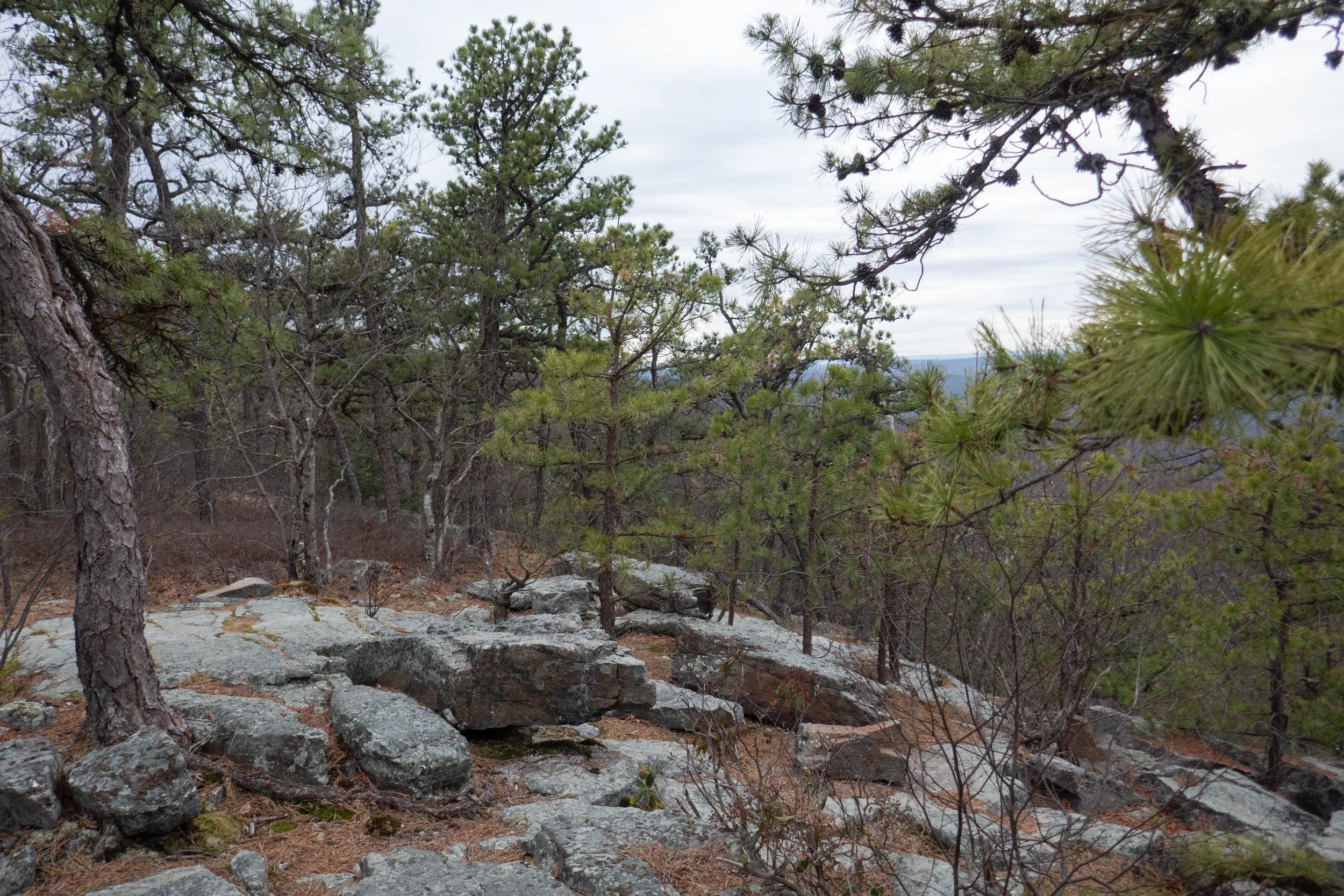
Our route was an 8-mile loop: from Blue Mountain Lake to Hemlock Pond, up to the ridge via a connector trail to the AT, past Lake Success, around Crater Lake, and back. We hiked it clockwise so we could spend time on the cliffs at Indian Rocks first. We made our way through pitch pines and up to the edge of the cliffs, where we sprawled out on a flat rock, taking in the quiet and the distance from the city. I love New York, but I can’t do it without balance. I need wild places and space with no people, no concrete, and no noise. The stillness was like a song in my ears. I stared up at the tops of the pines and then closed my eyes, finally able to breathe.
Eventually, we continued on to Hemlock Pond. We didn’t linger there as we usually do because this time of year, black snakes and corn snakes often nest between the rocks. They’re harmless, but I preferred not to disturb them. We climbed the connector trail to the AT and veered off toward Lake Success. There’s a beaver dam on this lake, and last time I was here, the beaver had chewed down a number of trees on the shore. I was curious to see how much more he’d worked on since then, but it didn’t look too bad.
At Crater Lake, we stopped at a picnic table for a snack before finishing the loop back to Blue Mountain Lake where I spotted a corn snake in the water, patiently waiting for a fish. One swam close, but the snake didn’t seem particularly interested. It slithered off out of the water and back to the grassy shore.
By the time we made it back to the car, I felt like myself again; clear-headed, calm, and reconnected to nature. It was exactly what I needed: a cool morning, a quiet forest, and a reminder that nature always welcomes you back.
Click “Read More” below for more photos from this hike.
Read More