Hike

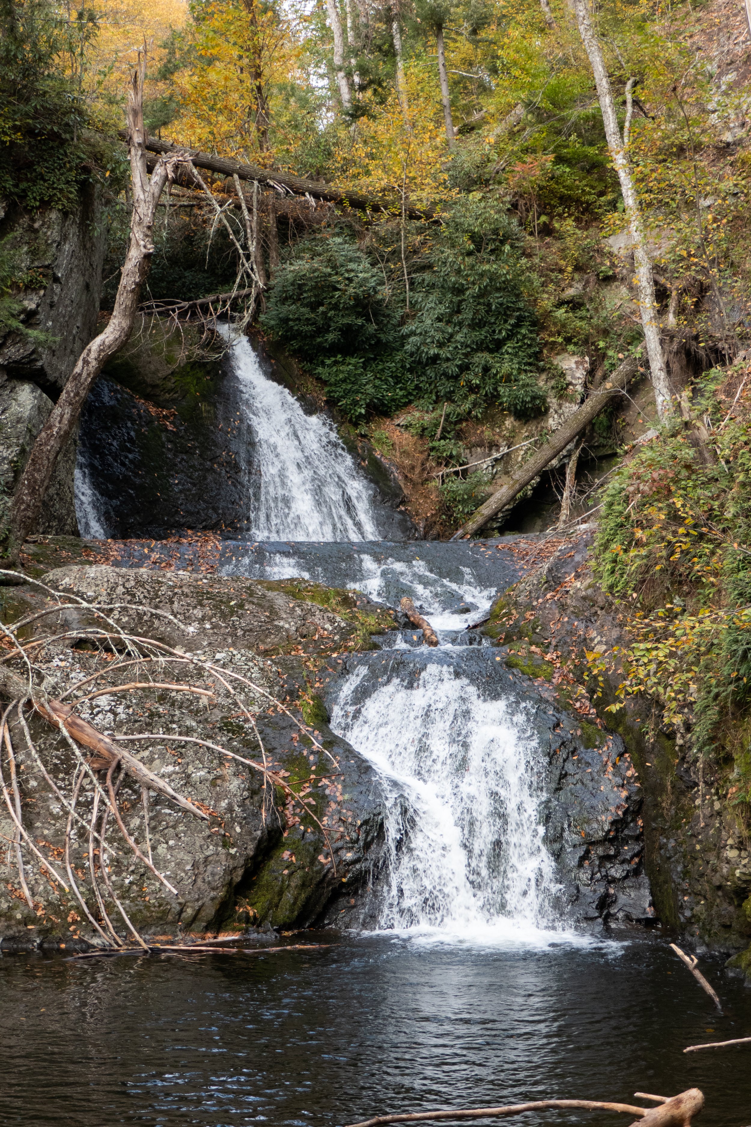
Worlds End State Park, Loyalsock State Forest, Canyon Vista Trail, 5 Miles RT, 780' +/-, May 18, 2024

Worlds End State Park, Loyalsock State Forest, Canyon Vista Trail, 5 Miles RT, 780' +/-, May 18, 2024

This was our first Pennsylvania camping trip. It had been a long time, and I think the last time we used our overnight gear may have been when we backpacked the Mt. Whitney trail in the Eastern Sierra. I was excited to experience an overnight in the woods. Our previous overnights were high up in the mountains of California, a completely different experience. But I enjoy the woods and the quiet of the forest. I find being surrounded by lush green forest and birdsong very relaxing. The Wood Thrush and Ovenbirds are back for the season. They are my favorite sounds to hear while hiking through the dense woods.

We planned a night at the campground in Worlds End State Park. The camping here is much more modern than what I’m used to. There are modern bathrooms and even showers. I feel like I could get used to this. We chose one of the “walk-in” campsites. The walk isn’t far from the car but set back enough not to be right on the edge of the road that loops through the campground. We had a picnic table, fire ring, and there was even a tent pad with mulch.

When we arrived in the morning around 11:30 am, we stopped at the visitors’ center. We picked up a map and chatted with a very helpful woman at the center who showed us exactly where our tent site was and recommended some hikes. I’d already done my homework and knew I wanted to start with the Canyon Vista Trail which was the hike she recommended.

We left the center and parked at the campground heading towards Loyalsock Creek to begin the loop in a northeast direction. The first part of the loop took us around Loyalsock Creek just off the side of Route 154 across from the campground. There were fishermen here and the creek looked very pretty. The trail eventually crossed over the 154 and began to ascend switchbacks into a forest of hardwood and fern. Light rain fell off and on, but the temperature was warm. The forest looks like green technicolor in the rain. The trail met up with the Cold Run extension trail loop and we took a short side adventure to explore the impressive boulder formations that made me feel as though I was in Jurassic Park. I wondered how many millions or possibly billions of years old this geology was. We could have hiked the Cold Run loop and added another mile and a half, but with the weather being unpredictable, we opted to stay on the Canyon Vista trail and explore Cold Run another day. The forest had a heavy mist of fog lying low all around us. It was beautiful. When we made it to the top of the trail, there was a viewpoint overlooking Loyalsock Canyon. This is the most expansive forested area I have seen since being in Pennsylvania. Most of the views I have experienced in this state have been blocked by trees or they overlook farms or freeways. It’s been difficult adjusting to the lack of wild spaces like I was used to coming from out West, but Loyalsock was an exception. And while the mountains are not high peaks, the name of this range “Endless Mountains” was fitting. The vista is accessible by car and you can drive up from Mineral Springs Road if you don’t want to hike it. It is also ADA-accessible. After enjoying some time at the vista, we made our way back to camp, got a fire going and enjoyed the rest of the evening.

Click “Read More” below for more photos.

Read More

Hickory Run State Park, October 9, 2023, Gould, Switchback, Hickory Run, Fireline Skyline Loop, 5.4 Miles RT, 899' +/-

Hickory Run State Park, October 9, 2023, Gould, Switchback, Hickory Run, Fireline Skyline Loop, 5.4 Miles RT, 899' +/-

Today we hiked in Hickory Run State Park. It had been a while since we’d been here, and I knew the fall foliage would be starting to change into autumn color.

Hickory Run was once territory of the Lenape, Susquehannock and the Iroquois Nation. When the colonists arrived, they named the area Shades of Death due to the rocky unfarmable soil and swamps.

We started on the Gould Trail which took us through the woods and down to Hickory Run via the Switchback Trail. Hickory Run was beautiful and the leaves were starting to change to golden color. We headed north on the Fireline Trail which took us up the hillside overlooking the Lehigh River and the distant State Gameland 149. I particularly enjoyed the Pitch Pines along the trail. We passed an overlook with a clear view of Lehigh Gorge. Heading east on Fireline, we turned south to take the Skyline Trail back to Gould to make a lollipop loop. But before reaching the trailhead, we found a comfortable log just off the trail to stop, make coffee and have light breakfast on our campstove. I miss camping. We haven’t been since we left California. Most of the campgrounds in our area are very developed and mostly made for large campers. I’m not a fan of this type of camping, so I haven’t had much luck finding more remote space.

It was a lovely day. As we reached the trailhead the sun began to hide behind the clouds and we headed back home.

Click “Read More” below for more photos from this hike.

Read More

Swiftwater Forest Preserve, Short Loop Hike in the Snow, February 6, 2022

Swiftwater Forest Preserve, Short Loop Hike in the Snow, February 6, 2022

Swiftwater Forest Preserve in Paradise Township is a very quite, very beautiful short loop in and out of tall white pines and hemlock trees. It was still pretty cold out this weekend, but the sun was shining and the snow was frozen enough to need light traction to keep from slipping. We hiked the short loop around the preserve which is just about 2.5 miles, stopping for a moment by the chimney to watch the white pines sway in the wind. Many times when I’m hiking, I like to stop, feel my feet connect to the earth and observe the stillness of my surroundings. There’s a lot to be learned from what you find in the forest, and today these wise old trees had a lot to say. After a short meditation, we headed back around the loop and headed home feeling at peace having and such a beautiful day.

Click read more below for more photos.

Read More

Delaware Water Gap National Recreation Area, Fairview Trail, Holly Springs, Dunnfield Creek, AT, 8 Miles RT, December 12, 2021

Delaware Water Gap National Recreation Area, Fairview Trail, Holly Springs, Dunnfield Creek, AT, 8 Miles RT, December 12, 2021

Went back to the DWG again today. I like the NJ side of the Gap. The trails all connect and you can piece together different hikes depending on how long or short you want. We started at the Fairview Trail just off Old Mine Road. From here we hiked to the intersection with the AT and the Holly Springs connector. We took the connector down to Dunnfiled Creek, then back up the hillside to Sunfish Pond. From there we picked up the Appalachian Trail and followed it back to Fairview. It was about an 8 mile loop. I enjoyed hiking along Dunnfiled Creek. The terrain was more interesting as was the scenery with the tall Hemlock trees and Rhododendron and Mountain Laurel. We rock hopped across the creek several times and there were a few little rock scrambles along the way. After you pass the backpacker’s camp at the junction for the Douglas Trail and the AT, the trail gets super rocky. Not the fun scramble rocks, but the ones that jut out and trip you. With the leaf debris it’s hard to tell where you’re stepping. Overall, it was a nice day, sun was out and the cooler temperature made for good hiking weather.

Click “Read More below for more photos.

Read More

Delaware Water Gap National Recreation Area, Garvey Springs, Sunfish Pond, AT, Douglas Trail, 5 Miles RT, November 21, 2021

Delaware Water Gap National Recreation Area, Garvey Springs, Sunfish Pond, AT, Douglas Trail, 5 Miles RT, November 21, 2021

Another day in the Delaware Water Gap. We hiked from Garvey Springs up to Sunfish Pond. Perfect weather and lots of rock hopping along Sunfish pond. Took the AT to the Douglas Trail to close the loop. Nice day and not too many people out and about on the trails.

Click “Read More” below for more photos.

Read More

Delaware Water Gap National Recreation Area, Pocono Environmental Education Center, Tumbling Waters, Ridge Trail, Scenic Gorge Trail, 7 Miles RT, October 22, 2021

Delaware Water Gap National Recreation Area, Pocono Environmental Education Center, Tumbling Waters, Ridge Trail, Scenic Gorge Trail, 7 Miles RT, October 22, 2021

After hiking in the Adirondacks where it was mostly past peak foliage, we were able to catch the some of the colors spreading south through Northeastern Pennsylvania. We hiked the Delaware Water Gap National Recreation Area from the trailhead at the Pocono Environmental Education Center. We first took the Two Ponds trail to Tumbling Waters falls, then back to the parking area where we picked up the Ridge Trail that looped us through Scenic Gorge. Some fun, easy rock scrambles on this hike and pretty scenery made for a nice, relaxing day.

Click on “Read More” below for more photos

Read More

Adirondack Mountains, Roaring Brook Falls Trail, Cobble Lookout Trail, Van Hoevenberg Trail, Marcy Dam, Avalanche Pass Trail, Heart Lake, October 17 & 18, 2021

Adirondack Mountains, Roaring Brook Falls Trail, Cobble Lookout Trail, Van Hoevenberg Trail, Marcy Dam, Avalanche Pass Trail, Heart Lake, October 17 & 18, 2021

We spent another couple of days hiking in the Adirondack Mountains High Peaks Region. Weather was not ideal for high elevation since it’s the beginning of shoulder season when fall starts to turn into winter. Trail conditions are beginning to become a mix of mud, ice and snow so we stayed low and just enjoyed our time exploring the area and scouting out more potential hikes for future trips. Once there’s a good coating of snow on the ground we’ll be back for snowshoeing. Despite the weather, (rain mixed with snow which I honestly don’t mind… better then humidity!), we had an amazing time.

Read More

Tuscarora State Park, Lake View & Crow Trail Out & Back, August 1, 2021

Tuscarora State Park, Lake View & Crow Trail Out & Back, August 1, 2021

We had a nice hike around Tuscarora State Park. We started from the Day Use area on the Lake View Trail heading east and clockwise around Tuscarora Lake. The trail looped along the edge of the north side of the lake until crossing over the dam and heading back into the woods. The views along the trail of the lake were quite nice. We then passed through open meadows and followed the Crow Trail to its terminus at the parking area. I had thought we might be able to make a loop around the lake, but I wasn’t quite sure of the route. I had a feeling we’d have to take the road, but decided to wait until I had better intel and come back another day. We made our way back the way we came and enjoyed the scenery from the opposite direction. I enjoyed the hike today and this is a lovely area with very few people. The terrain isn’t quite as rocky as further north so the walking wasn’t as tough on your feet. I really enjoy this area and will be back again to complete the loop.

Click Read More Below for More Photos.

Read More