creek

Bear Creek Preserve, 7.9 Miles RT, 856' +/-, March 31, 2024

Bear Creek Preserve, 7.9 Miles RT, 856' +/-, March 31, 2024

The day started cold and damp. The kind of dampness that chills to the bone. It had rained the night before and sections of the trail were mud which is mostly to be expected this time of year. But we continued our hike, hoping to see the sun eventually. We hiked through hardwood forest until we descended to the creek. We crossed the bridge and hiked through rhododendron tunnels, hemlock, and white pine. The bridge to return that crosses over Shades Creek further south of where we started was washed away. But I remembered there was another bridge further up the trail and luckily that one was intact. Once on the other side, we hiked to my favorite rocks on the creek's edge and sat down. We got lucky and the sun broke through the clouds. We spent a while there lounging around and soaking it in before heading back in a loop to complete the day.

Click “Read More” below for more photos from this hike.

Read More

Nothstein Preserve, April 4, 2022

Nothstein Preserve, April 4, 2022

This is one of my favorite Nature Preserves in Paradise Township the Pocono Mountains. I’ve been here several times and keep coming back to see the changes throughout the seasons. There’s always something new to experience along this very short hike of about 3 miles. Today’s weather was cloudy and a little on the chilly side. The sun popped in and out of the clouds throughout the morning. It cast beautiful light across the moss covered rocks along the cascading Cranberry Creek. Soon the trails here will be covered with bright red-orange Red Efts (a second stage eastern newt). It was a lovely morning and a nice way to start the day.

Click “Read More” below for more photos.

Read More

Nockamixon State Park, Old Mill Trail, March 27, 2022

Nockamixon State Park, Old Mill Trail, March 27, 2022

Today we hiked the Old Mill Trail at Nockamixon State Park. I hiked this trail in July of 2021 on a very hot, humid day. It looked much different at that time with everything so green, but this trail seems to be muddy no matter what time of year you hike it. Today it was especially so. Luckily, I have a good pair of Keen waterproof boots and my feet stayed dry despite the boot sucking mud. The trail is about 5.6 miles and there’s a creek crossing to be negotiated at about .4 miles in if you start from the trailhead at Deerwood Lane. In July, we did this without issue, but today the water level was higher and I didn’t want to risk a slip. We decided to forego the water crossing and drive to the other side where you can park at a different trailhead off Old Bethlehem Road and pick up the loop from the other side. On our way back to the parking area at Deerwood Lane, we took a paved path that passed by Stover Mill and a small waterfall. We got back in the car and drove to a the trailhead on Old Bethlehem Road and continued with our hike on Old Mill. The day was chilly and the ominous clouds reflected like a mirror in the lake. Most of this hike takes you through hardwoods with scattered pine and cedar. As we neared our last half mile, it began to snow with some hail. Not too many people out on the trail today, but it’s always a good day to be outside if you’re prepared for weather.

Click “Read More” below for more photos.

Read More

Jacobsburg State Park, Snow Day! February 13, 2022

Jacobsburg State Park, Snow Day!  February 13, 2022

What a difference a day makes. We went back to Jacobsburg State Park today. It had just finished snowing and it was just beautiful. Fresh snow, no tracks laid down yet and all was quite. We hiked the same trails as we had the previous day and what a difference in scenery. I will admit that is one thing I enjoy about the east coast… everything looks so different each season.

Click read more below for more photos.

Click read more below for more photos.

Read More

Delaware Water Gap, Frozen Dingmans Falls, January 16, 2022

Delaware Water Gap, Frozen Dingmans Falls, January 16, 2022

This was more of a walk then a hike. It was cold today. Even a little too cold for me, and I love winter. But we still wanted to get outside. This hike to Dingmans Falls is more of a walk then I hike. You’re walking a flat boardwalk the whole way - except for the road to the trailhead which is now closed so you have to walk the road to get to the start of the trail. Silverthread is the first waterfall you see on this hike. It was completely frozen over and we saw some ice climbers making their way up it. Then we walked over to see Dingmans falls. This waterfall is the 2nd largest in Pennsylvania at 130 feet. The tallest in Pennsylvania, also in the DWG, is Raymonskill which is 178 feet tall. Dingmans wasn’t totally frozen yet, so no climbers on it. We took some photos and then made our way back. Felt good to get out, but today wasn’t the day to spend too much time on the trail. Really enjoyed this little sight seeing excursion and it was a treat to get to see these frozen waterfalls

Click “Read More” below for more photos.

Read More

Nockamixon State Park, Old Mill Trail, 5 Miles RT, July 9, 2021

Nockamixon State Park, Old Mill Trail, 5 Miles RT, July 9, 2021

It was another hot and humid day in Pennsylvania. Despite the weather which I am not taking well to, I slathered myself in bug spray and set out on the Old Mill Trail at Nockamixon State Park. The previous evening had brought storms, and sections of the trail were covered in boot sucking mud. I’d gotten myself a pair of Keen Ridge Flex waterproof boots earlier in the year, and they are serving me well. At about .4 miles we arrived at a creek crossing where we boulder hopped over the water to continue along the trail. Along side the creek we spotted an impressive grouping of oyster mushrooms growing up the side of a tree. The trail took us through a forest of hardwoods and in and out of sunny areas of tall grass surrounded by lush, green vegetation. As we hiked, chorus of cicadas surrounded us. I saw a number of dragonflies and butterflies along the route as well. Somehow, we both managed to come off the trail without one tick hitching a ride. Lyme Disease is common in this state and you need to always check yourself for the creepy crawlies after hiking. We could have continued from Old Mill onto the Quarry Trail, but we were already at about 5 miles and I was more then ready to hit the shower. So we headed back and noted to return on a less hot/humid day to get in more mileage. I enjoyed my time exploring the trails here, and I’m looking forward to doing a night kayaking trip out on the lake during the next full moon.

Click on “Read More” below for more photos.

Read More

Ricketts Glen State Park, Falls Trail Loop, 9.6 Miles RT, 1,122' +/-, April 19, 2021

Ricketts Glen State Park, Falls Trail Loop, 9.6 Miles RT, 1,122' +/-, April 19, 2021

Ricketts Glen State park is home to the Glens Natural Area, a National Natural Landmark in Pennsylvania. The Falls Trail system that we hiked today consists of 21 incredible waterfalls that flow between steep, narrow valleys known as glens. The tallest waterfall on the circuit, Ganoga, is 94’ impressive feet. Ricketts Glen State Park is one of the most scenic hikes in Pennsylvania. It’s named after Colonel R. Bruce Ricketts who bought land in northeastern Pennsylvania for timbering. When fishermen exploring Kitchen Creek found that there were waterfalls flowing through the deep gorges, Colonel Ricketts spared the land. He hired six men to build the trail system in what is now known as the Glens Natural Area and the project was completed in just four years. Each of the 21 waterfalls has a name. Colonel Ricketts named them after American Indian tribes and also his friends and family.

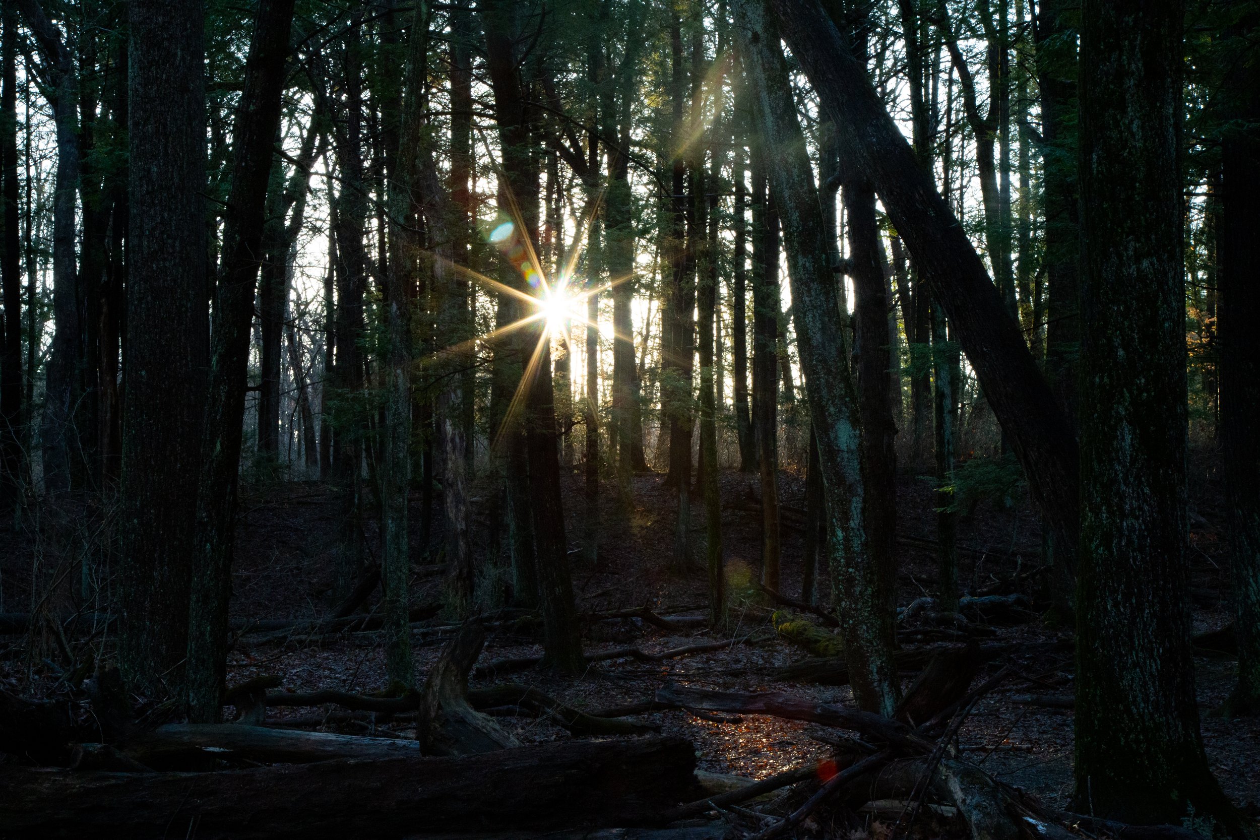
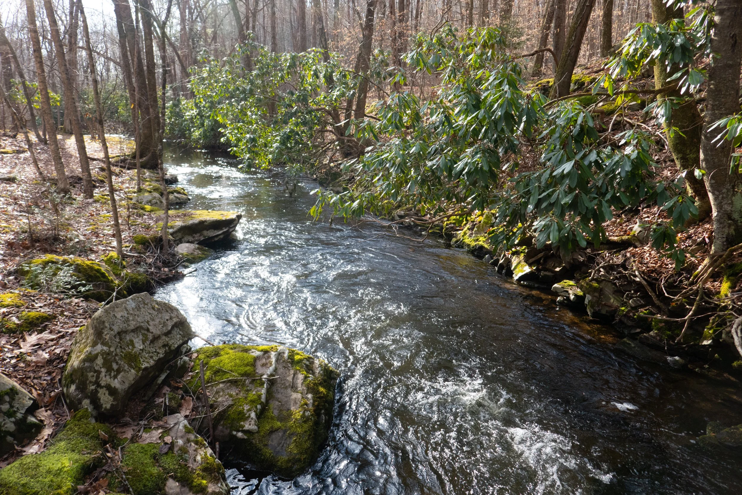
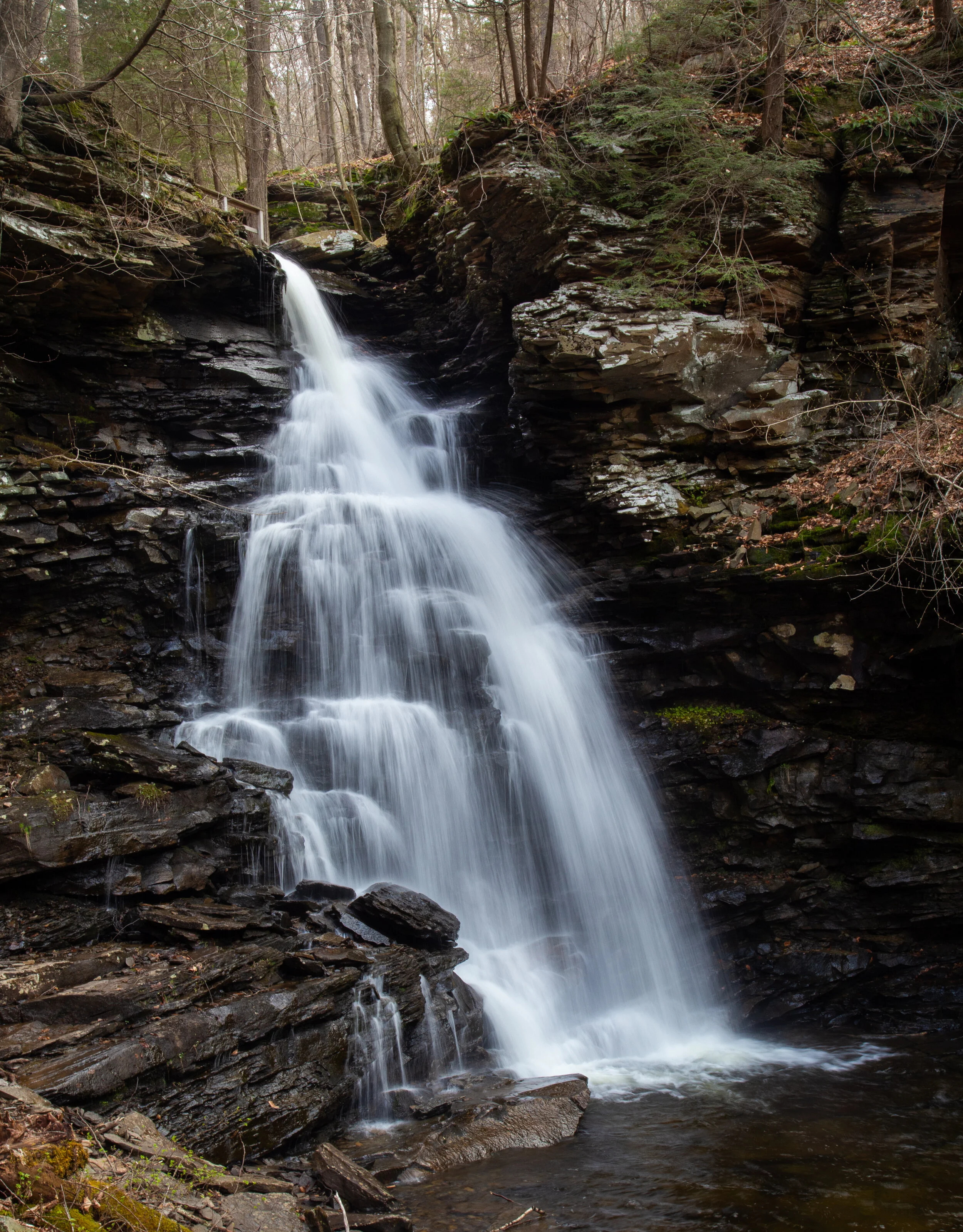
We began our hike at the trailhead off the 118. From here we had a pleasant walk along Kitchen Creek on a flat path before reaching a junction for the lower and upper trails. The lower trail was marked as difficult, and the upper trail was marked as moderate. Of course we opted for the lower, more difficult path. Both trails meet back up again at waters meet before the beginning of the Falls Trail Loop. The lower trail hugged the creekside going up and down muddy, slippery terrain. It wasn’t particularly difficult, but we had to watch our footing. Soon, we started to see the waterfalls. There are three falls before you reach waters meet: Murray Reynolds, 16’, Sheldon Reynolds, 36’ and Harrison Wright, 27’. All three were absolutely beautiful. When we reached the junction at waters meet, we opted to hike up the Glen Lehigh side first. There are eight waterfalls on this side ranging from 15 to 60 feet. We made our way up the steep rocky gorge crossing over bridges that took us right up and over the top of the falls. It was a spectacular trail which varied between flat, rocky sections along the creek and steep climbs up rocky steps. We stopped at each fall to take photos and spent time enjoying the uniqueness of each waterfall. Once we completed the traverse up the Glen Leigh side, we got on the Highland Trail heading west. The Highland trail would take us to the Ganoga Glen side to see the next set of falls. The Highland Trail was mostly flat, quiet and very peaceful. It took us through a beautiful forest of pine and along the trail I noticed a wooden bench for sitting and taking in the serenity of the forest. About half way through this section of trail, we reached some giant rock formations and passed through two large boulders called the Midway Crevasse. Soon, I began to hear the sound of rushing water again which meant we were coming up on the next set of falls. We crossed over a bridge and were soon making our way down the gorge on the Ganoga Glen side. The rocky steps were muddy and slippery. We had to take extra care coming down the steep sections, as I think it’s harder coming down then it is going up because it’s easier to slip. We passed by three lovely falls before reaching Ganoga, the 94’ waterfall. It was absolutely stunning. As we continued down the Ganoga Glen side, we began to see more people coming out to enjoy the trail. At this point I sort of lost track of which waterfall we were passing and I was spending more time looking at the smaller details like the Trillium blooming alongside the trail, the green fern and bright moss growing above the gorge. There is so much to take in on this trail besides the just waterfalls. When we reached the junction for the upper and lower trails, we decided to take the upper trail for a change in scenery. The trail was an easy flat path that travelled high above Kitchen Creek. Along this trail I saw more blooming Trillium. By now it was early afternoon and the sun had started to come out. The weather up until this point had been cloudy and we even had a light sprinkle of rain. When we reached the final mile that would take us back to the trailhead, I noticed some blooming Trout Lily. It was a wonderful day and Ricketts Glen Natural Area is a really special place.

Click on “Read More” below for more photos.

Read More

Targa Falls, Red Rock Trail to Mt. Sophia, March 15, 2021

Targa Falls, Red Rock Trail to Mt.  Sophia, March 15, 2021

The first stop on our Sunday adventure was Targa Falls, a natural waterfall found on the Broadhead Creek. The waterfall is easily accessible from a parking area just off the 447, or you can hike to it from the Paradise Price Preserve. I wanted to see and photograph it in the very early morning sunshine, so we chose the easy drive up access for today. Someday I plan to return to hike in from the west side of the preserve. We parked the car and as I stepped out I could hear the loud rushing waters. Just a few steps more and there it was, this incredible flowing creek roaring past me over large, rocky boulders. The early morning sunlight danced on the white foaming rapids, and the tall hemlocks swayed in the breeze on the banks. It was a beautiful sight just a stone’s throw away from the road. At that moment I honestly felt a little guilty having such a natural wonder within such easy reach. Being used to the rugged mountains of Southern California, I’m not used to having this kind of quick and easy access to something so beautiful as a roaring waterfall. I got my hiking legs out west where you have to earn your views by trekking miles into the wilderness and climbing to precarious mountain tops to view such spectacular places; no cell service, no wifi and only your two legs to rely on to get you there and back. Pennsylvanian’s are so very lucky in this respect.

After enjoying the waterfalls, we hopped back in the car and headed to the trailhead for the Red Rock Loop and Mt. Sophia. The Red Rock Trail is part of the Mount Airy Trail Network and sits on lands protected by a conservation easement held by Paradise Township. At the trailhead there’s a helpful map laying out the topography of the hike, and the trail begins just beyond the kiosk. It starts out on a gravel path leading up stone steps. Right away I noticed the beautiful oak trees and not far into the trail we arrived at a vernal pool. I imagined it would soon be filled with salamanders, wood frogs and other critters. The trails here seemed to be very well kept (save for some downed trees), and they were so pleasant to walk on. So much so that I forgot how rocky the Pennsylvania terrain usually is. We soon arrived at a well-marked junction for the Red Rock Loop and decided to continue northwest directly towards the junction for the top of Mt. Sophia. Along the trail there were large stands of mountain laurel which I am so excited to see bloom in late spring and early summer. This will be my first spring on the east coast in over 20 years. Soon the trail became covered with patches of icy snow and we reached the junction for Mt. Sophia. The trail took us up gently graded switchbacks and as we continued upward, there were helpful wooden steps peeking out from underneath the snow. As we approached the summit, an impressive forest of large pine and hemlock came into view. The sunlight radiated through the majestic trees. I spent some time exploring the summit and the views. From here I could make out the ski runs on Camelback Mountain to the south and more views to the north. We followed the trail a little further as it looped us around in a circle with a convenient “Exit” sign pointing back to the direction in which we came. We took our time hiking down enjoying the views through the beautiful pines and the sunshine. We then arrived at a junction for Red Rock Spur #1. It led us to the site of an old car from the 50s that was flipped upside down and settled into a ditch. It made me wonder what its story was and how it even got up there. There were some old logs that looked like they’d make a perfect place to sit down and enjoy the fresh mountain air, so we sat down and took a break. It was a windy day and I was enjoying listening to that groaning, creaky sound the trees make when they sway against each other in the wind. After our break, we continued along the trail and the winds started kicking up even more. We reached a junction for Red Rock Spur #2 (another outer loop) and began a gentle ascent. We passed by some interesting rock formations before noticing a vintage car graveyard nestled below us, deep in the woods. Had this been summer, we would have never even seen it since the trees would have concealed it with their leaves. We decided to move in closer to explore. There were three rusty cars who had clearly been here for a long time; their final resting place nestled into the forest. We took some photos and then got back on route, enjoying more views to the south as we hiked. The trail made its way down some lovely switchbacks until finally we were back at the junction for the Red Rock Trail on which we had started. This was a wonderful day hike. I really enjoyed my time here and again, it felt like wilderness even though we were so close to civilization. I’d like to come back again and explore more of the spurs and see it when the mountain laurel is in full bloom.

Click on “Read More” below for more photos.

Read More

Hickory Run State Park, Hawk Falls, Orchard Trail, Mud Run, March 6, 2021

Hickory Run State Park, Hawk Falls, Orchard Trail, Mud Run, March 6, 2021

Today our adventures took us to Hickory Run State Park. The last time we were here it was fall when the leaves were showing off their vibrant autumn colors. I was excited to see how it was going to look in winter covered in snow. We got an early start so we could avoid the crowds. This area has become quite popular over the years, and can be very overcrowded on weekends. The parking area for Hawk Falls off route 534 was empty when we arrived. We parked the car, geared up in our microspikes and made our way onto the icy trail. Light snow showers began just as we started the hike. The trail was packed down into a hard sheet of ice. But the path was wide and not very steep, so it was safe to travel with just light traction. A foot bridge crossed over Hawk Run, and we continued past steep rock walls lined in hemlock and rhododendron. We followed a short use trail to a rock outcropping that gave us a nice view of the top of the falls tumbling down the side of the rocky ledge. It looked so beautiful as soft white snowflakes fell from the sky. In just a short .6 miles we arrived at the bottom where the 25 foot Hawk Falls plunged into a clear pool of cascades. We spent some time here enjoying the magnificence of this natural waterfall. Near the falls, we noticed some ice formations along the high cliff walls and decided to explore them. The moss covered ledges and large icicles dripped with melting water. We then got back on the trail and followed along Mud Run until we reached the junction for the Orchard Trail. We turned east and made an ascent up a hill and onto a ridge with nice views that continued through a hardwood forest. Eventually, the trail dropped us down again on some switchbacks into a windy thicket of rhododendron. It led us to a large rock outcrop just above Mud Run where spectacular cascades tumbled over large rocks and boulders. There were many use trails branching off to offer closer views of the beautiful water flow. The trail then turned northeast and we started to ascend moving away from the creek. Now higher above Mud Run the trail was a mix of patchy snow and muddy pools of water flowing down the mountain. Our waterproof boots came in handy here. Eventually, the trail looped west and back into the hardwoods where it was mostly snow. We closed the lollipop loop and made our way back over the ridge and down to the Hawk Falls trail to return the way we came. By this time many people were starting to arrive. We saw several large groups slipping and sliding on the ice attempting to make their way to the falls on the icy trail. When we arrived back at the parking area, there were at least 20+ cars with more lining up to get a spot. I was grateful to have been able to enjoy a quiet morning in solitude along this beautiful trail.

Click on “Read More” below for more photos.

Read More

Snowshoeing Jacobsburg State Park, 5 Mile Loop, Henry's Woods, Blue Blazed Trail, Homestead Trail, February 6, 2021

Snowshoeing Jacobsburg State Park, 5 Mile Loop, Henry's Woods, Blue Blazed Trail, Homestead Trail, February 6, 2021

Jacobsburg State Park got about 31” of snow in the latest Lehigh Valley snow storm earlier this week. Saturday we were up and out early to catch the morning sunrise and do a little snowshoeing. We parked at the main parking area and headed into Henrys Woods. The giant hemlock forest was quiet and still. The snow was already well traveled from the past few days which made it hard packed and icy. The early morning temperature was below freezing, but with the lack of wind the crisp winter air was refreshing and quite pleasant. From Henry’s Woods, we crossed the bridge over the creek towards the Boulton Historic site on the Blue Blazed Trail. We then continued onto the Homestead Trail through some open fields with views of the Pocono Mountains off in the distance. The snow here was deep in spots and less packed down making for a great leg workout. There were also some really great sections of trail that were a little less soft, and I was able to enjoy gliding on top of the snow. We took our time, enjoyed the sunshine and continued on the Homestead Trail until we arrived back at the Environmental Center making it about a 5 mile loop. It was such a beautiful morning, so we took another short walk back through Henry’s Woods to enjoy the change of light and the sunshine that was now sparkling on the creek and its frozen icicles. It was such a great day and I was happy to get out for a bit between storms since the weather service was calling for more snow on Sunday.

Click on “Read More” below for more photos.

Read More

Tuscarora State Park, Spirit Trail, 5 Mile Loop, January 30, 2021

Tuscarora State Park, Spirit Trail, 5 Mile Loop, January 30, 2021

Saturday morning we had a lovely walk around Tuscarora State Park. The temperatures were below freezing again, but there was no wind and the day was sunny. We hiked the Spirit Trail which we had done in the summer when it was filled with wildflowers. Today it was covered in a dusting of snow and patches of ice. The trail starts off following along the lake for about a mile ascending through an oak and hemlock forest. We could see views of frozen Tuscarora Lake below and also hear the water shifting under its thick coating of ice. It makes an eerie sound; kind of hard to describe. We then took the loop south heading back down towards Locust Creek where we hiked in and out of rhododendron tunnels. Parts of the creek were frozen solid and others had a coating of ice above with water flowing underneath. We passed by the Spirit Tree which is covered in a green coating of moss and mushrooms, even in the winter. We made our way to a newly added bridge and crossed over the creek to begin another ascent. At the top we came to a clearing with lovely views and an evergreen forest. Before continuing onto the second loop (the trail is actually a figure eight if you look at it on a map), we explored a side trail which ascended the mountain again. I believe would have taken us to the Crow Trail. We’ll have to explore that one on another day. The trail then dropped us back down for more creekside hiking. We crossed another bridge over the creek that had been broken by a fallen tree. When we arrived back at the trailhead, we took a walk down to the lake. By this time there were ice fisherman and ice skaters taking advantage of this beautiful winter’s day. It was a nice contrast to when we had visited over the summer.

Click on “Read More” below for more photos.

Read More

A Cold Winter Morning Walk in Jacobsburg State Park, Sobers Run, January 23, 2021

A Cold Winter Morning Walk in Jacobsburg State Park, Sobers Run, January 23, 2021

It was a bitter cold morning, but despite the weather we headed out for a short hike along Sobers Run in Jacobsburg State Park. It was somewhere in the 20s and the winds were blowing steadily which made it feel even colder. We Parked in the turn out just off Jacobsburg Road, crossed the bridge and headed south on the service road that would take us to the creek. We then turned north onto a one track trail which follows along Sobers Run. The trees here are mostly hardwoods and the forest looked completely different from when we had hiked this section of trail over the summer. At about 1.5 miles we reached Keller Road where we crossed a footbridge and circled back south on a long stretch of paved trail until it intersected with the dirt track that would take us closer to the creek. Along the way we discovered some large tree carvings which appeared to be either tikis or jack o’lanterns. I’m not really sure what they were supposed to be. It was a sunny morning and although it was quite chilly, it felt good to get out in the fresh winter air.

Click on “Read More” below for more photos.

Read More

Lackawanna State Park, South Branch Trail, Tunkhannock Creek, Bassett Trail, Lake Shore Trail, Abington Trail, Lee Hill Trail, 6 Miles RT, January 9, 2021

Lackawanna State Park, South Branch Trail, Tunkhannock Creek, Bassett Trail, Lake Shore Trail, Abington Trail, Lee Hill Trail, 6 Miles RT, January 9, 2021

Today we explored some of the trails in Lackawanna State Park. Lacka-wanna is Native American for “the meeting of two streams”. We parked at the trailhead just off Cole Road on the north side of Tunkhannock Creek, crossed the bridge and headed east onto the South Branch Trail. The trail first took us through an open field covered in snow. It looked so magical with the icy snowflakes blowing off the trees like glitter against the blue sky. It was a sunny day, and the snow covered ground sparkled in the morning sunlight as we followed the path. The temperatures were in the mid 20s, but no wind and the sun felt warming as we hiked. The trail then moved closer to the creek entering a beautiful forest of hemlock trees. It followed along the edge of the creek on a narrow track before ascending upward to a wider path. We continued along this track about 2 miles to Messimer Preserve where we found a sign stating, “Sorry We’re Closed”. At this point we turned around and headed back in the opposite direction. On our way we found a spur trail that descended to the creek where we spent time exploring the area and enjoying the small cascades. After our side adventure, we continued back to Cole Road where we crossed and headed west on the Bassett Trail. The trails here were a mix of mud and ice, but the scenery was beautiful nonetheless. We took the Abington Trail to the Lake Shore Trail to get some views of Lackawanna Lake which looked like it was mostly frozen over. We reached a junction for the Lee Hill Trail, took a sharp turn north and began to ascend into more beautiful forest. This trail is also used for mountain biking and I can see why. The trails here were undulating and very enjoyable to hike. Eventually, we met up again with the Bassett Path and closed out the loop. Lackawanna State Park is a beautiful area with many more trails to explore and also a number of preserves in the same vicinity. I’ll surely be back again to see more of this place.

(Click Read More Below to See More Photos)

Read More

New Year's Day Hike, Austin T. Blakeslee Natural Area, January 1, 2021

New Year's Day Hike, Austin T. Blakeslee Natural Area, January 1, 2021

We started out the year with a hike to Tobyhanna Falls in the Austin T. Blakeslee Natural Area. Pennsylvania has so many waterfalls, I haven’t even scratched the surface of what there is to discover. The weather reports were calling for freezing rain later in the day, so we got up and out early so as not to risk it.

The Austin T. Blakeslee Natural Area was once home to Harrison Amusement Park which entertained the community along the Tobyhanna Creek. What was then known as Toby Park had a carousel, skating rink, swimming pool, dining hall, penny arcade, sporting fields and a creekside beach. It was destroyed in a flood in 1955.

Today the area is open to hikers with a small network of trails that take the hiker along Tobyhanna Creek to the scenic Tobyhanna Falls.

We started at the trailhead off the 115 heading west along the Creek Trail. The first section of the hike takes you through a beautiful stand of tall spruce trees. A short half a mile walk then leads to the waterfall. The falls aren’t very tall, but they are mighty. It’s quite a spectacle to see. The fast moving water was tinted with an amber color which is caused by the tannic acid produced by hemlock and spruce along the banks of the creek. It was a beautiful site to start off the new year. After taking it all in, we continued west. At about .9 miles Tunkhannock Creek flows into Tobyhanna. We looped around north heading away from the creek on the Highland Trail and into a beautiful coniferous forest.

It was a wonderful morning and this is a beautiful area to explore in just a few short miles. We got back in plenty of time to beat the weather.

(Click Read More Below to See More Photos)

Read More

Icy Lake Frances and Snowshoeing Nescopeck State Park, 4.8 Miles RT, December 20, 2020

Icy Lake Frances and Snowshoeing Nescopeck State Park, 4.8 Miles RT, December 20, 2020

Another cold day here in the Keystone state. Today I was up and out earlier then yesterday and heading up north to the Pocono Mountains to Nescopeck State Park. The temperature this morning was in the 20s and expected to climb to about 30. The DCNR page was reporting a higher snow level at Nescopeck, and I was looking forward to snowshoeing in a bit more snow. I’m still uncertain how well they plow the roads so venturing out is a bit of an unknown adventure. We turned the car onto Honey Hole Road and it was clear. None of the turnouts were plowed, but the main lot for the lake paring was completely open. We arrived to find only one other car. I was completely baffled where everyone was? Why aren’t people out enjoying this winter wonderland? I can only conclude that where I have lived in California, snow is a novelty. Every time it would snow, Angelenos (myself included) couldn’t wait to drive up into the forests and mountain towns for outdoor recreation. Maybe winter in Pennsylvania is just an inconvenience to those who’ve lived here all their lives winter after winter. I honestly can’t say but regardless of the reason, I was not complaining about having the place pretty much to ourselves. We donned our snowshoes and headed over to Lake Frances which was just beginning to ice over. Winter is such a different world. We snowshoed around the Lakeside Trail and made our way onto the Nescopeck Trail being careful not to step onto the tracks that had been made by the cross-country skiers (outdoor winter etiquette). The snow conditions here were perfect! We had soft powder and each step was a joy to take. We trekked along until we reached the Creekside Loop Trail which crossed over Nescopeck Creek by way of a rickety, wooden bridge. The sound of the running creek and the chirp of a chickadee were all I heard in the quiet of the forest. As we continued south, I remembered we were going to end up at a trail washout that we’d encountered over the summer and would have to loop back on the Fern Trail. I made my way through the snow and along the edge of the creek enjoying every moment. The giant hemlocks heavy with snow leaned in over the partially frozen water. On our way back, we passed a couple of cross-country skiers. Again, another great place to cross-country ski with the mostly level terrain. We took our time going back and soaked in the beauty of winter. We arrived back at the frozen lake with my Garmin clocking us at about 4.8 miles. I checked the temperature just before heading home and it had reached 30 degrees by about 1:30. It was a lovely day on the eve of the winter solstice to enjoy the outdoors!

Read More

A Walk Along the Monocacy Nature Trail & the First Snowfall of 2020 in Bethlehem, Pennsylvania, December 9, 2020

A Walk Along the Monocacy Nature Trail & the First Snowfall of 2020 in Bethlehem, Pennsylvania, December 9, 2020

Wednesday was the first snowfall of 2020 in Bethlehem, Pennsylvania, and I was not going to let the beauty of it pass by without getting some local photos. The Monocacy Nature Trail is a place I sometimes like to come to in the mornings to take in the fresh air and enjoy the wildlife before getting my day started. I was so excited to see it covered in a fresh of dusting snow. While I’m not really sure what to expect here in NEPA, winter in SoCal was my favorite time of year to drive up to the mountains and enjoy the weather. I’m looking forward to seeing what the months ahead will bring and hopefully getting in some snowshoeing.

Read More

Exploring Bear Creek Preserve, December 6, 2020

Exploring Bear Creek Preserve, December 6, 2020

Today we spent a few hours exploring Bear Creek Preserve in the Lehigh River Watershed. The preserve is part of a network of protected lands and the hiking trails here are pristinely beautiful. There are about nine miles of rolling trails leading to waterfalls, crystal clear cascades, rocky ledges and through hemlock, pine and rhododendron. It was about 30 degrees with a wind chill today, and we had some snow flurries. The ground had just the slightest dusting of snow. Winter is finally setting in. There are three streams running through the preserve: Shades Creek, Bear Creek and Stony Run. We hiked the yellow and green trails which took us to an overlook and then stream side along Shades Creek to the top of a flowing cascade. We didn’t have time to hike much more today, but I am looking forward to coming back here and exploring more of the preserve

Read More

Trexler Nature Preserve, November 22, 2020

Trexler Nature Preserve, November 22, 2020

Today I hiked around the Trexler Nature Preserve. Pennsylvania is doing a thing this year where they are allowing hunting on three Sundays, this past Sunday being one of those weekends. It’s very odd to me that the state lets people hunt and hike in the same areas, but many of the state parks here seem to be on state game lands. Regardless, I wanted to play it safe and not have my head mounted on someone’s wall, so I stuck to the nature preserve where most of the trail was on open lands and did not allow hunting. I started on the Border Trail which actually goes around the entire preserve and then crossed over Jorden Creek to make a loop back to the trail head. During the hike I crossed path with a deer and saw plenty of birds in the open fields. It was a short hike, just a little over 5 miles with a lot of ups and downs in the hills. I was happy to get out for a bit and enjoy the outdoors.

Read More