Ice Hiking Ricketts Glen State Park, January 23, 2022

Ice Hiking Ricketts Glen State Park, January 23, 2022

This weekend we did a guided ice hike with Valley to Summit and had an amazing day. I wanted to do this last year, but with the plague hanging around and no vaccine available yet, we waited. Today was the perfect day. Weather was great. A little cold (12 degrees in Benton), but who’s thinking about being cold when you’re hiking to 22 beautiful waterfalls. The guides from Valley to Summit were great. They took good care of us. They provide all the equipment (crampons, ice axe, ropes, harness and helmet). The Falls trail is closed to the general public so unless you have the proper equipment, you’re not supposed to be on this trail because it can be dangerous if you don’t know what your’e doing. This was my first time wearing crampons. We’ve done steep climbs in snowshoes and microspikes out in California, but I was excited to see what it was like using crampons and walking on ice. Honestly, I felt safer on this trail in winter then I did in the spring when we were there. The hike itself is not hard depending on your level of fitness, but you do have to watch your step in the spring and summer because the rocks can get slippery. The crampons were great. Felt super safe in them and the glen looked incredible. I loved how the falls reflected an icy blue color. It was a wonderful experience.

Click “Read More” below to see more photos.

Read More

Delaware Water Gap, Frozen Dingmans Falls, January 16, 2022

Delaware Water Gap, Frozen Dingmans Falls, January 16, 2022

This was more of a walk then a hike. It was cold today. Even a little too cold for me, and I love winter. But we still wanted to get outside. This hike to Dingmans Falls is more of a walk then I hike. You’re walking a flat boardwalk the whole way - except for the road to the trailhead which is now closed so you have to walk the road to get to the start of the trail. Silverthread is the first waterfall you see on this hike. It was completely frozen over and we saw some ice climbers making their way up it. Then we walked over to see Dingmans falls. This waterfall is the 2nd largest in Pennsylvania at 130 feet. The tallest in Pennsylvania, also in the DWG, is Raymonskill which is 178 feet tall. Dingmans wasn’t totally frozen yet, so no climbers on it. We took some photos and then made our way back. Felt good to get out, but today wasn’t the day to spend too much time on the trail. Really enjoyed this little sight seeing excursion and it was a treat to get to see these frozen waterfalls

Click “Read More” below for more photos.

Read More

Delaware Water Gap, Van Campens Glen, January 8, 2022

Delaware Water Gap, Van Campens Glen, January 8, 2022

Beautiful day to hike Van Campens Glen on the New Jersey side of the Delaware Water Gap. Old Mine Road is now closed for the season, so we parked near Millbrook Village and walked in about a mile or so to the upper glen. Very pretty hike with waterfalls along the way. Falls were not frozen yet and the snow on the trail was still pretty soft since it hadn’t been packed down yet by other hikers. It was pretty cold out there today. Finally starting to feel more like winter.

Click “Read More” below for more photos from this hike.

Read More

Delaware Water Gap, Coventry Pond, Millbrook Village, Donkey Hollow, January 2, 2022

Delaware Water Gap, Coventry Pond, Millbrook Village, Donkey Hollow, January 2, 2022

We hiked the New Jersey side of the Delaware Water Gap today. First stop was Coventry Pond. This is just a short trail leading up to the pond. Very quiet in here. Beautiful Hemlock forest and white pine up around the pond. Saw some bear scat along the way, but didn’t cross paths with the bear. From there we took a walk around Millbrook village to check out the old style buildings. From there we did an out and back along Donkey Hollow. Very relaxing day and again, super pretty in the mist.

Click “read more” below for more photos.

Read More

Lehigh Gorge State Park, January 1, 2022, Luke's Falls & Buttermilk Falls

Lehigh Gorge State Park, January 1, 2022, Luke's Falls & Buttermilk Falls

So somehow I put the wrong address into the GPS and we ended up at Lehigh Gorge State Park. Well, it wasn’t a big deal. We’d been here before and instead of a hike we got a flat walk along the D&L trail to both Luke’s Falls and Buttermilk Falls. Best part was, no one was here. I think this area out of the Rockport access gets pretty busy in the summer months. I’ve only ever been here in the winter. Today was another warm-ish day with rain and fog. The river was moving pretty fast too. Enjoyed the exercise and the scenery.

Click “read more” below for more photos.

Read More

Maple Tract Preserve & Fern Ridge Bog, December 26, 2021, 7 Miles RT

Maple Tract Preserve & Fern Ridge Bog, December 26, 2021, 7 Miles RT

This is a super fun place to hike. The trail isn’t very well marked so it’s kind of fun to try and find your way through the hemlocks and in and out of the bog areas. The only downside is that this preserve is right next to a freeway so you get a lot of traffic noise on parts of the trail. I haven’t been here in the summer yet, but I imagine the mosquitos must be terrible. It’s a very interesting ecosystem and a beautiful place to go for a hike, especially if you don’t want to see a lot of people on the trail. Not sure many people come here.

Click “read more” below for more photos.

Read More

Christmas Day, December 25, 2021 at Hickory Run State Park, Fireline, Hickory Run, Switchback, Skyline Trails, 7 Miles RT

Christmas Day, December 25, 2021 at Hickory Run State Park, Fireline, Hickory Run, Switchback, Skyline Trails, 7 Miles RT

Well so much for the nice snow we had on Christmas eve. Most of it was washed away by the warmer temperatures and the rain. Nonetheless it was a beautiful day for a hike. I know a lot of people would disagree with me, but I love the rain. I love weather. Maybe that comes from living in California where it was sunny every day and there wasn’t much variation in weather. We did 7 mile loop starting at the Fireline Trailhead. Really enjoyed the foggy mist. Stopped and had a bite to eat along Hickory Run. Great day.

Click “read more” below for more photos.

Read More

Delaware Water Gap National Recreation Area, Fairview Trail, Holly Springs, Dunnfield Creek, AT, 8 Miles RT, December 12, 2021

Delaware Water Gap National Recreation Area, Fairview Trail, Holly Springs, Dunnfield Creek, AT, 8 Miles RT, December 12, 2021

Went back to the DWG again today. I like the NJ side of the Gap. The trails all connect and you can piece together different hikes depending on how long or short you want. We started at the Fairview Trail just off Old Mine Road. From here we hiked to the intersection with the AT and the Holly Springs connector. We took the connector down to Dunnfiled Creek, then back up the hillside to Sunfish Pond. From there we picked up the Appalachian Trail and followed it back to Fairview. It was about an 8 mile loop. I enjoyed hiking along Dunnfiled Creek. The terrain was more interesting as was the scenery with the tall Hemlock trees and Rhododendron and Mountain Laurel. We rock hopped across the creek several times and there were a few little rock scrambles along the way. After you pass the backpacker’s camp at the junction for the Douglas Trail and the AT, the trail gets super rocky. Not the fun scramble rocks, but the ones that jut out and trip you. With the leaf debris it’s hard to tell where you’re stepping. Overall, it was a nice day, sun was out and the cooler temperature made for good hiking weather.

Click “Read More below for more photos.

Read More

Delaware Water Gap National Recreation Area, Copper Mine, AT, Raccoon Ridge, Kaiser Trail, 8.5 Miles, December 5, 2021

Delaware Water Gap National Recreation Area, Copper Mine, AT, Raccoon Ridge, Kaiser Trail, 8.5 Miles, December 5, 2021

Today we hiked up the Copper Mine Trail on the New Jersey side of the Delaware Water Gap. From there we got on the Appalachian Trail and followed it out to Raccoon Ridge. Nice view point from the ridge. Came back down the Kaiser trail to close out the loop at about 8.5 miles.

Click “Read More'“ below for more photos.

Read More

Delaware Water Gap National Recreation Area, Blue Mountain Lake, Hemlock Pond, 6 Miles, November 28, 2021

Delaware Water Gap National Recreation Area, Blue Mountain Lake, Hemlock Pond, 6 Miles, November 28, 2021

Pennsylvania had its first dusting of snow. We headed out to the Delaware Water Gap to Blue Mountain Lake. Took the look to Hemlock Pond. Just a short one today. About 5 miles. Everything looks so beautiful dusted with snow.

Click “Read More” below for more photos.

Read More

Delaware Water Gap National Recreation Area, Garvey Springs, Sunfish Pond, AT, Douglas Trail, 5 Miles RT, November 21, 2021

Delaware Water Gap National Recreation Area, Garvey Springs, Sunfish Pond, AT, Douglas Trail, 5 Miles RT, November 21, 2021

Another day in the Delaware Water Gap. We hiked from Garvey Springs up to Sunfish Pond. Perfect weather and lots of rock hopping along Sunfish pond. Took the AT to the Douglas Trail to close the loop. Nice day and not too many people out and about on the trails.

Click “Read More” below for more photos.

Read More

Delaware Water Gap National Recreation Area, Pocono Environmental Education Center, Tumbling Waters, Ridge Trail, Scenic Gorge Trail, 7 Miles RT, October 22, 2021

Delaware Water Gap National Recreation Area, Pocono Environmental Education Center, Tumbling Waters, Ridge Trail, Scenic Gorge Trail, 7 Miles RT, October 22, 2021

After hiking in the Adirondacks where it was mostly past peak foliage, we were able to catch the some of the colors spreading south through Northeastern Pennsylvania. We hiked the Delaware Water Gap National Recreation Area from the trailhead at the Pocono Environmental Education Center. We first took the Two Ponds trail to Tumbling Waters falls, then back to the parking area where we picked up the Ridge Trail that looped us through Scenic Gorge. Some fun, easy rock scrambles on this hike and pretty scenery made for a nice, relaxing day.

Click on “Read More” below for more photos

Read More

Adirondack Mountains, Roaring Brook Falls Trail, Cobble Lookout Trail, Van Hoevenberg Trail, Marcy Dam, Avalanche Pass Trail, Heart Lake, October 17 & 18, 2021

Adirondack Mountains, Roaring Brook Falls Trail, Cobble Lookout Trail, Van Hoevenberg Trail, Marcy Dam, Avalanche Pass Trail, Heart Lake, October 17 & 18, 2021

We spent another couple of days hiking in the Adirondack Mountains High Peaks Region. Weather was not ideal for high elevation since it’s the beginning of shoulder season when fall starts to turn into winter. Trail conditions are beginning to become a mix of mud, ice and snow so we stayed low and just enjoyed our time exploring the area and scouting out more potential hikes for future trips. Once there’s a good coating of snow on the ground we’ll be back for snowshoeing. Despite the weather, (rain mixed with snow which I honestly don’t mind… better then humidity!), we had an amazing time.

Read More

Mt. Jo and Heart Lake, Adirondack Mountains, High Peaks Region, 4.2 Miles RT, 801' +/-, Max Elevation 2,877', September 21, 2021

Mt. Jo and Heart Lake, Adirondack Mountains, High Peaks Region, 4.2 Miles RT, 801' +/-, Max Elevation 2,877', September 21, 2021

After yesterday’s long journey to the top of Mt. Marcy, we were ready for an easy day. We decided to hit the trail again, but this time tackle a much shorter peak, Mt. Jo. The trail begins across the street from Adirondack Loj and starts off on a flat, gravel path with interpretive signs for the diverse vegetation. It passes by Adirondack Loj Nature Museum before becoming a dirt path that begins the ascent. It was a beautiful morning as the light shined through the trees on this crisp, fall day. And while I wasn’t planning for a steep climb, we did have some work to do to get to the top. After a little over a mile of steep climbing, the trail leveled off just before the summit. Another short scramble and a climb up some helpful ladders and we were at the top of Mt. Jo looking over at Mt. Marcy, where we were just yesterday. Down below we could see Heart Lake and the trees were just beginning to show signs of fall color. We chatted with some hikers at the summit before heading back down. People are always so much happier when you meet them on the trail. Once we got back down, we added a little more hiking with a walk around Heart Lake. We stopped a few times to sit and enjoy the views, listen to the sounds of the wilderness and watch people in their canoes paddling across the lake. It’s in these moments when I feel most at peace. I’m always happy in the mountains. It was a great way to end an amazing couple of days in the High Peaks Region of the Adirondacks and I foresee many more trips to come.

Read More

Mt. Marcy via Van Hoevenberg Trail, Adirondack Mountains, High Peaks Region, 16 Miles RT, 3,734' +/-, 5,344' Max Elevation, September 20, 2021

Mt. Marcy via Van Hoevenberg Trail, Adirondack Mountains, High Peaks Region, 16 Miles RT, 3,734' +/-, 5,344' Max Elevation, September 20, 2021

“The love of wilderness is more than a hunger for what is always beyond reach; it is also an expression of loyalty to the earth ... the only home we shall ever know, the only paradise we ever need -- if only we had the eyes to see.” -- Edward Abbey (American writer and naturalist)

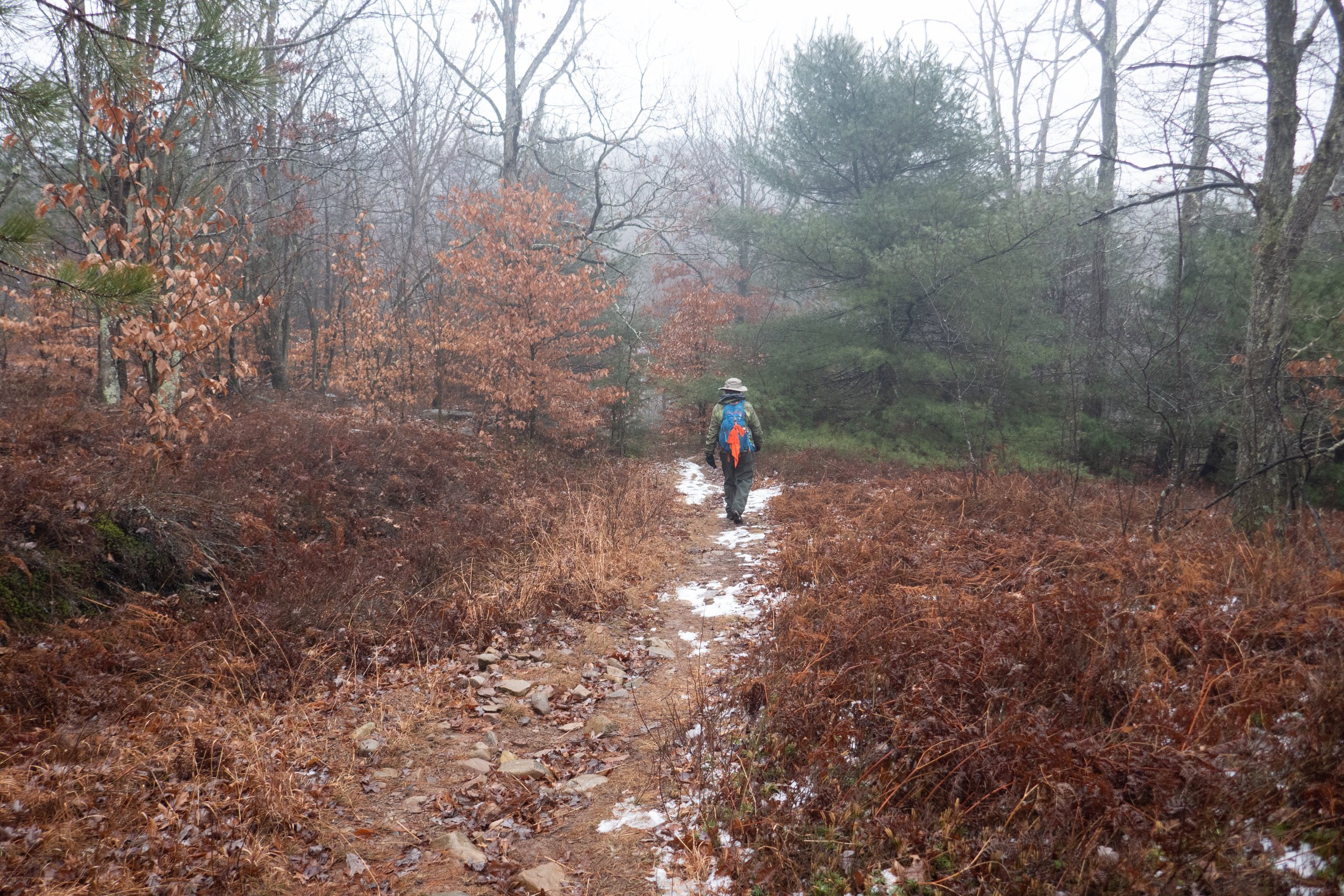
After over a year we were finally back in the mountains. Leaving California with its limitless peaks and vast wilderness and relocating to an area of Northeastern Pennsylvania which lacks high-elevation mountains was a very hard adjustment for me. We decided to drive to upstate New York and hike the High Peaks Region in the Adirondack Mountains. We would set up basecamp in Lake Placid, sleep one night and the next morning hike from Adirondack Loj on the Van Hoevenberg Trail to the top of Mt. Marcy, the highest peak in New York state. The journey would be an arduous climb of over 16 miles, most of which required bouldering, rock scrambling and climbing up large and oftentimes slippery slabs of rock. It had been over a year since I’d done any hiking with much elevation, but I craved the challenge and the rewards that come with reaching the summit after putting in a hard day’s work on the trail.

We arrived at Adirondack Loj at 5:30 am, about an hour before sunrise. We donned our headlamps and headed out on the Van Hoevenberg trail towards Marcy Dam. The trail was mostly easy going for the first two miles. We moved quickly to the first junction, and as we reached the dam the sun was starting to come up. We took a moment to enjoy the views of Mt. Colden, Avalanche Mountain and Wright Peak, but we couldn’t linger knowing we had a lot more miles to cover. We crossed the bridge over Marcy Brook and began to ascend on a moderate grade as we hiked along Phelps Brook. We passed the junction to Phelps Mountain and from here we began a steep climb up the trail which was covered in nothing but boulders. After the first steep pitch, the trail crossed Marcy Brook and briefly leveled off for a short distance as we passed the junction to Indian Falls. At about 5 miles in we began another steep ascent which seemed like endless scrambling and climbing. The terrain was slippery in sections and required a lot of mental concentration and careful foot placement. As we reached the top of the ridge, I began to see hints of blue sky. I knew we were getting closer. Now, the trail eased slightly except for the mud and the obstacle course of wooden planks we had to negotiate, and we began to get our first views of Mt. Marcy. We hiked through thick scrub and scrambled up more barefaced boulders before reaching the Alpine Zone. We were starting to get above the treeline, and I was beginning to feel anxious as the climbing got even harder and steeper. Higher and higher we ascended, scrambling the bare rock and slabs. We followed the cairns and the yellow paint blazes guiding the way straight up. And then, finally, we were there… standing on the summit of Mt. Marcy, the highest peak in New York State at 5,344 feet. It was an amazing feeling! One I haven’t felt since leaving the mountains of California. We took in the views and fueled up on snacks, but the moment could not last because we knew we had miles of strenuous descent before we could finally relax and celebrate. The climb back down the mountain was even more taxing. We were tired both physically and mentally, and the amount of concentration it took to descend the boulders and rocks was even more laborious then it was going up. It was about 6:30 pm when we finally reached the Loj. We were tired, sore and even a little delirious, but it was an incredible day and one which we will not soon forget.

Hiking Mt. Marcy was both a physical and mental challenge. It pushed us to our limits. There comes a point in hikes like these when you know you’re stretching yourself, but you just can’t turn back because you don’t want to waste all the effort you’ve already put in so you just keep pushing. The feeling of reaching a hard earned summit is a feeling that’s difficult to describe. It becomes an addiction. It’s a challenge not everyone will have the privilege of experiencing. It’s a journey that makes you stronger and brings you closer to those who are on that same journey. And although the moment of reaching the summit may be fleeting compared to the hours you put in to get there, it will always be worth it.

Click on “Read More Below for More Photos”

Read More

Woodland Hills Preserve, September 11, 2021

Woodland Hills Preserve, September 11, 2021

Nice walk around the Woodland Hills Preserve. This is a really nice place to come for a quick nature fix and some exercise. Lots of Goldenrod blooming right now. The milkweed has gone to seed and we saw many Monarch butterflies on the wing. Beautiful light today as well.

Click Read More Below for More Photos.

Read More

Dick and Nancy Eales Preserve at Moosic Mountain, September 6, 2021

Dick and Nancy Eales Preserve at Moosic Mountain, September 6, 2021

Today we hiked the Dick and Nancy Eales Preserve on Moosic Mountain. It looked quite a bit different then when we were here in the winter when it was covered in snow. We started the hike on the Blueberry Trail passing through stunted pitch pines, oak and blueberry. We then followed the Stonehenge Trail through a large garden of boulders where we connected to the After Five Trail following along large rock slabs. From here we dropped down to check out the O’Connor reservoir and then took Gene’s Trail to the Bruised Ego Trail closing the loop at a little over 8 miles. It was a nice day. The clouds kept the sun from making it too hot and the humidity wasn’t quite as bad as it’s been most of the summer. It was a nice hike with some variety in the terrain and scenery.

Click Read More Below for More Photos.

Read More