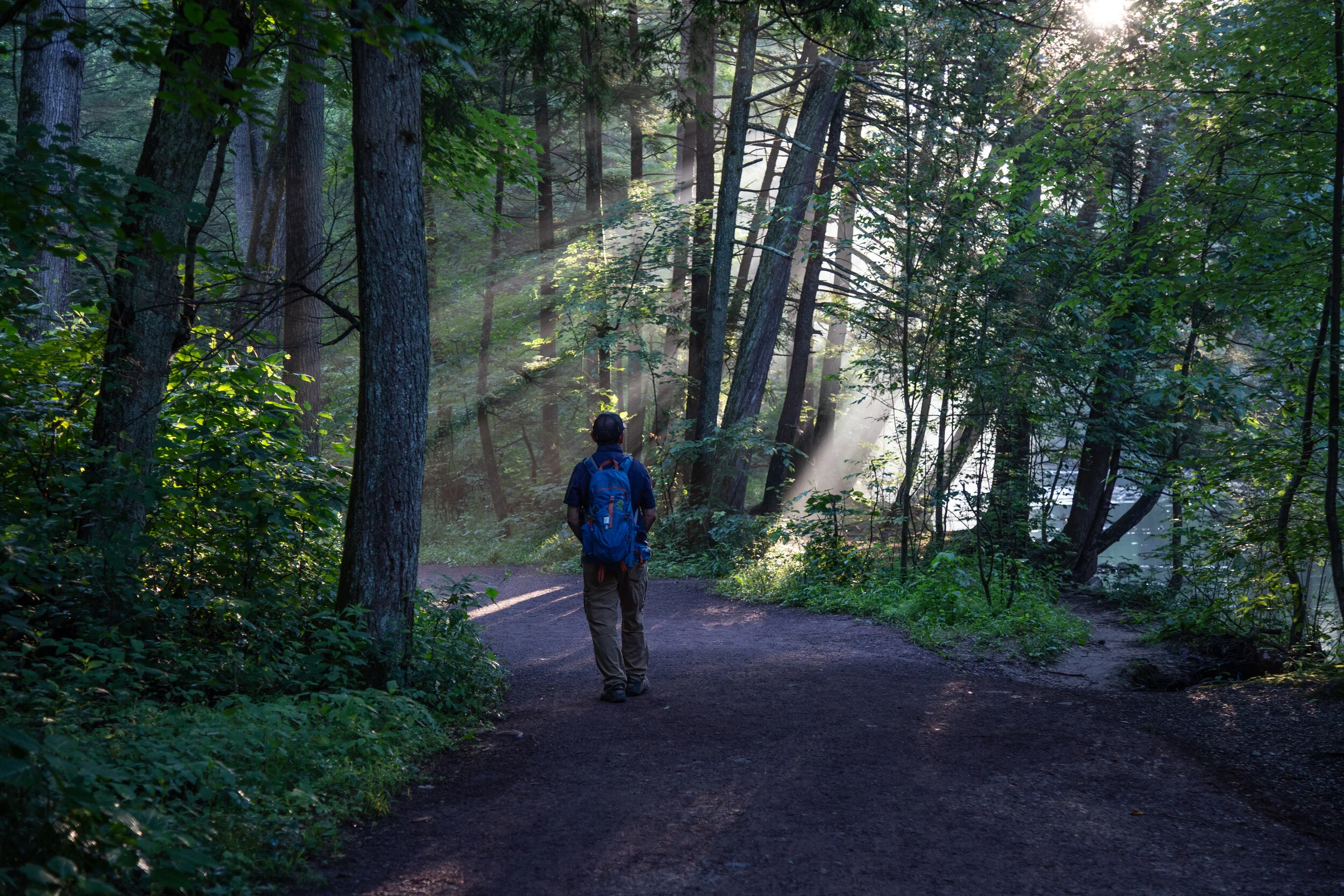
Bruce Lake Natural Area, Delaware State Forest, Promised Land State Park, Rock Oak Trail, Telephone Trail, Bruce Lake Trail, Rock Oak Ridge Trail Loop, 10.2 Miles RT, September 20, 2020
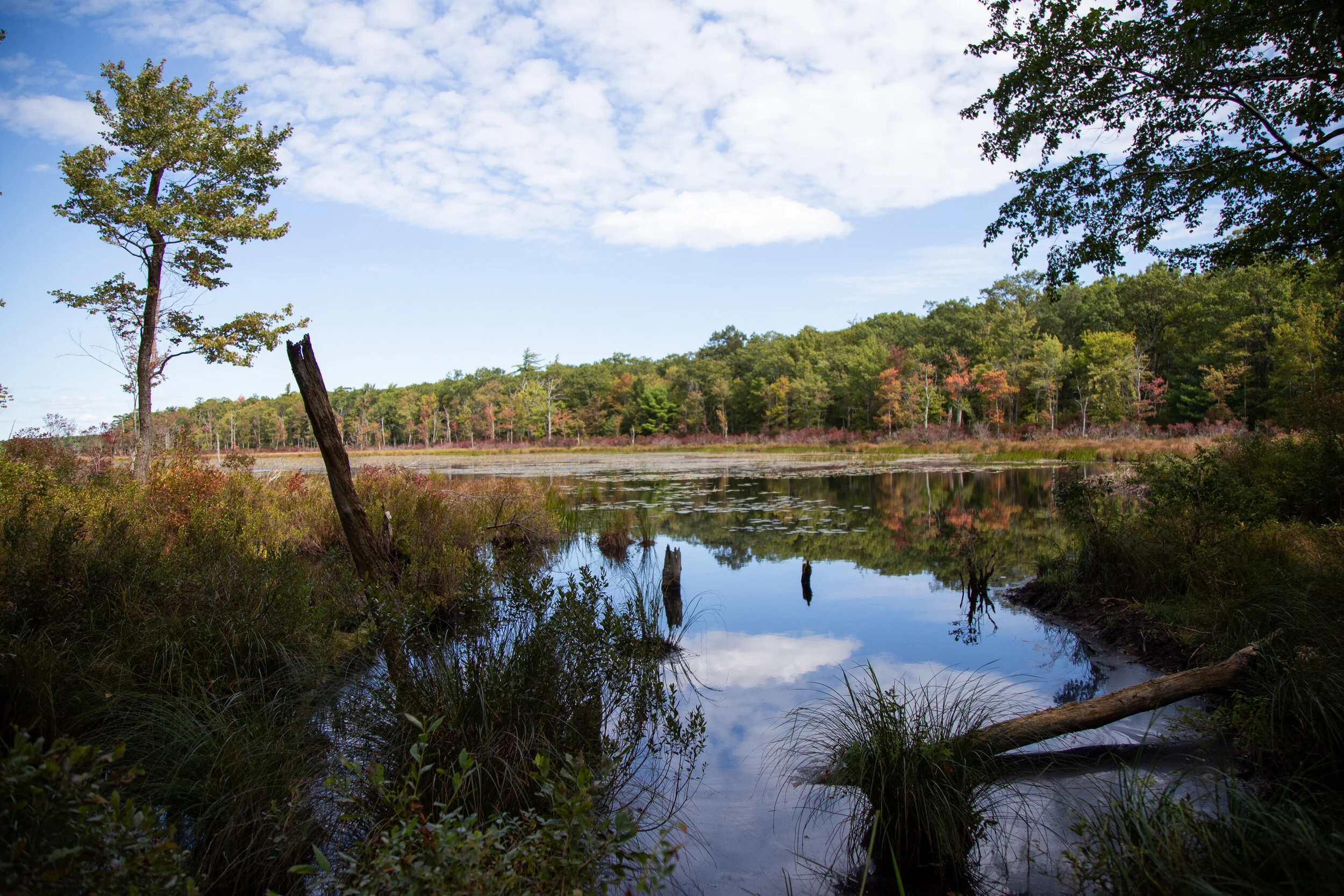
Bruce Lake Natural Area, Delaware State Forest, Promised Land State Park, Rock Oak Trail, Telephone Trail, Bruce Lake Trail, Rock Oak Ridge Trail Loop, 10.2 Miles RT,  September 20, 2020

This morning I headed up to the Pocono Mountains to Promised Land State Park in the Delaware State Forest. Promised Land is a huge area with about 50 miles of trails in a very well organized trail system. As per usual, I wanted to hike on a less populated trail, so I looked for the most remote looking area I could see on the map. I found a trail I could access off the 390 from a turnout on North Shore Road where I could link up to the Bruce Lake Trail outside of Promised Land and it would take me to Bruce Lake. According to the park map, the route was mostly a hiking only trail (no bikes) which was a plus, and it was away from the beaches and campgrounds near Promised Land Lake which meant it should be pretty isolated. From the parking turn out I got on the Rock Oak Trail heading east. The path started out wide and grassy through the shaded forest. The ground was a bit rocky as per usual Pennsylvania terrain, but I could still enjoy the scenery and not have to keep looking down to watch my footing. At the first junction I continued eastward as the trail turned into the Telephone Trail. From here it got interesting. I was rock hopping boulders for the majority of this section and bushwhacking through huge towers of rhododendrons. I felt like I was in a jungle, but I definitely was not bored. It was actually fun. As much as I complained about the rocks being a pain in my butt, I did enjoy the test in agility. As I neared the end of the Telephone Trail, I found the junction for the Bruce Lake Trail. This would take me northbound to the natural glacial lake where I could sit and enjoy the scenery before looping around the lake to make my way back. The Bruce Lake Trail started out pretty well maintained, but eventually I was back to bushwhacking my way through. Thankfully, the rocks weren’t that bad. Eventually, I reached another junction to make the loop around the lake. I headed east in a counterclockwise direction. Now the trail was wider and way less overgrown. I could see the lake to my left as I hiked along this beautiful section of trail. As I approached the north side of the lake, the trail came to an opening at the shore. It was absolutely beautiful. All that rock hopping and navigating through brush made it worth it for these views without a soul in sight. I took a nice long break here, had a sandwich and enjoyed the quite. When it was time to return, I made use of the West Bruce Lake Trail heading southbound. This trail was REALLY overgrown and on top of that it was right at the shore of the wetlands so it was super muddy. Luckily, it was still easy to make out the trial and the blue blaze markers/guides were always easy to find. I finished off the day by continuing the loop on the Rock Oak Ridge trail and then eventually the Rock Oak Trial back to the trailhead. It was a fun day. The peace and quiet and views of the lake were definitely worth the effort. I would love to come back again and see more of this area, especially in the next month because the leaves will be changing colors and it will be spectacular.

Read More

Rauch Gap Cemetery in the Woods, Appalachian Trail Beaver Dam, Stoney Valley Rail Trail, Another 10+ Mile Day, September 13, 2020

Rauch Gap Cemetery in the Woods, Appalachian Trail Beaver Dam, Stoney Valley Rail Trail, Another 10+ Mile Day, September 13, 2020

This weekend I went back to Stoney Valley to find the old coal mining cemetery. I parked just off Gold Mine Road and began the 3.5 mile walk to the junction with the AT on the Stoney Valley Rail Trail. This time I detoured off the main trail and made my way down to the Evening Branch Beaver Swamp to get a better look at it. I saw some frogs, but no luck seeing any beavers. I walked back up to the rail bed and veered off again when I reached Sand Spring. Sand Spring is true to its name with its sandy waters flowing out of the mountainside. It was a lovely day and temps were in the low 60s, perfect for hiking. When I arrived in Rauch Gap, I headed south on the AT in search of the cemetery. It wasn’t too hard to find. There’s a junction off the AT with a sign. Last time I was here I just didn’t hike in far enough to see it. There are only three readable headstones left in the cemetery; however, there are 100s buried here. These old coal mining towns have such a fascinating history. I can only imagine what it must have looked like in the 1800s. Along the way back up to the AT, I veered off trail again to check out more ruins of the town. I found lots of old stone building foundations hidden away in the woods. Once back on the AT I decided to check out the water crossing at the Beaver Dam. There’s a diversion to get around it about 1.6 miles east on the Stoney Valley Rail Trail for thru hikers. On the way to the crossing, I saw another hiker who said she tried to cross the dam but was unsuccessful. It was obvious, because she was wringing out her clothes! When I reached the beaver dam, I could see what an ordeal it would be to try and cross. Lots of deep mud and not exactly a short crossing either. There were trees growing up out of its waters and all kinds of wildlife including a couple of otters. Beaver swamps are a very strange sight to see coming from California where everything is so dry. This isn’t something I’d see too often (if ever) along the west coast trails, but on the east cost wetlands seem to be quite common. The light here was amazing as it changed and reflected off the murky waters. I spent a good amount of time here walking around exploring my surroundings before heading back up to the AT where I found a couple of campsites. I stopped near the creek to have a snack and enjoy the peacefulness of the wilderness. It was a quiet day and it was a while before I saw any other people pass by. After the break, I went back up to the rail trail and up to the Summit Siding rail bed which I had visited last time I was here. I followed it further out this time until I got tired of hopping over boulders and trees. It was very overgrown. Since I was here, I went back down to see the bridge piers at Rauch Gap again before getting back on the main rail trail. There was one more trail I’d seen last time that I wanted to check out before heading back. I found the red blazed trees off the rail trail and got on the path. I followed it north until finding a sign on the ground that said “to upper rail trail”. I am guessing this would have taken me up to the original rail bed. This trail was even more over grown, so I decided to turn around and head back. It was a really great day. There is still much to see in this area, so I’m sure I’ll be back again.

Read More

Appalachian Trail, Swatara State Park, Stoney Valley Rail Trail, Rauch Gap Ruins, 10 Mile Day

Appalachian Trail, Swatara State Park, Stoney Valley Rail Trail, Rauch Gap Ruins,  10 Mile Day

I didn’t plan on a 10 mile hike today, but over the course of the day, that was my mileage total. It felt good to finally have a nice, long day out on the trail. I started my day at Swatara State Park parking at the Trout Run Trailhead and making my way over to the AT at Green Point. I began heading southbound in the direction of the Waterville Bridge. Along the way I passed a few geared up backpackers which really made me miss backpacking in California. I haven’t done any backpacking, camping or even any long day hikes since February when I was still on the west coast. I don’t know enough about Pennsylvania yet to find the more challenging trails, but I’m working on it. Today was all about exploring. I hiked the AT for a few miles. This section is very close to the 72 and there was quite a bit of traffic noise, but it was still very beautiful. But what I really wanted to see today was Rauch Gap, an old mining town from the 1800s. When I got back to the trailhead, I got back in the car and drove over to the parking area just off Gold Mine Road for the Stoney Valley Rail Trail in SGL 211 (St. Anthony’s Wilderness). Rauch Gap is about 3.5 miles in on the trail, and I knew there would be ruins to explore and also an old cemetery. It’s fun being back in Pennsylvania because when I was a kid, I used to love exploring all the old cemeteries. There are a lot of them here. The Stoney Valley Rail Trail is beautiful. It’s about 20 miles long and runs through three counties. Eastern Hemlocks tower above and shade the duration of this section of the hike. There were a lot of rocks and boulders on either side of the trail so I wonder if that’s how “Stoney Valley” got its name. On the north side of the trail at about .5 in is the Evening Branch Beaver Swamp. There’s a deer path that goes around the swamp, but I decided to save that adventure for another day and continue on my quest to Rauch Gap. When we got to the bridge, I went off trail to begin my quest for ruins. I love visiting places that have so much history, even if only their ruins exist. On the north side I found a use trail which took me up to what looked like it had been an old rail bed. When I got back home I did some research and found out that this was the original rail bed for Summit Siding. At the creek I found two large stone structures which apparently were the bridge piers. I travelled up the creek a bit further to find some small waterfalls and then decided to head back down to the opposite side and see what I could find there. The AT has a junction here and so I got on it and followed it for a ways. I found more ruins here and some deep holes with foundation dug into the ground that must have been some sort of buildings. I never did find the cemetery, but when I got home and did more research I found out it was still there, but I hadn’t gone far enough. So of course now I need to come back to complete my mission. And perhaps I’ll find more ruins along the way. There’s a lot to explore here. Especially if you’re into some cool history.

Read More

Nescopeck State Park, Lake Frances, Wood Frog Trail, Swamp Trail, Mountain Loop Trail, September 4, 2020

Nescopeck State Park, Lake Frances, Wood Frog Trail, Swamp Trail, Mountain Loop Trail, September 4, 2020

Today’s adventure took me to Nescopeck State Park. This park sits between two mountains; Mt. Yeager to the south and Nescopeck Mountain to the North. Most of the trailheads are accessed via Honey Hole Road. This is a beautiful area, and I’m still in awe when I’m driving down these Pennsylvania backcountry roads. To start the day I took a walk around Lake Frances. There’s a nice wide loop trail that goes around the whole lake. It’s not a very big lake, just .6 miles around. I didn’t see many people here except for some fishermen. After checking out the lake, I got back on Honey Hole Road and drove to the Wood Frog Loop Trail. There are 200 acres of wetlands in this park, and this trail is an easy 1.1 mile loop around a swamp on a wide grassy path. It’s very serene and relaxing here. After meandering around the loop and taking in the scenery, I drove to the parking turnout for the Mountain Loop Trail. This trail boarders SGL 187 and just off the parking area there’s a beautiful creek that heads into the Game Lands. The Mountain Loop is about 3 miles. There are lots of rocks and uneven terrain very typical of Pennsylvania. I took the loop clockwise making my way steadily up Nescopeck Mountain. This trail must not see much use because it was very overgrown. It also had a lot of spiderwebs. In fact, I almost walked right through the spiderweb of the biggest spider I have ever seen (besides a tarantula). From what I could guess after I got home and looked up Pennsylvania spiders, it was a Marbled Orb Weaver. I watched her spin her web before ducking underneath to pass by. At the top of the loop, the trail turns east. There were a few boulders here which would be a nice place to sit and take a break after the walk up the mountain. As I continued eastward the trail opened up to a sunny, grassy path before descending back into the woods. I didn’t see another human being on this trail (always a plus), but I did scare up a large grouse that took off when she saw me. I also found a praying mantis which eyed me curiously as I took her photo. It was a beautiful day. There’s more to explore here and I am looking forward to coming back.

Read More

Tuscarora State Park, Spirit of Tuscarora Trail, August 30, 2020

Tuscarora State Park, Spirit of Tuscarora Trail, August 30, 2020

The Pennsylvania Department of Conservation and Natural Resources has a very well organized layout of Pennsylvania’s State Parks and Forests. The parks can be searched by region and each park has its own map and recreational guide in a downloadable pdf. I’ve been using these resources to find different trails to explore since I’m new to the area. This week I chose Tuscarora State Park. The stunning Tuscarora Lake sits at the foot of Locust Mountain with Locust Lake State Park being just six miles away. The trail I chose today was called “The Spirt of Tuscarora Trail” which was a little under 5 miles. It’s quite an amazing trail. Absolutely stunning scenery with thick, lush forest and wetlands. I still can’t get over how green it is in Pennsylvania. Part of the trail is carpeted in bright green moss with fern on either sides. It looked so magical. With a soft wind blowing through the trees, I truly was enjoying the morning. The single track trail can be done in a figure eight loop which took me up a few steep sections of rhododendron and then down through low rhododendron tunnels. I can imagine how beautiful they must look when in full bloom. The forest here consists of several species of oak, eastern hemlock, white pine, sycamore, birch, maple, ash and tulip trees. The trail looped me down to the edges of Locust Creek where there were late season wildflowers still in bloom. One of the highlights of this trail is the “spirit tree” which stands creekside in all his moss covered glory. I believe this tree was hit by lightening and his shape now takes on a mossy covered goat head. As I took my time taking in all of this great scenery, I saw a good number of very tiny toads hopping about as I walked. This really was a lovely trail. I walked it very early in the morning and did not see a soul. I will surely come back again to this magical place in the future to explore more of these wonderful trails.

Read More

French Creek State Park, Mill Creek, Raccoon and Lenape Trails, 7 mile loop, August 23, 2020

French Creek State Park, Mill Creek, Raccoon and Lenape Trails, 7 mile loop, August 23, 2020

I really enjoyed this hike around French Creek State Park. I chose the Mill Creek Trail because it was listed as a difficult back-country type hike. My favorite hikes are those that take you deep into the wilderness where you don’t see a sign of another human being for miles. It really makes me feel at peace and gives me a deep sense of connection with nature. While this hike really isn’t in a deep wilderness, it did wind through a dense forest of oak, beech, maple, poplar and hickory. French Creek State Park is the largest block of contiguous forest between Washington D.C. and New York City. American chestnut trees once grew here to provide wood for charcoal to sustain the operations of Hopewell Furnace, an iron plantation, from 1771 to 1883. Eventually the forest was tapped out, and the chestnut trees gave way to mixed oak forest.

A little history about French Creek State Park that was included in the handy park map provided at the trailhead kiosk: During the 1930s, the Federal government purchased the land as part of a project to reclaim marginal lands. These areas were located in close proximity to industrial centers for use by people of lower income groups, family camps and underprivileged children. Two Civilian Conservation Corps camps were built at French Creek and were in operation until the 1940s. The camps built dams, tent camping areas, beaches, roads, picnic areas and the restoration project of what is now the historic Hopewell Furnace was begun. In 1946, most of the property and recreation facilities were transferred to the Commonwealth and French Creek State Park was birthed.

Back to the trail… The terrain on the paths I took today were very rocky (something I’m having to get used to in Pennsylvania). Most of the trails were on a single dirt track (which was nice and more of what I’m used to having come from California). I reached a side spur with a sign pointing to Miller’s Point. So I went off to explore what is a large outcropping of rock that was formed out of magma during the Jurassic Period over 175 million years ago. The sign noted that in the winter time when the trees drop their leaves, there would be a view of the valleys below. After enjoying the rock formation, I made my way back to the Mill Creek Trail which intersected with the Raccoon Trail at Mill Creek. I spent some time at the creek enjoying the serene sounds of the trickling water with not a person in sight. After a short break, I took Raccoon southwest until it intersected at the boarder for the Hopewell Furnace National Historic Site. I branched off onto an intersecting trail to explore some ruins from Hopewell Furnace and then backtracked heading west on the Lenape Trail. There was a beautiful set of steps cut into the trail to hike up to the top of the hill. Once at the top, there was a bench where you could have a seat. So I did before heading back to the trailhead.

Overall I did a little over 7 miles. It was a really good day. The more time I can spend in the woods, the happier I am. I will come back to French Creek to explore more of the area, as there are many more trails throughout the park to enjoy.

Read More

Trexler Nature Preserve, August 16, 2020

Trexler Nature Preserve, August 16, 2020

I woke up to a rainy morning. The weather was cooler than it had been all summer and the air felt refreshing. After the rain stopped and only cloudy skies remained, I headed out to Trexler Nature Preserve. The Preserve has been around since the turn of the century when it was established by General Harry Trexler as a way to protect bison, elk and white-tailed deer. The Preserve also hosts the Lehigh Valley Zoo. I’d been to the zoo many times as a kid, but never walked any of the hiking trails along the lands. Today’s overcast skies made it the perfect day to hike these lands since many of the trails meander through open fields that are exposed to the sun. I parked in the lot off Orchard Road and got on the Border Trail heading north. The trail headed upward where there were nice views overlooking the farmlands below. The trail continued in and out of open meadows and through shady hemlock forest alongside Jordan Creek. I climbed up the trail to the top of the hill where I took a detour onto Park Road to have a look at a herd of bison roaming the central range. They looked very content as they lay in the tall grass. One of the cows had a calf who was sprawled out taking a nap. I took a few photos of the bison before backtracking the road and onto Fireman’s trail. This trail took me to Schlicher’s Covered bridge which was built in 1882. There are many historic bridges here in Pennsylvania that have been restored and preserved. I crossed Game Preserve Road and found the Elk View Trail which climbed on a single dirt track up above the creek and then into another meadow. The trail turned east and then south until I eventually reached the ford which you can actually drive through with your car. Above the ford there’s a footbridge that crosses Jordan Creek. I walked across it to snap a few photos before closing the loop by following the Trexler Nature trail back to the parking area. There was a good amount of up and down on this trek. I walked a little over five miles enjoying the diverse habitats of wildflower filled meadows, pasturelands with roaming bison, hemlock forests, ravines and wetlands. I really enjoyed my time here and plan to come back to explore more of the area.

Read More

Mariton Wildlife Sanctuary, August 9, 2020

Mariton Wildlife Sanctuary, August 9, 2020

Sunday morning I went back to Mariton Wildlife Sanctuary. It was a good day for moody photography with the forest layered in fog. The paths were quiet in the early morning and I enjoyed the serenity walking among the flora and fauna undisturbed. There were a few butterflies nectaring in the meadow, but without the shining sun there weren’t nearly as many as last time. It was another very humid weekend and not a good time to be doing any type of strenuous hiking. I’m saving that for the cooler months. For now I am still working on learning to enjoy the slower pace.

Read More

A walk between storms, Monocacy Way, August 2, 2020

A walk between storms, Monocacy Way, August 2, 2020

I woke up to the sound of pouring rain coming from Tropical Storm Isaias today. I love listening to the sound of rolling thunder and the feeling of being safe in my bed. There was no rush to go anywhere, so I enjoyed listening to the rain and nodding in and out of sleep. About mid-morning the rain let up, and I left the house and took a walk down by the creek. The mist coming off the water was beautifully eerie. I didn’t see anyone braving the stormy weather save for a few fishermen. The sun was peeking in and out between the gray clouds as I walked the nature trail and crossed over the rail tracks to the meadow. I travelled up and down the hillside admiring the wildflowers, the trees and the stormy sky. The goldenrod is beginning to bloom and I saw some butterflies and clearwing hummingbird moths. The storm was still brewing and so I thought it best to head out before the next round of downpour rolled through. It’s nice to have such a wonderful place to visit that’s so close to home.

Read More

Jacobsburg State Park, Homestead Trail, Blue Blazed, Meadow Walk, August 1, 2020

Jacobsburg State Park, Homestead Trail, Blue Blazed, Meadow Walk, August 1, 2020

Today was a good day to walk the meadows at Jacobsburg State Park. The sun was shining and it was still early enough that it wasn’t too hot. Jacobsburg is such a great place to observe wildlife. I saw and heard so many different birds as I meandered around the blue blazed Homestead Trail. I spent time watching two Common yellowthroats (male and female) in the meadow, and I heard the songs of the Eastern towhee and Indigo bunting. There were Tufted titmice high up in the tree canopy, Blue jays and so many others. One thing I’m learning as I do more exploring of Pennsylvania’s natural areas is that the trails here are less about reaching the summit of a big mountain and more about taking your time, observing, and enjoying the journey. It reminds me of a quote by John Muir, “I don't like either the word [hike] or the thing. People ought to saunter in the mountains - not 'hike!”. Mountains or meadows, I am learning to spend more time “sauntering”.

Read More

Mariton Wildlife Sanctuary, July 26, 2020

Mariton Wildlife Sanctuary, July 26, 2020

This morning I went back to Mariton Wildlife Sanctuary. This time I left a bit later after sunrise so I’d have a better chance of catching a glimpse of the Clearwing Hummingbird Moths. I had read they were pretty active this time of year when the Wild Bergamot is blooming. I took a look at the map and headed towards the open meadow (an obvious place to look). When I arrived at the break in the woods it was like stepping into another world. Wild Bergamot, Woodland Sunflowers and pollinator flowers abound! The meadow was alive with the fluttering wings and buzzing of bees and other pollinators. It was absolute heaven! I observed many butterflies from Monarchs to Silver Spotted Skippers to Swallowtails. There were all kinds of bees and of course, the Clearwing Hummingbird Moths. I spent a lot of time here just watching and observing the busy meadow. In between I did my best to capture some photos of all the action. I lost track of time and really didn’t want to leave, but I knew I needed to carry on and continue with my morning trek. I met up with my husband who had been patiently waiting for me sitting on a tree stump at the edge of the woods. We continued our journey which took us on pathways that lead up and down Bougher Hill. I was really surprised with the steepness of the hill. The humidity was high and I had worked up a sweat that was well worth the effort. It was a fantastic morning and experiencing that lively meadow was a wonderful gift of nature.

Read More

Mariton Wildlife Sanctuary, July 25, 2020

Mariton Wildlife Sanctuary, July 25, 2020

I recently learned about Mariton Wildlife Sanctuary which is located not far from where I live. I’ve been doing short hikes and nature walks early in the mornings and sticking close to home because it’s been too hot and humid this summer to do any long mileage or strenuous hiking. This was my first time visiting the sanctuary which is part of Natural Lands, a non-profit organization preserving open space in Pennsylvania and southern New Jersey. Mariton is absolutely lovely. It sits on top of Bougher Hill and overlooks the Delaware River. There is a small trail system that took me through the woods and along the slopes of Bougher Hill to the River Lookout which on a clear day may have provided views of the Delaware Canal below. The woods were thick with morning mist and being the first on the trails so early in the morning I was breaking through spider silk from the previous evening. The forest was so still and quiet. The kind of quiet that almost hurts your ears. Who knew such a place existed so close to home! I kept my walk short today and didn’t bother to record any mileage. I simply enjoyed the scenery and took these wonderful photos. I will most definitely be back to do more exploring.

Read More

Jacobsburg State Park, Sobers Run, Red/Green Blazed Trail, July 19, 2020

Jacobsburg State Park, Sobers Run, Red/Green Blazed Trail, July 19, 2020

Today I went back to Jacobsburg State Park. I think this is going to be my “go to” place whenever I don’t want to do a long hike or drive too far. The temperatures were supposed to be in the mid 90s today, and I wanted to be back home in the a/c before that happened. I parked in the parking area just before the bridge over Bushkill Creek on Jacobsburg Road. Since the bridge was closed I made my way on foot to enter the west side of the park at the locked gate heading south across State Park Road. From there, I turned west and followed along Sobers Run on the Red/Green blazed trail. It was still fairly early and it was a pleasant walk in the shade along the creek. I had no real plan to do any mileage today, so I took my time and enjoyed the scenery. I could hear the song of a Wood Thrush and also the locusts chattering high up in the trees. I took the connector trail (yellow/green blazed) to make a loop. I crossed back over Jacobsburg Road and began to follow the trail South. According to the map, the trail should have crossed over Bushkill Creek and taken me back to the parking area. Unfortunately, I think the trail has become overgrown or washed away because I didn’t see anything that resembled a trail on the other side of the creek. I backtracked and walked a short ways on State Park Road to the car. Once back at the parking area, I took a short side trip down to the creek on the Jacobsburg Trail, but even from this direction, I didn’t see a trail on the other side of the creek. Maybe one day when it’s a little cooler I’ll do a bit more exploring off trail to see what I find.

Read More

Appalachian Trail, Fox Gap to Wolf Rocks, 4.8 Miles RT, July 12, 2020

Appalachian Trail, Fox Gap to Wolf Rocks, 4.8 Miles RT, July 12, 2020

Today I wanted to hike some of the Appalachian Trail. I figured it would be a nice way to experience more of the terrain and try out the rock scrambles because that seems to be a common thing here. After I got on the road, I realized that I’d forgotten my camera. Ugh. So all of my photos were taken with my mobile phone.

I started this hike at the Fox Gap trailhead and did the Wolf Rocks Loop. The hike starts out mostly flat, but the terrain is rocky in most parts so you have to watch your step or you’ll stub your toe like I did about a million times.

The trail meanders through beautiful groves of fern and it looks like something out of a fairytale at times. There isn’t much elevation to gain until you reach the boulders where you’ll scramble your way up to the ridge to the overlook. Once on the ridge you’ll boulder hop your way across. You can pick any of the outcroppings to climb up and check out the views. I could see a little above the tree line and make out some of the area’s high points, one of which is called Pimple Hill, a summit in Monroe County that stands at 2,197’. What a funny name. We sat for a bit on the boulders and enjoyed the cool morning breeze before heading back. It was a fun early morning hike and we saw only a few people on this trail. I would like to come back to this trailhead and next time hike it northbound from Fox Gap towards the Delaware Watergap.

Read More

Columcille Megalith Park, Bangor, PA, July 11, 2020

Columcille Megalith Park, Bangor, PA, July 11, 2020

I woke up a little before 5 am on this Saturday morning. The cardinals were singing outside my bedroom window in the big maple tree as dawn was about to break. As much as I wanted to enjoy the birdsong and keep sleeping, I couldn’t get my mind off a place my aunt had shared with me called Columcille Megalith Park in the Appalachian mountains.

Columcille is a hidden gem located in Bangor, PA. It is the creation of the late William Cohea, Jr. who was inspired by a dream he had after visiting Iona, a small island on the western coast of Scotland. According to ancient history, the early Celts considered Iona a place where the veil is thin and one’s spirit could easily travel between worlds. There were once over 350 standing stones on the isle along with sacred oak groves. Inspired by his vision, Mr. Cohea made his dream reality in 1975 when he created Columcille.

Within the grounds of this enchanted park you’ll find circles of standing stones, pathways to hidden sacred sites, a faerie ring (don’t be surprised if you see one), a winding labyrinth and a chapel, named after St. Columba. There is a beautiful bell tower with large quartz and lapis lazuli stones inset in the top of the stone building. The surrounding woods are filled with fern, wild mushrooms and toadstools. I could have lingered here all day. Each winding path led to something magical. It’s a wonderful place for a quiet walk or meditation. I will definitely be visiting again.

Read More

Hickory Run State Park, Hawk Falls and Shades of Death Trail, Pocono Mountains, July 2, 2020

Hickory Run State Park, Hawk Falls and Shades of Death Trail, Pocono Mountains, July 2, 2020

Today I ventured up to the Pocono Mountains to Hickory Run State Park. I was here years ago, but barely remember it. Hickory Run State Park sits on 15,990 acres in Carbon County and there are 41 miles of hiking trails. It’s also home to Boulder Field, a National Natural Landmark. I parked at the turn out off the 534, east of the turnpike overpass. I picked up a park map at the kiosk and examined the area. I was near Hawk Falls which is just a short .6 miles. I decided to make that my first stop. The trail starts off through thickets of tall rhododendrons and descends on an easy grade to Hawk Run. I’m learning that streams here are referred to as a “run”. I crossed over a footbridge and came to an intersection where you can climb up the steps leading to the Orchard Trail or carry on to Hawk Falls. I noticed that the trails are very well marked and have paint blazes on the trees to guide you. I made my way over to the 25 foot waterfall which was flowing nicely. I wondered if these waterfalls ever get down to a trickle as they do in Southern California where we didn’t get much rain. After snapping some photos, I made my way back to the car. From here I drove over to Sand Spring Lake to use the facilities (Flushable toilets and soap in the restrooms! Score!). There were some families with their kids swimming in the lake and the lake was loaded with bright green bullfrogs! I ran back to my car and pulled out the camera for some pictures. After being way more excited over frogs then a person should be, I pulled out the map again to decided on my next trail. I found a one mile trail called Shades of Death. This trail was noted as being the most difficult hiking in the park. I am not sure what is considered difficult here on the east coast, so of course I wanted to find out. The reality is that this trail was mostly full of rough terrain; tree roots, mud, rocks, but nothing overly terrifying to warrant the name Shades of Death. I later learned after reading the park brochure, that the trail was named by the colonists for its dark forests, swamps and rocky soil. So don’t let this name discourage you, I saw many families with small children hiking here. The muddy, rocky trail follows along Sand Spring run and takes you through more rhododendrons just like the Hawk Falls trail. There are notable rock formations and at one point there’s a narrow slot with steps cut into stone that you have to climb up. Along my way I saw many small waterfalls. I was not at a loss for lush greenery. There were a couple of dams and the remains of logging mills which I understand date back to the early 1800s. This hike does not gain much elevation, but it was a very nice hike through the shady forest along the stream. The trail ended in a grassy meadow leading up to the visitors center. I turned around here and returned the way I came. It was a lovely morning and a good introduction of what’s to come on the Pennsylvania trails.

Read More

Jacobsburg State Park, Hazard Trail to Homestead Trail and Henry's Forge, 2 Miles, June 30, 2020

Jacobsburg State Park, Hazard Trail to Homestead Trail and Henry's Forge, 2 Miles, June 30, 2020

Today I headed back up to Jacobsburg State Park. It’s nearby and such a wonderful place to take in some nature. I parked in the main parking lot and took the Hazard Trail. I remember hiking this with my dog when I was a kid in the snow and ice. In the summer months, it’s really not much of a hazard. The trail is a single dirt track and it’s well maintained. There’s even a set of steps to take you up one of the steeper sections. The trail climbs easily above Bushkill Creek and there are nice views looking down to the water. At about a half mile I came upon a beautiful meadow filled with Yarrow and Common Milkweed. There were many birds here enjoying the first rays of sunshine. I could hear Eastern Towhee, Brown Thrasher and Gray Catbirds. I turned south and followed the path through the meadow which is part of the Homestead Trail. This trail skirts around the edge of the park on the southeast side. It was partly cloudy today making the walk around the open grassy areas very pleasant. The dewy grass and cool breeze felt so refreshing. In my journey I noted some wildflowers; Coneflower, Common Milkweed, Yarrow, Common St. John’s Wort, Red Clover, Crown Vetch, Wild Bergamont and a few others that I wasn’t able to identify. I closed the loop around the park by heading towards the Jacobsburg Environmental Education Center and exiting the trail there. I took a quick side trip across Belfast Road to visit the Henry’s Forge historic buildings before heading home. I’m really enjoying these relaxing morning hikes and taking the time to explore and learn the flora and fauna of the east coast.

Read More

Jacobsburg State Park, Henry's Woods to Jacobsburg Trail, 4 Mile walk, June 28, 2020

Jacobsburg State Park, Henry's Woods to Jacobsburg Trail, 4 Mile walk, June 28, 2020

Today I woke up before sunrise and headed out for a walk around Jacobsburg State Park* in Nazareth. Jacobsburg State Park offers a 19 mile network of trails ranging from deciduous forest to open fields and streams. Its diverse habitats host many species of butterflies, birds, reptiles, mammals and amphibians.

Today I was interested in photographing the early morning light in Henry’s Woods, an old growth forest consisting of tall stands of hemlock and white oak.

I arrived at the main parking lot off Belfast Road around 6:30 am. There was only one other car in the lot as I began my walk along the wide dirt path leading into Henry’s Woods. The forest was dark but rays of morning sunlight pierced through the trees making for some interesting light. The great Hemlock and White Oak trees towered above my head. The air was humid but cool as I meandered alongside Bushkill Creek taking photos of the lush greenery and the wildflowers. At the end of the Henry’s Woods Trail I reached a fork and followed it northeast to the Jacobsburg Trail which crosses over Belfast Road and onto a wide, grassy path. I followed along the Jacobsburg Trail which runs parallel to highway 33 until it turns southwest and crosses over a bridge above Engler’s Run Creek. I went a little too far and ended up at the parking area on State Park Road. There are a lot of interconnecting trails within the park, and it can get confusing. But if you have a general sense of direction and a map (which you can find at the main parking lot kiosk), you’ll figure out where you are. From here I backtracked and veered off the wide path to explore one of the overgrown use trails that lead down to Engler’s Run Creek. There wasn’t a good spot to ford the creek (unless you were on horseback), so I went back up the path and did a lollipop loop back onto the Jacobsburg Trail and eventually back through Henry’s Woods. By this time it was around 8 am and joggers and dog walkers were making their way onto the trails. It was a lovely morning to spend a few hours enjoying the quiet hours of the park.

*A quick little history about Jacobsburg: In 1792 William Henry II purchased land at Jacobsburg and built a gun manufactory. Henry II acquired the land from the heirs of Jacob Hubler who founded the community which is now called Jacobsburg. The famous Henry rifle was once crafted here, and the Henry family’s small arms industry played an important role in the American Industrial Revolution.

Read More

Monocacy Way Trail, Heritage Trail Section 26, Illick's Mill to Schoenersville Road, 2 Mile Nature Walk Out & Back, June 26, 2020

Monocacy Way Trail, Heritage Trail Section 26, Illick's Mill to Schoenersville Road, 2 Mile Nature Walk Out & Back, June 26, 2020

It had been a long couple of months locked away in a city apartment with the Covid pandemic looming over the world. On top of everything I was preparing for a move to eastern Pennsylvania. I was able to get in a few short, local hikes in Griffith Park before I left California, but no wilderness or desert hiking for months. Being away from the backcountry took a toll on my mental and physical well being. It broke my heart to cancel all my plans in Joshua Tree, Idyllwild and the Eastern Sierra, and I was not able to bid what I loved most about California, which were its high-elevation trails, wilderness and desert backcountry a proper farewell. But now I have arrived on the east coast and as the world is beginning to return to what people are referring to as “the new normal”, I am finally starting to feel more like myself again.

Tonight my husband and I began our journey to exploring nature on the east coast. Even though I grew up here, seeing Pennsylvania as an adult is seeing it with a new perspective. We started off with a short walk on a nature trail not far from our home called the Monocacy Way Trail. I used to walk this trail when I lived here over 20 years ago. It has now become part of Historic Bethlehem’s 10.9 mile long Heritage Trail which was designed to give Bethlehem city explorers a taste of Bethlehem history from its Moravian roots to its industrial heyday of the Bethlehem Steel.

We started at the trailhead at Illick’s Mill* across from Monocacy Park. The trail begins as a paved walkway but quickly turns into a proper dirt track. The first thing I noticed is how much greener everything is compared to Southern California. It’s quite a different color pallet. As I walked the trail became a symphony of birdsong; Gray Catbirds, Wood thrush, Carolina Wren and American Robins. There are many use trails along the path if you want to veer off the main trail and walk along Monocacy Creek. Wildflowers are plentiful here with Forget-me-nots, Honeysuckle, Day Lily, Milkweed and Aster. The trail winds along the creek and eventually crosses over the train tracks. I then passed by an open grassy meadow full of thistle and grazing bunnies. At about .8 miles I arrived at Schoenersville Road. If you cross Schoenersville Road, you will continue on past the Burnside Plantation. It was already dark by this time, so we headed back. As we did the fireflies started to light up the trail, just as I remembered from when I was a kid. This is a nice little nature walk bursting with wildlife such as deer, rabbits, box turtles, birds, etc. Great for a quick dose of nature any time of day.

*A little history about Illick’s Mill: The grist mill was built on the Monocacy Creek by John Peter and his son Joseph in 1856. At that time it operated as a flour and feed company. The Mill changed hands many times over the years opening and closing its doors. In 1935, the Bethlehem Water Authority took over the Mill and the Civilian Conservation Corps and the Works Progress Administration constructed Monocacy Park. Then in 1965 the Mill was restored and reopened as a music venue appealing to Lehigh Valley teenagers. It closed its doors again in 1973. Over the years, the Mill continued to change ownership. But what I remember most about Illick’s Mill were the years it hosted a haunted house attraction run by the Bethlehem Jaycees in the 80s and 90s. In the year 2005, the Mill was added to the National Register of Historic Places. As of today the Mill is home to the Appalachian Mountain Club’s Mid-Atlantic Conservation Office and is available for meetings and events through the City of Bethlehem.

Read More