Delaware Water Gap National Recreation Area, Pocono Environmental Education Center, Tumbling Waters, Ridge Trail, Scenic Gorge Trail, 7 Miles RT, October 22, 2021

Delaware Water Gap National Recreation Area, Pocono Environmental Education Center, Tumbling Waters, Ridge Trail, Scenic Gorge Trail, 7 Miles RT, October 22, 2021

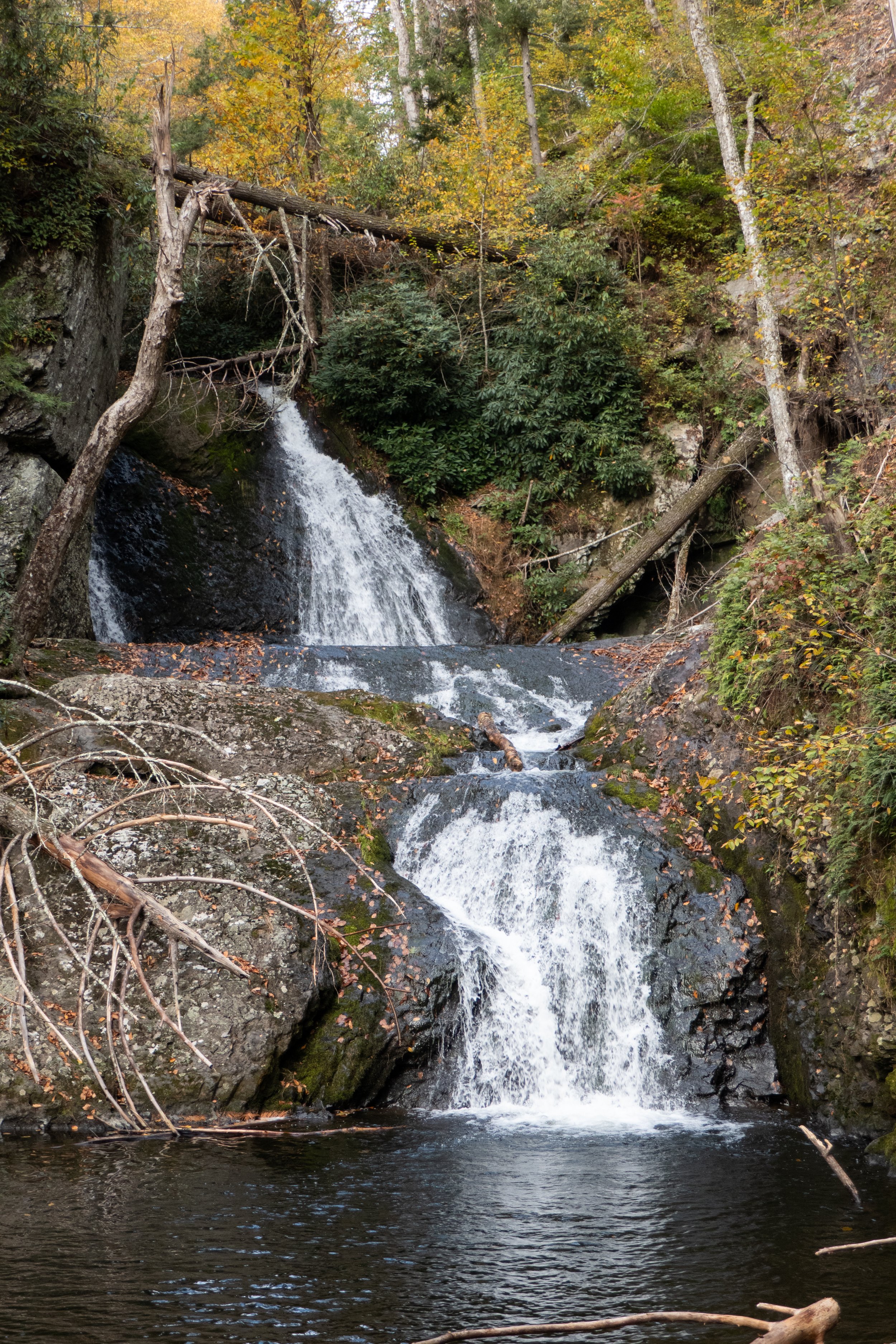
After hiking in the Adirondacks where it was mostly past peak foliage, we were able to catch the some of the colors spreading south through Northeastern Pennsylvania. We hiked the Delaware Water Gap National Recreation Area from the trailhead at the Pocono Environmental Education Center. We first took the Two Ponds trail to Tumbling Waters falls, then back to the parking area where we picked up the Ridge Trail that looped us through Scenic Gorge. Some fun, easy rock scrambles on this hike and pretty scenery made for a nice, relaxing day.

Click on “Read More” below for more photos

Read More

Adirondack Mountains, Roaring Brook Falls Trail, Cobble Lookout Trail, Van Hoevenberg Trail, Marcy Dam, Avalanche Pass Trail, Heart Lake, October 17 & 18, 2021

Adirondack Mountains, Roaring Brook Falls Trail, Cobble Lookout Trail, Van Hoevenberg Trail, Marcy Dam, Avalanche Pass Trail, Heart Lake, October 17 & 18, 2021

We spent another couple of days hiking in the Adirondack Mountains High Peaks Region. Weather was not ideal for high elevation since it’s the beginning of shoulder season when fall starts to turn into winter. Trail conditions are beginning to become a mix of mud, ice and snow so we stayed low and just enjoyed our time exploring the area and scouting out more potential hikes for future trips. Once there’s a good coating of snow on the ground we’ll be back for snowshoeing. Despite the weather, (rain mixed with snow which I honestly don’t mind… better then humidity!), we had an amazing time.

Read More

Mt. Jo and Heart Lake, Adirondack Mountains, High Peaks Region, 4.2 Miles RT, 801' +/-, Max Elevation 2,877', September 21, 2021

Mt. Jo and Heart Lake, Adirondack Mountains, High Peaks Region, 4.2 Miles RT, 801' +/-, Max Elevation 2,877', September 21, 2021

After yesterday’s long journey to the top of Mt. Marcy, we were ready for an easy day. We decided to hit the trail again, but this time tackle a much shorter peak, Mt. Jo. The trail begins across the street from Adirondack Loj and starts off on a flat, gravel path with interpretive signs for the diverse vegetation. It passes by Adirondack Loj Nature Museum before becoming a dirt path that begins the ascent. It was a beautiful morning as the light shined through the trees on this crisp, fall day. And while I wasn’t planning for a steep climb, we did have some work to do to get to the top. After a little over a mile of steep climbing, the trail leveled off just before the summit. Another short scramble and a climb up some helpful ladders and we were at the top of Mt. Jo looking over at Mt. Marcy, where we were just yesterday. Down below we could see Heart Lake and the trees were just beginning to show signs of fall color. We chatted with some hikers at the summit before heading back down. People are always so much happier when you meet them on the trail. Once we got back down, we added a little more hiking with a walk around Heart Lake. We stopped a few times to sit and enjoy the views, listen to the sounds of the wilderness and watch people in their canoes paddling across the lake. It’s in these moments when I feel most at peace. I’m always happy in the mountains. It was a great way to end an amazing couple of days in the High Peaks Region of the Adirondacks and I foresee many more trips to come.

Read More

Mt. Marcy via Van Hoevenberg Trail, Adirondack Mountains, High Peaks Region, 16 Miles RT, 3,734' +/-, 5,344' Max Elevation, September 20, 2021

Mt. Marcy via Van Hoevenberg Trail, Adirondack Mountains, High Peaks Region, 16 Miles RT, 3,734' +/-, 5,344' Max Elevation, September 20, 2021

“The love of wilderness is more than a hunger for what is always beyond reach; it is also an expression of loyalty to the earth ... the only home we shall ever know, the only paradise we ever need -- if only we had the eyes to see.” -- Edward Abbey (American writer and naturalist)

After over a year we were finally back in the mountains. Leaving California with its limitless peaks and vast wilderness and relocating to an area of Northeastern Pennsylvania which lacks high-elevation mountains was a very hard adjustment for me. We decided to drive to upstate New York and hike the High Peaks Region in the Adirondack Mountains. We would set up basecamp in Lake Placid, sleep one night and the next morning hike from Adirondack Loj on the Van Hoevenberg Trail to the top of Mt. Marcy, the highest peak in New York state. The journey would be an arduous climb of over 16 miles, most of which required bouldering, rock scrambling and climbing up large and oftentimes slippery slabs of rock. It had been over a year since I’d done any hiking with much elevation, but I craved the challenge and the rewards that come with reaching the summit after putting in a hard day’s work on the trail.

We arrived at Adirondack Loj at 5:30 am, about an hour before sunrise. We donned our headlamps and headed out on the Van Hoevenberg trail towards Marcy Dam. The trail was mostly easy going for the first two miles. We moved quickly to the first junction, and as we reached the dam the sun was starting to come up. We took a moment to enjoy the views of Mt. Colden, Avalanche Mountain and Wright Peak, but we couldn’t linger knowing we had a lot more miles to cover. We crossed the bridge over Marcy Brook and began to ascend on a moderate grade as we hiked along Phelps Brook. We passed the junction to Phelps Mountain and from here we began a steep climb up the trail which was covered in nothing but boulders. After the first steep pitch, the trail crossed Marcy Brook and briefly leveled off for a short distance as we passed the junction to Indian Falls. At about 5 miles in we began another steep ascent which seemed like endless scrambling and climbing. The terrain was slippery in sections and required a lot of mental concentration and careful foot placement. As we reached the top of the ridge, I began to see hints of blue sky. I knew we were getting closer. Now, the trail eased slightly except for the mud and the obstacle course of wooden planks we had to negotiate, and we began to get our first views of Mt. Marcy. We hiked through thick scrub and scrambled up more barefaced boulders before reaching the Alpine Zone. We were starting to get above the treeline, and I was beginning to feel anxious as the climbing got even harder and steeper. Higher and higher we ascended, scrambling the bare rock and slabs. We followed the cairns and the yellow paint blazes guiding the way straight up. And then, finally, we were there… standing on the summit of Mt. Marcy, the highest peak in New York State at 5,344 feet. It was an amazing feeling! One I haven’t felt since leaving the mountains of California. We took in the views and fueled up on snacks, but the moment could not last because we knew we had miles of strenuous descent before we could finally relax and celebrate. The climb back down the mountain was even more taxing. We were tired both physically and mentally, and the amount of concentration it took to descend the boulders and rocks was even more laborious then it was going up. It was about 6:30 pm when we finally reached the Loj. We were tired, sore and even a little delirious, but it was an incredible day and one which we will not soon forget.

Hiking Mt. Marcy was both a physical and mental challenge. It pushed us to our limits. There comes a point in hikes like these when you know you’re stretching yourself, but you just can’t turn back because you don’t want to waste all the effort you’ve already put in so you just keep pushing. The feeling of reaching a hard earned summit is a feeling that’s difficult to describe. It becomes an addiction. It’s a challenge not everyone will have the privilege of experiencing. It’s a journey that makes you stronger and brings you closer to those who are on that same journey. And although the moment of reaching the summit may be fleeting compared to the hours you put in to get there, it will always be worth it.

Click on “Read More Below for More Photos”

Read More
Woodland Hills Preserve, September 11, 2021

Woodland Hills Preserve, September 11, 2021

Nice walk around the Woodland Hills Preserve. This is a really nice place to come for a quick nature fix and some exercise. Lots of Goldenrod blooming right now. The milkweed has gone to seed and we saw many Monarch butterflies on the wing. Beautiful light today as well.

Click Read More Below for More Photos.

Read More

Dick and Nancy Eales Preserve at Moosic Mountain, September 6, 2021

Dick and Nancy Eales Preserve at Moosic Mountain, September 6, 2021

Today we hiked the Dick and Nancy Eales Preserve on Moosic Mountain. It looked quite a bit different then when we were here in the winter when it was covered in snow. We started the hike on the Blueberry Trail passing through stunted pitch pines, oak and blueberry. We then followed the Stonehenge Trail through a large garden of boulders where we connected to the After Five Trail following along large rock slabs. From here we dropped down to check out the O’Connor reservoir and then took Gene’s Trail to the Bruised Ego Trail closing the loop at a little over 8 miles. It was a nice day. The clouds kept the sun from making it too hot and the humidity wasn’t quite as bad as it’s been most of the summer. It was a nice hike with some variety in the terrain and scenery.

Click Read More Below for More Photos.

Read More

Tuscarora State Park, Lake View, Spirit and Crow Trail Loop, August 6, 2021

Tuscarora State Park, Lake View, Spirit and Crow Trail Loop, August 6, 2021

We went back to Tuscarora State Park today to see if we could figure out how to do the loop from Lake View, Spirit and Crow trails. After some research, it seemed we’d have to take the street a short way and then reconnect with the trail. This time we headed off on the Lake View Trail heading counterclockwise or west. The trail followed along a road and past by some camping areas. The lake was crystal clear and for once, the weather wasn’t super humid. From the Lake View Trail we picked up the Spirit of Tuscarora Trail. I’ve been on this trail a couple of times and it’s a really beautiful trail. It’s very well take care of and ironically, we happened to bump into its creator, Pap. He was out on the trail cutting back the shrubs and making sure the trail was clear. We stopped and chatted with him for a while and he told us he had created this trail over 30 years ago and has been taking care of it ever since. You can easily see it is a well loved trail. It’s also a very unique area. There’s quite a bit of diversity compared to a lot of Pennsylvania trails which tend to all kind of look the same after a while. The terrain is also less rocky in this region. I’m not quite sure why that is compared to most other Pennsylvania trails, but i wasn’t complaining. After talking with Pap, he confirmed we would have to follow the trail to the street, hop the guard rail and walk up the road a short way if we wanted to pick up the Crow Trail and continue the loop. We took his advice and found our way. It was an absolutely beautiful day. The monarda was flowering in the meadows and it was full of butterflies. We also came upon a majestic larch plantation. It was a really nice hike. As the day went on, it started to warm up and the humidity began to rise. Luckily we were just about wrapping up our hike and ready to head home. It was a great day at Tuscarora State Park. I always enjoy coming here.

Click Read More Below for More Photos.

Read More

Tuscarora State Park, Lake View & Crow Trail Out & Back, August 1, 2021

Tuscarora State Park, Lake View & Crow Trail Out & Back, August 1, 2021

We had a nice hike around Tuscarora State Park. We started from the Day Use area on the Lake View Trail heading east and clockwise around Tuscarora Lake. The trail looped along the edge of the north side of the lake until crossing over the dam and heading back into the woods. The views along the trail of the lake were quite nice. We then passed through open meadows and followed the Crow Trail to its terminus at the parking area. I had thought we might be able to make a loop around the lake, but I wasn’t quite sure of the route. I had a feeling we’d have to take the road, but decided to wait until I had better intel and come back another day. We made our way back the way we came and enjoyed the scenery from the opposite direction. I enjoyed the hike today and this is a lovely area with very few people. The terrain isn’t quite as rocky as further north so the walking wasn’t as tough on your feet. I really enjoy this area and will be back again to complete the loop.

Click Read More Below for More Photos.

Read More

Pinchot State Forest, Pine Hill Trail, July 25, 2021

Pinchot State Forest, Pine Hill Trail, July 25, 2021

Today we hiked in the Pinchot State Forest which is named for Gifford Pinchot who played a founding role in America’s conservation movement. The Pinchot State forest is approximately 50,000 acres and encompasses five different counties. There are many hiking trails within this forest, and today we barely scratched the surface with a short hike in the Thornhurst Track on the Pine Hill Trail. The Pine Hill Trail led us to a vista point where there’s a wooden observation tower. You can climb the stairs to the top and overlook some of the surrounding area which in the summer (as with most of Pennsylvania’s ‘views’) is mostly looking at the tops as trees. It was a very nice hike and I hope to explore more of this forest in the future, as there are many trails with a lot of miles to cover including the 26 mile Pinchot Trail loop which is a popular backpacking excursion.

Click Read More Below for More Photos.

Read More

Nockamixon State Park, Old Mill Trail, 5 Miles RT, July 9, 2021

Nockamixon State Park, Old Mill Trail, 5 Miles RT, July 9, 2021

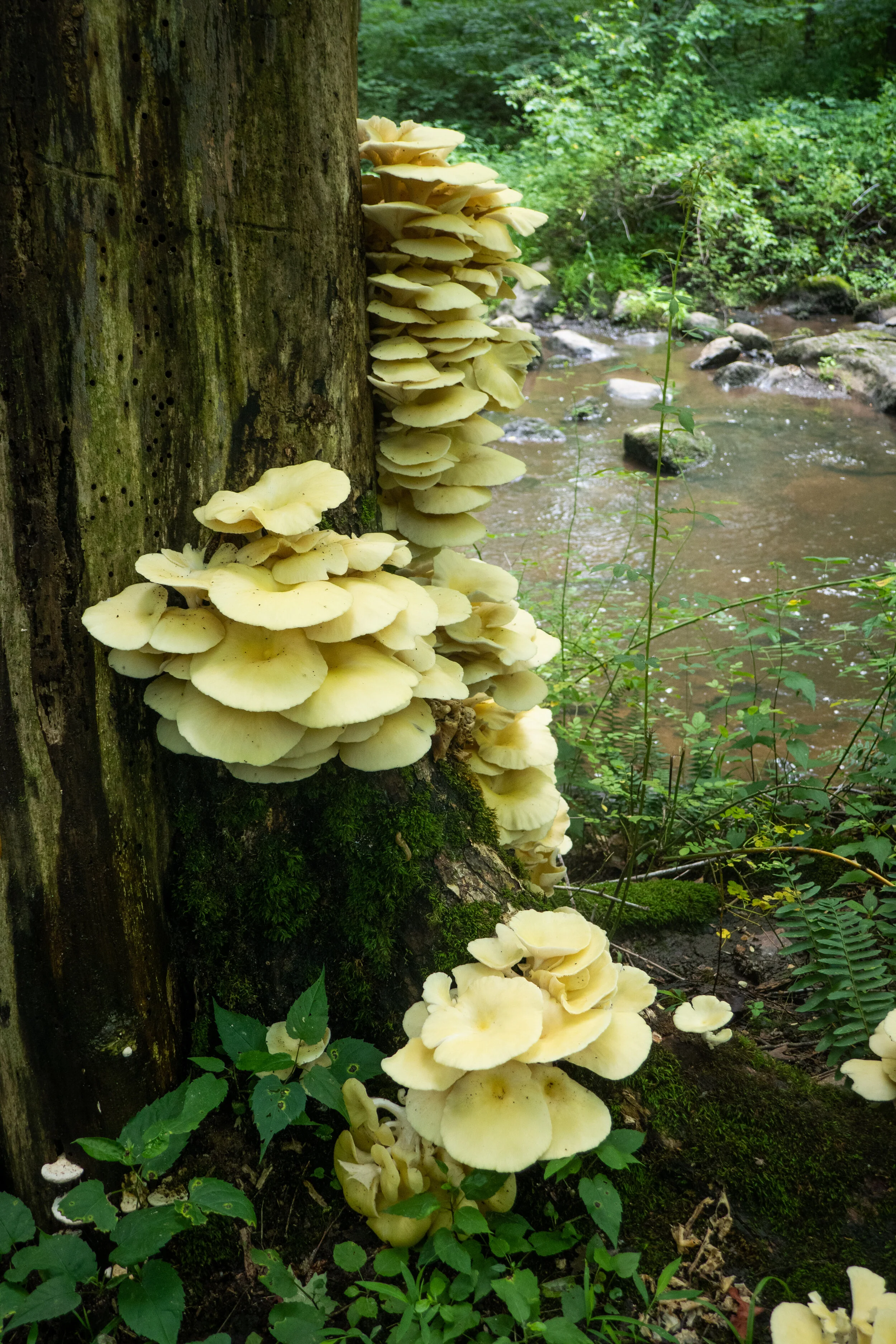
It was another hot and humid day in Pennsylvania. Despite the weather which I am not taking well to, I slathered myself in bug spray and set out on the Old Mill Trail at Nockamixon State Park. The previous evening had brought storms, and sections of the trail were covered in boot sucking mud. I’d gotten myself a pair of Keen Ridge Flex waterproof boots earlier in the year, and they are serving me well. At about .4 miles we arrived at a creek crossing where we boulder hopped over the water to continue along the trail. Along side the creek we spotted an impressive grouping of oyster mushrooms growing up the side of a tree. The trail took us through a forest of hardwoods and in and out of sunny areas of tall grass surrounded by lush, green vegetation. As we hiked, chorus of cicadas surrounded us. I saw a number of dragonflies and butterflies along the route as well. Somehow, we both managed to come off the trail without one tick hitching a ride. Lyme Disease is common in this state and you need to always check yourself for the creepy crawlies after hiking. We could have continued from Old Mill onto the Quarry Trail, but we were already at about 5 miles and I was more then ready to hit the shower. So we headed back and noted to return on a less hot/humid day to get in more mileage. I enjoyed my time exploring the trails here, and I’m looking forward to doing a night kayaking trip out on the lake during the next full moon.

Click on “Read More” below for more photos.

Read More

4th of July hike at Paradise Price Preserve, 5.5 Miles RT, July 4, 2021

4th of July hike at Paradise Price Preserve, 5.5 Miles RT, July 4, 2021

We spent 4th of July morning hiking the loop around Paradise Price Preserve. We were last here in March when the ground was just starting to thaw out from the long, cold winter. Now the forest was full of life; butterflies, toads, wildflowers, etc. We walked along the trail dodging the red efts that were scattered about the mud and rock debris. I saw a unique wildflower, Monotropa uniflora, also known as ghost plant or Indian pipe that could easily be mistaken for some type of mushroom. There were many other notable mushrooms along the path, but I’m still not up to par on my east coast flora. When we reached the first creek crossing, we discovered a new bridge that had been added. In fact, there were two new bridges built since the last time we hiked here making it easier then boulder hopping over the creek. This preserve is very well loved. Next, we came upon the use trail and followed it to the edge of Targa Falls where we stopped for a moment to take in the scenery. We could have continued further, but the day was warming up and we had other obligations. We cut the hike short by following a more direct route back to the trailhead making it about 5.5 miles. It was a nice morning to get outside and enjoy some nature before continuing with our plans for the day.

Click on “Read More” below for more photos.

Read More

Delaware State Forest, Egypt Meadow Lake, Bruce Lake Natural Area Hike, June 26, 2021

Delaware State Forest, Egypt Meadow Lake, Bruce Lake Natural Area Hike, June 26, 2021

I’ve now spent an entire year hiking in Pennsylvania and can honestly say that the summer months are the absolute worst times to hike in this state. It’s hot, humid and bugs (mosquitoes and ticks) abound. That said, the scenery (lakes, woods, wildflowers) is lovely with plenty of active wildlife (bears, birds, butterflies, snakes, etc.) I will admit it hasn’t been easy trying to adjust from high peak mountains out west to low elevation, woodsy trails of Pennsylvania. I miss a good climb and being rewarded with incredible views. Also, the lack of elevation here means there is no escaping the heat of summer. But I digress. I’m making the best of it and learning to enjoy my surroundings and simply appreciate nature.

This past Sunday we hiked a familiar trail in the Delaware State Forest: Egypt Meadow Lake to the Bruce Lake Natural Area. We had snowshoed here in the winter and so it was nice to see such a dramatic change in scenery. I do love the obvious change of seasons here and seeing how different the trails look throughout the year.

Even though we were on the trail early today, the humidity was still pretty bad. There really is no escaping it. But we finished the hike before 11 am, just as the sun was starting to come out from the clouds and really warm things up. I was happy to get out and enjoy an early morning walk in the woods.

Click on “Read More” below for more photos.

Read More

Mountain Laurel at Bear Creek Preserve, June 12, 2021

Mountain Laurel at Bear Creek Preserve, June 12, 2021

We went back to Bear Creek Preserve today. Last time we were here we were snowshoeing and it was 19 degrees. Looks quite a bit different in the spring. Everything in Pennsylvania is a lush green now and the mountains are filled with blooming Mountain Laurel. We hiked from the main parking area off Rabbit Run following the red trail. It took us down a muddy, rocky service road that was under construction. As we reached a clearing to a power line, I saw a black bear meandering around the open field. We were far enough away to make our presence known by making noise and putting the bear whistle to use. As we did, the bear slowly headed away from our direction and disappeared into the field. We crossed the clearing and headed back into the woods. We then connected to the gray trail where we used the suspension bridge to cross over shades creek. We followed the trail passing in and out of rhododendron tunnels along side the creek enjoying its many cascades. We found the use trail that took us to a very small waterfall just off the main trail and stopped to enjoy the scenery. As we left the creekside, the trail took us back into the hardwoods and a blooming sea of Mountain Laurel. The day was cloudy, but it was beautiful nonetheless and a great day for a hike. I enjoyed seeing Bear Creek Preserve during the spring.

Click on “Read More” below for more photos.

Read More

A spring hike at Nothstein Preserve and Van Buskirk Farm Preserve, May 31, 2021

A spring hike at Nothstein Preserve and Van Buskirk Farm Preserve, May 31, 2021

Today we revisited both the Nothstein Preserve and the Van Buskirk Preserve, both of which we had hiked in March before the deciduous trees had gotten their leaves and the earth awakened from its winter slumber. We started the day at the Nothstein Preserve. As we began the hike on the now grassy path, it seemed like a completely different world. The brown tones were replaced with hues of green, and the trail once covered in snow was lined with fern and wildflowers. As I was walking and keeping my eye out for wildflowers, I came upon a Red Eft which is the juvenile stage of the Eastern Newt. We saw many of these along the trail today, as they are not hard to find due to their bright orange color. The Red Eft is poisonous to anything that eats it; therefore I assume this is the reason for it not having to camouflage itself. We followed the trail upward to the red rock quarry we had seen last time. Now the oaks and birch trees were filled with bright green leaves. The beautiful pitch pines stood tall showing off their prickly cones, but the views of the ridge beyond were now masked by the leaf covered trees. After exploring the quarry we made our way through a grove of pine where I spotted a Lady’s Slipper Orchid. The genus name of this orchid is “Cypripedium.” It comes from the Greek word Cypris which in Greek mythology is a reference to the Goddess Aphrodite. Pedilon means sandal, and the orchid’s labellum resembles a slipper; hence, the name “Lady’s Slipper”. It was a unique find and a very curious looking flower. Next, the trail took us over a bridge and over Cranberry Creek. I remembered this section from winter because everything here was covered in snow at that time. We followed the trail along the creek. It looked so beautiful with its many cascades flowing over the moss covered rocks, and its False Hellebore strewn banks. When we arrived back at the trailhead, it was still pretty early in the day. We decided to stop by the Van Buskirk Preserve which is just a few miles away. Here again, everything looked completely different covered in lush, green foliage. I remembered back in March, we had passed by a vernal pool full of singing wood frogs. This time, the pool was filled with tadpoles. I guess those frogs we heard in early spring were busy! As we hiked past the ruins of the old Van Buskirk Farm, I could smell the sweet fragrance of flowers from the Black Locust trees. By now the day was warming up and the sun was shining high in the sky. I made a plan to revisit some of the other preserves we had seen over the winter to experience them in a new season.

Click on “Read More” below for more photos.

Read More

Delaware Water Gap National Recreation Area, Dunnfield Creek Natural Area, Sunfish Pond, Appalachian Trail, May 24, 2021

Delaware Water Gap National Recreation Area, Dunnfield Creek Natural Area, Sunfish Pond, Appalachian Trail, May 24, 2021

It was a beautiful Monday morning and we headed to the Delaware Water Gap to the Dunnfield Creek Natural Area. The trailhead was right off the 80 Freeway, so there was a lot of traffic noise at the beginning of the hike. But as we moved further into the woods, the traffic noise was washed away by the sound of the running creek and birdsong. The trail started off on a wide path following along Dunnfield Creek and crossed over a wooden bridge. I noted wild geranium and other wildflowers in bloom along the way. In less than a mile we crossed another wooden bridge and arrived at Dunnfield Falls, a small waterfall just off the side of the trail. From here the trail became single track and gently made its way up into a forest of emerald green. I noticed fallen blooms of yellow poplar on the ground and more wildflowers amongst the bright green foliage of the abundant fern covering the forest floor. We passed by the Pahaquarry Trail which leads to the top of Mount Tammany, another very popular hike in this area. The trail began to get more rocky the further on we hiked and I saw tiny flower buds starting to form on the mountain laurel. We then reached the Holly Springs connector trail that could take us back in a loop along the AT. We weren’t ready to turn back yet, so we decided to continue on Dunnfield Creek Trail to its termination at Sunfish Pond. The trail crossed the creek several times before making an ascent leading away from the water. Soon we arrived at Sunfish Pond, where we stopped for a snack and listened to the bullfrogs calling back and forth to one another. After our break, we made our way back on the A.T. Along the way we crossed paths with a large Eastern Black Rat Snake who was sprawled out along the trail. We passed by her slowly so as not to disturb her as she made her way back into the woods. We ended the day with about 9 miles. When we arrived back at the trailhead, the parking area was full. I can only imagine how packed it must be on a weekend. Nonetheless, this was a beautiful area and I would love to visit again.

Click on “Read More” below for more photos.

Read More

Columcille Megalith Park, May 9, 2021

Columcille Megalith Park, May 9, 2021

Today we went back for a visit to Columcille Megalith Park in the Appalachian mountains. I was here for the first time last summer, and it truly is a magical place. Even if you’re not particularly spiritual or in tune with the nature spirits, you can’t help but feel their high vibrations here as you walk the sacred grounds.

A little about Columcille as I noted in a previous blog post:

Columcille is a hidden gem located in Bangor, PA. It is the creation of the late William Cohea, Jr. who was inspired by a dream he had after visiting Iona, a small island on the western coast of Scotland. According to ancient history, the early Celts considered Iona a place where the veil is thin and one’s spirit could easily travel between worlds. There were once over 350 standing stones on the isle along with sacred oak groves. Inspired by his vision, Mr. Cohea made his dream reality in 1975 when he created Columcille.

We quietly walked the grounds through the circle of standing stones and followed the path into the forest leading us to enchanted sites and ritual circles. We stepped through the Celtic Eye which led us down to a small stream where the banks were abound with skunk cabbage and wildflowers. We circled the faerie ring path and noticed an orange carnelian crystal charging in the morning sunlight. Lastly, we walked the labyrinth where offerings can be laid upon the stone alter if one so chooses.

I left Columcille feeling inspired and rejuvenated.

Click on “Read More” below for more photos.

Read More

Delaware Water Gap National Recreation Area, Blue Mountain Lake, Hemlock Pond, Lake Success, Crater Lake, 9.9 Miles RT, May 5, 2021

Delaware Water Gap National Recreation Area, Blue Mountain Lake, Hemlock Pond, Lake Success, Crater Lake, 9.9 Miles RT, May 5, 2021

We started our day with an early morning hike on the New Jersey side of the Delaware Water Gap National Recreation Area. We parked at the trailhead for Blue Mountain Lake and planned to hike to Hemlock Pond and then on to Crater Lake, a natural glacial lake left behind from the Wisconsin Glacier approximately 22,000 years ago. It was a beautiful spring morning. The sun was shining and the birds were singing as we headed onto a wide, grassy path which was once a former road for a housing development. The easy trail took us along the northern side of Blue Mountain Lake offering lovely views along the way. At about 2.5 miles, the mostly hardwood forest became a green canopy of tall hemlocks. Soon we reached the shores of Hemlock Pond. The landscape here was incredibly picturesque. We spotted a milk snake sunning itself on the rocks and also noticed a den full of black snakes which if I had to guess were either water or rat snakes. After taking in the scenic landscape and the wildlife, we continued around Hemlock Pond until reaching the connector trail to Crater Lake. The trail made an ascent on a rocky, single track before reaching the Appalachian Trail where we found a vista point with some views. From here we began to circle around Crater Lake then followed a short spur trail down to the shores for a closer look. We then continued on the main path and found Lake Success on the southeast side. The banks of Lake Success were filled with fragrant Lily of the Valley. I know these are not native, but the aroma is amazing and they are also one of my favorite flowers. In the middle of the lake I spotted a beaver dam. As we continued the loop, we crossed the trailhead and parking area for Crater Lake. There were some inviting picnic tables here, so we decided to sit for a bit, have a snack and enjoy the peaceful setting before moving on. When we were ready, we got back on the trail and headed back towards Blue Mountain Lake. This time we hiked along the inner loop trail which took us directly to its peaceful southern shores. I couldn't believe there wasn’t any one here except for one lone fisherman who we had seen at the trailhead very early in the morning. It was such an amazing day. We ended up hiking a little over nine miles which always seems to go by so fast when there’s so much beautiful scenery.

Click on “Read More” below for more photos.

Read More

A walk around Swiftwater Forest Preserve, April 25, 2021

A walk around Swiftwater Forest Preserve, April 25, 2021

It was a rainy start to our Sunday morning, so we waited for the rain to stop before heading out about mid-morning into the Pocono Mountains. Our destination this time was Swiftwater Forest Preserve in Paradise Township. We found the trailhead off Donaldson Road and made our way onto the trail into a beautiful forest of pine. The soft pine needles covering the ground were like walking on a soft carpet. It was a really nice feeling after traversing all the rocks on the AT the day before. The walk through the forest was nice and easy. Along the trail I noticed many different kinds of mushrooms and blooming wildflowers. We passed through a section of mixed hardwood with Shagbark Hickory, Maple and Oak. There were also some interesting rock outcroppings. After hiking around the inner loop trail, we followed the outer loop. Along this path we found a short spur which lead to an old chimney and a fireplace that must have been part of a cabin at some point long ago. There was also an old out house that had been left behind. The forest here was quiet, peaceful and so relaxing. It was a perfect hike for a lazy Sunday.

Click on “Read More” below for more photos.

Read More

Delaware Water Gap National Recreation Area: Sunfish Pond via Garvey Springs, Appalachian Trail, Douglas Trail, Rockcores Trail, 7 Miles RT, 1,345 +/-, April 24, 2021

Delaware Water Gap National Recreation Area:   Sunfish Pond via Garvey Springs, Appalachian Trail, Douglas Trail, Rockcores Trail, 7 Miles RT, 1,345 +/-, April 24, 2021

I’m really loving the Delaware Water Gap. There are so many trails here to link together to make the most out of your day. I admit it’s been hard for me to find the challenges I had hiking out west, but I’m finding that there are some places, such as the DWG, where you can get a little climbing in and also link up trails to add some decent mileage. Today we hiked to Sunfish Pond, a 44-acre glacial lake located on the Kittatinny Ridge. It lies within the Worthing State Forest on the New Jersey side of the DWG. We took the steepest, shortest route up to the lake via the Garvey Springs Trail which has a respectable gain of 1,058’ in 1.2 miles. There’s a more gradual ascent up the Douglas Trail from the same trailhead, which we planned to take on the return. Laurel Falls is also a nice feature to see that’s right at the start of the Douglas Trail if you go up that way. It was a somewhat chilly morning, but the sun was out and the ascent got us warmed up fast. The trail leads through a hardwood forest, and I saw some patches of bluets (wildflowers) along the path. As we hiked, two wild turkeys crossed the trail up ahead. The trail became more and more rocky as we got closer to the top of the ridge. We leveled off for a short distance and Sunfish Pond came into view. Next, we made our way onto the Appalachian trail which runs along the western and northern shores of the lake. The trail here was mostly rock hopping large rocks and boulders with a few breaks in between. There were some campsites on the way to sit on a log and enjoy views of the serene lake. There were also some alcoves to climb the rocks out onto the water to get a closer view. I very much enjoyed the scenery here and hiking along the shores. On the western side of the lake there’s a stone monument and a plaque marking Sunfish Pond as a registered natural landmark. We continued following the AT as it moved away from the lake on a wider path that was much less rocky. We reached a backpacker campsite where there were several campers. We then connected to the Douglas Trail and began to descend. When we reached the junction with the Rockcores Trail, we decided to take it northeast and then connect back to the Garvey Springs Trail. The Rockcores Trail passes Laurel Falls on the drainage from Sunfish Pond. There was a steep use trail that made a beeline along the drainage, but I wanted to hike further so we kept on following Rockcores until linking back up with Garvey Springs. It was now about 11:30 am and as we approached the trailhead, I could see that parking was already at maximum capacity. I looked over at Laurel Falls and there were some hikers trying to climb on top of the waterfall. One of them slipped and fell, but luckily was okay. It always makes me wonder what makes people do the things they do. As we made our way to the car, someone was already asking for our parking spot. We packed up our gear and headed out. I had a really nice time on this hike. It had a little bit of a challenge and the lake was a beautiful early morning destination.

Click on “Read More” below for more photos.

Read More